| Home | Kona | Air Tour | Saddle | Kilauea | Kamokuna | Hilina | Waipio | Glossary (Volcanoes) | Glossary (Geology) | Bottom |
This strenuous but richly rewarding 20-mile round trip hike along Kilauea's highly active East Rift Zone (ERZ) begins at the Mauna Ulu parking lot off Chain of Craters Road in Hawaii Volcanoes National Park (HVNP). The trail currently ends at Napau Crater, the closest safe approach to the active Pu'u O'o vent since a January, 1997 collapse of the unstable Pu'u O'o cone and associated fissure eruption running uprift to Napau Crater forced closure of the final trail segment from Napau Crater to the west edge of the post-1983 Pu'o O'o flows.
According to the unnamed author of the VolcanoWorld Napau Crater Trail guide, "This is one of the best hikes in any National Park." I'd have to agree, and I missed the best part.
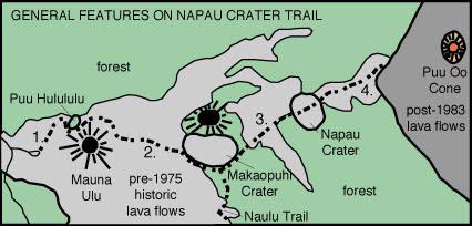 The map at right shows the trail prior to closure of
the final segment. Outbound, the Napau Crater trail
The map at right shows the trail prior to closure of
the final segment. Outbound, the Napau Crater trail
Unfortunately, that's as far as I got in January, 1999. A very late (11:30 am) start due to bad weather forced me to turn around just short of the Naulu Trail intersection. With on-again-off-again rain and wind and many photo stops slowing an otherwise quick pace, I regained the trailhead around 6:30 pm, just after sunset.
Napau Crater Trail Gallery
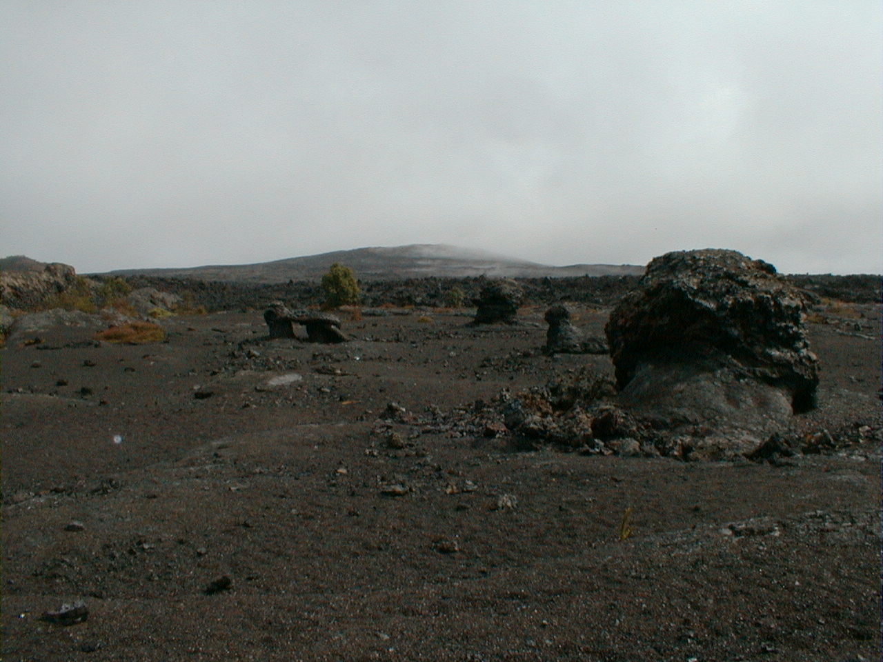
nap00.jpg 205 KB |
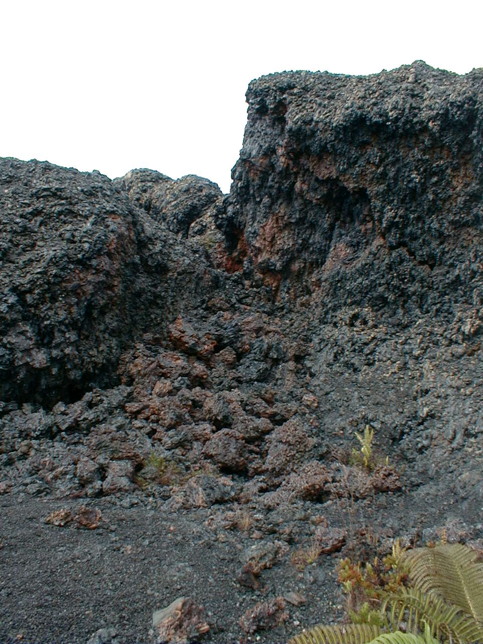
An oxidized and revegetated (1973?) fissure vent just south of the 1973 Pauahi flow's crossing of the old Chain of Craters Road. Smoothly glazed fissure lips suggest a constant drainback of very hot, highly fluid spatter during eruption. A fine, crunchy black tephra blankets most of the area, but rain and wind presumably keep the steep fissure margins swept clean. The depth of the fissure appeared to exceed 10 m (33') in places. Note the miniature spatter cone at top left. |
 nap01.jpg 195 KB |
An intricately constructed spatter rampart to the left of its parent fissure. Improbably shaped cavities separate the frozen splats on close inspection. |
 nap02.jpg 204 KB |
Fantastically-shaped lava trees near the fissure. I wonder if falling spatter contributed to their oddly shaped tops. |
nap03.jpg 207 KB |
The spatter rampart collapsed here, apparently while still hot. |
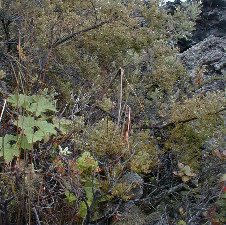
nap04.jpg 212 KB |
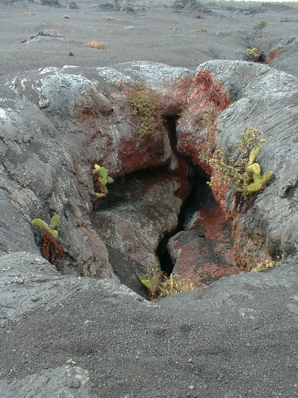
The fissure presumably invites revegetation by trapping spores, seeds, fine sediments and water and by sheltering seedlings against sun and wind. Algae typically arrive first, followed by lichen, then native wood plants and finally exotics. Ferns appear early on with either the algae or the lichen. Is oxidation of the rock also a draw? |
 nap05.jpg 201 KB |
Those odd lava trees again, this time with the Mauna Ulu shield in the background. |
 nap06.jpg 372 KB |
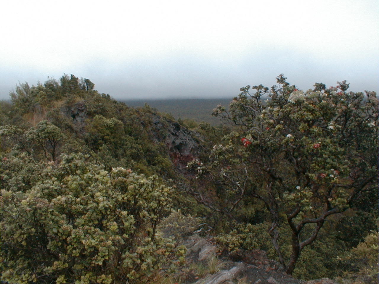
This colorful kipuka ("old ground") was spared by the both the 1973 pahoehoe flow and the overlying 1974 Mauna Ulu a'a flow. The typically steep a'a flow front is to the right. |
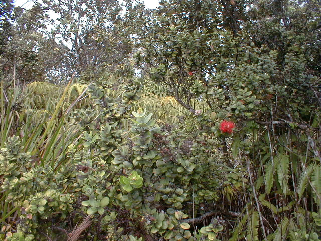 nap07.jpg 212 KB |
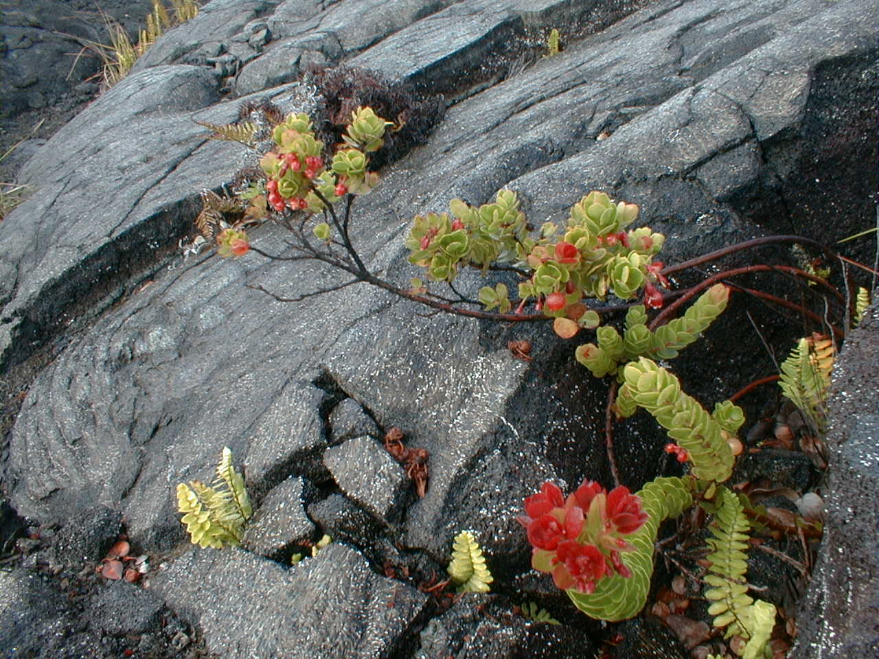
A red lepua blossom adorns this ohia tree against a backdrop of ferns in the kipuka above. These pioneer species are common on young Kilauea flows. |
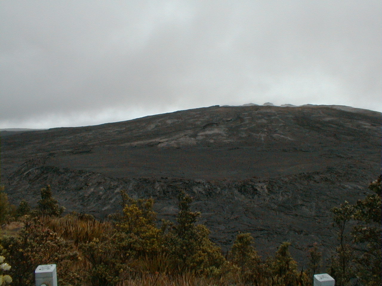 nap08.jpg 202 KB |
During its 1969-1974 fling, the still-steaming Mauna Ulu ("growing mountain") shield vent hosted spectacular fountaining eruptions and sent lavas south to the sea over the Holei Pali fault scarp. Note the self-ponded flow perched in the saddle between Mauna Ulu and Pu'u Huluhulu. As of June, 2000, a magma reservoir remains on stand-by 600' below the Mauna Ulu summit. |
 nap09.jpg 198 KB |
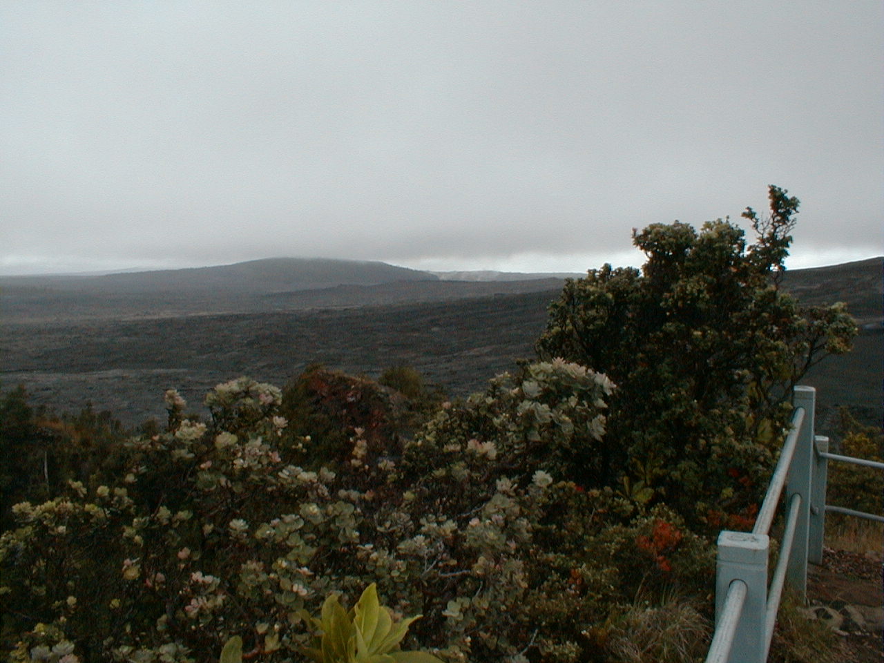
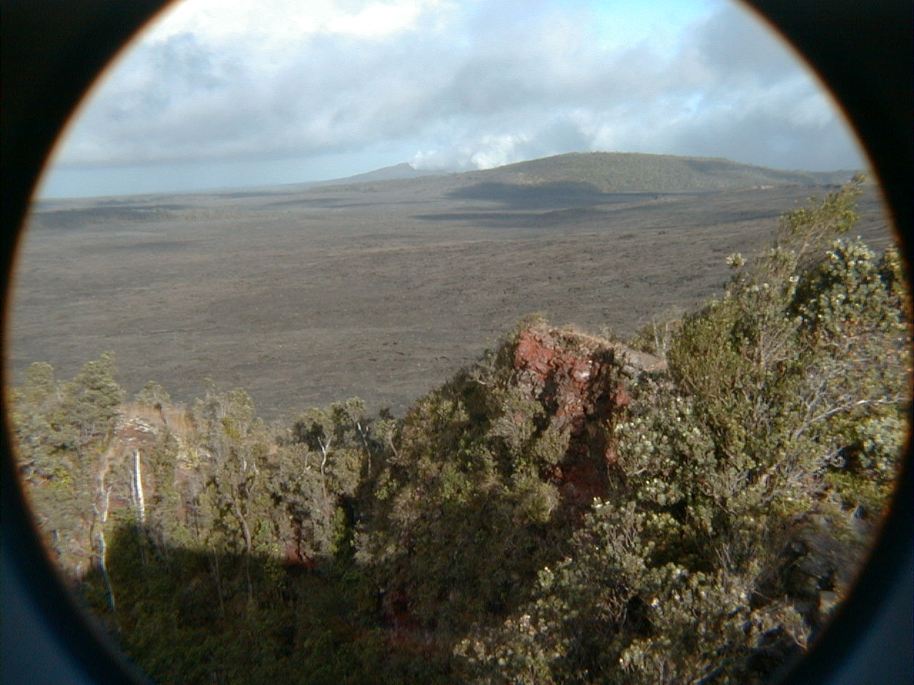
Kane Nui o Hamo, a prehistoric shield vent, looking down the ERZ to the east from Pu'u Huluhulu. Its southwest flank collapsed 500 years ago to form the Makaopuhi pit crater, whose east wall is barely visible from here, at the base of Kane Nui o Hamo. (See below.) |
 nap10.jpg 194 KB |
The west crater wall of Pu'u HuluHulu ("hairy hill"), a densely forested 400-year-old ERZ cinder cone awash in now frozen Mauna Ulu flows. The whitish sepals on the ohia on the right are precursors to the red lehua blossoms. |
 nap11.jpg 62 KB |
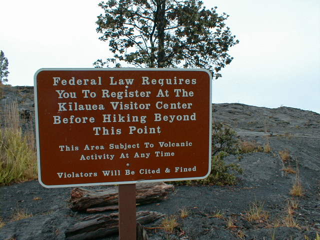
A sobering reminder at the base of Pu'u Huluhulu. Kilauea's ERZ is the world's most active volcanic region. Whose idea was this hike, anyway? |
 nap12.jpg 202 KB |
A frozen lava river and fall on the north flank of Mauna Ulu, here looking upstream. Self-constructed levees contained the river below the fall. Perched atop the fall are car-sized lava balls formed as upstream levee fragments calved off into the flow and rolled down the river surface, growing by accretion like rolling snowballs. |
 nap13.jpg 195 KB |
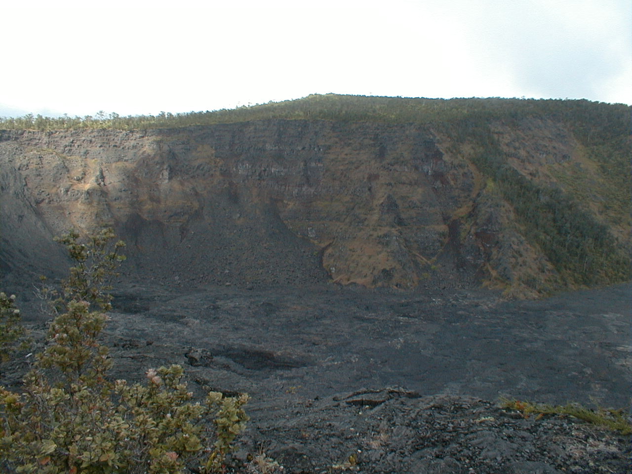
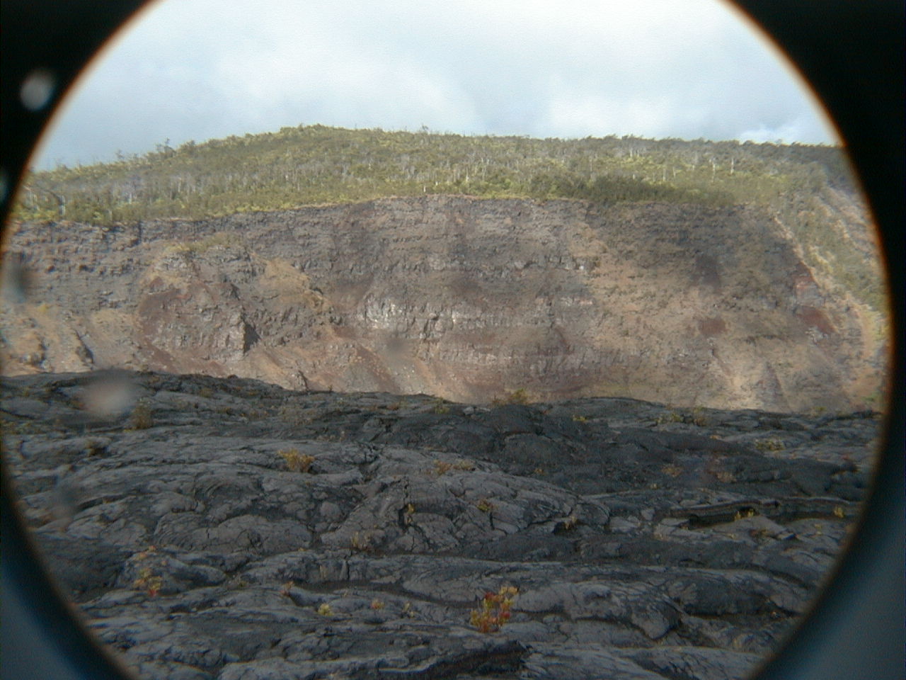
Kane Nui o Hamo shield flows seen in cross-section in the north wall of Makaopuhi Crater, last active in 1965. At a mile across and 430' deep, Makaopuhi is the largest of the ERZ pit craters. |
 nap14.jpg 198 KB |
The scrawny ohia in the left center foreground marks the edge of a 400' precipice above the now frozen lava lake that partially filled the Makaopuhi Crater in 1965. The drop is hard to appreciate at this angle, but with evidence ongoing crater rim spalling all around, standing here gave me the willies. |
 nap15.jpg 210 KB |
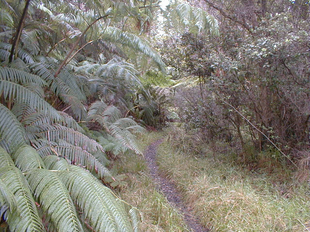
Hapu'u tree ferns and ohias dominate this lush tropical forest of several hundred years age along the south rim of the Makaopuhi Crater. |
 nap16.jpg 203 KB |
A shiny pahoehoe flow laps onto an earlier a'a flow, both from Mauna Ulu. Some say the name "a'a" (note the glottal stop as in "oh-oh" between the two vowels) imitates the mutterings of those who walk over it. |
 nap17.jpg 197 KB |
A lava fall frozen as it spilled over the west rim of Makaopuhi Crater is now spalling off into the crater. The lip of the fall, just beyond the fume clouds, sports a central tongue resembling the supercritical ramps often seen at the heads of water rapids. Unfortunately, I couldn't capture the tall trees filling the 40-foot-wide crevasse between the vertical portion of lava fall and the crater wall behind it! The steam in the fumes provides extra moisture to accelerate soil formation and plant growth. |
 nap18.jpg 198 KB |
A rare appearance of the sun brightens this view of the north wall of Makaopuhi Crater. Low clouds filled the sky most of this day, but the afternoon brought a few sunny moments. Summer days tend to be the sunniest here, but the trade winds bring rain and fog to the ERZ year round. |
 nap19.jpg 196 KB |
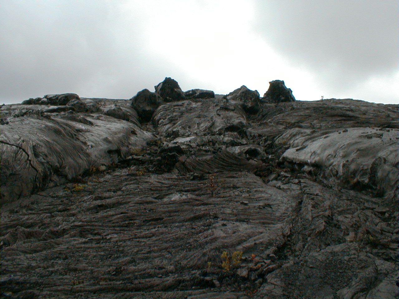
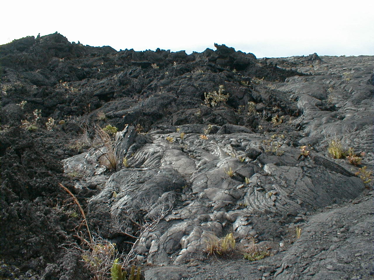
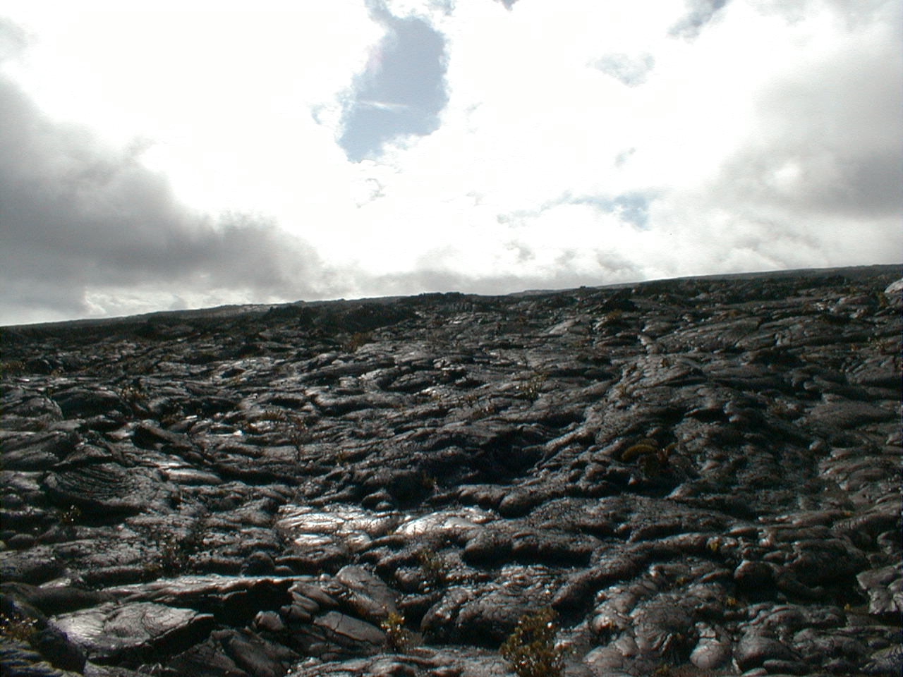
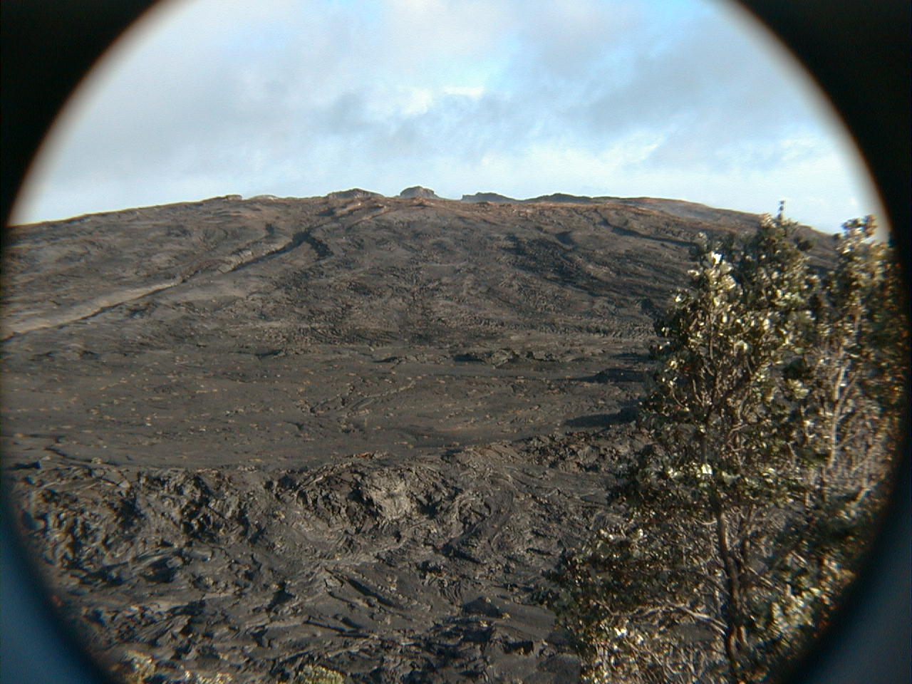
Pahoehoe as far as the eye can see, here looking up the east flank of Mauna Ulu. Self-similar pahoehoe surface structures repeat themselves at scales ranging from a few millimeters to kilometers. That should qualify the flow surfaces as fractals. |
 nap20.jpg 215 KB |
A graceful young ohia sets up shop
in a crack decorated with white lichen in this circa 1974 Mauna Ulu
flow. The lichen are
often the first to colonize flows. Fine tephra and strands of Pele's hair collecting in cracks and crevices weather quickly to soil in Kilauea's wet windward climate. The process takes a lot longer on parched leeward Kona flows, many of which (like the 1801 Hualalai flow at the airport) remain barren and fresh-looking 200 years after the fact. |
nap21.jpg 213 KB |
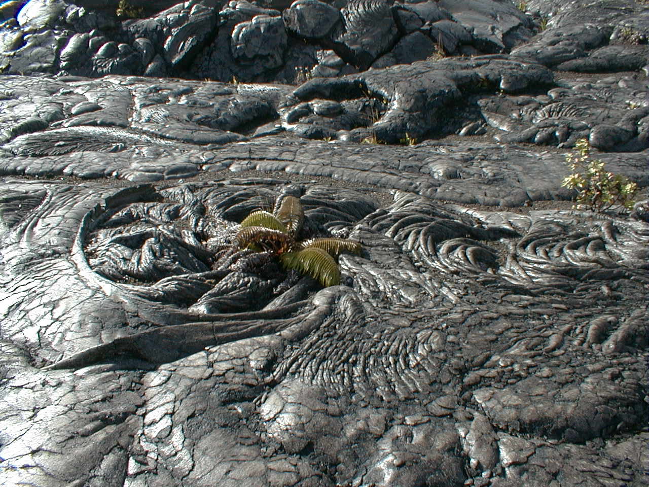
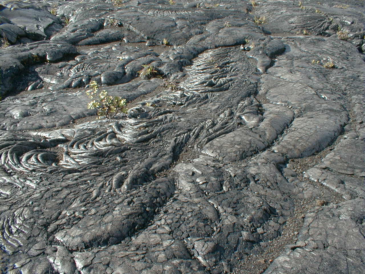
This frozen lava vortex with fern on Mauna Ulu's north flank stopped me in my tracks. The self-similarity everywhere evident in the pahoehoe flows crosses the mineral-vegetable boundary here. The vortex appears to mark the re-entry point for the gorgeous rippling lava tube breakout flow featured in this and the next shot. The surface must have frozen very quickly to have captured this much motion, perhaps beneath a quenching rain. |
 nap22.jpg 214 KB |
At top right is the breakout point
for this artfully draped tube-top flow, which continues
in the previous shot. Through the nonlinear interplay of gravity, momentum and turbulence, fluids in motion captivate the eye like few other sights can. Add rapid surface freezing to the mix, and you have the improbable beauty of pahoehoe. |
 nap23.jpg 203 KB |
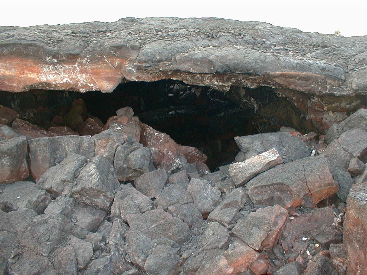
A roof collapse opened up this large inflated lava tube for inspection, here looking downslope. How many lava tubes have I walked over today? |
 nap24.jpg 210 KB |
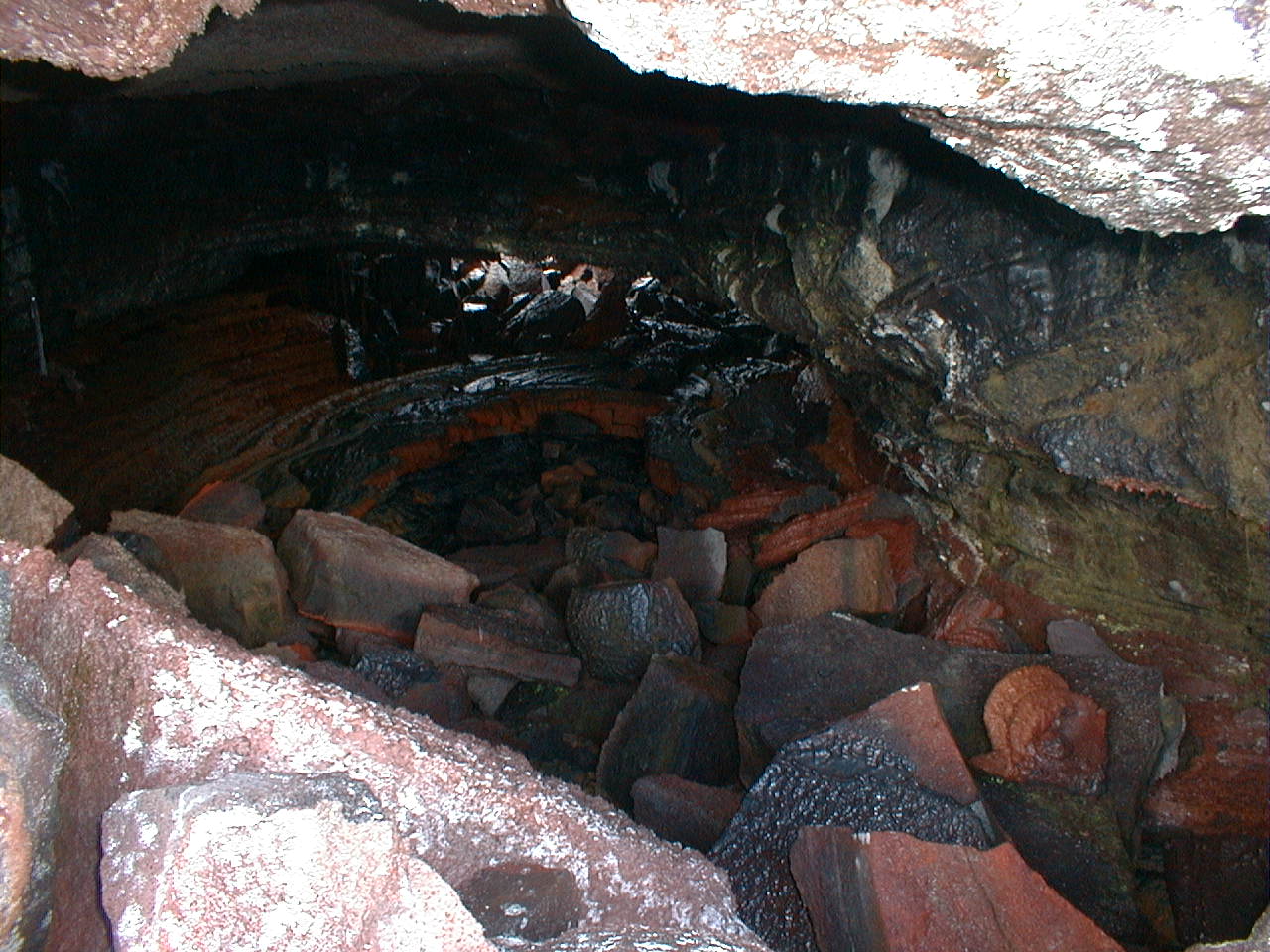
Inside the lava tube are several highly oxidized curled lava extrusions apparently squeezed into this emptied tube through wall cracks connecting it to adjacent tubes still running with lava at the time. Anyone out there know about the green rock colorations seen at right? |
nap25.jpg 209 KB |
Vesicles ( frozen gas bubbles) in inflated lava tubes such as this one tell the story of roof formation. Hawaiian magmas typically contain 0.5% gas by weight, most of it steam. Most of the degassing occurs at vents prior to eruption; little gas escapes while the lava flows. Myriad tiny bubbles at the outer surface reflect a gas charge at maximum total volume in surface lava rapidly quenched at near-atmospheric pressure. In subsequent ceiling layers, added at ever higher confining pressures as the roof grows in weight, the same gas charge occupies progressively smaller total volumes. While total gas volume decreases downward, average bubble size increases downward due to bubble-bubble interactions at the liquid-solid boundary. Spatter adds a finishing coat to the ceiling as the tube drains. Combustion of gases above the lava can melt the ceiling. |
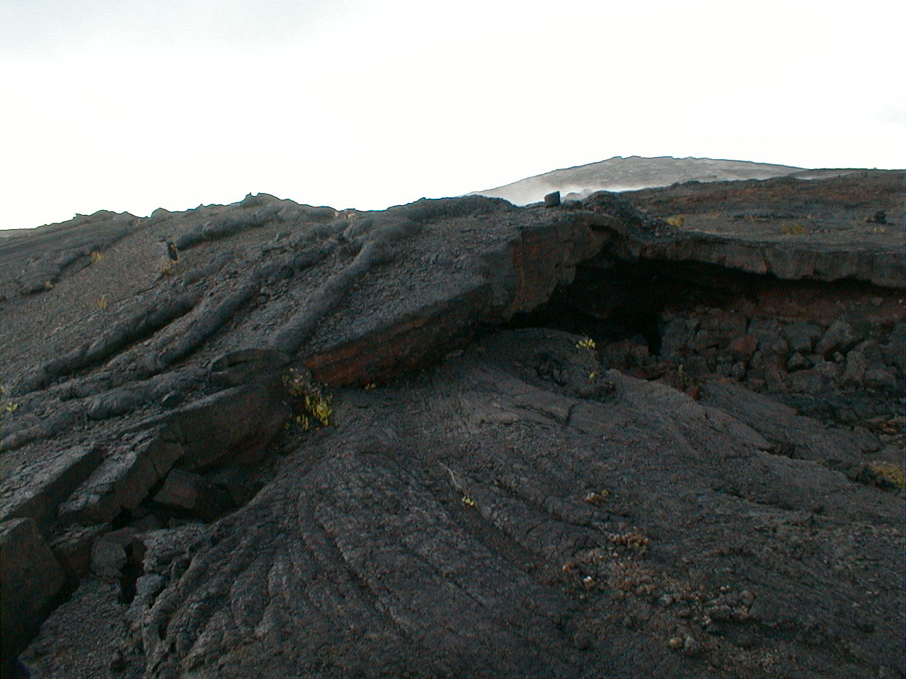 nap26.jpg 192 KB |
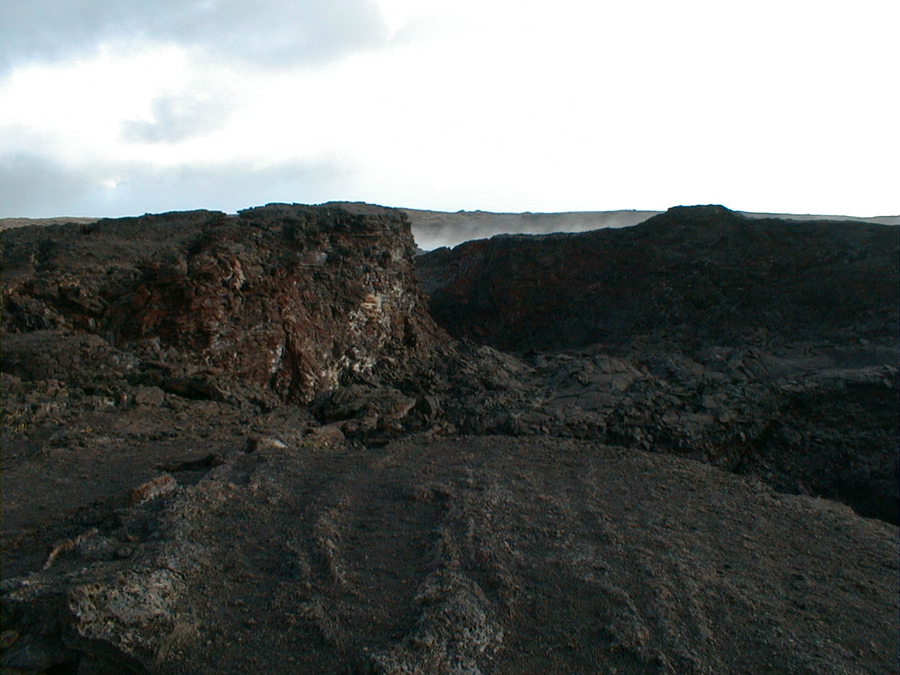
The same lava tube, now looking upslope toward the source, Mauna Ulu. Note the reverse step faults allowing the roof apex to lift as the once-full tube inflated under the lava's lithostatic pressure head. The candle drippings running off the tube axis are breakouts at roof skylights. Pahoehoe flows grow in volume as much by vertical inflation as by horizontal advance. |
 nap27.jpg 191 KB |
The still-fuming summit crater of a north flank Mauna Ulu satellite shield vent built over the once grand Alae Crater, since drowned by Mauna Ulu flows. The clearly failing crater rim and the rock rotten from stewing in the sulfurous fume and acidified rainwater kept me well back from the edge. |
 nap28.jpg 199 KB |
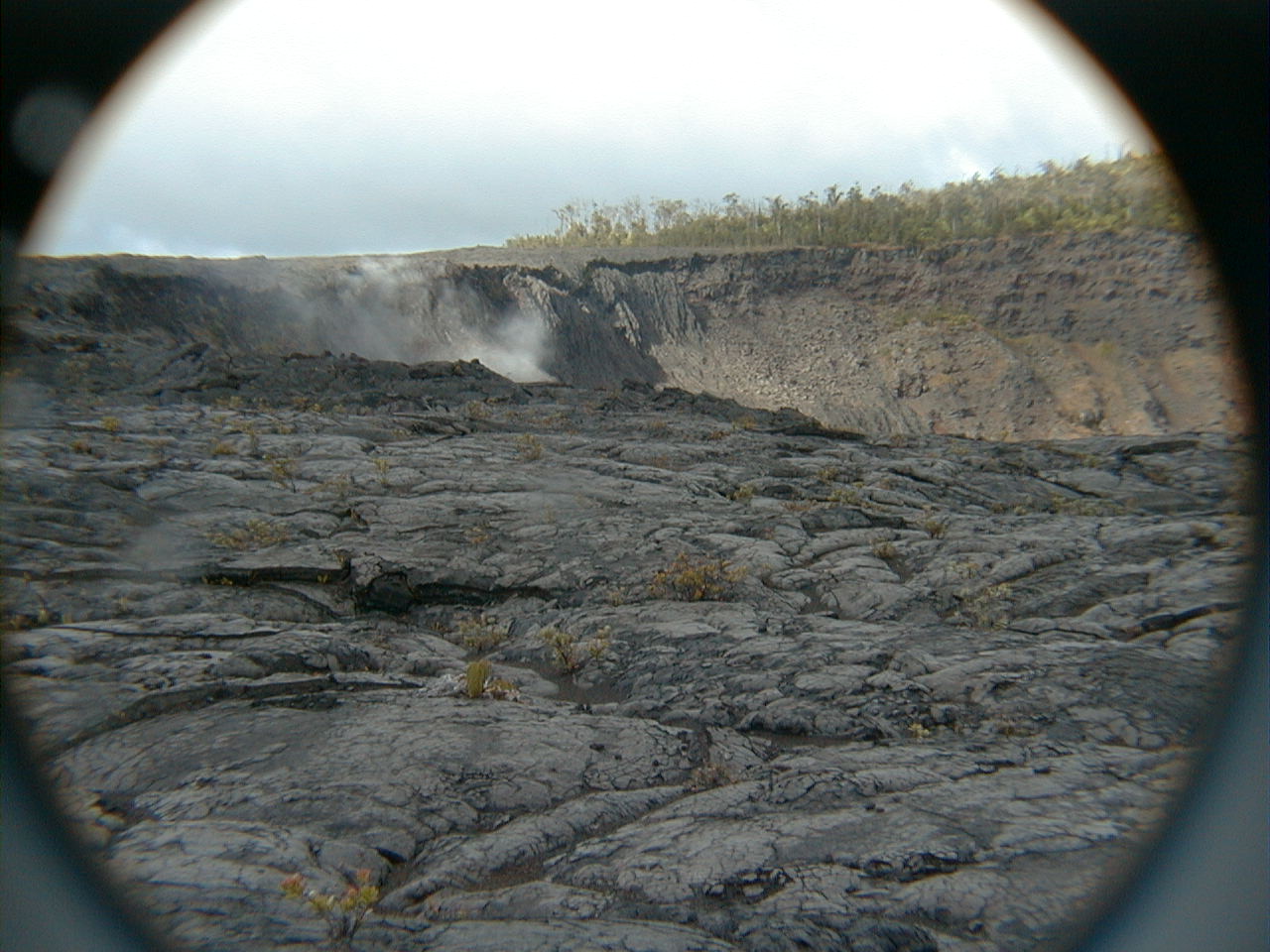
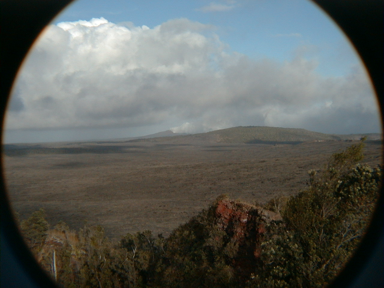
Back at Pu'u Huluhulu summit overlook now, looking east again along the ERZ to a vigorously fuming Pu'u O'o previously lost in the low clouds. Built during its initial fountaining eruptions of 1983-1986, the Pu'u O'o cinder cone now hosts a lava lake that feeds a giant lava tube system carrying magma to the coast to form new land, usually without surface flows. Pu'u O'o means "hill of the o'o bird", but its exquisite namesake is now extinct. |
 nap29.jpg 193 KB |
The coastal lava tube output (400,000 m3 daily at Kamokuna in January, 1999 and ~300,000 m3 to Waha'ula in June, 2000) roughly matches the previously determined recharge rate for Kilauea's main summit magma reservoir. Current plumbing apparently conducts the entire recharge from the summit down the ERZ, out Pu'u O'o, down the lava tubes and into the sea to create new land. The lava cools only a few degrees during its 11 km run down the tubes. That's pretty good insulation considering the 1100-1200° C (2200° F) temperature drop across the tube tops. The gas bubbles trapped inside the tube tops no doubt reduce their thermal conductivity. |
 nap30.jpg 185 KB |
Pu'u O'o, in continuous eruption since 1983, now claims the record as longest-running historic Hawaiian eruption. Surface flows from Pu'u O'o and the nearby Kupaianaha vent have also claimed the HVNP coastal visitor center (1989) and the villages of Kalapana and Kaimu (1990), among other coastal settlements—all fortunately without loss of human life. Flows have been largely confined to the tube system since a pause in the Pu'u O'o magma supply in August, 1998. |
 nap31.jpg 194 KB |
I kept hoping Pu'u O'o would revert to its old ways and do something spectacular, like the 1500' lava fountains spewed forth at its inauguration in 1983. For now, however, Pu'u O'o remains content to degas its magma reservoir and spill its lavas quietly down the tubes. |
 nap32.jpg 200 KB |
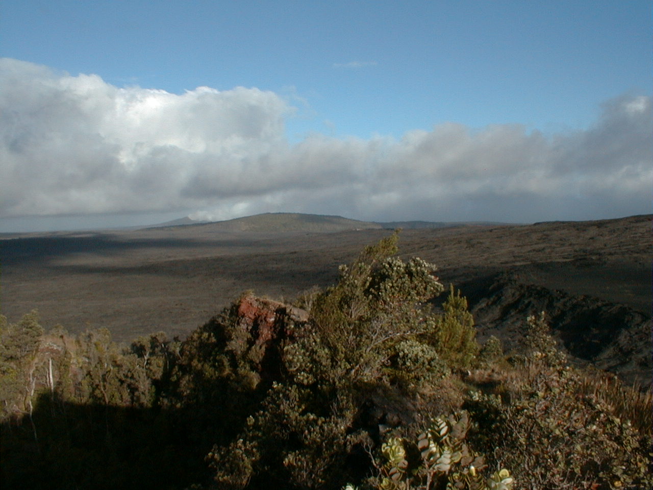
A sunnier look at Mauna Ulu from atop Pu'u Huluhulu, this time with a 2.0x telephoto lens. |
 nap33.jpg 191 KB |
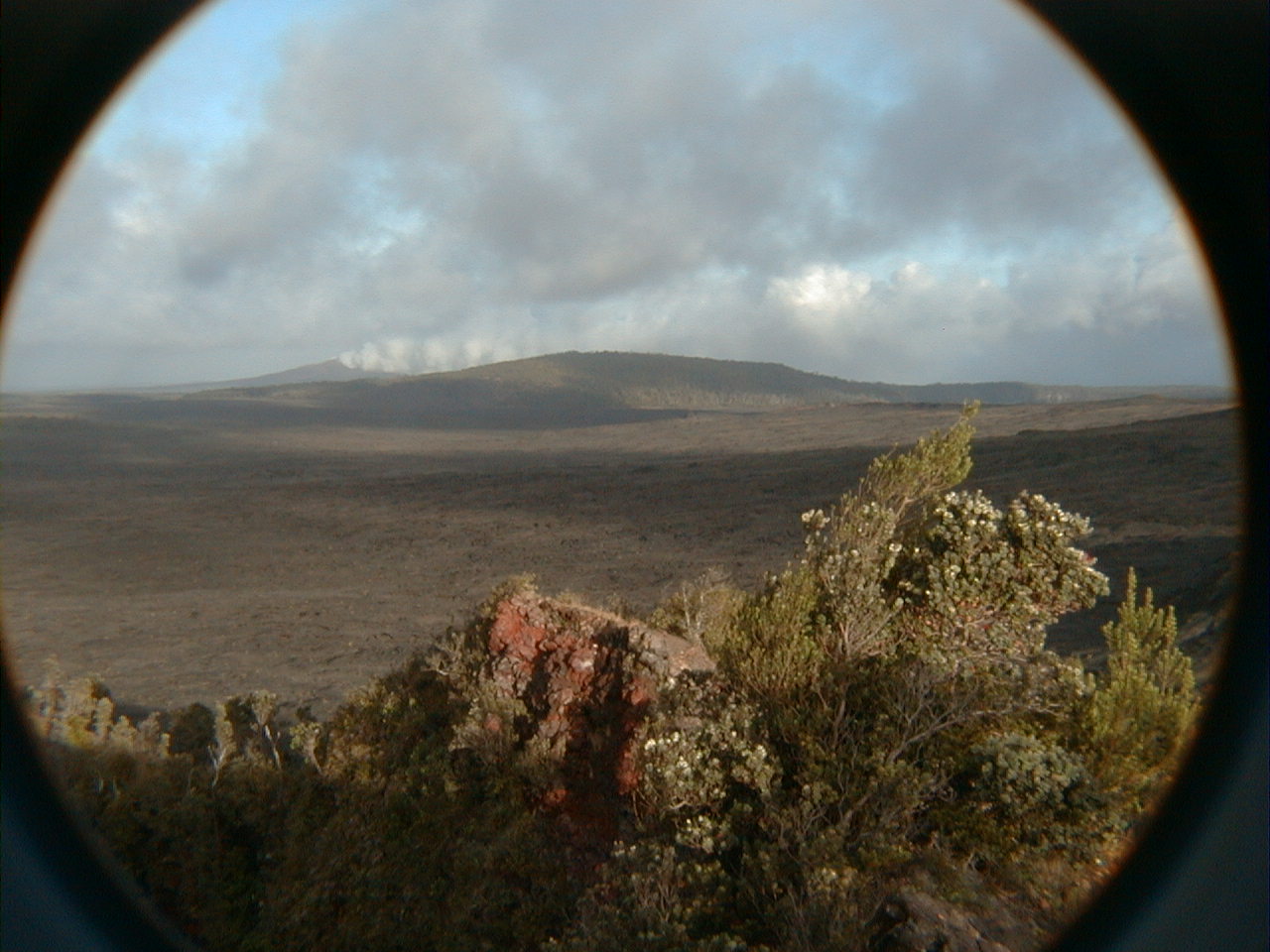
Pu'u O'o with a 2.0x telephoto lens. To see what this gas plume looked and felt like several kilometers downwind, see this site's Kamokuna page. |
nap34.jpg 200 KB |
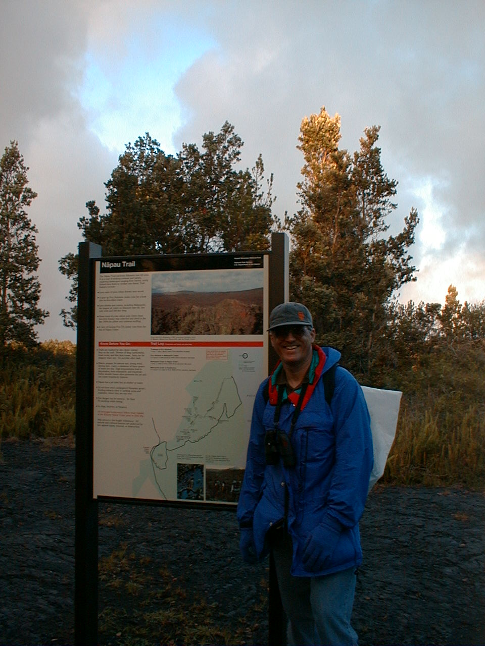
At the
trailhead after the hike. It was rainy, windy, cold and exhausting, but I can't wait to come back and finish the trail. Next time, I may jump on at Makaopuhi via shorter the Nalau Trail from the Kealakomo overlook further down the Chain of Craters Road. |
| Home | Kona | Air Tour | Saddle | Kilauea | Kamokuna | Hilina | Waipio | Glossary (Volcanoes) | Glossary (Geology) | Top |
Please address comments and corrections to jeremy@cliffshade.com
© 2002 Jeremy McCreary; last updated January 21, 2006