| Home | Kona | Air Tour | Kilauea | Kamokuna | Hilina | Napau | Waipio | Glossary (Volcanoes) | Glossary (Geology) | Bottom |
Nestled between the Big Island's two tallest volcanoes, Mauna Loa and Mauna Kea, the sparsely populated Humu'ula Saddle offers an excellent platform for the exploration of both. Hwy 200, otherwise known as the Saddle Road, connects windward Hilo to the leeward Kona and Kohala districts, cresting at 6,500' near the Mauna Kea Recreation Area.
Most of the locals tried to discourage me from driving the Saddle Road. Bad road, they warned, not safe. Indeed the accident rate in the Saddle is higher than along other Big Island routes, so you'll need to drive with extra care and an eye on the weather. If you break down, run out of gas or hit dense fog, you could be stranded for quite a while, and you'd probably end up paying for road service out of pocket. But the route's no more challenging than any other curvy mountain road, and the visual rewards are well worth the ride all along the way.
 Things to see here include
Saddle Gallery
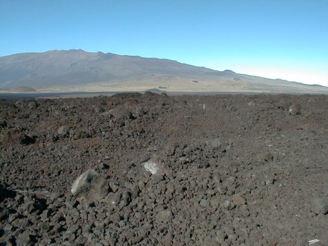
 sad00.jpg 200.03 KB |
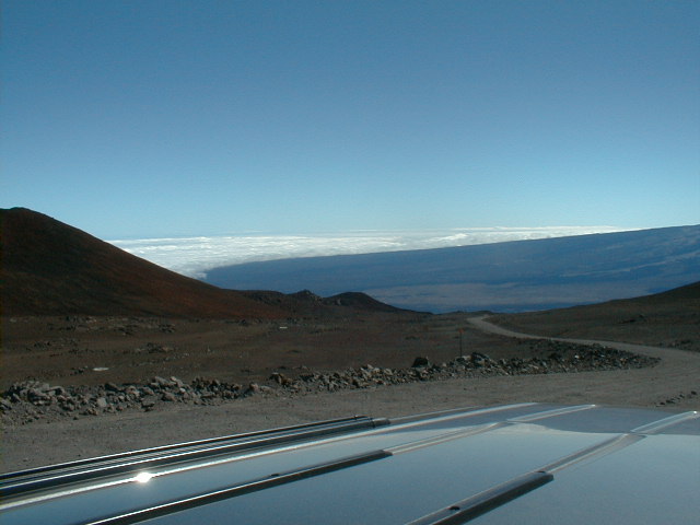
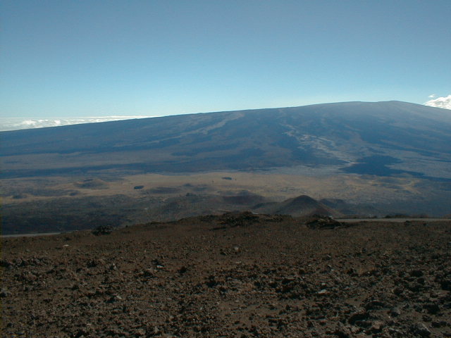
The first of a 2-frame panorama
shows the east limb of Mauna Loa
("long mountain") looking south from a
colorfully oxidized 3,000-year-old spatter rampart built
by the oldest and farthest-flung of Mauna Loa's fissure
vents. The axis of the rampart aligns roughly with Mauna
Loa's summit. The bumps on the otherwise smooth east limb
are the pyroclastic cones of Mauna Loa's northeast rift
zone (NWRZ). The Saddle Road makes a sharp jog south here along the rampart. Spent military bullet casings were everywhere underfoot at this site, just within the Pohakuloa Military Training Area. Alas, the repeated explosions I heard nearby were not volcanic. |
 sad01.jpg 203 KB |
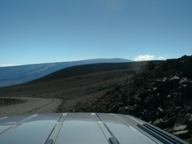
The west limb of Mauna Loa from
the same vantage. Lacking a major rift zone, the west
limb is much smoother than the east. My freebie panorama stitching software QuickStitch wouldn't line up Mauna Loa correctly. Maybe yours will. |
 sad12.jpg 62 KB |
The out-of-this-world candy selection at the Onizuka Center for International Astronomy Visitor Information Station at 9,300' on the Mauna Kea Road. |
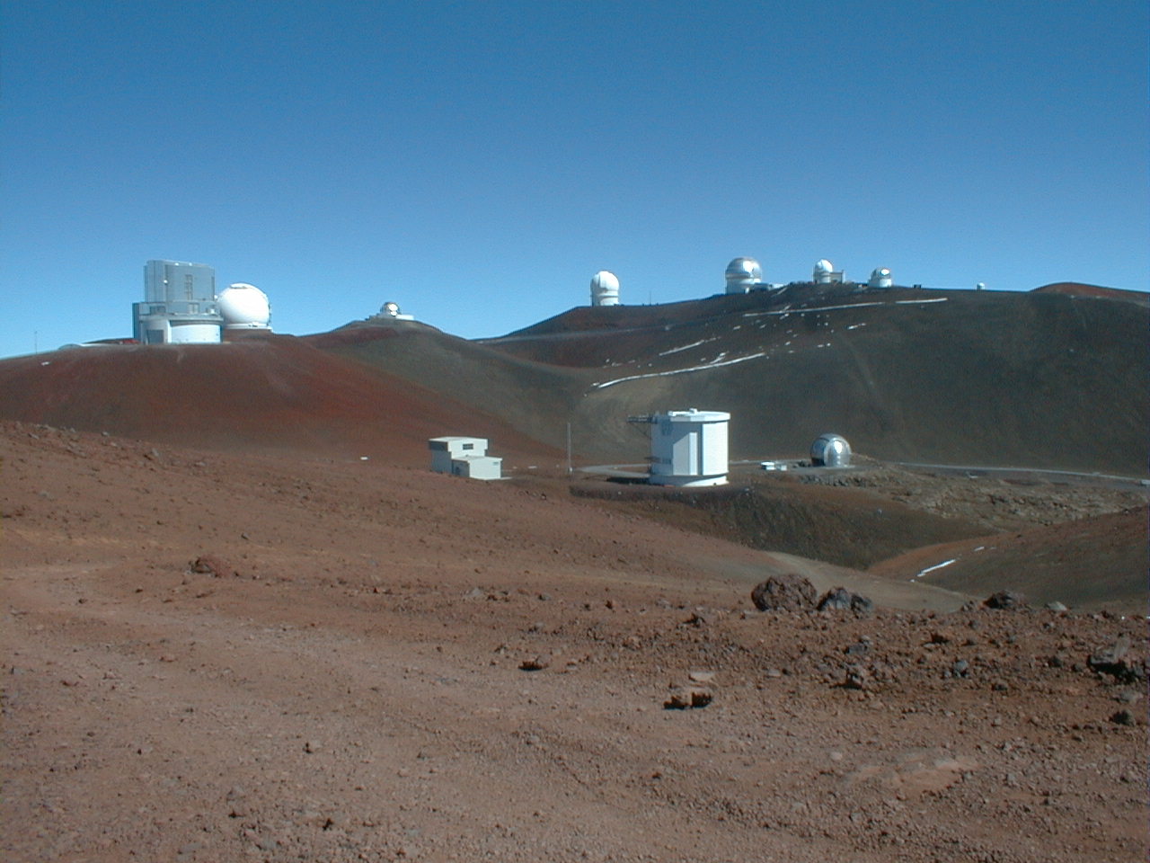
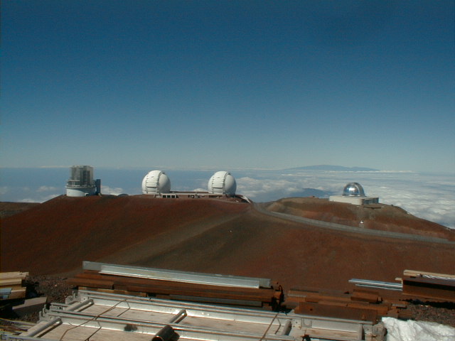 sad02.jpg 56 KB |
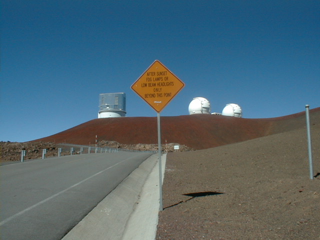
The lower tier of the Mauna Kea
("white mountain") summit complex, looking NW
from the upper tier. Left to right are the recently
inaugurated Subaru 8.2 m single-mirror optical telescope,
the Keck I and II multi-mirror visible and infrared pair
and the NASA Infrared Telescope, all atop an oxidized
cinder cone of Mauna Kea's capping stage. On the horizon across the Alenuihaha Channel is Maui's youngest volcano, Haleakala ("house of the sun", 10,025 ft), last active in 1790. Now 225 km NW of the hot spot, Haleakala is 100,000 years into its post-erosional stage of rejuvenated and usually explosive volcanism. |
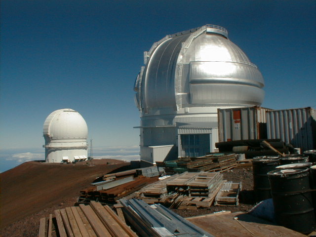 sad03.jpg 61 KB |
The largest of the upper-tier
observatories at the true summit, here looking north. The friendly construction workers I encountered nearby drive up to the summit (13,796 ft) daily from homes at or near sea level. I'm short of breath just walking around up here, and they're doing heavy labor. What an unusual physiology they must have developed on this job! |
 sad04.jpg 196 KB |
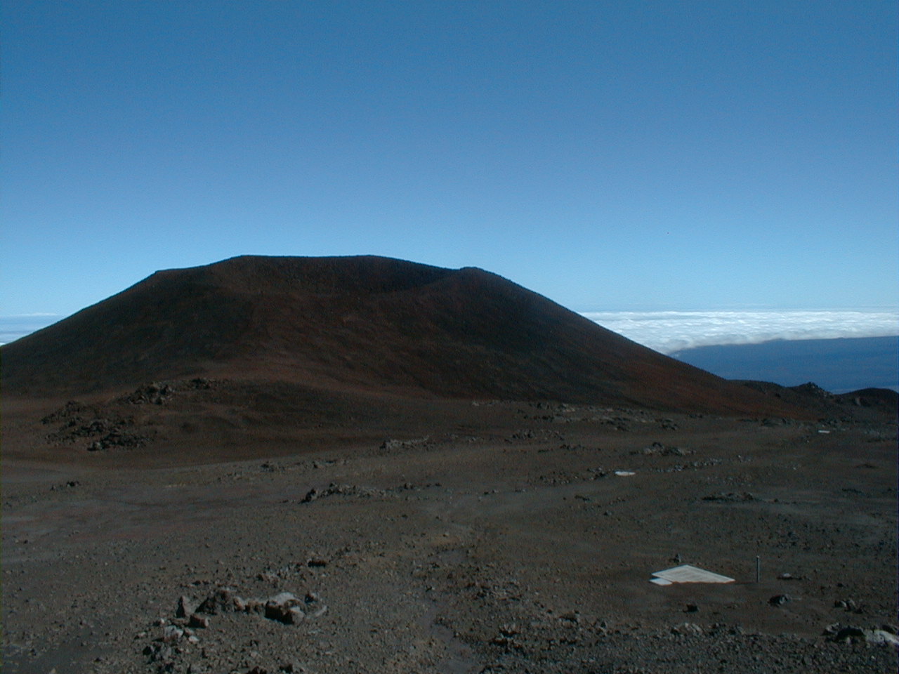
Pu'u Poliahu ("hill of the
snow goddess"), a capping phase cinder cone with its
summit and crater intact. The cone's asymmetry reflects
the direction of the prevailing northeasterly tradewinds. In the distance to the WSW is Kona's Hualalai volcano (8,271 ft), also in the capping stage. Many cones just like Pu'u Poliahu here rough up its profile. |
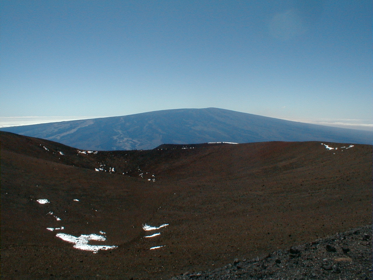 sad05.jpg 213 KB |
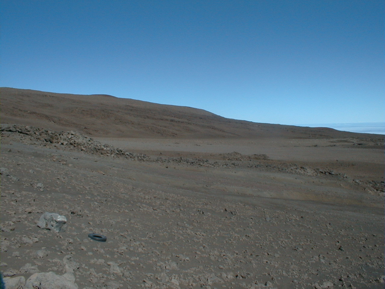
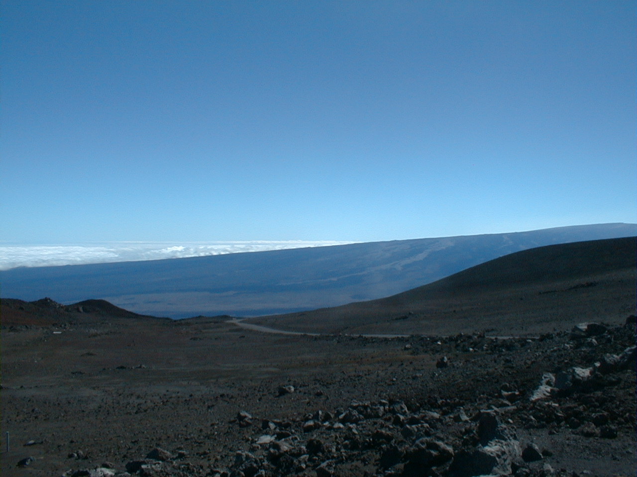
The majesty of Mauna Loa, looking
south. Dark flows of 1843-1942 vintage have dripped down
from the NERZ. The semi-circular ridge in the middle ground is a glacial moraine from the Wisconsinan ice age. Glaciers last covered the summit about 20,000 years ago. |
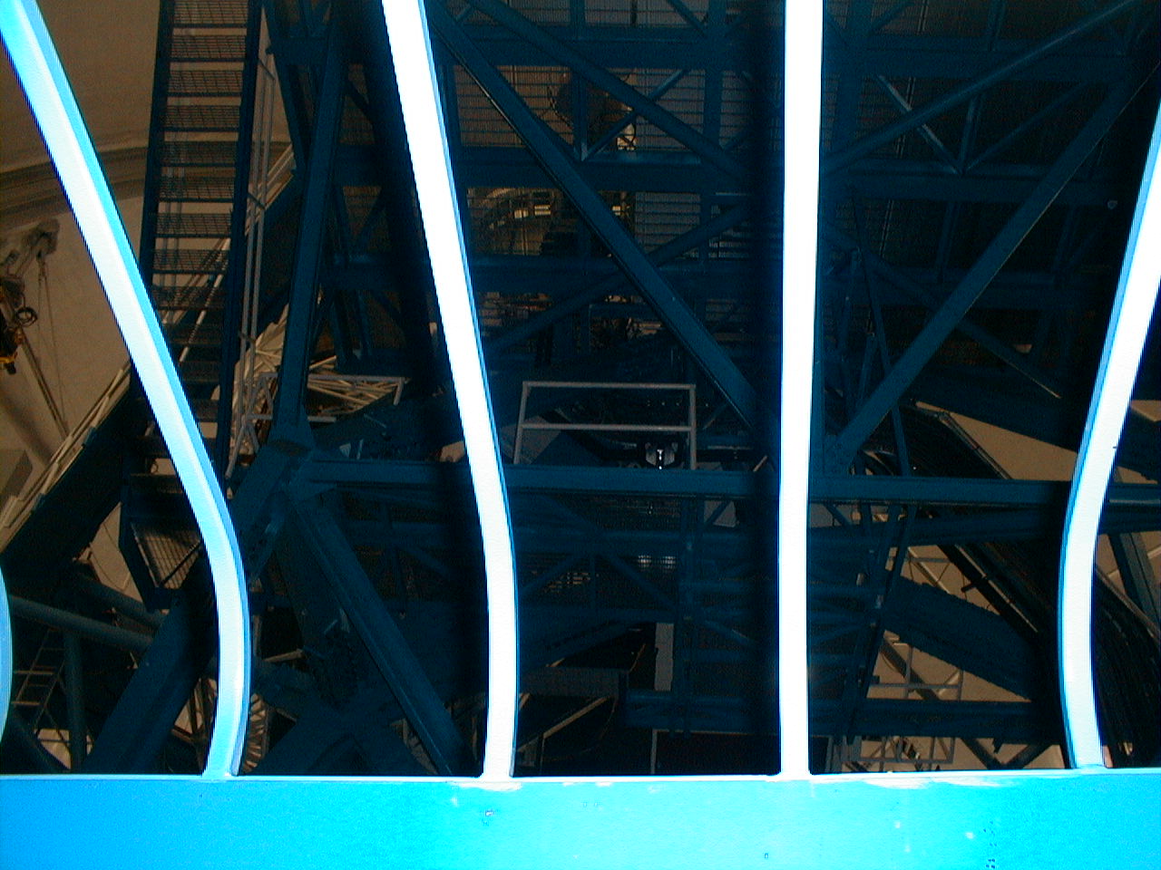 sad06.jpg 214 KB |
To maintain the thermal stability of the mirrors and instruments, Keck visitors are restricted to this small glassed-in viewing area beneath Keck I. It's hard to convince yourself you're looking at a telescope through all the steel girders and cables. The only thing I could tell for sure was that this was all very expensive. |
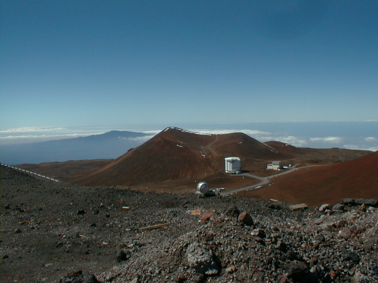
 sad07.jpg 188 KB |
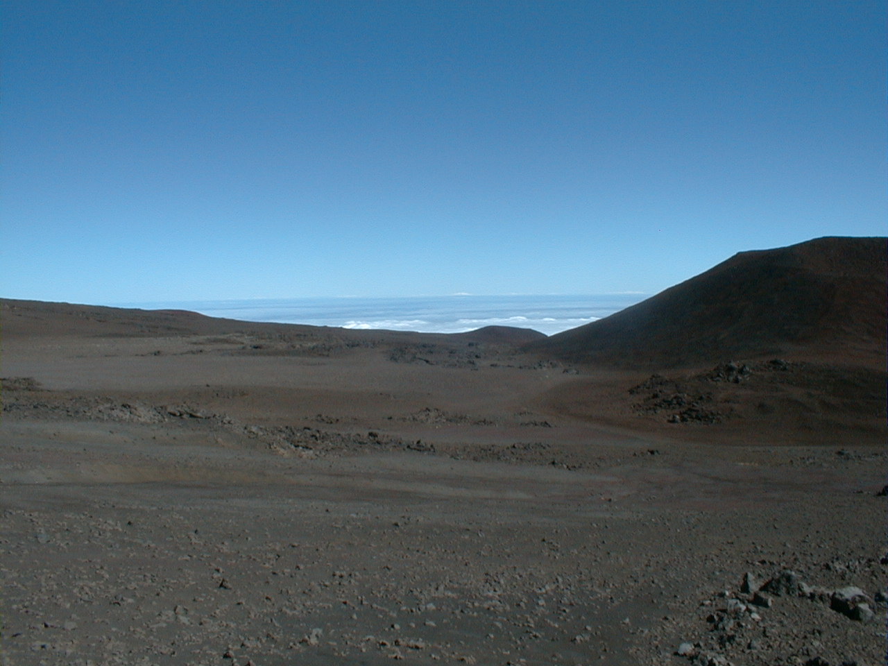
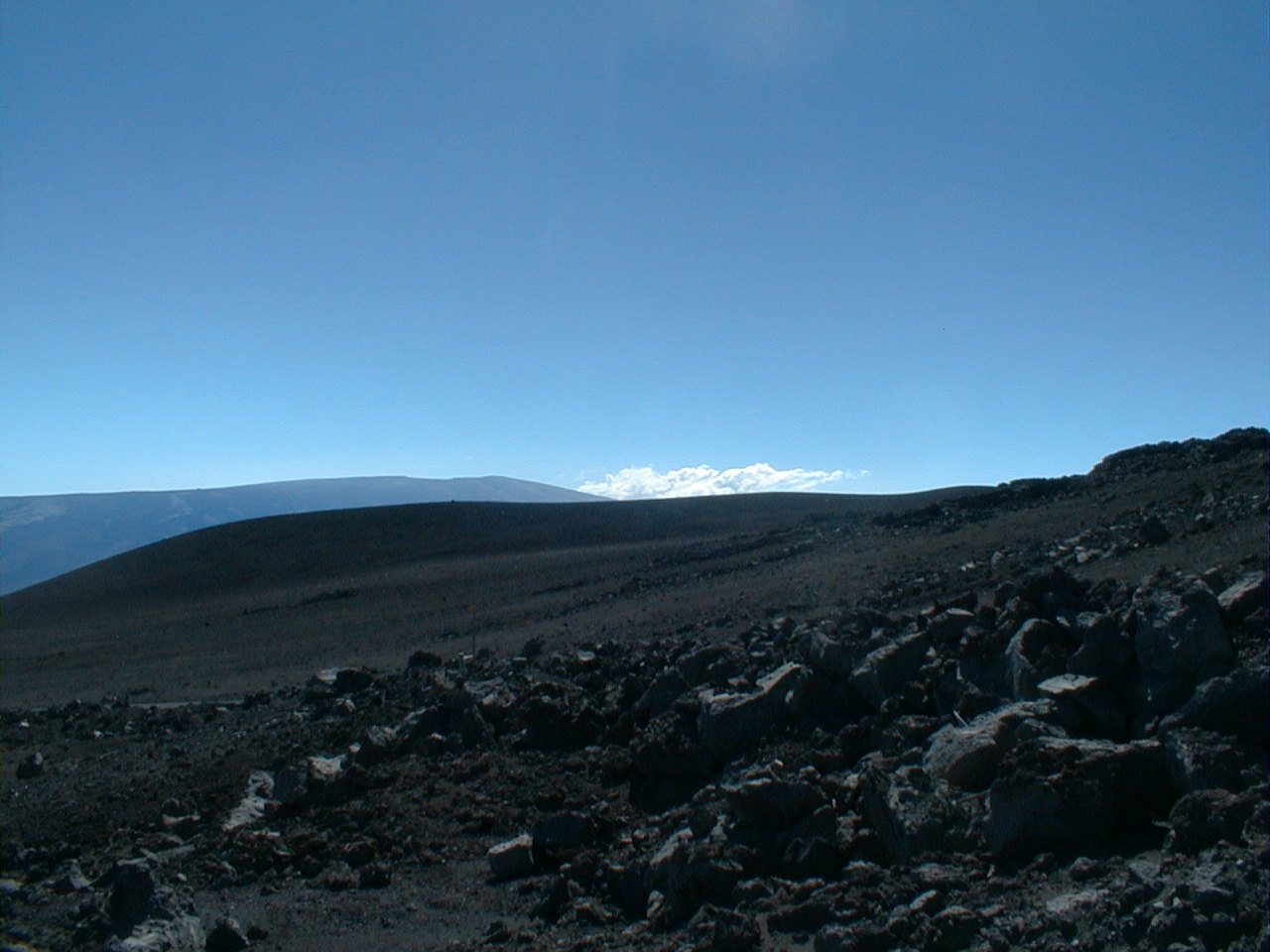
The entire Mauna Kea summit
complex, now looking back to the east from Pu'u Poliahu.
At this altitude, you're above 60% of the atmosphere,
which is great for seeing but so-so for breathing. The volcanic bombs littering the foreground slope of cinder testify to the explosive nature of capping phase alkalic eruptions. Such pyroclastics cover most of the summit area. Exposed flows like the one to the right of the small silver dome are the rule on Mauna Loa and Kilauea but are uncommon up here. |
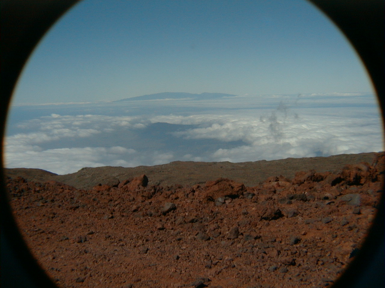 sad08.jpg 183 KB |
Looking NW from Mauna Kea's summit in the direction of Pacific Plate motion relative to the hot spot, Maui's Haleakala volcano dominates the horizon. Directly in line between these two giants and barely visible through the clouds is the summit of Hawaii's oldest shield volcano, Kohala (5505 ft), last active 400,000 years ago and now in its final erosional phase. |
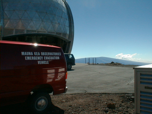 sad09.jpg 61 KB |
Is there an emergency evacuation
vehicle where you work? The dome houses a radio telescope. Hundred mile an hour winds, blizzards that last for days, UV radiation you can feel, 4,000-year-old cinder cones that probably won't explode again, the world's largest active volcano for a neighbor—what's to worry? |
 sad10.jpg 58 KB |
Subaru—built and owned by the Japanese government, not the car maker—is to the left of this light pollution control sign; the Kecks are on the right. "Subaru" is the Japanese name for the beautiful open cluster in Taurus we call the Pleiades. |
 sad11.jpg 62 KB |
Big holes cut to appease the wind didn't save this sign from a backbend. Believe both messages. |
 sad15.jpg 57 KB |
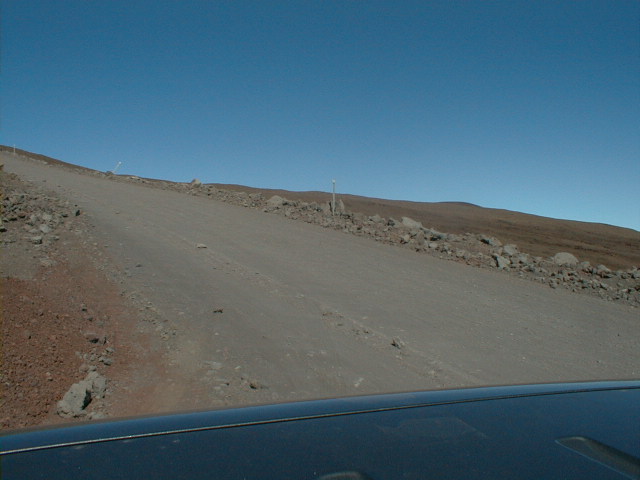
This is the first shot of a 5-frame low resolution (640x480) 135° panoramic sweep from northeast to south, taken a little below Mauna Kea's summit. |
 sad16.jpg 55 KB |
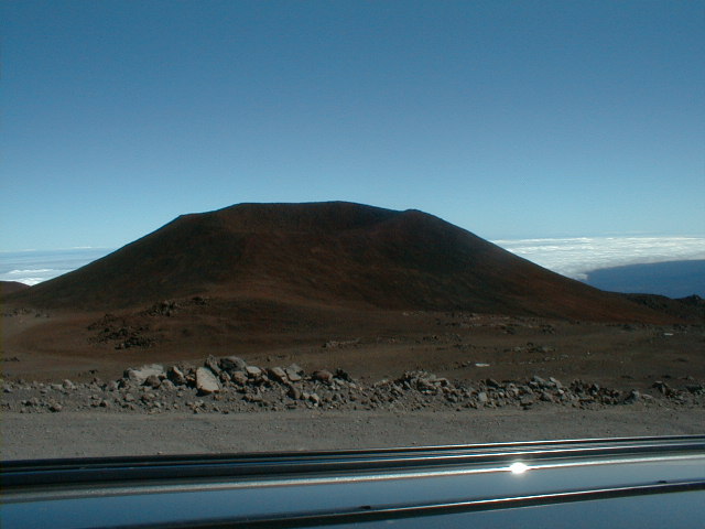
With oxidized cinder cones and tephra dominating the highest reaches of Mauna Kea, everything looks rusty. Mauna Kea means "white mountain", no doubt for its frequent snow cap, but "red top" would have been another good choice. This coloration is evident even at a distance. |
 sad17.jpg 57 KB |
An oxidized capping phase cinder cone capping Mauna Kea. |
 sad18.jpg 54 KB |
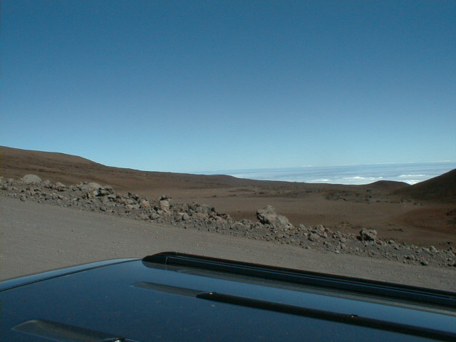
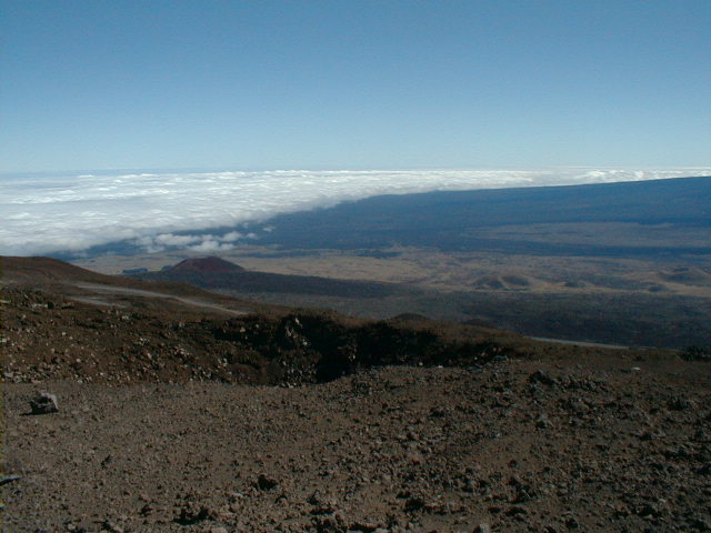
Ever-present clouds lap onto the windward coast at the foot of Mauna Loa. Hilo, socked in as usual, is behind the cinder cone at left. |
 sad19.jpg 54 KB |
Looking south now, Mauna Loa's Mokuaweoweo Caldera is visible at the summit. At 4 km wide and 180 m deep, the caldera is similar in area to Kilauea's but not as deep. |
 sad20.jpg 184 KB |
Now a high resolution (1280x960) version of the same 5-frame 135° panoramic sweep from a slightly different vantage. |
 sad21.jpg 202 KB |
Similar to sad16.jpg. |
 sad22.jpg 195 KB |
Similar to sad17.jpg. |
 sad23.jpg 198 KB |
Similar to sad18.jgp. |
 sad24.jpg 197 KB |
Similar to sad19.jpg—my best shot yet of the Mokuaweoweo Caldera at Mauna Loa's summit. |
 sad25.jpg 64 KB |
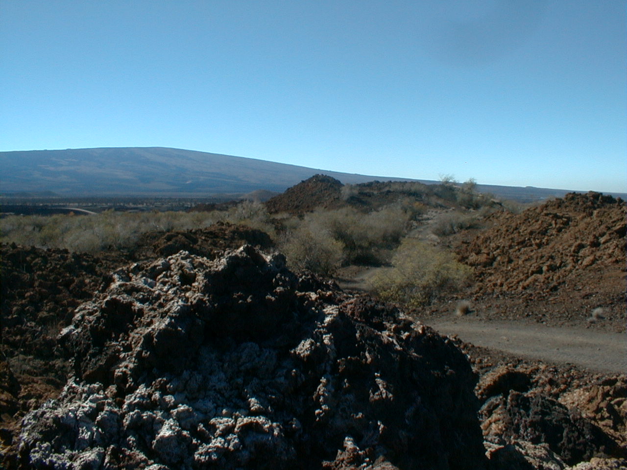
This 2-frame panorama shows the eastern half of the Humuula saddle. Unfortunately, the photo doesn't do justice to the beautiful deep reds and greens of the forested lower Mauna Kea cinder cone at left center. |
 sad26.jpg 59 KB |
The cinder cones in the saddle here all belong to Mauna Kea. Might they reflect passage of the hot spot and the transfer of the torch to Mauna Loa? |
 sad27.jpg 62 KB |
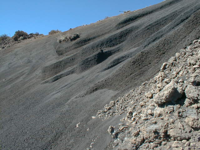
Tilted beds of black lapilli (pea-sized cinders) below the Mauna Kea summit. |
 sad28.jpg 62 KB |
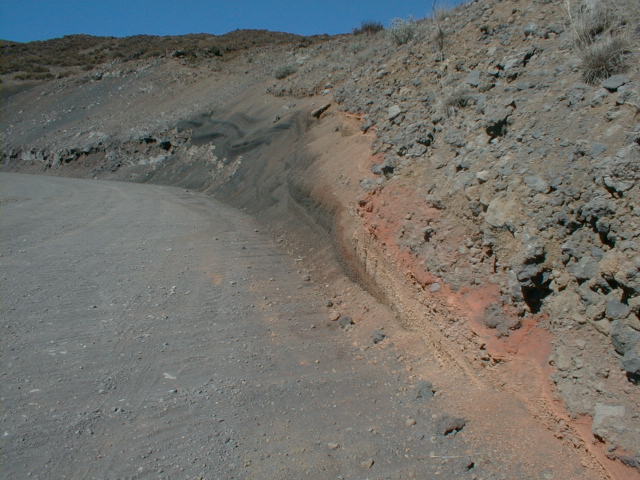
More colorful pyroclastic beds further down the road. Note the discrete red bake zone formed when the dark gray rubbly a'a flow overran the pale red pyroclastics at road's edge. The deep weathering of the a'a reflects the extreme climate here and the 4,000+ year age of the flow. Compare, for example with the ca. 1970 Mauna Ulu a'a flow seen in nap16.jpg on the Napau Crater Trail page. |
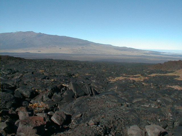
 sad29.jpg 61 KB |
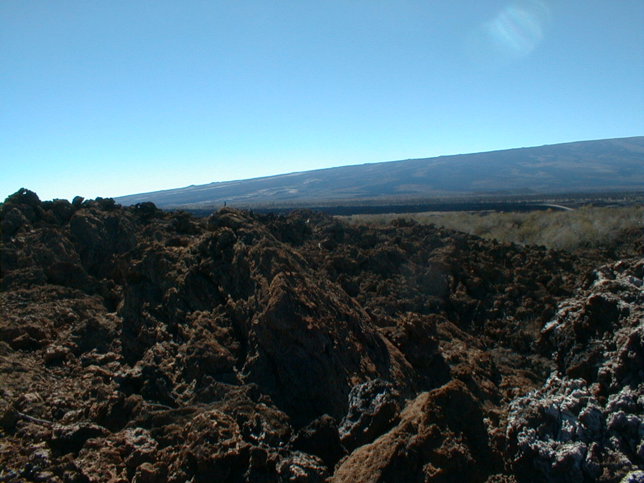
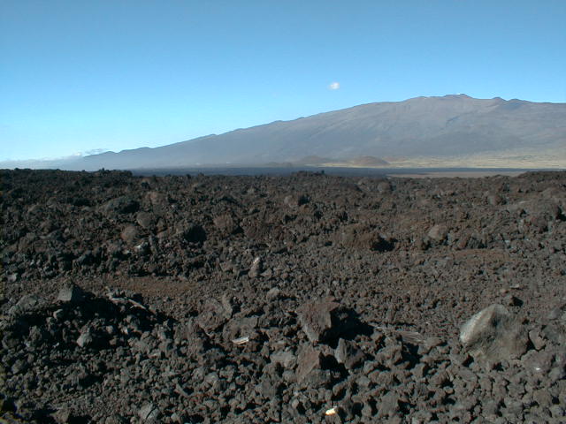
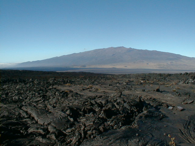
A 2-part low resolution panoramic sweep of Mauna Kea looking north from the foot of Mauna Loa, just above the Saddle. |
 sad30.jpg 59 KB |
The weathered a'a in the foreground is probably prehistoric. |
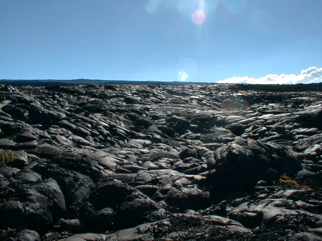 sad31.jpg 60 KB |
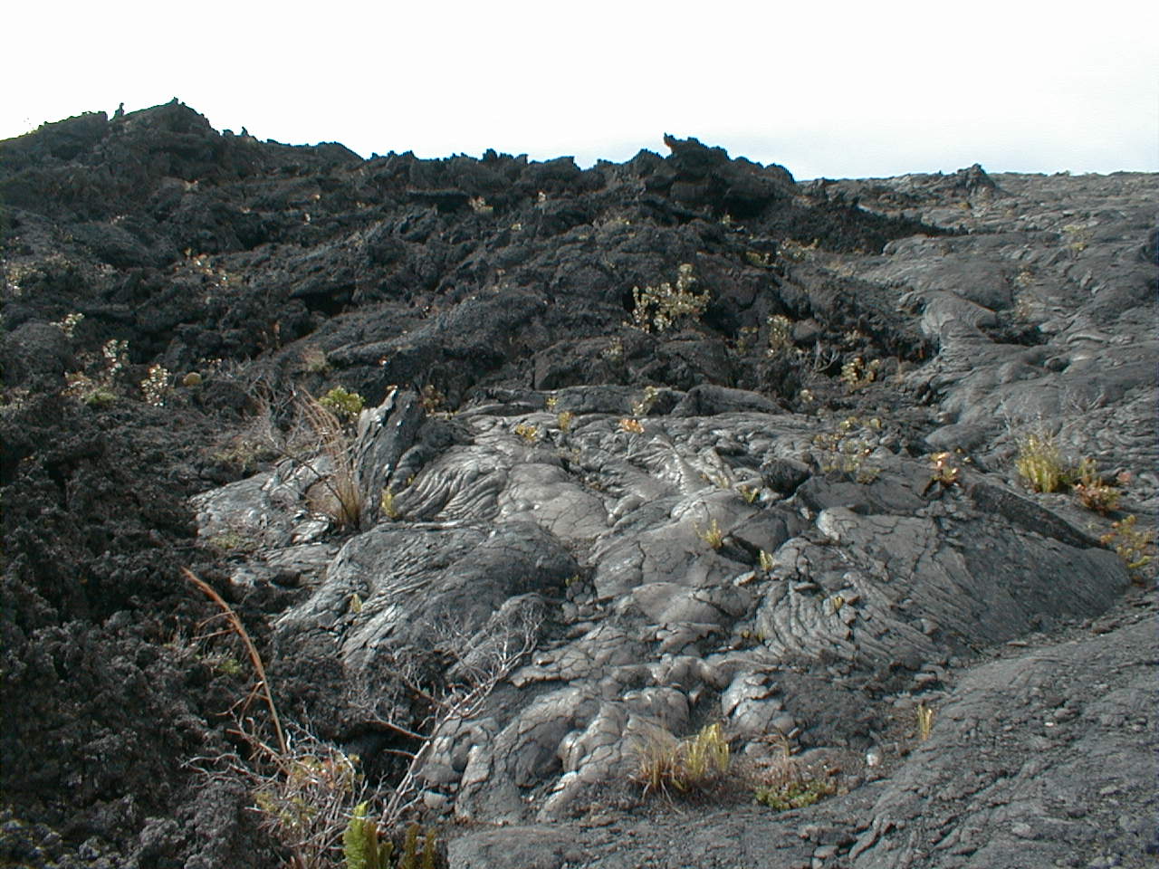
Endless pahoehoe from a Mauna Loa flow (1899?) stretching to the horizon, here looking upslope to the southwest. Distant cones dot horizon along Mauna Loa's NERZ. |
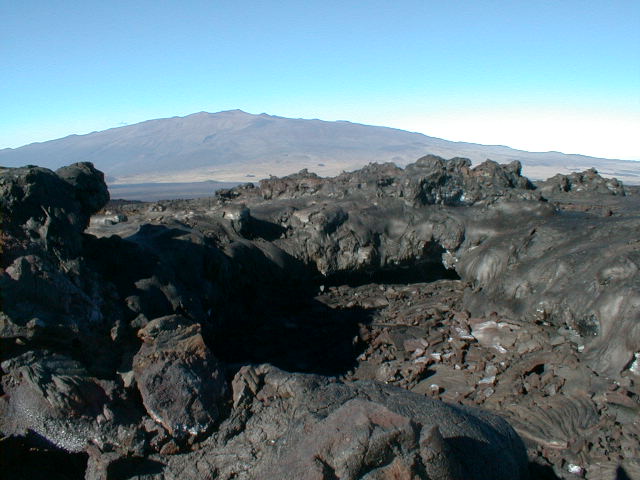
 sad32.jpg 63 KB |
The same pahoehoe flow, now looking downslope and northeast to the saddle. |
 sad33.jpg 61 KB |
This 8-10 m tube skylight well down a pahoehoe flow (1899?) at the foot of Mauna Loa looks to me like it hosted a fountaining breakout at one point. Note the drainback glazing at the lips and the spatter ramparts beyond. |
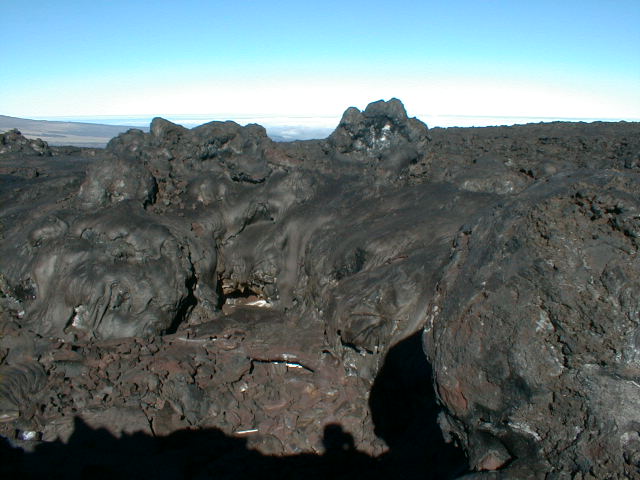 sad34.jpg 59 KB |
A close-up of the same skylight. |
 sad35.jpg 65 KB |
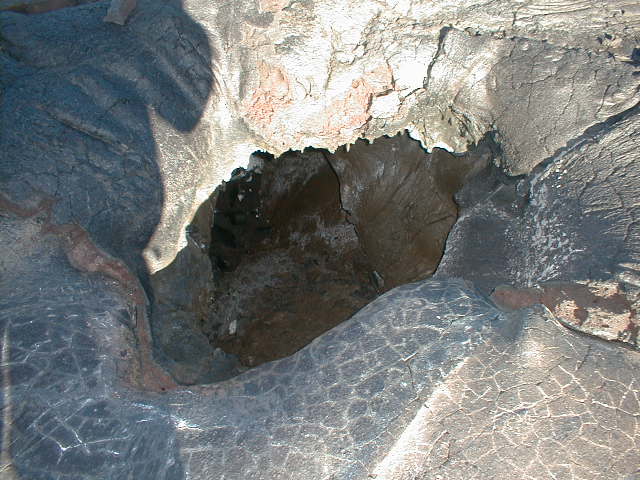
An even smaller breakout nearby, less than 1 m across and at least 2 m deep. Presumed cooling cracks form a polygonal pattern on the drainback surface at bottom. |
 sad36.jpg 63 KB |
Mauna Kea's north flank, this time at low resolution. Oxidized tephra from capping phase eruptions impart the reddish color at the top. |
| Home | Kona | Air Tour | Kilauea | Kamokuna | Hilina | Napau | Waipio | Glossary (Volcanoes) | Glossary (Geology) | Top |
Please address comments and corrections to jeremy@cliffshade.com
© 2002 Jeremy McCreary; last updated January 21, 2006