|
| |
Photojournal
Black Canyon of the Gunnison
Simply Extraordinary
|
 |
Pink veins of 1.4 Ga granite and
pegmatite adorn the Painted
Wall in the Black Canyon of the Gunnison
|
Last modified 10/17/04
 Under construction
— south rim pictures coming Under construction
— south rim pictures coming
Simply Extraordinary
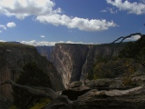
A spectacular day hike on the
north rim section of the Black
Canyon of the Gunnison National Park (BCGNP) was to my mind the high point of
our September, 2002 Colorado geology road trip. In geology, as elsewhere, extraordinary results point to extraordinary events
or, perhaps more often, to extraordinary combinations of less exceptional
happenings. The extraordinary Black
Canyon of the Gunnison (BCG) is a prime example of the latter pathway, and
"extraordinary" hardly does it justice.
Nothing—neither the Black Canyon pictures we'd seen, nor anything we
encountered along the approach to the north rim—prepared
us for our first disbelieving look into the chasm.
South of Crawford, the 15-mile dirt road to the North Rim Visitor Center runs on
a flat, monotonous high-desert plateau of hard Precambrian rock flanked by
unimposing, gently dipping cuestas of Morrison shale capped by Dakota sandstone. Nothing
out of the ordinary struck the eye as we entered the park entrance and headed east along
North Rim Road to Kneeling Camel View, our first stop. We could hear the distant rush of a hidden
river as we parked the car, but even here, within a hundred yards of the
brink, we could see
nothing but plateau.
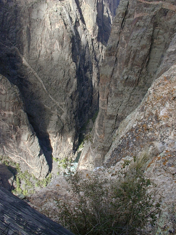
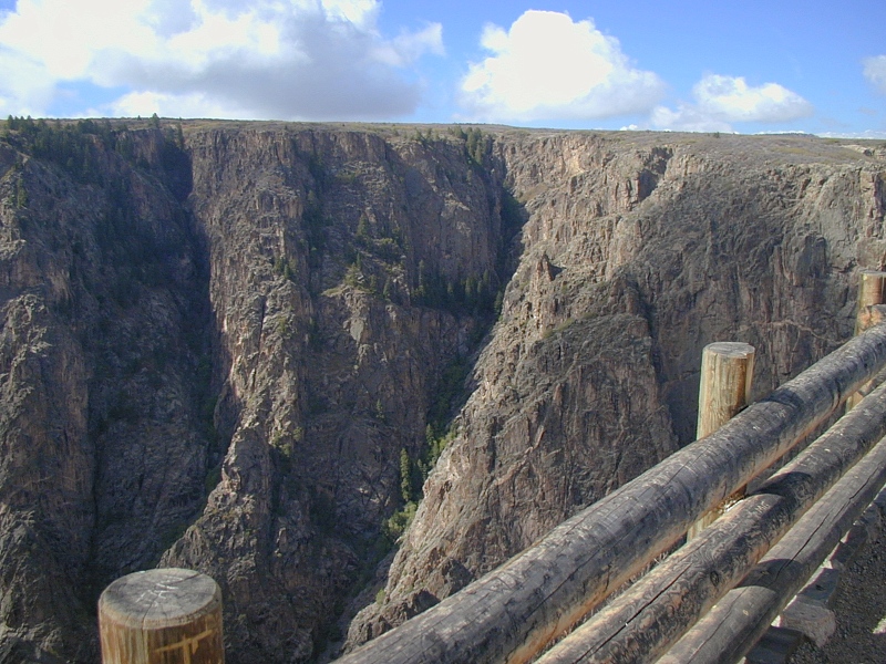
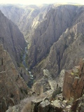
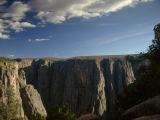
Exclamation Point
Suddenly before us was a guard rail and an
unimaginable vertical gash in the earth some 1,700 to 2,772 feet deep and in
places only 1,300 feet wide, cut smack through the most resistant of Colorado's
basement rocks. Half a mile straight down tumbled the mighty Gunnison River, looking innocent enough at the
moment—a glinting emerald and
white thread on the canyon floor.
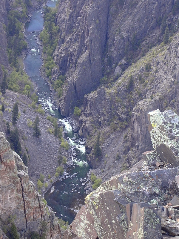
 |
Gunnison River
|
We tried to imagine the utterances (no doubt, some prehistoric version of
"Holy shit!") that must have passed the lips of
anyone stumbling onto this
chasm unprepared. The mind reels at its improbability as the gut
recoils from the terrifying drop. How on
earth could such a thing have happened? Every overlook here could have been called Exclamation Point.
How to Make a Black Canyon
 |
South Rim
|
Local and regional events of the last 70 Ma generously endowed the upper
Gunnison with all the tools a river needs to cut deeply into hard rock—a steep gradient,
an abundance of water, and a heavy and abrasive sediment load. Laramide basement uplifts,
voluminous mid to late Tertiary volcanism, and late Tertiary regional uplift
together progressively elevated the headwaters of the Gunnison. The volcanics
provided ample sediments, and the late Tertiary climate added great volumes of
water.
The Gunnison River
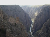 |
Gunnison River
|
Above and along
the Black Canyon, the waters of the Gunnison River gain momentum like a runaway
train on a steep grade. Over its 48-mile run through the Black
Canyon, the Gunnison
now drops over
4,600'—farther than the Mississippi falls over its entire 1,500 mile course. Along
the 12-mile stretch within
the National Park, the river's gradient averages a steep 96' per mile (about 2%) but
reaches 240' per mile at The Narrows. A wet, stormy late Tertiary climate, an
already high and
areally extensive drainage basin, and nearly 2 Ma of Pleistocene glaciations and
interglacials pushed
huge volumes of water and sediment into the river, often in floods of unimaginable fury.
Glaciers never reached downstream as far as the Black Canyon, but their outwash
and melt waters helped to shape it nonetheless. Coarse debris plucked from of the
upper Gunnison highlands by glaciers and brought down by high-energy streams gave the river
big, sharp teeth needed to cut through the Precambrian basement rocks that now
form the sheer canyon walls. As at Red
Canyon in the Colorado National Monument and the Inner Gorge of the Grand
Canyon, the great strength of the Precambrian rocks forced a very narrow
cut.
 |
Gunnison River
|
The stage for something
extraordinary was set, and the Gunnison played its part with a ferocity hard to
imagine from the dam-tamed river we see today. As with Glenwood Canyon
along the Colorado River to the north, most of the downcutting in the BCG took place in the
Pleistocene.
Step-By-Step Recipe
Interested in making your own Black Canyon? Just follow these simple steps.
1. Starting at ~72 Ma in the Laramide
Orogeny, elevate the future upper Gunnison basin in several discrete basement uplifts cored with resistant 1.7-1.4
Ga metamorphic and
granitic rocks. The resulting faulted anticlines
now underpin some of Colorado's highest ranges—the Sawatch, the Elks and the
San Juans.
2. To the southwest, raise a lesser Gunnison Uplift and begin to erode away its
Mesozoic sedimentary
cover to expose its tough Precambrian core. Specifically, remove the Lower Cretaceous Dakota coastal sands marking the arrival of the
Western Interior Seaway, the Late Jurassic Morrison floodplain clays and fluvial
sands, and the Early Jurassic Entrada desert
dune sands resting unconformably on the Precambrian core. Complete the stripping
in Step No. 5.
3. Starting ~36 Ma, begin covering the upper Gunnison basin and the Gunnison Uplift with a volcanic pile more than
4000' feet thick accumulated in 3 long and prolific episodes of explosive and
basaltic volcanism centered in the San Juan Mountains and the West Elk and Sawatch Ranges. Continuously sprinkle the
pile with easily mobilized volcanic debris—cinder and ash falls, ash flows and
mudflows. Heap up West Elk volcanic flows to the north to push the course of the Gunnison
River progressively
to the south across the
top of the ever-changing volcanic pile. Stop at ~6 Ma when the river is finally
and irreversibly entrenched directly over the
long-buried Precambrian core of the Laramide
Gunnison Uplift.
5. Starting in the late Tertiary around 28 Ma, add a wet, stormy climate and 5,000' of regional uplift
affecting all of the Southern Rockies. This will further energize the streams
feeding copious volumes of water and abrasive sediment to the Gunnison and
further steepen the Gunnison River's own gradient. The river will now cut
downward with vigor, even after reaching the hard Precambrian rock coring the
Gunnison Uplift.
6. At elevations above 8,000', ice down the West Elk and San Juan volcanic
fields with a series of voraciously erosive
glaciations starting
at around 1.8 Ma and lasting throughout the Pleistocene.
7. Rinse and scour the narrow
Gunnison channel copiously, first with repeated torrents of glacial outwash heavily
laden with coarse glacial debris and then with frequent and furious Quaternary (post-glacial) floods. Stop around 10 Ka.
Now stand back and enjoy the view.
Black Canyon of the Gunnison and West Elk Mountains
|
Hotchkiss and Crawford
|
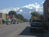 |
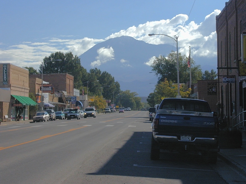
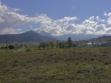
Hotchkiss:
An imposing Mt. Lamborn (11,401') of the West Elk Range looms in the east as we pass
through rural Hotchkiss on our way to the north rim portion of the
Black Canyon of the Gunnison National Park (BCGNP).
From Hotchkiss to
Crawford, CO92 passes though lush rolling green farmlands far removed
from the urban sprawl of the I-25 corridor just east of the Front Range.
|
 |
 |
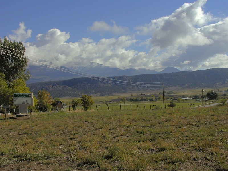
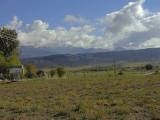
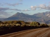
Crawford:
Looking east from CO92 just west of Crawford, the West Elks rise behind
a low dark ridge of rocks (2nd frame) likely to be Early Phase volcanic breccias.
The West Elks are resistant mid-Tertiary intrusions now supporting
erosional remnants of the volcanic pile that the intrusions once fed.
Flows from the West Elk volcanic field set the Gunnison's course across
the Gunnison Uplift, and volcanic debris shed from the field gave the
river teeth.
|
 |
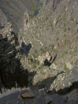
Black Canyon of the Gunnison National Park, North Rim
|
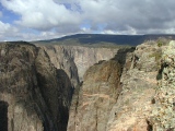 |
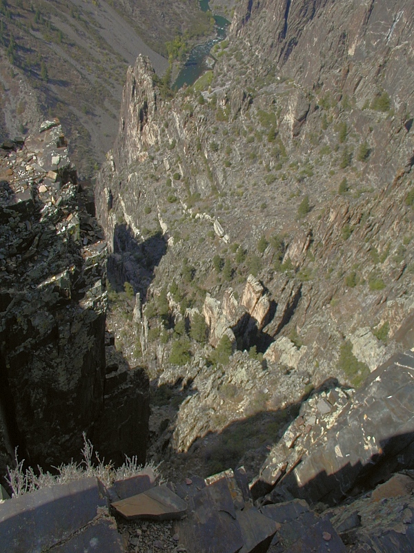
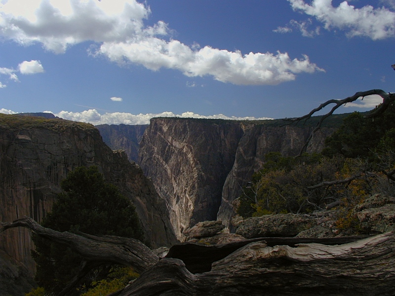
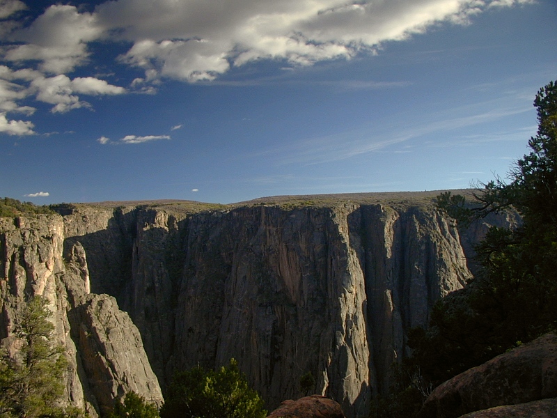
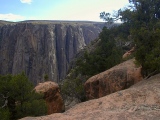
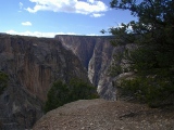
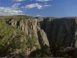
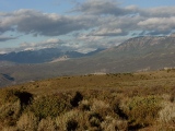
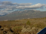
Kneeling
Camel View: This west-looking series, panned from the rim down to the canyon
floor, records our first look into the canyon. Above the rim in the
distance are late Jurassic Morrison
Formation claystones capped by
resistant Early Cretaceous Dakota Sandstone in a north-dipping cuesta
aptly named Mesa Inclinada, here with Green Mountain (8,563') at its
crest. Beneath the Morrison are desert dunes of the early
Jurassic Entrada Sandstone (not visible here). Between the Entrada and the Morrison,
Colorado's climate got wet. Between the Entrada and
the planed off Precambrian basement exposed in the canyon walls are ~1.5
Ga of missing earth history—the local version of the Great
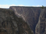
Unconformity. Black Canyon
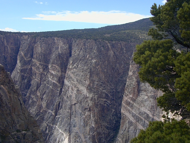
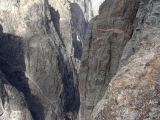
Gneiss: The dark wall rocks seen here are the Black Canyon Gneiss, a suite of
1.78-1.65 Ga quartzitic gneisses, mica schists, intruding
granites and migmatites, the last with the swirling banded pattern of light and dark taffies pulled
together. The gneisses and schists are the remains of one or more oceanic
volcanic arcs that docked against the nascent continent along the southern margin of the
Wyoming Craton ca. 1.7 Ga. The 300 Ma-long slow-motion collision
heated
and compressed the arc rocks to their present metamorphic
state. Everywhere, the canyon walls are laced with white and pink veins of
granite and
pegmatite related to 1.4 Ga and later intrusions particularly
well displayed in the Painted Wall.
Occasional dark Cambrian
dikes mark the last known igneous intrusions at 510 Ma. |
 |
|
 |
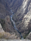 |
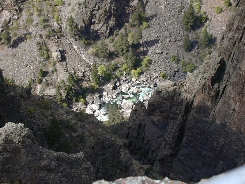
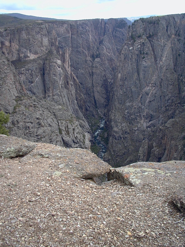
The
Gunnison River: Before the Gunnison River was dammed
upstream for irrigation water and flood control, its water and sediment
load gained tremendous momentum both above and within the Black Canyon.
Today, the Gunnison drops over
4,600' along its 48-mile run through the Black Canyon — farther than the Mississippi falls over its entire 1,500 mile course. Along
the 12-mile stretch within
the National Park, the river's gradient averages a steep 96 ft/mile (about 2%)
and tops out at 240 ft/mile at The Narrows.
With that kind of head, historical Gunnison flows reached a
thundering 12,000 cubic feet per second at flood stage in the Black Canyon
prior to damming. According to the BCGNP brochure, that represents 2.75 million
horsepower of concentrated cutting power. By all accounts,
Pleistocene floods were much greater. The violence of such events
are beyond imagination.
Canyon Comparisons: A hundred miles or so below the Black Canyon, the
mighty Gunnison joins the
Colorado River at Grand Junction.
(Above the confluence of the Green
River at Dead Horse Point in western Utah, the Colorado used to be
rather aptly known as the Grand River—hence place names
Grand Junction, Grand Valley, etc.) Gunnison waters and sediments helped
the Colorado cut a spectacular canyon of its own through another Laramide
uplift—the Kaibab Uplift of northern Arizona, at the western margin of
the Colorado Plateau. I refer, of
course, to the Grand Canyon of the Colorado, the longest and largest
canyon on the planet.
Most Grand Canyon vistas feature the 2-mile-wide outer canyon
the Colorado and its local tributaries cut through the thick, relatively
soft sedimentary cover of the
Kaibab Uplift. To anyone standing on the brink of the Grand Canyon,
these sedimentary walls look sheer enough, but the Black Canyon's walls
are much steeper on average. Since little sedimentary cover remains over
the higher and generally wetter Gunnison Uplift, the Black Canyon has no
outer canyon to speak of.
When the meandering Colorado finally cut down to the hard
Precambrian rock at the core of the Kaibab Uplift, it settled into a much narrower Inner
Gorge, the true analog of the Black Canyon. The Inner Gorge penetrates
an impressive ~1,800 ft into the Precambrian basement, while the Black
Canyon cuts through 2,772 ft of Precambrian rock just as hard.
Worldwide, few rivers can claim
great canyons deeper than they
are wide. The Gunnison is a standout among them; the Colorado never made
the cut.
|
|
|

|
 |
 |
 |
 |
 |
 |
|
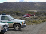 |
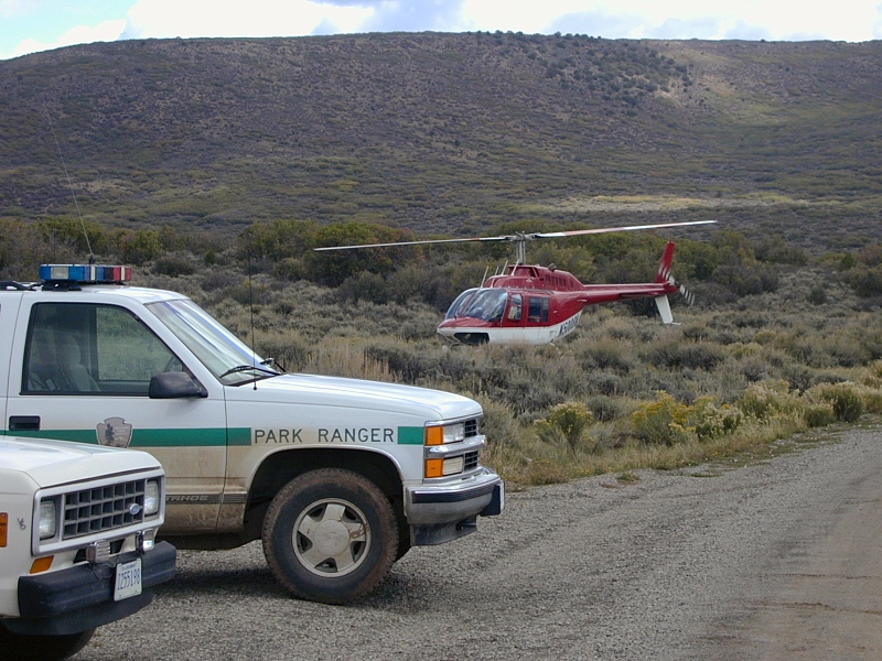
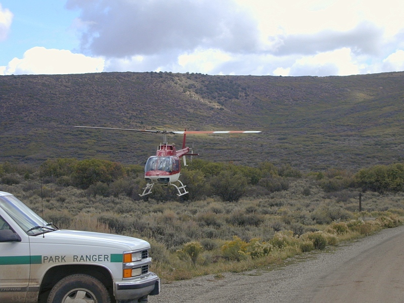
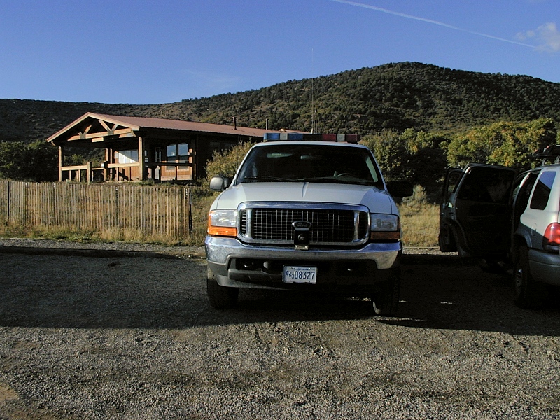
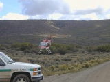
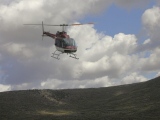
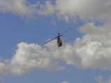
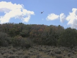
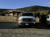
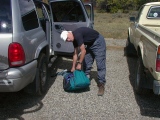
North
Rim Ranger Station: When we pulled up to the
remote and usually quiet North Rim Ranger Station around noon, the place
was hopping with National Park Service
(NPS) personnel, sheriff's crews and a swarm of official vehicles,
including this support helicopter. A hiker reported missing several days
earlier had been found dead on the floor of the canyon that morning.
Whether the deceased had fallen or jumped had yet to be determined, but
an NPS anthropologist pulled into the search from his dig 50 miles to
the south told us that many people
come to national parks to end their lives each year. The sequelae had
become an unwelcome and all too frequent part of life in the NPS.
Later, on our North Vista Trail hike, we ran across a contemplative park
ranger sitting elbows on knees, staring across the canyon. His young
muscular face, military bearing, short hair, fatigues and side arm made
him look more like a soldier, as I suspect he had been not so long
ago. Some of the overlaps between soldiering and rangering were
beginning to dawn on me.
John wondered aloud if his 22 year old outdoor-minded daughter Heather
might end up doing
something like the NPS. She holds a passion for climbing and a degree in environmental
chemistry. When these photos were taken, she was a Peace Corps volunteer stationed in
Nicaragua. As we chatted with NPS personnel returning from the search,
John decided that she could certainly do worse. For that matter,
both of us wondered how the life of a ranger might have compared
to our own lives in medicine. Carrying guns and cleaning up after suicides
doesn't sound much better than doing radiology, we concluded, even if it
is outside. |
 |
 |
 |
 |
 |
 |
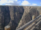
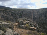
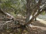
Chasm
View Nature Trail: The day's hiking began with the Chasm
View Nature Trail, a self-guided 0.5 mile loop that served as an
excellent introduction to the area. We enjoyed former ranger Paul Zaenger's lovingly written
guide book, Beyond the Brink of Time, nearly as much as the hike itself. Together with the pinyon pine, the
shaggy-barked Utah junipers shown here dominate the pinyon-juniper
woodlands rimming the canyon. After surviving nearly 8 centuries, the
pinyon pines at the brink of the canyon are some of the oldest and largest in the
US.
Not far from here, we came across a pocket of rounded cobbles worn smooth and left
behind by the ancestral Gunnison as it entered the Precambrian core of
the Gunnison Uplift. How these conspicuously out-of-place river rocks managed to escape
removal, by the elements or by visitors, is unclear.
|
 |
 |
 |
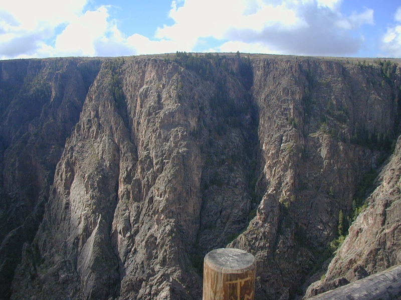
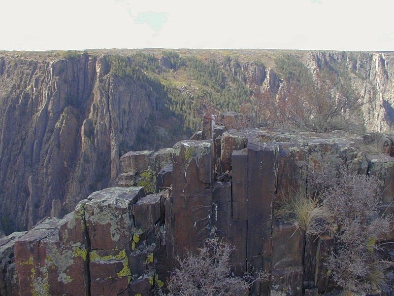
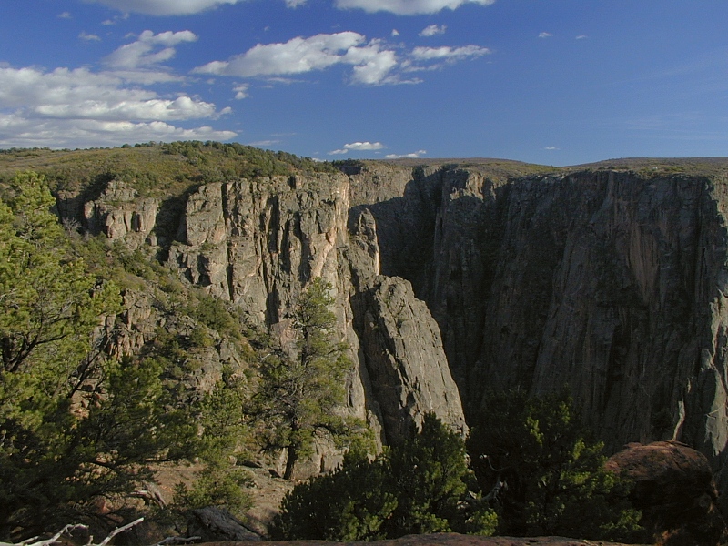
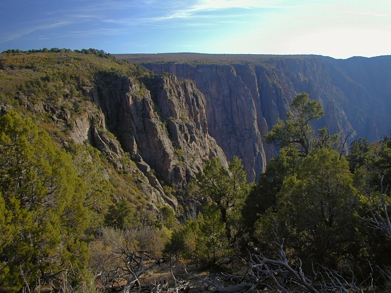
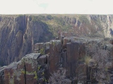
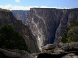
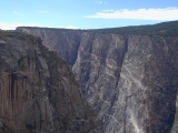
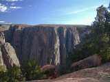
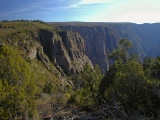
The
Painted
Wall: At a sheer 2,300 feet, the Painted Wall, a prominent segment
of the Black Canyon's north rim, is Colorado's highest cliff. The darker
rock is Black Canyon Gneiss. The bold
white and pink bands are granites and
pegmatites injected during Middle Proterozoic (1.4 Ga) through
Cambrian (~510 Ga) intrusions.
Large books of white
mica (muscovite) and crystals of pink potassium feldspar and translucent
quartz give the
pegmatites their lustrous pink look.
Just as
Precambrian joints and faults controlled the placement of these igneous
intrusions, the current regional jointing system now controls the
locations of the side canyons cut by smaller streams left behind as the
mighty Gunnison cut through the Gunnison Uplift.
These views look west from the Chasm View Nature
Trail overlook, which is across the canyon from Chasm View on the
South Rim.
|
 |
 |
 |
 |
 |
 |
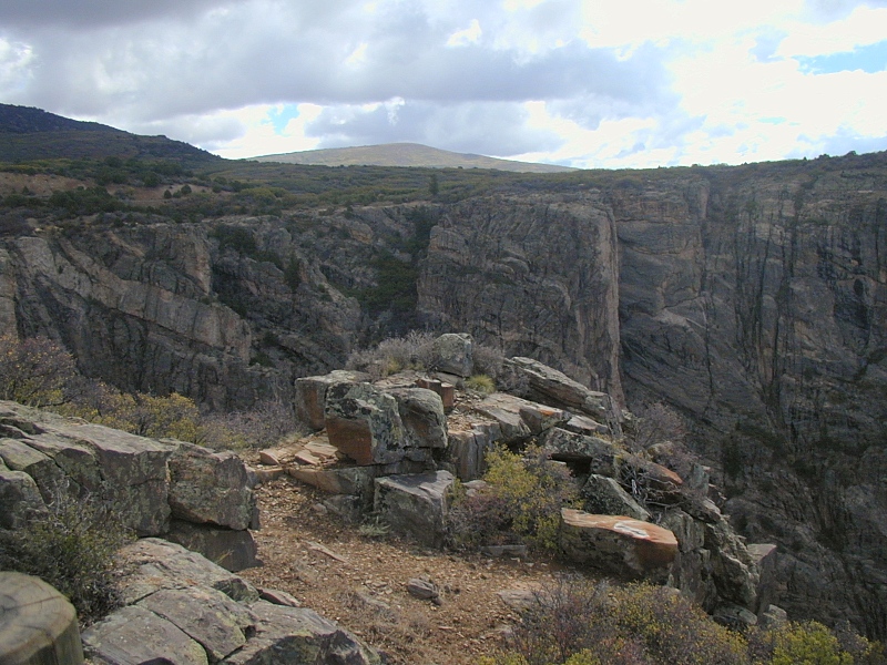
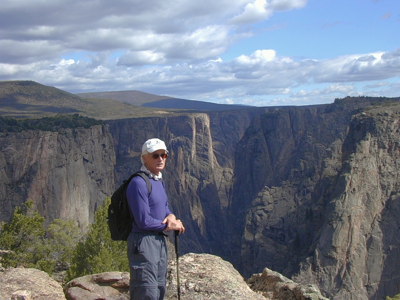
North
Vista Trail: The deservedly popular North Vista Trail
starts at the North Rim Ranger Station and ends atop the Cretaceous and
Jurassic strata of Mesa Inclinado at Green Peak (8,563'). It's an easy
but dramatic walk with a sky-high gain/pain ratio.
A common and worthwhile halfway destination is the aptly named
Exclamation Point, just upstream from the Painted
Wall.
|
|
 |
 |
 |
 |
 |
 |
|
|
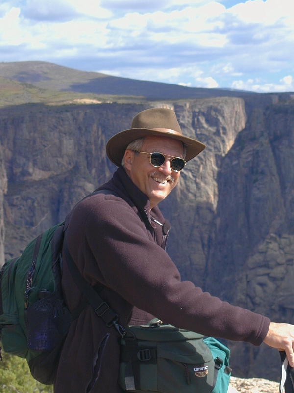
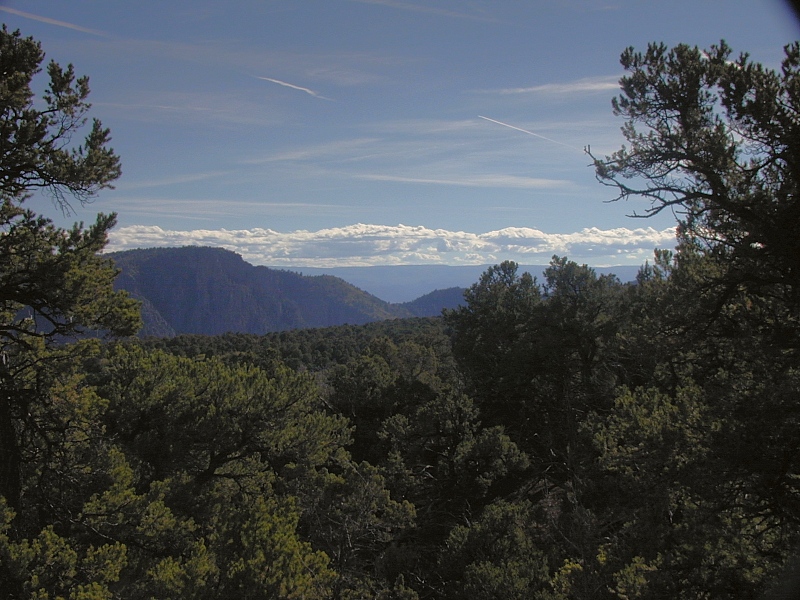
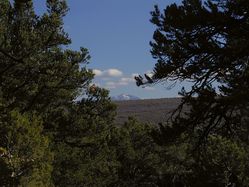
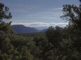
Beyond
the rim: A short
scramble up the face of the cuesta above the North Vista Trail near
Exclamation Point opened up the view to the south beyond the canyon rim.
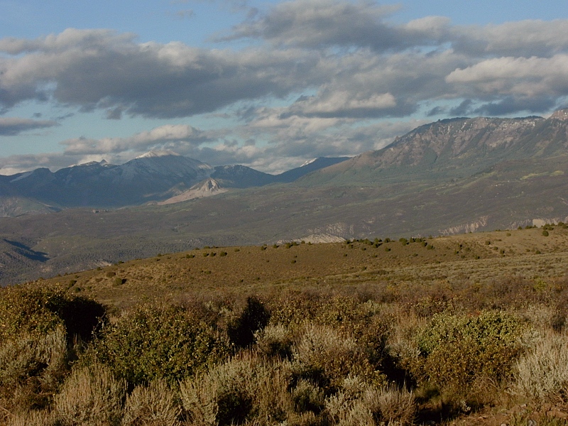
Looking SW (top left), the north flank of the Uncompahgre Plateau
(bottom left) looms as a long dark ridge on the horizon.
To the SE (bottom left), we caught our first and only glimpse of the San
Juans. The peak is Sheep Mountain (13,168'), a volcanic remnant on the
north flank of the range. |
 |
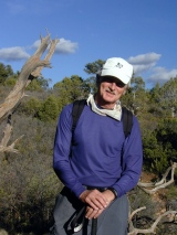 |
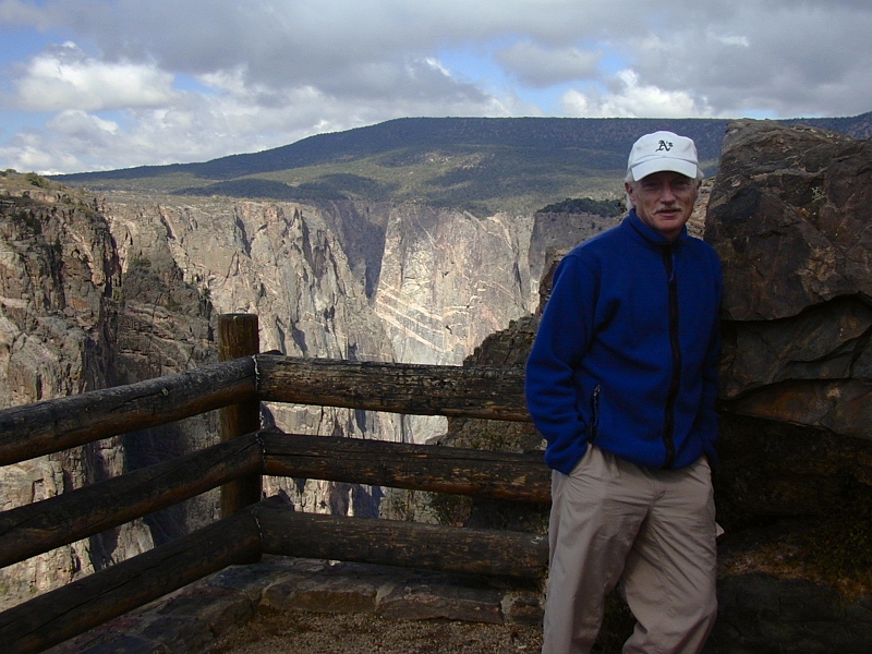
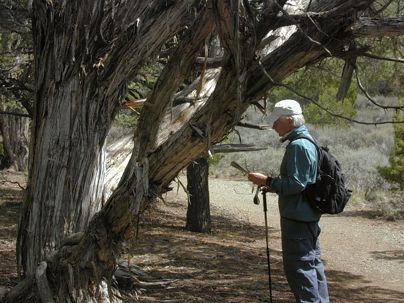
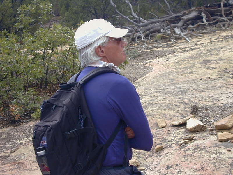
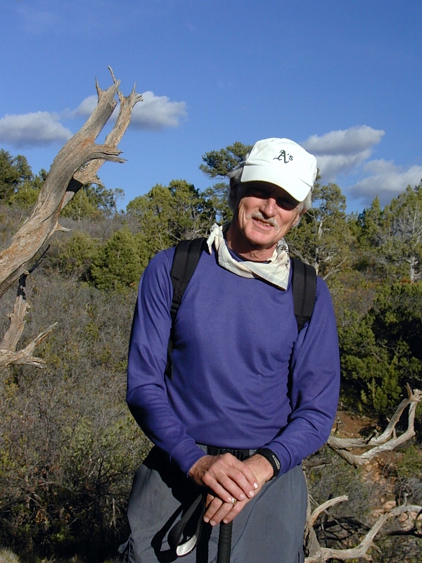
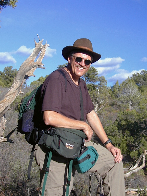
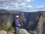
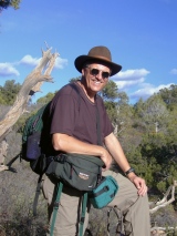
John
(top left) and I take a breather on the way back to the ranger station,
still on the North Vista Trail. Over his
long career as a boy scout leader, John had perfected a slow and steady
approach to hiking. My long legs seem to have a certain minimum speed
that gobbles up flat ground but makes for frequent breathers on the
uphills. To a hiker-photographer, the rabbit style can be very useful,
but we all know that the turtle usually wins.
|
 |
 |
Our parting shot of the Black Canyon caught late afternoon sun on the
north rim near the ranger station. We were sorry to be leaving,
but it had been a very good day indeed. |
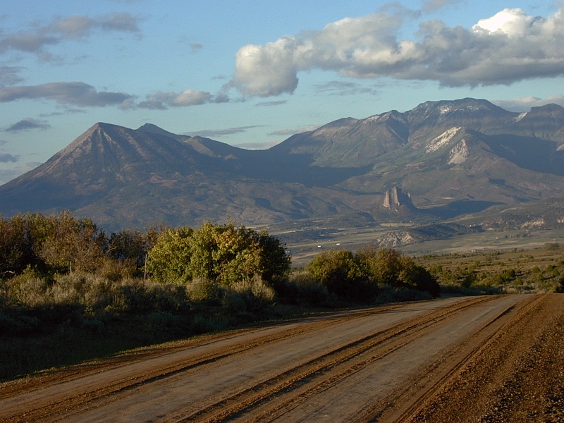
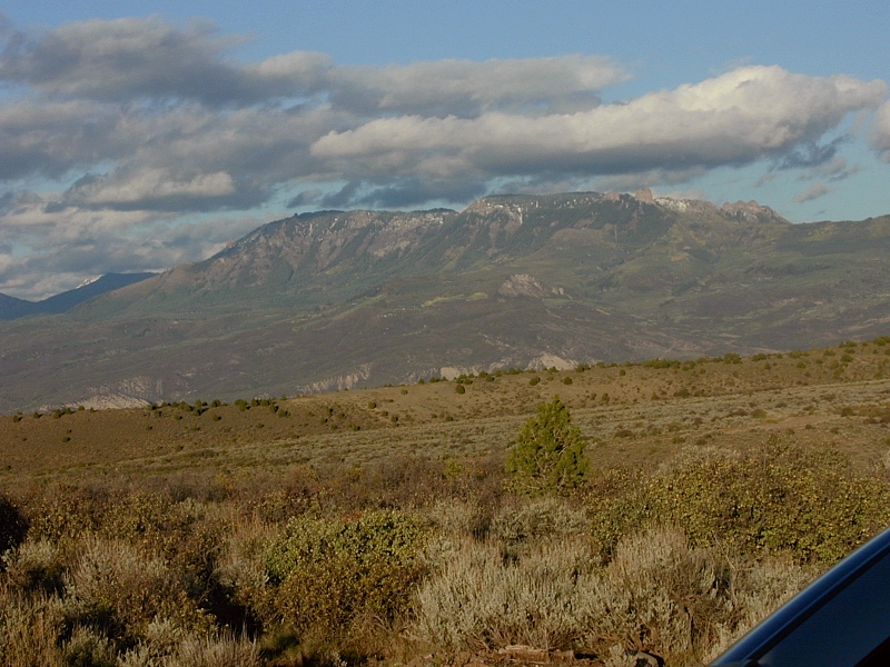
West Elk Mountains
|
 |
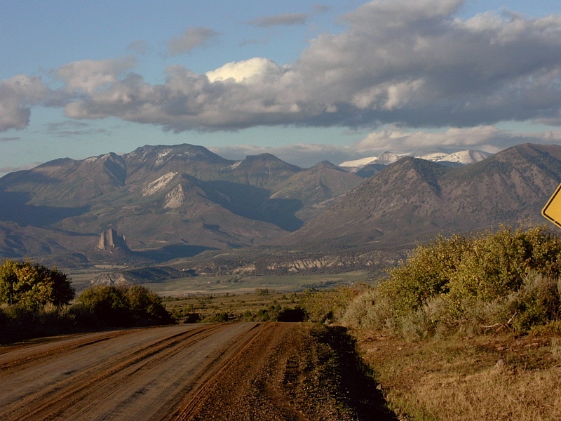
West
Elk Mountains: The lure of a much-anticipated hike to Cathedral Lake
the next day finally pulled us away from the Black Canyon around 5 PM.
We had to push now to make Castle Creek Canyon south of Aspen by mid
morning, but this magical view of the West Elks to the NW from the dirt
road back to Crawford was reason enough to stop one last time.
Landsend Peak (10,807') on the far left towers over Needle Rock, a
volcanic neck in the center distance. The hard, light-colored Oligocene intrusions forming the skeleton of the West Elk Range are more
apparent in the late afternoon light than they had been in that morning. The West Elks are erosional remnants of an immense volcanic field
erupted in two waves of explosive volcanism that inundated much of
central and southwest Colorado in mid- to Late Tertiary time. Early
Phase (36-31 Ma) eruptions blanketed large areas with andesitic lava flows, volcanic
mudflows and ash falls, particularly in the
West Elk and San Juan Mountains. The far-flung West Elk Breccia dates from this
phase. Erosion has since carved it into many fantastic shapes, including
the Castles near the town of Gunnison.
Middle Phase (30-26.5 Ma) eruptions seared the
by this time eroded Early Phase landscape with fast-moving incandescent ash flows
(AKA pyroclastic
flows, glowing cloud eruptions) depositing ignimbrites
(welded tuffs)
and unwelded tuffs over nearly a third of the state. Middle Phase tuffs
apron the south flank of the West Elks to form the Palisades on the
Gunnison. The Middle Phase coincides in timing and style with the
Ignimbrite Flare-up that turned the entire Basin and Range into a
lifeless moonscape around 30 Ma. Non-explosive Late Phase volcanism (25-5 Ma) blanketed the state
with less violent basaltic lava flows. This final volcanic episode isn't
preserved in the West Elks but left basalts capping Grand Mesa
and ridge tops north of Aspen.
|
 |
 |
 |
 |
 |
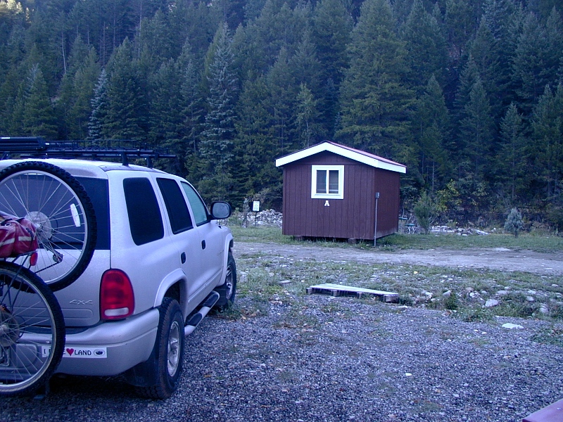
Somerset—Coal Country
|
 |
As we drove north from Hotchkiss on beautiful CO133 in the failing
light, we couldn't bring ourselves to press on and lose the scenery to
the dark. Just past Somerset, we took a tiny cabin (top left) on Coal
Creek at Crystal Meadows
Resort, a rustic West Elk hunting and fishing lodge at the turnoff for County
Road 12 (a well-graded dirt road leading to Crested Butte and Gunnison
— a must-drive for anyone interested in seeing the best of Colorado).
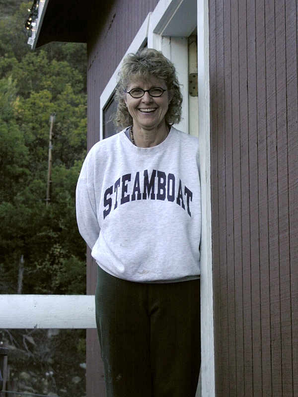
Owner Cheryl Dix (2nd frame) took care of us with an ever-present
warm smile that could brighten anybody's day. That evening, we plopped
down to a hearty hunter's dinner. When Cheryl learned that we'd be
shoving off for Cathedral Lake
at dawn, she insisted on getting up early to make us a breakfast that
kept us going into early afternoon.
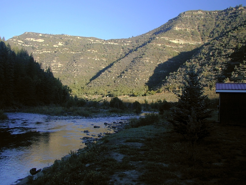
The Somerset area is prime Colorado coal country. Most of the coal
mined from the richly organic late Cretaceous Mesaverde
sandstones (3rd frame, here above Coal Creek and CO133) is valuable
low-sulfur bituminous, but heat from the nearby West Elk volcanic field
cooked up an especially prized anthracite here. The Somerset mining
operation founded by Cheryl's father fills over a hundred 100,000-ton
coal cars every other day. After this stop, we noticed long coal trains
everywhere. |
 |
 |
Gallery Note: All images on this page are from September, 2002 unless noted otherwise
below.
References
In addition to the references cited on the home
page and in supporting articles, this
article relies on the following sources, in alphabetical order by first author:
|