|
| |
Groundwork
Colorado Geology Overview
The What, Where, When, How and Why of Colorado's Physical Past and Present
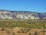
Right: Trees and snow mark major Laramide
uplifts in green and white while salmon pink marks the Colorado
Plateau in this true-color satellite image of Colorado and surrounding
states, courtesy NASA's Visible
Earth
|
 |
Last modified 10/18/04
 Under
construction Under
construction
Top
Page Index
About Time
 |
The 'About Time' icon
|
Geologic understanding requires careful attention to time as well as
three-dimensional space, so we'd better stop here first. If you're unfamiliar
with geologic time terminology and
abbreviations, take that detour now.
With over 50 million modern human
lifetimes elapsed since the planet formed around 4.5 Ga, geologic or deep time is, to say the least,
difficult to grasp. But the effort pays, for with a feel for deep time
comes a sense of its great power: Given enough time, almost anything
energetically possible can happen—even at very large scales. And so it goes
with the bending of seemingly rigid rocks, the cutting of majestic canyons, the raising
and erasing of entire mountain ranges, the opening and closing of globe-girdling
oceans, and the incessant splitting and regrouping of the dancing
continents.
Easy Does It
Our usually reliable day-to-day sensibilities tell us that such things can't
happen, but they can and do happen because solid rock reveals its
malleability only over time scales
very long compared to human events—typically in spans of tens of thousands if
not millions of years. Given enough time, cold surface rock will yield to flowing water and
buried rock will bend or even flow rather than break. The planet's
had ample time for all of this, even if it's out of our ken.
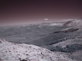
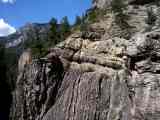
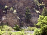
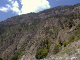
 |
Upturned sedimentary strata at the mouth of Boulder Canyon
|
Under great confining pressures, or at depths
where temperatures reach a significant fraction of their melting points (typically 10-15 km),
rocks that are quite brittle at the surface become sufficiently plastic to deform
without fracture at rates comparable to
the rate at which fingernails grow (~10 mm/yr). Granted, that makes molasses look
downright mercurial, but then relative viscosity is the whole idea here.
My piano tuner's job security rests on the fact that properly tuned piano wire flows
(stretches) at a similar rate and falls out of tune in a matter of months. Over
a few Ma, fingernail speed is plenty fast enough to fold great thicknesses of
sedimentary rock over the east edge of the relatively brittle Front Range
basement block, as in the photo at right. Over 50 Ma, an entire mountain range
like the Ancestral Rockies can rise up and vanish.
 The pink feldspar bands in the severely deformed
metamorphic rock at right (a mylonite from the Homestake Shear Zone
in the northern Sawatch Range) show the kind of internal folding you'd expect
from warm taffy, but this rock didn't actually melt. The wavy fabric indicates
solid flow at mid-crustal temperatures of 400-500°C. The pink feldspar bands in the severely deformed
metamorphic rock at right (a mylonite from the Homestake Shear Zone
in the northern Sawatch Range) show the kind of internal folding you'd expect
from warm taffy, but this rock didn't actually melt. The wavy fabric indicates
solid flow at mid-crustal temperatures of 400-500°C.
All in a Day's Work
To recast barely conceivable geologic time intervals in a more familiar format, they'll also
appear from time to time as military
hours in a single 24-hour day (and all-nighter) of creation beginning at
the planet's formation and ending with the here and now.
With the formation of the earth pegged at
00:00:00 h (midnight), our work day finishes at 24:00:00 h, just as we pull up to the
present. We'll ignore
seconds until we get close to 24:00 h. Each hour corresponds to 0.875 billion years (Ga), each minute to 3.125 million years (Ma) and each second to 52.1
thousand years (Ka). Conversely, 1 Ga takes
4 hours, 20 minutes out of the day; 1 Ma, 19.2 seconds; and 1 Ka, 19.2
milliseconds—literally the blink of an eye.
"About Time" Headers
After an introductory section, Colorado's
geologic history will unfold in chronological order below. As we come up on major
divisions along the geologic timeline, a
brief "About Time" header will summarize what event or fossil record
breakpoint ushered in the upcoming division and show how it's subdivided. The table
below collects the links to these headers.
Notice how even deep time can fly in proper perspective: The Precambrian was
admittedly a slow start, taking until mid-evening to unfold on our day of
creation, but then life as we know it appeared only in the last 3 hours. The
entire Mesozoic Era (295 Ma long) shot by in under an hour, the dinosaurs
departed just 20 minutes ago (thank goodness), and we've been comfy and
relatively ice-free for only a mere 0.2 seconds. A healthy human female can expect to
live just under 2 milliseconds in a developed country.
If you need more help with geologic time or
terminology, check out these resources.
Top
Page Index
Preliminaries
"I would have written a shorter letter if I'd had more time." — Benjamin Franklin
"It requires a very unusual mind to undertake the analysis of the
obvious." — Alfred North Whitehead
"Science is a way of trying not to fool yourself." — Richard
Feynman
"The universe is not only queerer than we suppose, it's queerer than
we can suppose." — J. B. S. Haldane
"Civilization exists only with geologic consent subject to change without
notice." — Will Durant
Note: Up until a few years ago, the first two quotes headed up the instructions to authors in the
journal Geology.
Colorado's geologic history is as complex as it is
fascinating. The geology is in turn inextricably entwined with Colorado's human history. That's true everywhere, of course, but it goes double here. Colorado's
generous endowments of accessible mineral wealth and fertile farmland were not
inevitable birthrights. Things could have turned out quite differently.
This overview ventures a
"to the best of our knowledge" summary of Colorado geologic evolution current as of
late 2004. Colorado's story still includes many gaps and controversies, often
around events and structures shrouded in deep time, deep earth or both. I've attempted to
point out the most significant
unknowns and disagreements,
but often, rightly or wrongly, I've simply taken sides.
If you take nothing else away from this humble attempt, please consider this:
Of Colorado's 55 Fourteeners, all but 2 (Longs Peak and Pikes
Peak) lie either along the Colorado Mineral Belt or on the shoulders of the
Rio Grande Rift. Most
of them cluster around the intersection of these two
profound lineaments, both which almost certainly cut the full thickness of
the lithosphere. This telling elevation distribution reflects a powerful
synergy between truly ancient plate processes driven by
the cooling of the earth in the presence of gravity and
ongoing mantle processes driven by Lord knows what.
Scope
Colorado spans three major North American geomorphic provinces roughly
organized in distinct north-south bands:
|
The Rocky Mountains in the center, imposing
by any standard; |
|
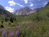
 |
Maroon Bells, Elk Range
|
|
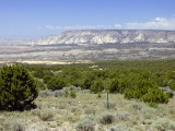
Tablelands
to the
west, including portions of the Colorado Plateau; and |
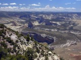
|
Echo Park, Dinosaur NP
|
|
High Plains, ramping down to the east toward the Mississippi Valley. |
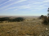 |
East of Kiowa
|
This geologic overview focuses primarily on the Colorado Rockies and
the Colorado Plateau, but adjoining portions of Wyoming, Utah
and the High Plains as far east as the Black Hills of South Dakota also have important
and related stories to tell. Throughout this article, I'll refer to Colorado
and these adjoining areas as our region of interest, which closely coincides both with the area shown in the NASA photo at Bearings just
below and also with the area affected by Laramide
uplift.
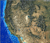 |
Western U.S. tectonic upland
|
Colorado's
also part of an immense, heterogeneous and longstanding tectonic upland covering
the entire western third of the United States and ultimately can only be understood in that
context. From the Middle Proterozoic on, much of Colorado's
story also applies, with some notable
exceptions, throughout the Southern Rockies* and the Colorado Plateau.
Events in the Basin and Range and along the West Coast have also influenced
Colorado's physical development, particularly from ~80 Ma on.
* Note: The Southern Rockies stretch ~1500 km from the Lewis and Clark fault
zone of southern Montana to central New Mexico.
Bearings
|
Laramide Orogen from space, NASA
|
Let's pause now to get oriented within and around our region of
interest. If you haven't done so already, click on the
true-color ^NASA
Visible Earth satellite photo at right to open a larger version in a new
browser window. Find Four Corners, where four state lines meet at right angles. Colorado holds
down the northeast quadrant; New Mexico,
Arizona and Utah run clockwise from there.
Snow caps highlight the highest of the green forested Rocky Mountain uplifts, all of which first rose in the region-defining Latest
Cretaceous through Early Tertiary Laramide orogeny. The uplifts are highest and most
densely packed in western Colorado, but they clearly extend well to the
north and south. Important outliers include the Black Hills uplift of South Dakota
(clipped in the NE corner) and the Uinta Mountains and the Wind River Range
in the NW quadrant of the photo. The largest Laramide uplift, the Front Range,
dominates the north central portion of Colorado. The highest Laramide uplift, the Sawatch
Range, stands on the west shoulder of the Rio Grande rift,
the narrow north-south gash between the two largest snow packs near the center of the photo.
Further south, the rift is visible as the broad almond-shaped San Luis Valley
of south-central Colorado. The narrower Rio Grande Valley, heading directly south from
the San Luis Valley, is also part of the rift. (Keep your eye on the Rio Grande rift as we come up
on post-Laramide
events below. It's a key player in the development of the current landscape.)
In the southwest quadrant of the photo, exposed iron-stained sedimentary
rocks nicely mark the Colorado Plateau (CP) in salmon pink.
The CP saw action in the
Laramide
Orogeny but gained most of its elevation via post-Laramide
epierogenic uplift. Four Corners lies near the east central margin of the
Colorado Plateau.
You'll encounter many similar satellite photos and physiographic maps throughout this
site
because, in many important ways, the land speaks for itself. Anyone
interested in learning to read the landforms will some find very powerful interactive
tools at
NASA's ^Visible Earth and ^Earth
Observatory sites and at UNAVCO's ^Jules
Verne Voyager site.
Parting Ways
To a large extent, the Colorado Rockies and the Colorado Plateau have evolved together
since 1.8 Ga or so, but since the onset of the
Laramide
Orogeny at around 72 Ma, the rigid, block-like Colorado Plateau has been something of a
loose cannon. To complicate matters further, shared events have played
out rather unevenly in the two provinces with somewhat disparate timing.
Follow the Processes
 |
Colorado in context
|
The dominant earth processes
shaping our region of interest provide a
convenient framework for both discussion and understanding.
Each set of events has overprinted preceding events in its own way, sometimes preserving and
sometimes destroying traces of what came before. Disentangling these
layers of process in both space and time makes for a fine puzzle. Geoscientists have
gathered many of the pieces on the table and have even fit a good many of them
together, but the geologic record is still full of holes, and more pieces have been
lost to burial and erosion than anyone would
like.
Beyond Plate Tectonics
Plate tectonic processes have shaped Colorado since
their inception at ~2.0 Ga, but Colorado hasn't
been within 1,000 km of a credible plate margin for at least 1.4 Ga. The intracontinental
deformations so beautifully in evidence now in Colorado reflect both
far-field stresses generated at remote plate boundaries
and cryptic upper mantle processes not directly related to plate interactions. One recent, strongly overprinting intraplate process to keep an eye on as we
proceed is the Rio Grande rift, which has been busy
rearranging the central and south central Colorado landscape in big ways since at least 28 Ma.
Don't Forget Climate!
Another important influence to track throughout this overview is climate.
It's importance is easy to overlook when you're focused on the rocks and how
they've moved. Many earth processes play out at depth, well beyond the reach of the atmosphere and
hydrosphere. But for processes like weathering,
erosion, sediment
transport, deposition, diagenesis,
isostatic rebound
and basin subsidence, the rubber meets the road at the surface, where the atmosphere,
the hydrosphere and the land all interact strongly to shape both land and climate in a
never-ending dance. Streams cut Colorado's deepest canyons in only the last
10 Ma. The relative contributions of wetter climate and uplift remain topics of
contentious debate among geoscientists.
Defining Earth Processes in Colorado's Geologic History
|
| Time |
Process
|
Noteworthy Results
|
|
1.78-1.65 Ga
|
Colorado Orogeny
|
The
southern margin of Laurentia, the nascent North American continent,
accreted Colorado's oldest Precambrian basement rocks.
|
|
1.45-1.35 Ga
|
Berthoud Orogeny
|
This mysterious and protracted event added copious 1.4 Ga
granites, northeast-trending ductile shear zones and differential uplifts to
the Precambrian basement throughout the Southwest. It also left behind
basement-cutting rift faults that subsequent orogenies
(mountain-building events) would reuse for their own purposes.
|
|
1.2-1.1 Ga
|
Grenville orogeny
|
The voluminous Pikes Peak Batholith intruded the basement of the
southern Front Range
and the adjacent High Plains.
|
| 1.4-0.6 Ga |
Late Proterozoic
continental rifting |
Continental rifting related primarily to the Berthoud
Orogeny and to the later breakup of the supercontinent
Rodinia created enduring basement faults throughout the western 2/3 of the
US. The compressive Ancestral
Rocky Mountain and Laramide orogenies would later
reactivate these faults in reverse. |
| 1.1 Ga - 510 Ma |
Great Unconformity |
Erosion planed off the differentially uplifted
and rifted Precambrian basement
during this immense gap in Colorado's rock record. With few exceptions, all pre-existing sedimentary
cover was lost, and no new cover accumulated during this time. |
| 510-300 Ma |
Early Paleozoic marine sedimentation |
The planed-off Precambrian basement
accumulated a 2-3 km-thick blanket of flat-lying tropical marine sediments. |
|
300-248 Ma
|
Ancestral Rocky Mountain Orogeny
|
The Ancestral Rockies rose along reactivated Proterozoic
rift faults as two large island mountain ranges that were eventually buried
in their own debris.
|
|
248-72 Ma
|
Mesozoic sedimentation
|
Terrigenous sediments accumulated widely over Colorado through earliest
Cretaceous time. Marine sediments blanketed the state from then on, right up to
the Laramide orogeny.
|
|
72-40 Ma
|
Laramide orogeny
|
Basement-cored uplifts rose again along reactivated Proterozoic
rifts, this time in greater numbers as the current Rocky Mountains, the Colorado Plateau
and, to a lesser extent, the High Plains. Associated volcanism left behind
dozens of Laramide intrusions strongly
clustered within the Colorado Mineral Belt (CMB) lineament.
CMB mineralization had begun.
|
| 36-5 Ma |
Post-Laramide magmatism |
Thick, widespread volcanic piles reorganized much of Colorado's topography and
drainage patterns while intrusions peppered the Colorado Mineral Belt
from below to complete its mineralization. |
|
28-0 Ma
|
Post-Laramide uplift and extension
|
The Rockies and the Colorado Plateau rose to their present
elevations with the onset of regional epierogenic uplift
and extension, including the arrival of the Rio Grand rift.
|
|
10-0 Ma
|
Exhumation
|
Reinvigorated streams removed mass and incised channels to sculpt the uplands
of the Rockies and the Colorado Plateau and eventually the
range-front basins as well.
|
|
1.8 Ma - 10 Ka
|
Pleistocene glaciations
|
Glaciers and their outwash streams deeply eroded the higher Laramide
uplifts into their present dramatic topography but largely spared the
topographically lower Colorado Plateau.
|
|
10-0 Ka
|
Holocene uplift and erosion
|
Erosion- and mantle-driven regional uplift and stream erosion continue at slower
paces; overall, the Rockies maintain their elevations in the face of erosion.
|
The rocks and structures now exposed so beautifully at the surface in Colorado are important traces of
all these processes, to be both admired
and understood. (Far from diminishing the beauty, the understanding only enhances
it, at least to my mind and eye.) Other less
accessible but equally important clues come from geophysical investigations (tomography,
magnetic and
gravity surveys), geomorphic analyses (elevation models, stream courses and
profiles), and mine, tunnel and borehole logs, among many other data sets.
A Matter of Style
Several recurring themes become apparent as one studies Colorado's evolution
and current topography.
-
The interior section of the continent now graced
by the Rockies and the Colorado Plateau has been a seat of unrest for nearly
1.8 Ga. Far-field plate
tectonic stresses have reshaped the landscape here on and off since the Colorado
Province mobile belt joined the continent in Early Proterozoic
time; upper mantle stresses have been in on the act since at least
28 Ma.
-
 |
Four Corners from space, NASA
|
Basement rocks and faults loom large here,
controlling topography, sedimentation and even subsequent tectonics. Since at least the time of the Ancestral
Rockies, reactivated basement-penetrating
reverse and thrust faults of Proterozoic rifting
ancestry have dominated the mountain-building style throughout the Rockies
and the Colorado Plateau. These faults have typically uplifted large blocks
cored with hard Precambrian crystalline rocks and have folded and
occasionally even broken the overlying sedimentary
cover. Thus, flat-topped highlands seldom
showing more than 15° of tilt came to be the dominant large-scale landforms,
not just in the tablelands of the Colorado Plateau, but even in the highest parts of the
Rockies. Faulted sedimentary monoclines
showing substantial and opposing dips typically flanked the uplifts.
-
Antecedent streams armed with steep gradients
and generous fluxes of water and sediment entrenched their courses at a time
(in the mid- to late Tertiary) when the uplands generally showed little
relief, and the streams were free to meander. Later,
as uplift and climate synergized throughout the region,
the upland streams had no choice but to incise deep, narrow
canyons through rather than around buried uplifts of resistant basement and
sedimentary cover
throughout Colorado and Wyoming. Colorado's most spectacular antecedent canyons
— e.g., the Black Canyon of the Gunnison,
Glenwood Canyon and Royal Gorge — have become world-famous scenic
attractions, but lesser antecedent canyons riddle the Rockies and plateau
country.
-
Mid- to Late Tertiary magmatism profoundly
altered the landscape throughout the Rockies and the Colorado
Plateau, but most of the direct evidence (the
volcanic rock) has been lost to erosion, particularly in the Rockies. The
indirect effects of this intense period of magmatism are still visible today
in places like the Florissant Fossil Beds National Monument — if you know
where to look. Associated intrusions added great wealth to the Colorado Mineral Belt
and left us jewels like Mt. Sopris.
These recurring threads are worth keeping in mind as we now launch into the
particulars of Colorado geology.
Map Units
Most sections in this article close with a "Map Units" subsection
describing how to find pertinent bedrock (surface rock) units on the Geologic Highway Map of Colorado.
Top
Page Index
The Big Picture
To geoscientists, the "big picture" is a highly-prized and often
hard-won 4D understanding of a
landscape and its past at local to global scales. Here, I sketch the big picture in
Colorado, as best
I can put it together, from past to present. Subsequent sections will flesh out
the details, also in chronological order.
Pile-up
The land we now call Colorado was first assembled in the Early
Proterozoic between 1.78 Ga and 1.65 Ga (14:30-15:12 h) from a hodgepodge of
island arcs, backarc basins and more mature continental fragments docking or developing
against a backstop provided by the Archean
Wyoming Province at the southern margin of the nascent North American continent. The
mobile belt added to the continent during this time is known as the Colorado
Province. Despite a long-standing intracontinental location, it's been unstable ever since.
The assembly
of the Colorado Province resembled in some respects the Early Proterozoic
assembly of northeast Australia, which has changed little since then and
therefore has a history
much easier to
unravel than Colorado's oft-overprinted story. In other important respects, the gathering Colorado
Province must have resembled the swarm of oceanic and
continental elements now coalescing feverishly (by geologic standards) in the closing ^Banda
Sea of Eastern Indonesia above.
Around 1.7 Ga,
in
the midst of this accretional frenzy, large quantities of granite
and associated pegmatites intruded the middle to
upper crust throughout the
region, as at Buffalo Mountain
(right) and ^Rocky Mountain National
Park. Colorado intrusive rocks with radiometric dates in the
1.660-1.790 Ga range are sometimes referred to collectively as the Routt
Plutonic Suite.
Just Add Granite and Stir
A large number of granitic intrusions, ductile shear zones, differential
basement uplifts and rifts peppered the Colorado
Province, along with the rest of the continent, in the Berthoud
orogeny
at 1.45-1.35 Ga (16:16-16:48 h). Colorado's many intrusive rocks with radiometric dates in the
1.400-1.450 Ga range are sometimes referred to collectively as the Berthoud
Plutonic Suite.
At
1.2-1.1
Ga (17:36-18:08 h), granite widely intruded the continent once again in a rather
mysterious event often called the Grenville orogeny,
but this time, Colorado took only one known hit — albeit a big one — in the
Pike's Peak area.
The Berthoud and Grenville orogenies appear to have occurred in response to convergent plate interactions playing out far to
the south. The many granitic intrusions at 1.4 Ga and the one massive batholith
(very large intrusion) at 1.1
Ga added considerably to and effectively completed the Colorado basement
as we know it today.
Continental Crack-up
Over the long span of Proterozoic time, several major intracontinental rifting events
repeatedly tried to pull the western two-thirds of the US apart, Colorado
included, just as the East African Rift splits
northeast Africa today. Some of the rifts may have originated during the Berthoud and
Grenville orogenies, while others clearly developed in Late Proterozoic time at
0.9-0.6 Ga (19:12-20:48 h) around the breakup of Rodinia,
the planet's earliest known supercontinent.
Although an ocean-forming continental break-up never ensued in or around
Colorado, the recurrent rifting left behind a rhombic network of deep-seated intersecting
normal (extensional) basement faults. The E-W and NE-SW extensional stresses
driving the rifting produced primarily north- and northwest-trending normal
faults and pull-apart basins. (The particularly deep west-trending Uinta
rift basin was a notable exception.) Many of the rift faults probably cut
the entire lithosphere.
During the Phanerozoic Ancestral Rocky Mountain and
Laramide orogenies to follow, regional crustal
shortening would exploit the old rift faults by reactivating
them in reverse — hence the broad north- and northwest-trending tectonic grains
still obvious in any shaded relief map of the modern Rockies and the Colorado
Plateau. During the Laramide, two surviving rift basins filled with Precambrian
sediments (now the Uinta and Uncompahgre
formations) were squeezed and inverted to form the Uinta uplift and the southern
(San Juan) portion of the Uncompahgre uplift as well.
Around 28 Ma, rifting returned to Colorado with the arrival of the Rio
Grande rift.
Missing Evidence
 Between 1.1 Ga and 510 Ma (18:08-21:17
h), erosion reigned supreme throughout Colorado. With
rare but notable exceptions, all Precambrian sediments were removed, along with ~10 km of
basement. This enigmatic period is marked by a 0.6-1.1 Ga-long gap in the
Colorado rock column known as the Great
Unconformity. Colorado spent most of the ensuing Early
Paleozoic underwater, accumulating great thicknesses of tropical marine sediments
(primarily sandstones, limestones and shales) laid down flat on the planed-off
Late Precambrian basement surface. Between 1.1 Ga and 510 Ma (18:08-21:17
h), erosion reigned supreme throughout Colorado. With
rare but notable exceptions, all Precambrian sediments were removed, along with ~10 km of
basement. This enigmatic period is marked by a 0.6-1.1 Ga-long gap in the
Colorado rock column known as the Great
Unconformity. Colorado spent most of the ensuing Early
Paleozoic underwater, accumulating great thicknesses of tropical marine sediments
(primarily sandstones, limestones and shales) laid down flat on the planed-off
Late Precambrian basement surface.
Ancestral Rocky Mountains Come and Go—Quickly
Around 300
Ma (22:24 h), the Ancestral
Rocky Mountains rose quickly to moderate heights (probably no more than 10,000'
above sea level) along reactivated Proterozoic rifts, apparently in response to
a continent-continent collision between
North America's predecessor
Laurentia and the supercontinent Gondwana far to the
south.
The two largest island mountain ranges developed in Colorado—Frontrangia on the east and Uncompahgria
on the west. By 250 Ma (22:40 h), just 50 Ma later, both ranges had completely succumbed to
erosion, their debris piled high across half the state.
Note: The current Rockies first rose over 70 Ma ago and are now higher than
ever and still rising. The Ancestral Rockies were made of similar
materials but apparently lacked the advantage of continuing uplift. If anything, the tropical
and desert climates of their time would have been less erosive than the
temperate climates
faced by the current Rockies.
The mostly
nonmarine Late Paleozoic to Early Mesozoic sediments shed off these highlands
accumulated to great depths in large range-front
basins—in the Denver basin to the east, in the
Paradox
basin to the west and in the Maroon Basin in between. We have the
Ancestral Rockies to thank for the Maroon
Bells (above) that now grace the Elk Range.
If At First You Don't Succeed...
 |
Four Corners, NASA
|
Around 72 Ma (23:37
h), the Laramide Orogeny began to buckle up
basement from southern Montana to central New Mexico—and to a lesser extent in the
High Plains and the Colorado Plateau—along reactivated, basement-penetrating Proterozoic rift
faults. The regional deformation apparently occurred in response to the onset of
accelerated, low-angle (flat-slab) subduction of the young
Farallon plate beneath the western margin of North America. The resulting
basement-cored faulted uplifts and their flanking
sedimentary monoclines continue to define
the broad features of Rocky Mountain and Colorado Plateau topography. The ever stalwart Colorado Plateau
moved ~100 km north as a rigid unit during the Laramide but saw less uplift
and internal deformation than the neighboring Rockies.
As always, the Laramide uplifts began to erode as soon as they began to rise. By
Oligocene time, their debris had filled the structural basins
surrounding the uplifts to overflowing. Today, the stream-dissected syntectonic
strata of the upper Denver Basin expose a clear
record of the progressive unroofing of the rising Front Range block — a
process repeated throughout the Laramide orogen.
The Laramide died out around 40 Ma (23:47 h), first in the north and finally
in the south. Along the way, Laramide magmatism
got the mineralization of the Colorado Mineral Belt off to a good start.
Magma, Magma Everywhere
Between
36 Ma and 5 Ma (23:48-23:58 h), intense regional magmatism boiled up
through Colorado, leaving the Eocene erosional surface deeply buried under
volcanic flows and ejecta and the subsurface shot through with intrusions that
would elevate and metamorphose pre-existing sediments and inject mineral wealth
all along the Colorado Mineral Belt. The causes of this fiery
outburst remain
obscure. Over most of the state, the far-flung Tertiary volcanics
have been long lost to erosion, but the San Juan Mountains
and the West Elk Mountains
(right) are major exceptions. Nevertheless, the topographic legacy of the volcanic
era lives on in the head-scratching courses of some of Colorado's largest antecedent
streams. Before their removal by erosion, volcanic accumulations helped to reposition streams
directly over several then-buried Laramide uplifts. The Black Canyon of the Gunnison
is but one of the results.
Post-Laramide Epierogenic Uplift and Extension
 |
Front Range Pediment
|
Starting around 28 Ma (23:51
h), in the Late Oligocene,
epierogenic uplift
probably related at least in part to the approach of the Rio Grand
rift domed up the entire region to present average
elevations with little tilting. This uplift added over 1.5 km (5,000') to the Colorado skyline. The greatest
elevation gains centered on the intersection, near Leadville, of two of Colorado's most profound
structural lineaments—the Colorado Mineral Belt and the Rio
Grand rift.
Even with concomitant erosion, the nearby Colorado Plateau
managed
a net 6,000' elevation gain—much of it in the last 5 Ma alone. During the this time, the cohesive
Colorado Plateau once again moved as a unit relative to the Rockies, this time
to the northwest to accommodate the opening of the Rio
Grand rift.
Today, with the help
of erosion-driven isostatic rebound, mantle-driven regional uplift continues, albeit at a much slower
pace, maintaining the height of the Rockies and the Colorado Plateau in the face of ongoing erosion.
Exhumation
Exhumation of the Laramide Rockies
and the Colorado Plateau began in the mid-Tertiary and kicked into high gear in the
Late Miocene around 10 Ma (23:57 h). Stream incision was swift and deep, and
intermontane basins were cleared of their sediments, thanks to
continuing regional uplift and a wet Late Tertiary climate. Antecedent
streams setting their courses on the low-relief Eocene erosional surface
eventually found themselves cutting through buried uplifts that would become the ridges and even ranges of the
current Colorado landscape. The range-front basins
were uncovered and incised as well.
Glacial Sculpting
By Pliocene time, the Rockies and the Colorado Plateau had been
thoroughly dissected by stream erosion but continued to stand high between the
deep canyons. The devastating glaciations that would
come next, primarily in Pleistocene time, around 1.8 Ma (23:59:25 h), took the project of exhuming the Rockies to new highs and new lows. Nearly
everywhere above 8,000', the glaciers gouged out cirques, canyons and U-shaped valleys,
dammed lakes, diverted streams, moved house-size boulders like so much
furniture, and dispatched massive floods of outwash water and sediment to erode
again at lower elevations. The less lofty Colorado Plateau
largely escaped the ice.
Voila!
When
the last of the glaciations finally melted away at the close of the Tertiary around 10
Ka (23:59:59.81 h), Colorado looked
much as it does today—and quite likely more beautiful than ever before. Purple mountain
majesty indeed.
The sections to follow will attempt to flesh out the details of
Colorado's most formative processes in chronological order.
Top
Page Index
Archean Backstop, 2.7 Ga
About Time—the Precambrian (4.5 Ga - 543 Ma, 00:00 -
21:06 h)
The final condensation of planet Earth from the solar nebula at 4.5 Ga (00:00
hours on our metaphoric "day" of creation) kicked off the Hadean Eon (4.5-3.8
Ga, 00:00-03:44 h).
When the intense extraterrestrial bombardment defining the Hadean Eon fell off, the Archean
Eon (3.8-2.5 Ga, 03:44-10:40 h) of initial continent building began. The
long Proterozoic
Eon (2.5 Ga - 543 Ma, 10:40-21:06 h) followed. The current Phanerozoic
Eon (543-0 Ma, 21:06-24:00 h) began when complex life forms built on current
(not Edicarian) plans
first appeared explosively in the fossil record at the beginning of the Cambrian
Period (543-490 Ma, 21:06-21:23 h), which kicked off the Paleozoic
Era (543-248 Ma, 21:06-22:41 h) and ended Precambrian Time (4.5 Ga - 543
Ma, 00:00-21:06 h).
The Precambrian includes the Proterozoic, Archean and Hadean
Eons, but most Precambrian rocks exposed in Colorado and elsewhere in the region
date from the
Proterozoic. At the surface of the earth today, Archean rocks are fairly
uncommon and Hadean rocks are very rare.
The Archean Eon (3.8-2.5 Ga, 03:44-10:40 h)
Only a tiny sliver of Archean rock crops out in
Colorado's northwest corner. But just across the Wyoming and Utah state lines, the stiff southern margin of a Late Archean
craton (ancient continental core) known as the Wyoming Province
served as a backstop for the Early Proterozoic assembly of
the Precambrian basement now underpinning the entire
southwestern United States, Colorado included.
Archean Earth—A Different Kind of Place
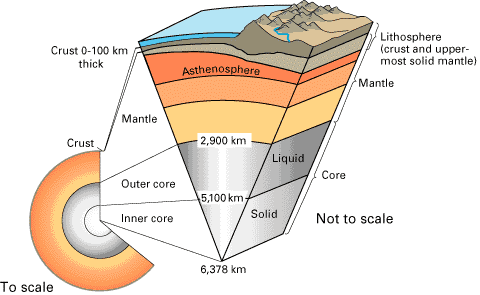 |
Structure of the Earth, source USGS
|
Our knowledge of the earth in the Archean Eon (3.8-2.5 Ga, 03:44-10:40) is necessarily dim and
incomplete, but parts of the puzzle are coming together, and they don't look all
that familiar. As the Archean Eon opened, the earth
was still piping hot if not frankly molten following its condensation from the solar nebula
around 4.5 Ga and a merciless pummeling by stray solar system debris during
the Hadean Eon (4.5-3.8 Ga, 00:00-03:40). Moreover, radioactive uranium, thorium and
potassium isotopes concentrated primarily in the crust
and upper mantle generated radiogenic
heat at 2-3 times
the current rate. Throughout the Archean, crust and mantle were both much hotter than
today's, and earth processes operating then differed considerably from those at
work in the
last 2.0 Ga.
When and how the earth developed its
current internal crust/mantle/core structure
remains controversial, but evidence now points to rapid and thorough chemical differentiation of a
largely molten earth very near the time of its formation, probably by ~4.4 Ga.
This process released more heat, particularly with the fall of iron to form the
planet's core. The important discontinuity between
the upper and lower mantle at 650 km below the surface probably
also developed at
this time, although at a shallower depth in the hotter early mantle. The
"650" has served as a fundamental barrier to
material transport, both up and down, ever since.
Initial
Continent Building
Hydrated low-density sialic (silicon- and aluminum-rich) crustal residues floating on a global ocean of dense
hydrated mafic (magnesium- and iron-rich) magma probably developed near the time of formation at 4.5
Ga and
may have persisted well into the Archean. Buoyant patches of sialic crust eventually
coalesced to form a number of large, durable, unsinkable rafts that eventually became the
cratons (stable cores) of our modern continents—e.g., the Wyoming
Province and the Canadian shield. Through fractionation and underplating of subjacent mantle, these early Archean cratons
developed thick (>100 km) hulls and very deep (>250 km) keels of cool, strong,
buoyant and refractory
lithospheric mantle that to
this day protect them from disruption by heat and currents in the deeper upper mantle.
Most of the planet's supply of sialic continental crust formed in the hot
early Archean
via high-temperature processes never repeated since.
Much of that crust was recycled into the upper
mantle prior to the advent of plate tectonics at ~2.0 Ga. The remaining
Archean cratons have been tied up in continental cores ever since. Continental crust
formed since that time, primarily at post-Archean collisional
and convergent plate boundaries, has been
much more mantle-like (mafic) than the surviving
Archean cratons.
The Wyoming Province
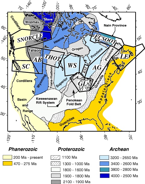 |
LITHOPROBE map of North American basement rocks
|
At the close of the Archean Eon, a nearby 3.2-2.1 Ga
craton called the Wyoming Province stood at the
southwest margin of Laurentia, a
northern supercontinent that would
eventually be trimmed down to North America. To this day, the Cheyenne Belt
lineament of southern Wyoming
and northeast Utah marks
the southern margin of the Wyoming Province.
The stalwart Wyoming craton played
a pivotal role in the
Early Proterozoic assemblage of Colorado's Precambrian basement by serving as a backstop for a
long series of juvenile Early Proterozoic island arcs and more
mature terranes rafted in from the south along a 1,300 km-wide, east northeast-trending convergent
plate margin active around 1.78-1.65
Ga.
In the ^LITHOPROBE
map of North American basement rocks at right, the Wyoming Province appears in medium blue.
The broad band of very light gray 1,800-1,600 Ma
basement to its south will become the Colorado Province,
which in turn will become the basement for the southwestern United States, including Colorado.
Red Creek Quartzite
Only one small fault-bound sliver of the Wyoming Province manages to nip
across the Utah state line into the northwest corner of Colorado—the 2.3 Ga Red
Creek quartzite at the northern margin of the Laramide
Uinta uplift north of CO318 near Browns Park.
The Red Creek quartzite is the closest any Colorado surface rock gets to an Archean
age. The
rest are all at least 500 Ma younger, including the nearby Uinta Mountain Group,
a thick mass of unrelated 1.7-0.9 Ga Precambrian
sediments preserved in an inverted rift basin.
Map Units
Unfortunately, the Red Creek Quartzite is too small to show on the
1:1,000,000 Geologic Highway Map of Colorado,
but on Ogden Tweeto's 1:500,000 Geologic
Map of Colorado, it appears as a tiny purple wedge marked "Wr"
against the Utah state line ~10 km (6 miles) south of the northwest corner of
Colorado.
Top
Page Index
Plate Tectonics—the Next Big Thing, 2.0-0
Ga
|
Colorado in context
|
Nowhere on the planet do Archean rocks record clear evidence of the plate tectonic processes
dominating earth dynamics today—no large thrusts, no overturned sedimentary
piles, no large-scale rifting or collisions, no subduction. Instead, Archean cratons like the Wyoming
Province tend to consist of
large domal bodies of primitive granite intruding folded greenstone (metavolcanic) belts
and covered with odd volcanic and sedimentary supracrustal rock sequences like
the Red Creek quartzite. The planetary processes underlying this pattern remain
largely unknown, but this much is clear—they haven't been repeated since anywhere on the planet.
Exactly when and how water-filled oceans formed is also unknown, but they
were clearly present by the time plate tectonics began to operate with the onset
of subduction in the Earliest Proterozoic, around
2.0
Ga (14:24 h). In fact, you must first understand the oceans to
understand the land, or at least the basement, in and
around Colorado.
Since its Early Proterozoic assembly via subduction, Colorado has been far removed from active
plate boundaries, but far-field effects from subsequent
plate interactions to the west, south and east continued to play an important role in
Colorado's evolution, both at the surface and at depth.
I won't digress to introduce plate tectonics
here, but
you'll find more than you need to know to understand Colorado's tectonic past and present at The Earth at Work on this site. Many of the
explanatory links in this article lead there.
Top
Page Index
Colorado Orogeny, 1.78-1.65 Ga
About Time—the Proterozoic Eon (2.5 Ga - 543 Ma,
10:40-21:06 h)
The Proterozoic Eon followed the Archean Eon (3.8-2.5
Ga, 03:44-10:40 h). Many
pivotal geologic and evolutionary biological developments of Precambrian Time
(4.5 Ga - 543 Ma, 00:00-21:06 h) occurred in the Proterozoic, including the initial build-up of
oxygen in the atmosphere and the global oxidation and precipitation of iron from
the oceans.
Colorado Province—Early Proterozoic Accretion
The oldest rocks exposed in Colorado are 1.78-1.65 Ga
(14:30-15:12 h) granites and metamorphic rocks of Early Proterozoic age. These
basement rocks crop out throughout the
Rockies, often on Fourteener summits, as at Mount
Evans, and also in the deeper canyons
of the Colorado Plateau, as at the bottom of Red
Canyon (right). These rocks accreted to the Archean North American continent in a
long series of
subduction zone collisions known as the Colorado Orogeny.
The
name Colorado Province has been given to the large Early Proterozoic mobile
belt added to the
continent in this protracted event. The Colorado Province joined the Archean Wyoming
Province along the oldest of Colorado's Early Proterozoic sutures,
an enduring east northeast-trending defect in the lithosphere known as the Cheyenne
Belt.
The Cheyenne Belt
 |
Cheyenne Belt, Southern Wyoming
|
Around 1.78 Ga, a south-dipping subduction zone developed off the
southern margin of the Wyoming Province and built an offshore magmatic
arc
now known as the Green Mountain arc. Shortly thereafter, this juvenile arc
collided with the
Wyoming Province, driving intervening 2.1 Ga oceanic
lithosphere to the north, beneath the southern
edge of the Wyoming craton. The resulting suture is still
discernable in satellite images as an east northeast-trending lineament across southern Wyoming
and northeast Utah known as the Cheyenne Belt (CB). (The CB barely nips
the northwest corner of Colorado.) Just south of the CB, highly
metamorphosed fragments of the Green Mountain arc still crop out in a band
across northern Colorado known as the Green
Mountain Block.
[diagram coming]
|
from GSA Today
|
A remnant of the oceanic plate subducted in the Wyoming-Green Mountain
collision may be preserved in the lithospheric
mantle along the suture. In tomographic (cross-sectional) images, the CB appears
distinctly as a steeply
south-dipping discontinuity of lithospheric scale accompanied by marked
localized crustal thickening consisting entirely of a prominent downward
bulge of the Moho to ~60 km. The crust here is
some of the thickest in North America and well outside normal variation around
the global mean. Isostasy would normally
predict a large topographic swell over a crustal thickening of this magnitude.
The absence of the expected mountain range means that the bulge (a "mountainless
root" if you will) must overlie an unusually dense body—in this case,
most likely eclogite replacing oceanic crust
trapped in the lithospheric mantle below
the basalt-to-eclogite transition (now at ~60
km) during the Wyoming-Green Mountain collision.
A number of other curious contrasts have been noted across the CB. To its
south, mantle xenoliths and tomographic
imaging reveal hydrated minerals, garnet-bearing rocks and
tomographic layering in the lithospheric mantle, but none of these features occur north
or the CB; nor do any of the 1.4
Ga Berthoud plutons so common to the south. These differences remain
unexplained.
Bottom line: The Cheyenne Belt is a significant lithospheric boundary whose
full import is still being unraveled.
More To Come
Subduction zones reappeared many times off the growing southern margin of the
nascent Colorado Province as additional arcs and other oceanic and small continental terranes of varying sizes, orientations
and origins rafted in over the 150 Ma following the initial Wyoming-Green
Mountain collision.
Today, these accreted terranes form several broad northeast-trending belts or provinces
that share common Early Proterozoic deformation histories but are far larger
than any single island arc they might contain.
West of the Green Mountain
arc, in Utah, a package of terranes known as the Mojave Province docked onto the
Wyoming Province at 1.75-1.70 Ga. In Colorado, the Rawah arc-backarc complex
(part of the larger Northern Yavapai Province) came in behind the Green Mountain arc,
followed by the Salida-Gunnison arc (part of the larger Southern Yavapai
Province). Terranes of the Mazatzal Province docked next at 1.65 Ga.
The Northern and Southern Yavapai Provinces account for nearly all the 1.7
Ga basement rocks found in Colorado. The Mazatzal Province now floors much of
New Mexico, but its docking was clearly felt in Colorado, as evidenced by 1.65
Ga deformations recorded in the older Yavapai basement.
Early Proterozoic Suture Zones in Colorado
The Cheyenne Belt, the 1.78 Ga suture between
the Green Mountain arc and the Archean Wyoming Province craton, barely grazes
the NW corner of Colorado. Just to its south, the 1.75 Ga Farwell
Mountain-Lester Mountain shear zones mark the suture between the Rawah block and
Green Mountain arc. The Homestake shear zone of the northern Sawatch Range may
overlie the suture between the Rawah block (part of the Northern Yavapai Province)
and the Southern Yavapai Province. The Colorado Mineral Belt roughly follows the
same suture, but its association with Early Proterozoic sutures remains
controversial. The volcanically active Jemez Lineament of northern New Mexico gives
surface expression to the 1.65 Ga suture between
the Southern Yavapai and Mazatzal Provinces.
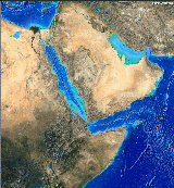
Australia and the Banda Sea of Indonesia—Modern Analogs of Colorado
Province Accretion
 |
Sunda Arc
|
Today, the northbound Australian continent is busily sweeping up a swarm of
Eastern Indonesian arcs in the Banda Sea (below) along its northern margin, just as the Wyoming
craton gathered up oceanic terranes along its southern margin in the Early
Proterozoic. Among the many arcs and continental fragments caught in this
ever-tightening Australian-Eurasian vice are the ^Lesser
Sunda Islands (right); the largest island shown is Timor.
An apparent reversal of
subduction polarity attending the docking of the Green Mountain arc also finds a
modern analog here: When the leading edge
of the Australian craton nosed into the north-dipping subduction zone beneath
the island of Timor (part of the ^Banda
arc) at ~2.2 Ma (23:59:18 h), subduction ceased
there but appears to be starting up again along a new south-dipping subduction zone just
north of the arc. The extreme topography
and bathymetry of the Banda Sea and nearby New Guinea reflect ongoing collisions with Australia as the Banda
Sea closes.
Colorado's Precambrian Basement
Geologists use the term basement to refer to the
igneous and metamorphic rocks between any sedimentary cover
that might be present and the Moho, the
boundary at the bottom of the crust. Colorado's oldest
exposed rocks are hard, resistant granites and metamorphic rocks
added to the continent in the protracted Colorado
Orogeny lasting from 1.78-1.65 Ga (14:30-15:12 h), and these make up most of
the basement in Colorado today. Many of them may be closer to
1.8 Ga in true age, but their radiometric signatures date instead from their
alteration in and around the Early Proterozoic
suture zones ca. 1.7 Ga. Later orogenies
would add voluminous 1.4 Ga and rare 1.1 Ga Middle Proterozoic granites to complete
Colorado's basement.
1.7 Ga Metamorphics
With each incoming Early Proterozoic magmatic arc came a typical package of
1.78-1.70 Ga arc rocks, as shown in the table below.
Arc-Derived Metamorphic Rocks of the Colorado Basement
|
| Raw Arc Materials |
Original Rock Types |
Metamorphic Products |
Colorado Basement Example |
|
Volcanic and, to a lesser extent, intrusive
igneous rocks, primarily of andesitic composition |
^Andesitic
lava, breccia and tuff; gabbro |
Gneiss, primarily of quartz and feldspar,
sometimes with hornblende |
Royal Mountain hornblende gneiss,
Black Canyon Gneiss |
|
Aprons of primarily submarine volcaniclastic
sediments |
Arkose sandstone and claystone |
Mica and pelitic schist |
Mount Evans schist |
|
Occasional fringing
coral reefs |
Limestone |
Marble |
?? |
|
Occasional mature sands |
Quartzose sandstone |
Quartzite |
Coal Creek Quartzite |
Occasional
slivers of oceanic crust |
^Basalt,
ribbon chert and turbidites |
Gneiss, metachert and metaturbidites |
Green Mountain Block |
 |
|
|
With each collision, arc materials
and other ocean floor edifices transferred to the building continent, often along
with rumpled fragments of surrounding oceanic crust. Overthrusting during the
arc-continent collisions buried arc rocks to depths of 11-16 km (7-10 mi) and severely
folded and faulted them at high temperatures and pressures. Regional
metamorphism accompanying nearly 200 Ma of protracted, recurring arc-continent
collisions recrystallized raw arc materials into the
suite of metamorphic basement rocks
listed above. The dark 1.7 Ga Black Canyon Gneiss in the Painted
Wall (right) in the north rim of the Black
Canyon of the Gunnison is typical of Colorado's metamorphic basement.
1.7 Ga Granites
Colorado's
1.8-1.7 Ga metamorphic rocks are shot through with slightly younger ~1.7 Ga granites and
associated pegmatites, including the 1.72 Ga Boulder Creek batholith and
the granites intruding the southern Gore Range at Buffalo
Mountain (right). Similar granites occur throughout the southwestern United
States. Some probably represent unerupted magma bodies within magmatic arcs or
backarc basins. In their rise through the crust,
some 1.7 Ga
granites near Gunnison entrained 1.8 Ga zircons recycled from older, more
mature crust of uncertain provenance. These inherited zircons imply that
the Colorado Province accreted both
magmatic arcs and older continental crust during its
assembly. Where that older
continental material originated remains a topic of considerable debate among
Precambrian geologists.
In the Rockies, granites and other intrusive rocks with radiometric dates in the
1.660-1.790 Ga range are sometimes referred to collectively as the Routt
Plutonic Suite. For convenience, I'll also use that nomenclature.
Post-1.7 Ga Quartzites
 |
Coal Creek Quartzite
|
Mature light-colored cross-bedded quartz sands accumulated in
substantial thicknesses in a number of places in the Colorado
Province shortly
after 1.7 Ga and now crop out as quartzite in several locations in Colorado and New Mexico.
In the central Front Range, these include the Coal Creek quartzite
(right) in ^Golden
Gate Canyon State Park and a similar quartzite that contributes to nearby El Dorado Canyon's reputation for world-class rock climbing. These quartzites rest on
granite of the 1.72 Ga Boulder Creek batholith intruded into even older pelitic
(clay-based) metasediments. They imply a source region of elevated
continental or felsic arc-generated
crust located far overland from the site of deposition. How
such crust found its way into the largely oceanic mix of the Colorado Province
remains unclear, but the mix of oceanic arcs and continental
fragments now forced together in the closing Banda
Sea of Eastern Indonesia suggests some possibilities. Deformation
of the Coal Creek quartzite in Golden Gate Canyon State Park probably relates to
initial motion on the Ralston-Idaho Springs shear zone sometime after 1.7
Ga.
A Legacy of Weakness
Colorado has been far removed from active
plate boundaries since at least 1.6 Ga, but far-field
stresses from distant plate interactions to the west, south and east continued to
find expression in the Colorado Province mobile
belt by exploiting persistent weaknesses left over from its assembly.
Never solidly healed, Early Proterozoic basement sutures and other structural defects have been reactivated many times, localizing subsequent deformation and magmatism throughout
the Southwest to this day. Prominent examples include ongoing magmatism along
Utah's St. George Lineament above the 1.75-1.70 Ga Mojave-Yavapai suture and
along northern New Mexico's Jemez Lineament above the 1.65 Ga Yavapai-Mazatzal
suture. Extensive Late Proterozoic rifting further
cracked up the Colorado basement.
To what extent 1.7 Ga or 1.4 Ga structures have controlled the location of the
NE-trending Colorado Mineral Belt remains under ^active
investigation, but the important Idaho
Springs-Ralston shear zone segment of the mineral belt seems to be a 1.7 Ga
structure reactivated in the Berthoud Orogeny at 1.4 Ga
and again during the Laramide Orogeny at ~72 Ma.
Map Units
On the Geologic Highway Map of Colorado, the symbol "Xm"
marks the 1.7 Ga metamorphics, while "Xg" marks the 1.7 Ga granites.
Both units appear in light gray, the dominant map color throughout the Rockies.
The Colorado
Mineral Belt is easily found by following the diagonal band of dark maroon
"Tki" Laramide intrusions and hot pink "Tmi"
mid-Tertiary intrusions from Four Corners to Boulder.
Top
Page Index
Berthoud and Grenville Orogenies, 1.45-1.35 and
1.2-1.1
Ga
Granites of Middle Proterozoic age (1.45-1.0 Ga, 16:16-18:40 h) intruding the
Early Proterozoic
basement completed the Colorado Province's Precambrian basement. NE-trending ductile shear
zones and rifts ripped the basement as these granites were emplaced, while differential
uplifts jostled basement blocks up and down across the state. Interestingly,
none of these disturbances
affected the Wyoming craton north of the Cheyenne
Belt.
Berthoud Orogeny, 1.45-1.35 Ga (16:16-16:48 h)
Colorado was well within the continental interior by 1.45 Ga (16:16 h), when a thus far
unidentified convergent plate interaction of immense scale some 1,000 km to the
south created ductile shear zones and emplaced numerous mid-crustal plutons
(subsurface magma bodies) in a band
stretching across the then closely apposed North American and Baltica (Northern European)
plates. Intracontinental rifting
accompanied these events. Far-field stresses related to transpression (combined
transform and convergent
plate motions)
at the distant plate boundary also produced differential uplift of basement
blocks throughout Colorado. This protracted event lasted 100 Ma, ending around
1.35 Ga (16:48 h).
Geoscientists now
variably refer to this enigmatic episode as the
Berthoud Orogeny, or simply as the 1.4 Ga event, the former after granite and shear zone exposures near Berthoud
Pass on US40 in Colorado's Front Range. Indeed, in the Rockies and elsewhere in
North America, intrusive rocks with radiometric dates in the 1.400-1.450 Ga
range are often referred to collectively as the Berthoud Plutonic Suite.
Berthoud granites are now known to dominate the basement across the midcontinental US and make up 20-30% of the
basement throughout the Southwest as well. For convenience, I'll also use the
Berthoud tag.
In the literature, Berthoud granites are also widely referred to as
"A-type" and "anorogenic" granites because they're typically
found without evidence of local mountain building. Such names are
misleading, however. Berthoud granites are commonly found with evidence of
significant regional tectonic stresses probably related to far-field plate
boundary influences; in some areas, the Rockies included, these stresses have
produced significant mountain belts and rifts.
Notable 1.4 Ga Granites in Colorado
Of the many Berthoud granites scattered through the crystalline Rockies,
these stand out by virtue of size or beauty:
Some 1.4 Ga Granites in Colorado
|
| Granite |
Age (Ga) |
Location |
Photo |
Photo Notes |
|
Silver Plume
granite
|
1.422
|
North central Front Range |
|
Horseshoe Park from Trail Ridge in ^Rocky Mountain National
Park. The domes adorning the Silver Plume walls of the park
are common granite landforms.
|
Mount Evans batholith
|
1.44
|
Central Front Range |
|
Mount Evans as seen from
Denver.
|
St.
Kevin batholith
|
1.40
|
Northern Sawatch Range |
n/a
|
The St. Kevin
granites rose along the ^Homestake
shear zone, which shows signs of movement at both ~1.7 and ~1.4 Ga.
|
The Mount Evans granite
apparently rose along the Idaho Springs-Ralston
shear zone, which appears to have been moving at the time but probably
originated around 1.7 Ga. (Today, this shear
zone, a segment of the Colorado Mineral Belt, is home to many of Colorado's richest mining districts.)
Later events exploited weaknesses left by the 1.4 Ga
shear zones, as we'll see. To what extent 1.7 Ga structures located the 1.4 Ga
granites and shear zones remains unclear, but that appears to have been the case
at
the Idaho Springs-Ralston and ^Homestake
shear zones.
Grenville Orogeny, 1.2-1.1 Ga (17:36-18:08 h)
 |
Coarse pink 1.1 Ga Pikes
Peak granite with green lichen near the summit of Devils Head, Rampart
Range
|
Another distant plate convergence far to the south at 1.2-1.1 Ga led to the emplacement of the
1.1 Ga Pikes Peak batholith (right), a huge granite body underpinning the
southern Front Range
and adjoining High Plains around Colorado Springs. They're common
elsewhere in the southwestern US, but plutons of this age are rare
in Colorado. (The ^Homestake
shear zone and Mount Evans host two small occurrences,
but the latter is probably a side lobe off the Pikes Peak batholith).
Little is known of the plate interaction triggering this intrusion, but
the large Grenville Province of Texas and northern Mexico docked against the
North American continent along the southern margin of the Mazatzal Province
segment of the Colorado Province around this time.
Some authors now refer to this event as the Grenville Orogeny, and for
want of a better name, so will I.
Middle Proterozoic Differential Uplifts
Differential uplift of basement blocks accompanying the 1.45-1.1 Ga
deformations brought rocks of widely varying crustal depths into juxtaposition
along deep-rooted faults that may cut the entire lithosphere in places. These
faults sometimes followed Early Proterozoic sutures and shear zones. Most of the basement rocks
now exposed at the surface in Colorado appear to have formed at mid-crustal
levels. Their mineral assemblages tell of time spent at depths of ~10 km or more
prior to their arrival at the surface.
Map Units
On the Geologic Highway Map of Colorado, 1.45-1.0 Ga granites carry the
symbol "Yg" and appear in dark gray.
Top
Page Index
Late Proterozoic Continental Rifting, 1.45 Ga - 600 Ma
(16:16-20:48 h)
|
Four Corners from space, NASA
|
The most visible
legacies remaining from the black hole of time spanned by the Great
Unconformity are the north- and northwest-trending tectonic grains of the Southern Rockies and
the Colorado Plateau. This texture, clearly visible in any shaded relief or geologic
map, follows a network of lithosphere-scale (extensional, normal) rift faults
that accumulated throughout the western and midwestern United States from the Berthoud
Orogeny at 1.4 Ga through the protracted breakup of the global supercontinent
Rodinia between 0.9 and 0.6 Ga.
Western North America gained a Pacific coast when East Gondwana,
a lesser supercontinent, rifted away from Rodinia's southwest margin sometime
around 0.7 Ga. This long passive margin most
closely approached Colorado in central Utah and remained stable through the
Early Paleozoic. Inland, failed rifts would permanently scar the North American
basement as far east as the midwestern United States.
After Late Proterozoic rifting subsided around or before 600 Ma,
the region fell quiet for ~300 Ma. Its many dormant rift faults would later be
reactivated
in reverse (i.e., in compression rather than in tension) during Colorado's two
most definitive Phanerozoic deformations—the Middle
Pennsylvanian Ancestral Rocky Mountain Orogeny and the Latest Cretaceous to
Eocene Laramide
Orogeny. To this day, Late Proterozoic rift faults still influence the broad features of the Rocky
Mountain and Colorado Plateau landscapes.
On the Rack
 |
Afar Rifts
|
At least twice during the Proterozoic, major rifting events driven by still
poorly-understood mantle processes tried to pull apart the western two-thirds of
the current North American continent—and Colorado along with it. (Large continents
seem to draw such fire, as East Africa does today.) There were some close calls—notably,
in the Uinta basin, the Midcontinent Rift and the
Reelfoot Rift (the last the source of the ~M8 New Madrid, Missouri earthquakes
of 1811-1812). Somehow, the western and midwestern United States managed to hold together against repeated
rifting attempts, but the basement sustained severe damage in the process, perhaps
through the full thickness of the lithosphere in places.
The timing and number of Proterozoic rifting events remain a matter of
debate. So far, four suspects have been proposed—a
NE-SW extension at 1.5-1.3 Ga surrounding the Berthoud
Orogeny, an E-W to NW-SE extension at 1.3-1.0 Ga coeval with the Grenville
Orogeny and the opening of the Midcontinent Rift, an E-W to NW-SE extensions
at 0.9-0.7 Ga attending the early breakup of Rodinia
and again at ~0.7 Ga during East Gondwana's breakaway
from
Rodinia.
Whatever the timing, these deep-seated rifts left a rhombic network of intersecting
north- and northwest-trending basement-penetrating normal
(extensional) faults that would reactivate in reverse during the
Ancestral Rocky Mountain and the Laramide deformations
that have so strongly shaped modern Colorado.
Modern rifting
 |
Afar tectonics, source USGS
|
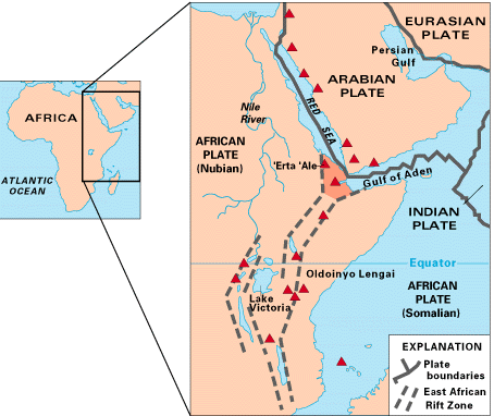
Current rift environments at various stages of development include
-
the Red Sea Rift,
the Gulf of Aden and the Great Rift of East Africa (right and above)
-
our own Rio
Grand Rift of New Mexico, Colorado and southern Wyoming (here we go again!)
The Rio Grande Rift is still
developing, the
East African Rift is more advanced, and the Red Sea and Gulf of Aden are at end-game—the sundering of
a continent by a seaway floored with oceanic lithosphere. The East African, Red Sea
and Gulf of Aden (right) rifts are three arms of a single ongoing large-scale continental rifting
event centered over an upper mantle hot spot in the Afar Province of
Ethiopia and Somalia.
The East African rift may one day lop off the
entire east coast of Africa in a colossal Madagascar recap.
Precambrian Sediments Preserved in Colorado
Little is known about Colorado during the Late Proterozoic because nearly all the
evidence has been culled from the geologic record by the long erosive interval
marked by the Great Unconformity. Two important
Precambrian sedimentary remnants have been preserved in western Colorado,
however—the 1.4-0.95 Ga (16:32-18:56 h) Uinta Mountain Group and the 1.7-1.4 Ga
(14:56-16:32 h) Uncompahgre Formation. Both were accumulated and subsequently sheltered in the deepest of
the Proterozoic rift basins.
In Colorado, the only older sedimentary rocks still unaltered enough to be
easily recognizable as such are preserved in the 2.3 Ga Red
Creek quartzite, part of the Wyoming Province.
Uinta Mountain Group
 |
Uinta Uplift, south flank
|
 |
Steeply-dipping Mesozoic flatirons lean against
their flat-lying counterparts atop the southern margin of the Uinta uplift
|
From 1.4 Ga to the Laramide, a deep, 160 km-long west-trending rift of Berthoud
Orogeny ancestry in western Utah and adjoining northwest Colorado sheltered nearly
7.3 km (24,000') of terrigenous sediments washed into it from surrounding highlands.
These quartzites, conglomerates and shales comprise the Uinta Mountain Group,
with ages ranging from 1.4 Ga at the bottom of the pile to 0.95 Ga at the
top.
The Laramide Uinta Uplift is a classic example of rift
inversion. As the Colorado Plateau plowed north during the Laramide
Orogeny, it squeezed the Uinta Mountain Group up and out of
its west-trending rift along
reactivated rift faults and new parallel reverse faults that flared south toward
the surface to thrust Precambrian Uinta strata over much younger pre-Laramide Paleozoic and
Mesozoic strata deposited on the rift margin. The resulting Uinta Uplift,
a larger than usual Laramide faulted anticline, now rises steadily to the west,
culminating in the magnificent Uinta Mountains, with their still flat-lying
layer-cake stratigraphy. The lower but rugged and deeply dissected east end of
the Uinta Uplift provides a spectacular backdrop for ^Dinosaur
National Monument of Colorado and Utah. There, Mesozoic strata still cover
the southern margin of the uplift (right); the underlying Precambrian Uinta
Group sediments are exposed only along the north flank.
The northern bounding fault of the Uinta Uplift (and basin) in southern Wyoming coincides
with the southern boundary of the Archean
Wyoming Province, which here recapped in a small way its major role of
backstop during the Colorado Orogeny.
Uncompahgre Formation
 |
Gently-dipping late Devonian Elbert sandstones rest unconformably on
nearly vertical Uncompahgre
Formation quartzites in Box Canyon near Ouray
|
Like the Uinta Mountain Group to the north, the
Precambrian sediments of the Uncompahgre Formation collected in a rift,
but here the basin involved a pair of northwest-trending grabens
(down-dropped fault blocks) bounded by ~1.6 Ga
normal faults developing shortly after the Colorado Orogeny.
Unlike the Uinta Mountain Group, the originally flat-lying sandstones, shales and
conglomerates of the Uncompahgre Formation are somewhere between
1.7 and 1.4 Ga in age and were tilted vertically and mildly
altered into quartzites, slates and schists later in the Proterozoic. Just NNE of Durango, Uncompahgre
rift sediments peek out from beneath the skirts of the SW margin of the massive
mid-Tertiary San Juan Volcanic Field. Near Ouray, a smaller outcrop of vertical
Uncompahgre beds appears unconformably in the walls of Box Canyon beneath gently
dipping Late Devonian Elbert Formation sandstones.
The tough-as-nails quartzites and other metasediments of the Uncompahgre
Formation hold up most of the highest topography as one leaves Ouray headed
south on US 550.
Map Units
In the Geologic Highway Map of Colorado, the Uinta Mountain Group and the
Uncompahgre Formation are both subsumed under the
symbol "Ym" and mapped in a medium gray with wavy dark gray stripes.
Look for them near the northwest and southwest corners of the map, respectively.
Top
Page Index
The Great Unconformity, 1.1 Ga - 510 Ma
(18:08-21:17 h)
An exceptionally long and effective
period of erosion held sway throughout
Colorado from sometime before 1.1 Ga to the Late Cambrian (~510 Ma). This profound gap in Colorado's geologic record is
known as the Great Unconformity. Where Early Cambrian sediments like the
Sawatch Formation rest on
the Precambrian erosion surface, the gap can cover as little as 600 Ma, but in many
places, it's much wider. At Red Rocks Park near
Denver, the gap spans 1.4 Ga where coarse ~300 Ma basal
Fountain
conglomerates rest unconformably on 1.7 Ga gneiss.
Late Proterozoic rifting must have interrupted the
process at times, but by Late Cambrian time, statewide erosion had exposed a featureless expanse of
planed off crystalline basement rocks originally hailing from a variety of
mid-crustal levels, judging from their mineral assemblages. The sedimentary
cover and at least 10 km of Precambrian basement were
removed during this time. Where all the debris went is unclear, but little if any of
it hung around Colorado.
Denudation proceeded unevenly across the state,
with some basement horizons reaching the surface as early as 1.1 Ga and others
closer to 600 Ma. In Colorado, the only Precambrian sediments to escape
removal—the Uinta Mountain Group and the Uncompahgre
Formation—were those sheltered in the very deepest of the Proterozoic
rift basins. All other rift basins were planed off in toto. Any volcanism or surface topography developing in Colorado during
or before this
time had been thoroughly erased by the close of the Great Unconformity.
We're now left to rely on basement exposures to reconstruct what went on in
Colorado prior to the Late Cambrian. Luckily, the Rockies expose a good bit of
basement, but most of that rock had resided at depths of 10 km or below prior to
the Great Unconformity and had long been out of touch with the surface.
Surprisingly, the basement still has much to tell about the period from 1.7 to
1.1 Ga, but from there to the Late Cambrian, we have very little to go on.
Map Units
On a geologic map with dip indicators, an unconformity between sedimentary
units might show an abrupt change in dip along a depositional contact. Beyond
that, unconformities have no explicit map representations. Their presence must be inferred
from the absence of rock units that might otherwise have been expected to appear
in a particular location.
Top
Page Index
Early Paleozoic Sedimentation, 510-300 Ma
(21:17-22:24 h)
About Time—the Paleozoic Era (543-248 Ma, 21:06 -
22:40 h)
The current Phanerozoic Eon (543-0 Ma, 21:06-24:00
h) began when complex life forms
built on current (not Edicarian) plans suddenly appeared in abundance in the fossil record at
the beginning of the Cambrian Period (543-490 Ma,
21:06-21:23 h). This "Cambrian Explosion" also kicked off the Paleozoic Era
(543-248 Ma, 21:06-22:41 h).
Geologists refer to the ~4.0 Ga interval prior to the Cambrian as Precambrian
Time (4.5 Ga - 543 Ma, 00:00-21:06 h). The 210 Ma chapter about to unfold
lasted a little more than an hour (1:07 to be exact) in our day
of creation.
Tropical Seas Return
During the Paleozoic Era, the North American continent slid west 140° in
longitude and rotated counterclockwise 90° in the process, but for all that, it never strayed far from the equator. The
warm global climate had already melted the polar ice caps, leaving much of the continent
awash. In Utah to the west was a passive
continental margin with a growing continental shelf
and the Pacific basin beyond.
Between Late Cambrian and Early Pennsylvanian time (510-300 Ma), shallow
tropical epicontinental seas washed over Colorado Precambrian basement denuded during
the Great Unconformity. For the next 210 Ma (1:07
h), flat-lying marine shelf sediments would
accumulate to depths of 1.8-3.6 km (6,000-12,000') with few interruptions
throughout the region.
Cambrian Sands of the
Sawatch Formation
 |
Sawatch Fm at river level in Glenwood Canyon
|
 |
Sawatch Fm resting on Precambrian basement
|
In the Late Cambrian (510-490 Ma), a shallow
tropical sea spreading from west to east across the Precambrian plain of the Great
Unconformity deposited a thick transgressional blanket of beach sands now known as the Sawatch Formation.
This well-cemented, highly resistant sandstone is particularly well exposed
along and above I-70 in Glenwood Canyon (upper photo at right), where it forms sheer
thinly-bedded, buff-colored 150-180 m cliffs resting unconformably on 1.7 Ga Precambrian basement.
(The other prominent cliff-former in Glenwood Canyon is the massive gray Mississippian
Leadville limestone, not shown.) The Sawatch also crops out impressively along
the east side of CO24 in
the Eagle River Gorge south of Minturn.
Wherever it's found, the Sawatch Formation rests unconformably on 1.7 Ga Precambrian basement
at the
Great Unconformity (lower photo at right, also from Glenwood Canyon). Most good
Sawatch exposures occur west of the Front Range. It's generally been lost to erosion along the eastern
flank of the Front Range, but remnants have been preserved in the down-dropped ^Woodland
Park half-graben on the Rampart Range Fault just west of Colorado Springs. In Woodland Park and
Eldorado Canyon, Sawatch debris jammed into gaping Laramide
faults to form unusually large clastic
dikes. (Dikes are by definition slab-like crack-filling bodies of rock. Most
are are igneous in origin, but the rare clastic dikes involve sedimentary
fill instead.)
Some consider the Sawatch a sandstone, others a quartzite.
Who's right may depend on the exposure. Some Sawatch outcrops may be cemented well enough to qualify as quartzites, but most are not.
Ordovician Muds
Limy muds covered the Late Cambrian sands as the
tropical sea deepened through Ordovician time (490-443 Ma). Near
Colorado Springs, outcrops of the Ordovician Manitou Formation (cherty
limestones), Harding Sandstone and Fremont Dolomite leaning against the Rampart
Range record this environment. During Harding time, the sea shallowed enough for
wave action to rework older rocks along the shoreline.
Silurian Erosion
Silurian (443-417 Ma) sediments appear to have
accumulated across Colorado as well, but they were eroded away in toto during
the Early Devonian. A few limestone fragments preserved in kimberlite pipes near
the Wyoming border are the only Silurian rocks ever found in Colorado.
Late Devonian Transgression—the Seas Return
Early in the Devonian (417-354 Ma), Colorado
lost some of its older Paleozoic sedimentary cover to erosion during a brief
rise above sea level. By Late Devonian time, however, a returning tropical sea
had deposited the Parting Sandstone and Dyer Dolomite, which together make up
the Chaffee Group. Near Ouray, Late Devonian Elbert Formation
sandstones and Ouray Limestones are Chaffee equivalents.
Mississippian Limes
During the Mississippian (354-323 Ma), a
widened warm shallow sea deposited thick limy muds over most of Colorado. These
muds would become the massive gray cliff-forming Leadville Limestone of
1870's Colorado
mining fame, but much of the Leadville is actually dolomite. Regional uplift at
the end of the Mississippian raised the top of the Leadville limestone above sea
level, where it eroded into a karst landscape similar to those found in tropical
limestone platforms today.
Interestingly, a long-running series of subduction-related
collisions first hit the West Coast (then around the longitude of the Sierra
Nevadas at the latitude of Colorado) in the Early Mississippian in an event
known as the Antler Orogeny. Antler deformations didn't reach as far east
as Colorado to my knowledge, but the timing of the Late Mississippian regional
uplift makes me wonder about the effects of subsequent collisions there.
Pennsylvanian Regression
As Colorado continued to rise during the Early
Pennsylvanian (323-290 Ma), the retreating sea left behind shales,
sandstones and limestones of the Belden and Glen Eyrie Formations of Central and
Eastern Colorado, respectively. Such are the sediments exposed in the southern Mosquito
Range at Trout
Creek Pass. Early Pennsylvanian uplift brought to a close over 200 Ma
of widespread Early Paleozoic marine sedimentation in Colorado and ushered in
another major mountain-building period, this time driven by far-field
continental stresses related to the Middle Pennsylvanian assembly of the ^supercontinent Pangea.
Map Units
On the Geologic Highway Map of Colorado,
early Paleozoic sediments carry the symbol "MDOC" for
"Mississippian, Devonian, Ordovician and Cambrian" and appear in dark
purple.
Top
Page Index
Late Paleozoic Orogeny and Sedimentation, 300-248
Ma (22:23-22:41 h)
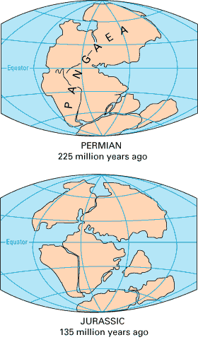 By the end of Early Pennsylvanian time (~300 Ma), Colorado had taken up an
equatorial position and a climate to match and had acquired a fairly
simple structure: A thick blanket of flat-lying Paleozoic sediments covered a
planed-off jumble of differentially uplifted Precambrian basement blocks. But in the Middle
Pennsylvanian, continent-continent
collisions completing the assembly of the supercontinent Pangea (top right) well
to the south would soon change all that. By the end of Early Pennsylvanian time (~300 Ma), Colorado had taken up an
equatorial position and a climate to match and had acquired a fairly
simple structure: A thick blanket of flat-lying Paleozoic sediments covered a
planed-off jumble of differentially uplifted Precambrian basement blocks. But in the Middle
Pennsylvanian, continent-continent
collisions completing the assembly of the supercontinent Pangea (top right) well
to the south would soon change all that.
Colorado had been solidly within the North American interior since the close of
Early Proterozoic time (1.6 Ga), but around 300 Ma, far-field stresses propagating outward
from the collision between
Laurentia and Gondwana along the
Ouachita Fold Belt of west Texas, Oklahoma and Arkansas rumpled up nearly a
dozen large elongated northwest-trending island mountain ranges across what is
now the North American south and southwest. The mechanics remain unclear, but
many of these large
basement-cored blocks apparently rose along Proterozoic rift faults
reactivated in reverse. The collision zone involved portions of North America, South
America and Africa.
Ancestral Rocky Mountains
Two of the largest of the Pennsylvanian island ranges rose in Colorado. These
are now known collectively as the Ancestral Rocky Mountains (ARM). The eastern ARM uplift,
now known as Frontrangia, came up in central Colorado a bit west of the
current Front Range uplift, while Uncompahgria occupied southwestern
Colorado. Both followed roughly NW-SE trends. The intervening lowland is now
variably known as the Central Colorado Trough or the Maroon Basin.
Note: Some authors limit the term "Ancestral Rocky Mountains" to
Frontrangia while referring to Uncompahgria as the Uncompahgre Uplift.
The ARM ranges rose as faulted anticlines, their Early Paleozoic
sedimentary covers draped over uplifted basement blocks bounded by steep reverse faults. Erosion eventually removed most of
the sedimentary cover and wore
deeply into the basement cores as well. Sediments shed to the east from
Frontrangia accumulated in the long-lived Denver Basin of central and eastern Colorado. Sediments
shed to the west from Uncompahgria accumulated in the Paradox Basin of southwestern
Colorado. The intervening Maroon Basin,
usually dry, received debris from both uplifts but mostly from Uncompaghria. It
also accumulated thick evaporite beds (typically calcium sulfate or gypsum)
left behind by seaways that sporadically flooded in and dried up.
 |
|
|
Most
of the sediments shed by the ARM were terrigenous, with brief and scattered
marine interludes. The first sediments to come off the rising highlands ringed them with
coalescing alluvial fans now preserved in the coarse red arkosic conglomerates of the
syntectonic Fountain
(right),
Minturn and lower Maroon Formations and the Hermosa Group. The red stains come
from hematite (ferric oxide, Fe2O3) cements
derived in turn from ferromagnesian minerals in the igneous and metamorphic
rocks exposed by the Ancestral Rocky Mountain Orogeny.
As erosion
progressed, the sediments became ever more fine-grained. By the end of the
Permian, the Ancestral Rockies had been almost completely eroded away. With their roots
now buried in
their own debris, their direct influence on sedimentation in Colorado had come
to an end.
Late Paleozoic Sediments Shed Off the Ancestral Rocky Mountains
|
Period
|
Age
|
Denver Basin
|
Maroon Basin
|
Paradox Basin
|
Late
Pennsylvanian
|
300-?? Ma
|
Lower Fountain Fm: Red arkosic
cross-bedded sandstones and conglomerates
|
Minturn Fm: Like the Fountain Fm,
but also with minor limestones and evaporites
|
Hermosa Group: Like the
Minturn and Maroon Formations
|
| Upper Fountain Fm: Same as Lower
Fountain |
Maroon Fm: Red shales,
siltstones, arkosic sandstones and conglomerates with evaporites |
Early
Permian
|
290-?? Ma
|
Lyons Fm: Red, pink and white dune
and fluvial sandstones
|
Cutler Fm:
Redbeds of conglomerate, sandstone and siltstone
|
| Late Permian |
??-248 Ma |
Lower Lykins Fm: Red mudstones
deposited in a coastal mudflat |
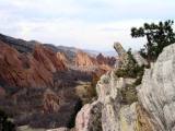 |
Bold red Fountain
Formation flatirons jut skyward toward the Front Range below a ridge
of white Lyons
sandstone at the north end of Roxborough State Park
|
Today
in the east, the Fountain and Lyons Formations crop out spectacularly all along the
Front Range—most notably in the Garden of the Gods Park
near Colorado Springs, in the Red Rocks Park (right)
and ^Roxborough
State Park near Denver, and in the imposing Flatirons south of Boulder. Lyons
sandstones, usually the pink variety, figure prominently in buildings, walls and walkways all along the
Front Range.
The
Maroon Formation crops out rather drably throughout the central
Colorado Rockies but finds its finest exposure by far in the oft-photographed Maroon Bells
(right) of the
Elk Mountains. Judging from the nature and extent of Maroon sediments,
central Colorado must have been one big nasty mudflat in the Late Paleozoic.
How's that for an ugly duckling story?
The Weber Formation
|
Deep Yampa River meanders cut in Weber Sandstone, Dinosaur National
Park East
|
In the northwest corner of Colorado and in adjoining portions of Utah and
Wyoming, the flanks of the large Laramide Uinta uplift
expose a 300 meter-thick deposit of handsome white Pennsylvanian aeolian dune
sands known as the Weber Formation. The Weber dune field was coeval with
the lower Maroon Formation, but its sands derived from
Wyoming uplands to the north, not from Colorado's Ancestral Rocky
Mountains. Deep antecedent meanders of the Green
and Yampa rivers now dissect the Warm Springs monocline where the rivers meet at
the east end of the Uinta uplift. The canyon walls are primarily of Weber
sandstone. Harper's Corner in the Colorado side of Dinosaur
National Park provides an excellent view of this spectacle; the 50-mile side
trip off US 40 is worth it.
The Permian Catastrophe
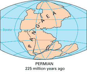 For reasons still shrouded in mystery, the Paleozoic Era closed with the greatest
known extinction of all time, the Permian Catastrophe at 251 Ma (22:40 h). Over 90%
of all marine species vanished from the fossil record in a geologic instant,
along with many terrestrial species. (Man, I hate it when that happens.) In fact, the
resulting break in the fossil record
defines the Paleozoic-Mesozoic boundary. The impact-related K-T extinction at the
Cretaceous-Tertiary boundary at 65 Ma (23:39 h), the one that killed off the dinosaurs, was
apparently a slap on the wrist by comparison. Many kill mechanisms have been
proposed for the Permian Catastrophe, including a large impact, a global loss of
atmospheric oxygen and a massive explosive release of ocean-floor methane
deposits, but no one knows for sure what went wrong. For reasons still shrouded in mystery, the Paleozoic Era closed with the greatest
known extinction of all time, the Permian Catastrophe at 251 Ma (22:40 h). Over 90%
of all marine species vanished from the fossil record in a geologic instant,
along with many terrestrial species. (Man, I hate it when that happens.) In fact, the
resulting break in the fossil record
defines the Paleozoic-Mesozoic boundary. The impact-related K-T extinction at the
Cretaceous-Tertiary boundary at 65 Ma (23:39 h), the one that killed off the dinosaurs, was
apparently a slap on the wrist by comparison. Many kill mechanisms have been
proposed for the Permian Catastrophe, including a large impact, a global loss of
atmospheric oxygen and a massive explosive release of ocean-floor methane
deposits, but no one knows for sure what went wrong.
Map Units
On the Geologic Highway Map of Colorado, the Pennsylvanian through
Permian strata discussed in this section appear in light blue.
Top
Page Index
Mesozoic Sedimentation, 248-72 Ma
(22:41-23:37 h)
About Time—the Mesozoic Era (248-65 Ma, 22:41-23:39 h)
The Mesozoic Era opened as new life forms—among them,
the dinosaurs and their predecessors—appeared in the aftermath of the global
extinctions of the Permian Catastrophe. The Triassic
Period (248-206 Ma, 22:41-22:54 h) kicked it off; the Jurassic
Period
(206-144 Ma, 22:54-23:14 h) and Cretaceous Period (144-65
Ma, 23:14-23:39 h) followed. The Mesozoic closed with the great Cretaceuos-Tertiary
"K-T" extinction that wiped out the dinosaurs.
This 176 Ma chapter lasted about 56 minutes in our day of
creation.
Triassic Mudflats
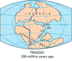 As the curtain opened on the Mesozoic,
the Late Paleozoic Ancestral Rocky Mountains had been
erased from the landscape. North America was by this time well north of the equator.
In and around Colorado, an
arid Triassic gave way to a moist Late Jurassic and finally,
to a largely marine Cretaceous. As the curtain opened on the Mesozoic,
the Late Paleozoic Ancestral Rocky Mountains had been
erased from the landscape. North America was by this time well north of the equator.
In and around Colorado, an
arid Triassic gave way to a moist Late Jurassic and finally,
to a largely marine Cretaceous.
North America's slow traverse of our planet's great northern desert belt at
30-40° latitude was largely a Triassic (248-206 Ma, 22:41-22:54 h) affair but began in the Late Permian and extended well into the
Jurassic. Colorado was entirely above water in the Triassic, but there was little
surface relief. The final assembly of ^Pangea,
the planet's most recent supercontinent,
in the Late Permian also fostered arid continental climates well into the
Jurassic.
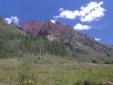 |
Triassic redbeds, Maroon Canyon, Elk Range
|
Colorful Triassic redbeds, like those shown
above along the north wall of Maroon Creek Canyon in the Elk
Range, tell of the arid mudflats that
dominated the scene statewide, as they do now along the southern coast of the
Persian Gulf. Bentonite layers in the Chinle redbeds in western Utah's ^Canyonlands
National Park record thick silicic ashfalls blown across the
Southwest from magmatic arcs active along the
West Coast in Late Triassic time.
Eastern Colorado Triassic Sediments
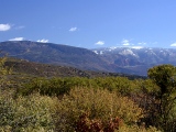
|
Basalt-capped ridge south of Glenwood
|
In eastern Colorado, Triassic muds accumulated in the upper Lykins
Formation, which started in Late Permian time and now crops out extensively along the eastern
margin of the Front Range. Minor marine limestone members embedded in the lower
Lykins record two brief returns of the sea in the east. In the Denver area,
thin upturned white limestone strata decorate red Lykins slopes cropping out below Red Rocks Park west of the Dakota
Hogback. Near Basalt, North of Aspen,
massive Triassic redbeds sport Late Tertiary basalt caps right).
Western Colorado and the Colorado Plateau
In
western Colorado, the Triassic redbeds make up the Moenkopi and Chinle
Formations. (The Chinle is the red slope-former at right.)
 |
Monument Canyon
|
Triassic mudflats eventually gave way to vast dune fields preserved in the thick,
cross-bedded Wingate Sandstone, which tends to form massive cliffs and spires
hundreds of feet high throughout the Colorado Plateau, as seen at left at Monument
Canyon in Colorado National Monument. After the Wingate came
the Kayenta Formation, with its easily recognizable irregular beds of buff
to purple shale, sandstone, limestone and conglomerate. Silica-rich groundwater
permeating the Kayenta after its burial cemented it into a hard and competent
but improbable caprock often seen protecting imposing Wingate edifices, as seen
here.
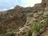 |
Chinle and Wingate Fms
|
Today, the Chinle, Wingate and Kayenta rest on Precambrian basement in the Colorado
National Monument, where they are all beautifully exposed. The Kayenta/Wingate/Chinle triad is a visually distinctive
combination responsible for very similar country throughout the Colorado
Plateau, including ^Canyonlands
National Park and vicinity in western Utah, where the Chinle also
includes silicic ashfalls erupted from magmatic
arcs hundreds of km away along the west coast of the time.
Note: While everyone seems to agree that the Chinle is Triassic, the exact ages of the
Glen Canyon Group (the Wingate, the Kayenta and the overlying Navajo Sandstone)
remain controversial. The Glen Canyon Group is largely devoid of fossils, and
there are no coeval igneous rocks (for radioisotope dating) anywhere in the
region. The ages assigned here follow USGS
convention after Taylor, but others assign the
Wingate and the Kayenta to the Early Jurassic.
Mid-Jurassic Climate Change
Arid Triassic conditions continued into the Early
Jurassic (206-?? Ma) in Colorado, at least in the west. Early Jurassic rocks are absent from
eastern Colorado, but in the west, the Navajo Sandstone, Carmel Formation and
Entrada Sandstone record yet another
transition from vast desert dune fields to vast red arid mudflats and back again. The
Entrada deserts would be the last regional dune environments Colorado has seen
to date. Colorado's ^Great Sand
Dunes National Monument is spit in the ocean by comparison, but it
exemplifies some of the processes responsible for dune fields in general.
By the close of the Jurassic, North America had reached its present latitude.
Along the way, and with the Mid-Jurassic breakup of the supercontinent
^Pangea (right) also in
progress far to the east and south, the Colorado climate became moist and the vegetation lush.
The entire state was monotonously flat and barely
above sea level.
Ralston Creek and
Summerville Formations
Late Jurassic (??-144 Ma) sedimentation in Colorado began with muddy flood plain
deposits now known as the Ralston Creek Formation in the east and the
Summerville Formation in the west. Both contain minor lagoonal deposits and
evaporites indicating occasional and brief marine transgressions. In places like
the valley separating the Dakota
Hogback and the Front Range foothills west of Denver, the soft Ralston Creek
serves as a valley-former.
Morrison Formation

|
Morrison in the I-70
road cut west of Denver
|
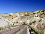 |
... and at Dinosaur West
|

|
|
|
Next came the flood plain clays and stream
channel sands of the statewide Morrison Form, which hosts many important
dinosaur fossil finds, including the first intact sauropod skeleton at the town
of Morrison in 1877. The thick, slope-forming Morrison is easily recognized by
its colorful diagnostic mix of gray, green and maroon claystones, as seen at
right in the distance in the Grand
Monocline at Colorado National Monument.
The greens come from the clay minerals themselves, from pyrite and from iron
silicate cements indicating bog-like reducing conditions at the time of
deposition. Iron oxide cements provide all the other Morrison colors. Minor
discontinuous lakebed limestones embedded in the Morrison also tell of a
poorly-drained landscape dotted with lakes. The vast low-lying flood plain
surrounding the Gulf of Mexico today is an analogous depositional environment.
In the upper photo at right, badlands erosions gives tilted but undeformed
Morrison beds a chaotic look.
A Cretaceous Sea Comes and Goes
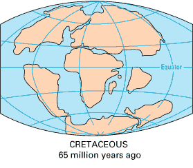 In the mid-Cretaceous, the oceans overflowed onto the continents. There were no
polar ice caps to store excess water, and unusually rapid seafloor spreading and
subduction rates attending the breakup of Pangea had together managed
to repave the much of the global ocean floor with young (thin and hot) oceanic
crust that floats considerably higher on the mantle than the thick old cold
crust it replaced. As the ocean basins shallowed, the excess
water washed over low-lying continental areas worldwide. With the tectonic help
of the Early Cretaceous Sevier Orogeny to its west, the
entire state ended up 600' beneath the waves of the Cretaceous
Interior Seaway, perhaps the largest continental sea in the global geologic
record. In the mid-Cretaceous, the oceans overflowed onto the continents. There were no
polar ice caps to store excess water, and unusually rapid seafloor spreading and
subduction rates attending the breakup of Pangea had together managed
to repave the much of the global ocean floor with young (thin and hot) oceanic
crust that floats considerably higher on the mantle than the thick old cold
crust it replaced. As the ocean basins shallowed, the excess
water washed over low-lying continental areas worldwide. With the tectonic help
of the Early Cretaceous Sevier Orogeny to its west, the
entire state ended up 600' beneath the waves of the Cretaceous
Interior Seaway, perhaps the largest continental sea in the global geologic
record.
Lytle Formation
In the Early Cretaceous (144-100 Ma, 23:14-23:28 h), new uplift in
western Utah
increased stream drainage across Colorado's Late Jurassic flood plains, leading
to deposition of the coarse fluvial sands of the Lytle Formation in eastern Colorado
and similar sands in the west. Small chert pebbles weathered out of Paleozoic
limestones and dolomites exposed far to the west differentiate the Lytle from
the upper sands of the Morrison Formation. The Lytle
Formation would mark Colorado's last stand above water for the next 30+ Ma.
Cretaceous Interior Seaway
and the Sevier Orogeny
Cretaceous seas flooded onto the North American continent simultaneously from the Artic and the Gulf of Mexico.
The waters met in SE
Colorado in the mid-Cretaceous (~100 Ma, 23:28 h) and spread west from there, covering the entire state by
~85 Ma and for another ~20 Ma thereafter. As this Cretaceous Interior Seaway
(CIS) swept across the
land (transgressed), it left
behind beach and barrier island sands and deltaic deposits. These shoreline
sands were later covered by thousands of feet of shallow-ocean muds punctuated
by occasional limes, sands and ashfalls blown in from magmatic
arcs active all along the West Coast, which at the time ran through western
California and Idaho.
The broad north-trending continental trough occupied by the CIS was at least
in part a large foreland basin developed in
response to the Latest Jurassic to Early Cretaceous ^Sevier
Orogeny, a thin-skinned (basement-sparing) east-directed fold-and-thrust
deformation affecting a broad swath of western North America from Alberta
through western Montana and Nevada. As Sevier thrust sheets stacked up to the
west, the lithosphere flexed downward beneath the added load. Colorado escaped
direct Sevier folding and thrusting but sat in squarely in the foreland
basin—the portion of the broad downwarp extending east of the Sevier
mountain front. Sediments shed to the east from the mountain front accumulated
in the CIS within Colorado and throughout the foreland basin. Interestingly, the
Sevier Orogeny petered out just the Laramide Orogeny
opened to its west. The causes of the Sevier Orogeny are still hotly debated,
but yet another complication along the West Coast subduction zone of the time is
likely.
In the Late Cretaceous
(85-65 Ma, 23:33-23:39 h), as western Utah continued to rise with the last of
the Sevier uplifts, the seas retreated eastward across Colorado state, leaving another
but this time regressive layer
of beach and barrier island sands in their wake. The resulting thick sandstone-shale-sandstone sandwich marks the Cretaceous throughout Colorado, but
the formation names differ a bit from west to east.
Western Colorado Cretaceous Strata
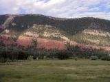 |
Dakota
sandstone caps the east wall of the lower Animas canyon along US 550
just above Durango
|
In western
Colorado, the layers in the
sandstone-shale-sandstone Cretaceous sandwich are fairly
straightforward. The Early Cretaceous sands recording the marine transgression
are known as the Dakota Sandstone. Counting its eastern equivalents, the Dakota is the most widespread
stratum in Colorado.
At right, Dakota sandstone caps the east wall of the lower Animas canyon a
few miles above Durango. Below it are the slope-forming, tree-covered Morrison
Formation; the buff-colored Entrada, Navajo
and Wingate sandstones; and the Permo-Triassic redbeds of
the Chinle and Cutler Formations.
Mancos Shale
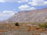 |
Slopes of Mancos shale capped by Mesaverde sandstone make up the Book
Cliffs, here along I-70 northeast of Grand Junction
|
The marine muds and minor limes and sands deposited in the
open Cretaceous sea are all lumped into the Mancos Shale, which crops out
extensively in the Colorado Plateau, most notably as the corrugated "row of
books" slopes of the Book Cliffs north of
Grand Junction.
The Mancos shale also floors the broad Mancos River Valley surrounding Mesa
Verde, the Grand Valley, the Gunnison Valley between Delta and Montrose, and
many similar topographic lows surrounding the high plateaus of southwest
Colorado.
Mesaverde Group
 |
Mesaverde Fm along CO133 in coal country near Somerset
|
|
"Cliff Palace" Anasazi dwelling at Mesa Verde NP nestles in
a large Cliffhouse sandstone alcove
|
The beach and barrier island sands and lagoonal deposits of the
regressing Late Cretaceous sea dominate the Mesaverde
Group. Between Somerset
(right) and Paonia, the Mesaverde is heavily mined for its abundant reserves of highly valuable low-sulfur
bituminous coal and its highly-prized anthracites, which were metamorphosed by
heat emanating from mid-Tertiary intrusions in the
nearby West Elk Mountains.
Mesaverde sandstones are common caprocks in plateau country. They cap the Book
Cliffs throughout western Colorado and much of southern Utah as well. More
famously, the uppermost sandstone member of the Mesa Verde Group, the Cliffhouse
sandstone, caps Mesa Verde, where it hosts all the cliff dwellings,
including the Cliff Palace at right.
Eastern Colorado Cretaceous Strata
In eastern
Colorado, Cretaceous stratigraphy and nomenclature are a bit more confusing, but the
basic sandstone-shale-sandstone sandwich structure remains.
Dakota Group
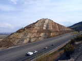 |
I-70 Road Cut
|
In the east, it's
more accurate to speak of a
Dakota Group than a Dakota Sandstone. The lower member of the Dakota Group is the fluvial
(river-laid) Early Cretaceous Lytle Formation already
discussed. Above it are the transgressing mid-Cretaceous shoreline sands
comprising the Dakota Group's
upper South Platte Formation member, but I'll stick with
the simpler and more common Dakota sandstone appellation in this web site. At right, the
geologically famous I-70 roadcut
west of Denver exposes the east-dipping South Platte (near), Lytle (middle) and Morrison (far) strata
that make up the well-developed Dakota Hogback
at Dinosaur Ridge.

|
Minor sandstone member capping a cuesta in Pierre shale at Kremmling
|
Benton
Formation, Niobrara Limestone and Pierre Shale
In eastern Colorado, Mancos-equivalent marine seaway sediments are
subdivided, from oldest to youngest, into the Benton
Formation, the Niobara Limestone and the dominant Pierre Shale.
The gray upper Benton shales are rich in organic materials that, under proper
burial and heating, release natural gas and petroleum into the underlying porous
Dakota sandstone, where it can be recovered from anticlinal drag-fold traps
created by Laramide faults flanking the Front Range. Black "coaly"
organic layers also occur in the eastern Dakota, but true coal is rare there.
Laramie and Fox Hills Sandstones
Topping off the Cretaceous sandstone-shale-sandstone sandwich in the east are
the Mesaverde-equivalent Fox Hills and Laramie Formations, both of which
are predominantly sandstones with minor shales and coals. In Colorado, the
Laramie coal lenses are economic in places but are no match for the massive seams of the
Mesaverde Group in the west.
Cretaceous Ash Falls
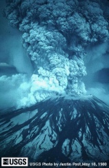 |
Mt. St. Helens, 1980
|
Ashfalls blown over Colorado's ocean from distant prolific magmatic
arcs along the coast to the northwest added hundreds of layers of bentonite and porcellanite to the
marine Cretaceous ooze all across the state. These volcanic shales consist primarily of
clay minerals weathered and compacted from the ash. The soft, dark bentonites
contain expansile clays that wreak havoc with building foundations all along the
eastern Front Range. Non-swelling clays make up the brittle white
porcellanites.
The Apocalyptic "X" Bentonite
The so-called "X" bentonite known from oil well logs in 6 states (Colorado, Kansas,
Wyoming, Nebraska, South Dakota and Montana!) records a massive ash fall conservatively estimated to have been at
least 15 m thick at the time of deposition! The "X" blew in from a Cretaceous vent
traced back to southern Idaho near the west coast subduction
zones of the time. Think about the "X" the next
time you catch yourself complaining about rain or snow falling from the sky:
Things could be a lot worse. Is it any wonder that all cultures have
worshipped sky gods?
Map Units
On the Geologic Highway Map of Colorado,
Triassic sediments carry the symbol "Tr" and appear in teal; Jurassic
sediments are marked "J" and appear in light green; Cretaceous
sediments are marked "Ku1" (upper part of the Upper Cretaceous),
"Ku2" (lower part of the Upper Cretaceous) and "Kl" (Lower
Cretaceous) and appear in 3 more shades of green.
Top
Page Index
Laramide Orogeny and Sedimentation, ~72-40 Ma
(23:37-23:47 h)
About Time—the
Mesozoic-Cenozoic Boundary (65 Ma, 23:39 h)
We're coming up fast on the Mesozoic-Cenozoic
boundary at 65 Ma (23:39 h), but we'll defer a description of the Cenozoic Era until the next
section. The Latest Cretaceous through Eocene Laramide Orogeny and
its sedimentary fallout spilled well across
the Mesozoic-Cenozoic boundary, but the Laramide is a region-defining event
worthy of special treatment.
The Laramide Orogeny
|
Laramide orogen from space, NASA
|
The profound Latest Cretaceous
through Eocene mountain-building event known as
the Laramide Orogeny first defined the broad features of the Rocky
Mountain and Colorado Plateau landscapes as we know them today. The Laramide
deformed the continent from northern Montana to southern New Mexico, and from
the western High Plains to Utah and perhaps beyond. The affected region is known
as the Laramide orogen.
The Laramide was first and foremost a regional shortening of the crust with
maximum contraction to the east northeast. With shortening came uplift.
Initially diffuse, the Laramide first raised the region up from the Cretaceous
sea in a broad arch. Then came the Laramide's most conspicuous legacy—a
swarm of discrete thrust-faulted uplifts most concentrated and elevated in
western Colorado but scattered through every surrounding state. The uplifts were
typically large, elongated, asymmetric basement-cored thrust-bound welts with a
north or northwest trend. Range-front basins were often paired with the uplifts.
Many of the Laramide uplifts still stand high enough to take on a natural
color-coding of forest and snow in the NASA satellite photo above. To this day,
they give form to all the major ranges of the Southern Rockies—the Front
Range, the Medicine Bow Mountains and the Laramie Range; the Sawatch and
Mosquito Ranges; the San Juans and Sangre de Christos; the Park, Gore
and Tenmile Ranges; the Wind River Range and the
Uintas. Lesser Laramide uplifts dot Wyoming. The Black Hills of South Dakota
(clipped at the top right corner of the photo) mark one of a number of High
Plains basement uplifts of Laramide origin; the others are now buried.
The Colorado Plateau, the large pink region at lower left,
also began to rise, rotate and move north as a rigid block during the Laramide,
but it's by no means a typical Laramide structure. The Laramide-age and
Laramide-like Uinta uplift at upper left owes its atypical east-west axis to
stresses related to the approach of the Colorado Plateau and only indirectly to
the Laramide per se.
Laramide deformations finally died out in the Eocene, around 40 Ma
(23:47 h). After a period of tectonic calm and magmatic
fury, a broad regional uplift very different in
style from that of the Laramide set in around 28 Ma and continues unabated to
this day. Some 70 million years of unrelenting erosion notwithstanding, the
Rockies and the Colorado Plateau now stand higher than ever and continue rise at
rates 2-3 times that expected from erosion-induced isostatic
rebound. Where they'll stop, nobody knows, but something in the mantle seems
to be pushing them up.
 |
East-side Front Range uplift, Red Rocks Park
|
The photo at right shows a small but typical segment of the east side of
Colorado's Front Range at Red Rocks Park west
of Denver. The Front Range is by far the largest of the Laramide uplifts, and
the second highest as well. The abrupt mountain front of Precambrian crystalline
rock and the pronounced tilting away of adjacent Paleozoic and Mesozoic strata
are common Laramide uplift features. These initially flat-lying strata once
covered the uplifted basement block in the distance but were largely lost to
erosion during its ascent.
Outstanding Questions
If nothing else, the Laramide was a time
of great complexity, and we seem to be just close enough to it to get really
confused by the evidence left behind. The why, how, and how much remain
controversial. Data sets from paleobotany, O18
paleoaltimetry, basalt vesicle paleobarometry, apatite fission track analysis and a host of other
increasingly sophisticated earth science techniques seem to point in conflicting
directions.
Before launching into
a tentative Laramide story, let me outline some of the
more important outstanding questions as of late 2003:
-
What really caused the Laramide? To what
extent was the subducting Farallon plate
involved?
-
How does intracontinental deformation on the
scale of the Laramide even occur? The nearest plate margin was over 1,000 km to the
west at the time!
-
How high were the Laramide mountains, and how
far did erosion take them down?
-
How deep do Laramide reverse and thrust faults cut? Do they reach
the brittle-ductile transition zone at the base of the upper
crust? Did they cut their own
paths through the top of the basement, or did they follow pre-existing
faults?
-
The Rockies are as high as ever and still
rising. How much of the cumulative Rocky Mountain uplift
can the Laramide claim, and when did it occur, early or late in the
orogeny?
-
How much have the Rockies risen since the
Laramide, and why?
-
How much deformation, displacement and rotation did the
Colorado Plateau undergo during vs. after the Laramide?
Many other nagging Laramide questions could have been
listed. Since the Laramide remains a topic of intense research among
geoscientists from around the world, answers will no doubt be forthcoming, but
many new questions are bound to come up along
the way.
A Tentative Laramide Story
The best story geoscience can muster for the Laramide
is still in pieces as of late 2003, but I'll try to cobble together a reasonably
coherent, defensible if not consensual saga in the next few subsections. Let's
start with some observations no one disputes.
|
Laramide orogen from space, NASA
|
Discrete Laramide uplifts
are typically elongated north- or northwest-trending thrust-bound blocks of crust
including both basement and sedimentary cover. Most are
50-300 km in length and all but one (the Elk Mountain
uplift) are cored with hard crystalline Precambrian
basement rock. Large structural
basins developed alongside some of the uplifts—e.g., the Denver Basin
against the Front Range. The paired basins deepened further as they accumulated
sediments from the rising uplifts; vertical structural offsets of up to 10 km
developed in some. In the ^NASA
Visible Earth satellite photo at right, snow caps and green forests mark the highest of the Laramide
uplifts, but many others remain inconspicuous here. The filled basins are not
apparent. Early on, crustal-scale Laramide faulting
released basaltic magmas to the surface. Few of these early Laramide
volcanics have survived in place (the Early Paleocene 62-63 Ma basalt
flow capping South Table
Mountain near Golden is a notable exception), but thick accumulations of
volcaniclastic gravels like those of the syntectonic Denver
and Arapahoe Formation tell of large volumes of
erupted Laramide basalt early on. These
"leaky fault" basalts suggest a component of extension in the early
Laramide, but it would eventually shorten the crust in a predominantly east northeast
direction by as much as 15-20% across the
combined width of the Southern Rockies and the Colorado
Plateau. The shortening produced the Laramide uplifts.
Tectonic
Influences
Now
for some speculation. The Laramide Orogeny coincided at least temporally and
probably causally as well with a period of unusually shallow flat-slab subduction of the
Farallon plate beneath the western margin of North America, which at
the time lay over
1,000
kilometers west of the Laramide orogen. During this pivotal chapter in the development of
the western United States, subduction-related arc magmatism first shifted
progressively to the east as the Farallon plate rose up beneath the overriding
North American Plate and
then ceased altogether—presumably when the shallowing slab
had finally risen above melt-generating
depths.
Why So Shallow?
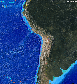 |
Nazca Ridge going down the Nazca-South American subduction zone off
Peru
|
Why the Farallon plate entered a protracted phase of
subhorizontal subduction during Laramide time (72-40 Ma) remains uncertain, but
the Nazca plate seems to have done the much same thing when
a particularly large buoyant aseismic
ridge (the Nazca Ridge, right) entered the Nazca-South American subduction
zone off Peru around 8 Ma. Large buoyant structures (aseismic
ridges, submarine basaltic plateaus, seamount
chains, etc.) riding on down-going slabs have been implicated in other
documented examples of shallow-slab subduction. Such edifices are common enough
on the ocean floor that a large one presenting at the West Coast subduction zone
in latest Cretaceous time might easily have initiated the shallowing of the
Farallon slab. If so, the direct evidence has gone down with the slab.
Laramide
Mechanisms
Suspiciously, the Laramide Orogeny took off just as
arc magmatism related to the Farallon plate snuffed out. The Rocky Mountain and Colorado Plateau
region began to shorten, buckle and rise, even though they were far
inboard of the West Coast subduction zone
and its primary magmatic arc, the Sierra
Nevadas. The mechanisms underlying the Laramide
Orogeny are still hotly debated, but most authors now favor a mechanical
coupling of one kind or another between the shallow Farallon slab and the base
of the North American lithosphere well inland of the West Coast subduction zone.
Today, a similar process shortens the South American crust within and well east
of the Andes in response to flat-slab subduction of the
Nazca plate. Note that the Andes and their eastern foothills are first and
foremost a compressional fold-and-thrust orogen; subduction-related arc magmas
intrude the orogen and feed many large Andean volcanoes, but they don't make up
the bulk of its volume. Undeformed forearc sediments along the Nazca-South
American subduction zone again indicate that the responsible compressive
stresses have developed not at but inboard of the subduction zone, presumably
due to inboard coupling between the subhorizontal Nazca slab and the base of the
South American plate. A competing
"end-loading" model denies inboard coupling in favor of the lateral
transmission of compressive stresses from the West Coast subduction zone to the
Laramide orogen via the North American lithosphere. Proponents of this model
cite the occurrence of young (<5 Ma) volcanics derived from lithospheric
mantle all across the western United States as proof that the lithospheric
mantle has not been eroded away by direct contact with the Farallon plate during
the Laramide. They conclude from that that significant mechanical coupling
between the Farallon and the overlying North American plate occurred only at the
subduction zone. This model ignores the possibility of a non-erosive viscous
coupling mediated by chilled asthenosphere and seems mechanically untenable for
a number of other reasons, chief among which is the lack of Laramide-age
deformation in the forearc sediments
deposited in California's Great Valley Sequence. End-loading of the North
American plate sufficient to rumple up the Rockies would surely have rumpled
these sediments as well. I find inboard mechanical
coupling with the flat Farallon slab much more compelling than the end-loading
model, but either way, hydration reactions fed by watery fluids rising
from the still-wet Farallon slab would amplify Laramide uplift and
magmatism by fostering melting and expansion of the overlying mantle
lithosphere. Farallon
Rollback
Around 40 Ma, Laramide deformation ceased and an odd
pattern of intense post-Laramide magmatism including
the devastating ignimbrite flare-up ensued
within and west of the Laramide orogen. These events are widely interpreted as
manifestations of the break-up and falling away of the subhorizontal Farallon
slab, an event referred to as the Farallon
rollback. The highly correlated temporal and spatial pattern of
post-Laramide magmatic fronts across the West suggests to some that a large
section of the Farallon plate beneath the Basin and Range also folded up along
an east-west axis as it sank. Whatever the details, the rollback once again
allowed asthenosphere to come into
direct contact with the base of the North American plate after tens of millions
of years of shielding by the Farallon slab. The influx of hot, buoyant
asthenosphere presumably generated the melts fueling post-Laramide magmatism and
may also have kicked off the broad regional uplift that
followed.
What Farallon Plate?
You won't find the Farallon plate marked on any
current map, but it made a profound mark on the western United States before it
disappeared down the West Coast subduction zone in the Miocene. Before that, it was the Pacific plate's eastern twin
across the East Pacific Rise (EPR), a great north-trending mid-ocean
ridge once rivaling the Mid-Atlantic Ridge in length. The gradual subduction of the
northern end of the EPR along the California coast
between 29 and 5 Ma brought the Pacific and North American plates into
contact for the first time. Since the Pacific Plate had a northwesterly
motion relative to North America, the EPR and the subduction zone had
to be replaced with the broad mixed
divergent-transform Pacific-North American boundary now familiar as the
San Andreas Fault System and the Basin and Range Province.
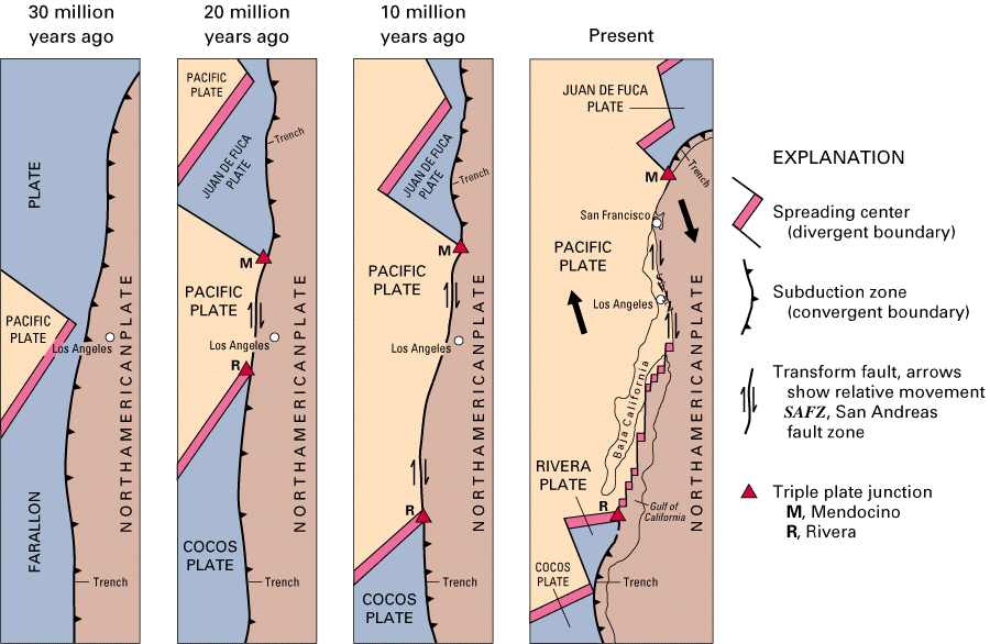
The small Gorda
and Juan de Fuca plates now subducting off Washington and Oregon and the
Cocos and Rivera plates now subducting off Central America are
nearly-consumed remnants of the Farallon plate. The ridges
associated with them are EPR remnants.
Faulting, Laramide Style:
Reverse and Short-Cut Thrust Faults
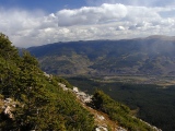 |
Williams Fork Thrust
|
The Laramide
block uplifts rose up along
deep basement-rooted Y-shaped faults as the
underlying crust shortened to the east northeast by as much as 15-20% across the
combined width of the Southern Rockies and the Colorado Plateau. Few Laramide faults are well
exposed, even after ~70 Ma of subsequent erosion, but the shallow Williams
Fork Thrust (right) and the Elkhorn Thrust along west side of the Front Range block are notable exceptions. Laramide
Fault Geometry
Many
if not all Laramide faults appear to represent
reverse (contractional) reactivations of basement-penetrating normal (extensional) faults
left over from Late Proterozoic continental rifting.
Some Laramide faults, like the Gore fault,
were active as reverse faults during the Pennsylvanian Ancestral
Rocky Mountain orogeny as well. Laramide fault slips were partitioned among thrust, reverse, oblique and strike-slip motions
according to the orientations of the old faults to the Laramide's
ENE-trending horizontal regional compression, but low-angle thrust faulting generally prevailed
near the surface while high-angle reverse faulting predominated at depth. As reverse
motions approached the top of the basement, they appear to have abandoned the steep
old rift faults to cut new lower-angle, mechanically-favored short-cut
thrusts in some cases. Whether reverse or thrust,
most Laramide faults remain blind—i.e., they failed to cut the surface
when they were active, and they were not uncovered during later exhumation.
Most died out somewhere within the then flat-lying
Paleozoic and Mesozoic sedimentary cover atop
the basement harboring
the reactivating faults. The monoclinal
folding now seen in the cover along the flanks of many Laramide basement uplifts developed as the
defining faults cut upward into the base of the cover from the top of basement. Trishear
Modeling
[diagram coming]
|
trishear
|
Luckily, the shape of a fault-propagation fold
provides valuable information about the geometry and movements of
the responsible blind fault. Blind Laramide faults have been known from
boreholes for years, but geoscientists are just now beginning to tease out their
details with the help of a
promising new technique known as trishear modeling. The trishear
model of fault-related folding has been successfully and profitably applied to
the many similar blind thrusts in Southern California's Los Angeles basin,
including those responsible for the damaging 1987 M6.0 Whittier
Narrows and 1994 M6.7 Northridge earthquakes.
It's Never That Simple
Laramide uplifts are fairly monolithic, but the
margins of their Precambrian cores show a good bit of splintering, particularly
along the east flank of the Front Range. Near Colorado Springs, the southern end
of the east flank of the Front Range block includes a substantial north-trending
splinter, the Rampart Range, separated from the main Front Range block by the
steep reverse Rampart Range Fault. During the Laramide, the Rampart block
actually rose higher than its parent. Garden of the Gods Park straddles the
Rampart Range Fault. Late Paleozoic strata there dip much more steeply to the
east on the east side of the fault due to differential drag-folding along the
fault. North of Garden of the Gods, the Woodland Park
half-graben sags into the Rampart Range Fault, thereby preserving early
Paleozoic strata found now in few other places along the east side of the Front
Range. With the Oligocene arrival of the Rio
Grande Rift, things got even more complicated. The
Sawatch Range and the southern portion of the Mosquito Range shared a common
basement uplift before the rift split them apart along the deep and narrow upper
Arkansas graben. The same thing happened to the originally united
Precambrian cores of the San Juan and Sangre de Christo Mountains, which are now
50 km apart across the San Luis Valley, the broadest section of the Rio Grande
Rift. Burying most of the San Juan uplift's Laramide core beneath the vast San
Juan volcanic field doesn't help. Normal faulting related to but north and east
of the main trace of the Rio Grande Rift now complicates many
other Laramide structures, including the Gore
Range and the lower Blue River Valley to
its east.
Folding, Laramide
Style: Range-Front Monoclines
A monocline is a fold that dips in only one
direction, at least locally. The trishear model nicely
fits the style of monoclinal range-front folding observed along one or both
sides of virtually every Laramide uplift. When
monoclines of opposite dips flank a single faulted uplift, it's also accurate to
speak of a faulted anticline, even though the paired monoclines may be separated
by many miles. Since the Dakota
Hogback and the Grand Hogback
flank the entire Rocky Mountain Province like gigantic bookends, it's not
unreasonable to think of the entire province as one big faulted anticline.
As the reactivated Laramide reverse faults and short-cut thrusts propagated laterally and upward through brittle
basement and into the more flexible overlying (usually Paleozoic)
sedimentary strata, they died out, but along the way, they folded the
sedimentary cover into variably faulted and often
asymmetric range-front monoclines. Prime examples of range-front
monoclines include
Well, that's my Laramide story for the Rockies, and I'm sticking to it—at least until next
month's issue of Geology.
What About the Colorado Plateau?
|
Four Corners from space, NASA
|
The Rockies
(in the right half of the photo at right) and the Colorado Plateau (CP, the football-shaped salmon-colored
area at left center) have been locked in a dance since
at least Middle Proterozoic time, but they've been badly out of step from the Laramide
Orogeny on.
Unlike the remainder of the Laramide orogen, the CP acts as a fairly rigid
crustal unit. Relative to the Rockies, it moved north northeast over 100 km during the
Laramide but rose and deformed less. Stresses related to it approach is likely
responsible for the atypical east-west axis of the otherwise Laramide-like Uinta
uplift in the upper left corner. The CP also rotated clockwise around a pole
near its southeast corner during the Laramide; later it would rotate more. All
these movements variously added left-lateral and right-lateral strike-slip
components to the Laramide and later normal faults surrounding the CP.
The CP clearly contains basement-cored Laramide
uplifts, albeit less dramatic than those in the Rockies. These include the
jostled, fault-bounded High
Plateaus—the Markagunt, Paunsagunt, Aquarius, Kaiparowits and Kaibab. All except the Aquarius bear Paiute names. At the western margin of the
CP, the Kaibab Uplift set the stage for the cutting of the Grand
Canyon, just as the Colorado's Gunnison Uplift set up the Black
Canyon of the Gunnison.
Promising new paleoaltimetry work based on vesicle
sizes in virgin CP basalt flows (Sahagian, 2002)
suggests that the CP gained most if not all of its
present 2.2 km average elevation during regional
uplift after 25 Ma and particularly in the last 5 Ma. Other recent work
(Pederson, 2002) relying on
the analysis of a CP digital elevation model and reconstructions of the
surfaces of the regressive 80 Ma
Cretaceous Castlegate sandstone (the last known time the CP was at sea
level) and the Eocene-Oligocene stratigraphic boundary favors Early Tertiary Laramide uplift
instead. Go figure.
Fault Reactivation
All other things being equal, it's mechanically much easier to overcome
friction and generate sliding on a pre-existing fault than it is to rupture a
new one—at least at the confining pressures found at upper crustal levels. Old
normal (extensional, rift) faults tend to be lined with especially weak rock due to
rock-water interactions invited by cross-fault tension and are particularly easy
to reactivate.
Old rift faults can thus give expression to regional stresses that might be
unable to break intact rock. That was exactly the setup that allowed the
relatively weak intracontinental stresses of the Ancestral
Rocky Mountain and Laramide Orogenies to generate
the uplift, folding and faulting evident in Colorado's current topography
and in her geologic record. Don't forget, these deep intracontinental deformations were the fallout of plate interactions playing out
over 1,000 km to the south and west, respectively.
Some of the faults reactivated in the Laramide, like the Gore
fault, were active as reverse faults in the Pennsylvanian Ancestral
Rocky Mountain orogeny as well, but these may also have capitalized on even
older rift faults.
Rift Inversion
The process of squeezing up basement and cover from deep in old rifts along
reactivated normal faults is known as rift inversion. Examples of varying
ages can be found all over the world, but some of the most striking are right
here in our own back yard. The magnificent Laramide Uinta Uplift
immediately comes to mind.
The Nuts and Bolts of Normal Fault Reversal
To understand how normal faults can reactivate in
reverse, one must first understand their geometry and thermomechanical habitat. Few normal faults are truly
planar. Most are concave upward instead—near-vertical at the surface, where
the initial failure is mainly tensile, but
increasingly horizontal at depth, where shear takes over as the rock becomes
more ductile. For mechanical reasons, normal faults reaching
the crust's brittle-ductile transition (usually around 10 km below the surface)
tend to cross it at an angle near 45°. Normal faults extending deeper into the
middle crust may flatten out to 30° or less, particularly if they link up to a
low-angle regional detachment fault. (No one knows if such a detachment
underlies the Laramide orogen, but regional detachments certainly
link the normal faults of the highly extended Basin and Range at depth.)
When a previously extended region cut deeply by normal faults comes under
compression, as Colorado did during the Laramide, the
pre-existing faults are easily reversed at depths of 3-4 km or more, where they
dip less than 60°. What happens at higher angles closer to the surface is less clear. At some point, it
apparently becomes easier, mechanically speaking, to cut a new shallow short-cut
thrust fault to the surface than to continue reverse motion upward along an
ever-steepening old normal fault. In many Laramide uplifts, this point is
reached below the top of the basement. When that occurs, the short-cut thrusts cut both
basement and cover, the abandoned rift fault segments retain their original
sense of offset, and the boundary between basement and cover becomes folded along with the
overlying monocline of sedimentary strata. Laramide reverse and short-cut
thrust faults fold up the monoclines as they propagate into the sedimentary
cover, but for some reason, they usually die out before reaching the surface.
Rift inversion appears to an important mechanism behind the highly dependable style of
deformation seen throughout the Laramide orogen—basement-cored uplifts bound by thrusts that tend to die out in
the sedimentary monoclines flanking the cores. Less well-developed inverted-rift
uplifts dot the mid-continent as far as south as the Ouachitas and as far east
as the Appalachians. Thanks to the profound Late Proterozoic erosion marked by
the Great Unconformity, expressed rift
sediments are rarely found in Laramide country, but post-unconformity
sedimentary strata manage to doll up the basement cores quite nicely.
Laramide Magmatism
The Laramide Orogeny brought magmatism to Colorado and indeed, to the entire region.
In Colorado, Laramide volcanics have largely been lost to erosion, but the 62-63
Ma basalt caprocks atop the North and South
Table Mountains near Golden are notable remnants. Thick syntectonic volcaniclastic
gravel deposits like the Denver Formation on the east flank of
the Front Range suggest that basaltic and andesitic
Laramide volcanoes had
come to dominate the Front Range uplands during Latest Cretaceous through Early Paleocene
time.
Laramide Intrusions
Laramide intrusions (crust-invading magma bodies that never reach
the surface) figure prominently in Colorado history, both geologically and
economically.
Nearly all fall along the Colorado Mineral Belt, particularly
between Breckenridge and Leadville, with a handful of outliers in the northern
Sangre de Christo Mountains and in the northern Sawatch Range south of Edwards.
Together with a roughly equal number of post-Laramide
intrusions, the Laramide intrusions pumped tremendous mineral wealth into
the Colorado Mineral Belt, particularly near Leadville
and along its Idaho Springs-Ralston shear
zone segment. It's no accident that the ^National
Mining Hall of Fame & Museum resides in Leadville.
Laramide intrusions dated at 75-55 Ma also mineralized many of the rich
copper-molybdenum porphyry deposits found in southern Arizona, southwestern New
Mexico, northern Mexico and west Texas. The Laramide had a long reach
indeed.
The structural importance of the Colorado Mineral Belt
can't be overstated. It receives more thorough coverage in the discussion
of post-Laramide magmatism below.
Synorogenic and Subsequent Sedimentation Along the East
Flank of the Front Range
At the onset of the Laramide around 72 Ma in Latest Cretaceous time, most of
Colorado remained near sea level. The earth, considerably warmer than now, still
lacked polar ice caps. A semi-tropical climate prevailed throughout Colorado,
even though it already lay quite near its current latitude. Two major events
would soon revise everything, however—the regional Laramide
orogeny and the global K-T impact. Here, we'll focus on
the sedimentary fallout attending Laramide mountain-building along the east
flank of the Front Range.
Laramide uplifts began shedding sediments into intervening and peripheral basins as soon as they
began to rise. The initial Laramide sands and gravels exposed in eastern
Colorado record the initial rise of the Front Range — the first mountain-building to affect the region since the Ancestral
Rocky Mountain orogeny. Late Oligocene and later sediments recorded the regional
uplift commencing at 28 Ma and continuing to the present. These sediments include the Latest Cretaceous through Holocene
formations listed below.
Arapahoe Conglomerate
Latest Cretaceous conglomerates and sandstones collected along the rising
Laramide range fronts in flat layers organized into alluvial fans built where
streams draining the range front lost their steep gradients and dropped their
loads. The Arapahoe rests discontinuously and unconformably atop the Laramie
Formation. Prominent within the Arapahoe are secondary sediments eroded
from the Paleozoic and Mesozoic sedimentary cover of the Laramide uplifts. It
also includes chert nodules eroded from Paleozoic limestones and basement clasts
of granite and gneiss.
Denver Formation
Latest Cretaceous through Early Paleocene alluvial sediments continued to
spread eastward from the range front and to coalesce into bajadas
(alluvial fans merged into one continuous range-front surface). By Denver time,
however, the sediments washing east off the Front Range uplift had become
largely volcaniclastic (derived from volcanic debris), indicating that basaltic and andesitic
Laramide volcanoes had
come to dominate the Front Range uplands during this chapter of its rise.
Fluvial beds containing clasts
of andesitic volcanic material characterize the Denver Formation.
Green Mountain Conglomerate
The Late Paleocene Green Mountain
conglomerate is a still flat-lying collection of gravels composed almost exclusively of pink granitic Precambrian clasts
shed from the Front Range to the west after its early Laramide volcanic cover had been breached
by erosion.
Dawson Arkose
 |
White outcrops of upper Dawson arkose (D2) dot the slopes of a mesa
capped with Castle Rock conglomerate
|
Feldspar-rich (arkose) Late Paleocene gravels, sands and muds spreading east
over the Denver Basin from the Laramide range front make up the Dawson
Arkose, named from outcrops on Dawson Butte ~7 miles south southwest of
Castle Rock. The lower Dawson is stratigraphically equivalent to the Green
Mountain conglomerate, but it accumulated farther out from the range front. Near
Colorado Springs, white bluffs and hoodoos of upper Dawson Arkose clearly
visible west of I-25 consist of debris weathered from Pikes
Peak granite. The upper Dawson is so friable
and easily eroded that, according to one local geologist, "it just melts
away" once exposed.
Between the upper and lower Dawson members is a brightly-colored clay paleosol (fossil soil) developed on
the floor of a Paleocene tropical rainforest. The paleosol once served as a source of
pigments for Native Americans living in the area. It now serves as a readily
recognized boundary between the lower D1 and upper D2 units of a much-needed
simplified and mappable syntectonic stratigraphy of the Denver Basin recently proposed by
Raynolds. Arapahoe, Denver,
Green Mountain and lower Dawson strata comprise the D1 unit, which records the
initial rise and progressive unroofing of the central portion of the Front Range block.
The D2 unit, equivalent to the upper Dawson, records the rise of the Pikes Peak
section of the Front Range 8 Ma later along the Ute Pass fault, which CO24
follows across the Front Range west of Colorado Springs.
Castle Rock and Larkspur Conglomerates
 |
Castle Rock conglomerate with large clast of Wall Mountain tuff
|
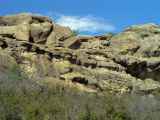
|
Castle Rock conglomerate in the east wall of Castlewood Canyon
|
The resistant 34 Ma Oligocene Castle Rock conglomerate
caps many of the mesas
and buttes of the east central Colorado Piedmont between Denver and Colorado
Springs, including the
prominent butte along I-25 named Castle Rock. Like so much coarse
concrete, it contains
many granite, quartz and metamorphic cobbles, large and small, in sandy matrix strongly cemented with
silica, with occasional ash layers from volcanic activity in the Rockies to east.
Among
the largest clasts are
huge angular boulders of
Wall Mountain tuff plucked from the walls of narrow canyons
cut through the tuff to the west by powerful range-front streams and
breakthrough floods roaring down from upcountry lakes (e.g., Florissant)
temporarily dammed by volcanic flows and mudflows of the Middle
Phase of Tertiary magmatism. The lower photo at right shows one such clast
about the size of a large watermelon.
It is the Castle Rock conglomerate, not
the older Wall Mountain tuff, that caps Castle Rock and most
of the surrounding buttes and mesas in the east central Piedmont. At the lower
photo at right, it forms the walls of scenic Castlewood Canyon south of
Franktown. Note the lens of coarse cross-bedded conglomerate (a stream channel)
wedged between two massive sandstone units.
The slightly older Larkspur conglomerate underlies the 37
Ma Wall Mountain tuff in the Colorado Piedmont near Larkspur.
It contains no clasts of Wall Mountain tuff but is otherwise similar in
composition to the Castle Rock conglomerate. It also caps some prominent
Piedmont buttes and mesa, including Larkspur Butte (below right).
Castle Rock, the Butte
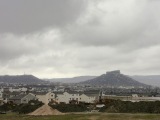 |
Castle Rock butte
|
As with most mesas and buttes in the east central Colorado Piedmont, Castle
Rock's conglomerate caprock rests on easily-eroded Dawson
Arkose. The whitish arkose forms the slopes below the caprock, but it's
usually poorly exposed. Instead, it's covered over and stabilized by an armor of coarse
debris spalled off the near-vertical caprock margins.
Castle Rock is a textbook example
of topographic inversion: As a high-energy streambed deposit, its
conglomerate caprock once occupied the very lowest spots in the local topography.
With burial, it acquired a strong silica cement
and locally unsurpassed resistance to erosion, so that its remnants now occupy the
highest elevations in the local landscape. Collectively, Castle Rock and
surrounding buttes and mesas provide a crude map of the local Oligocene drainage
pattern.
Butte Collapse Rings
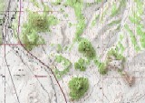 |
|
|
|
Butte collapse rings SW and SSE of Larkspur Butte
|
But the inversions don't end there. Geologists have only recently recognized
several odd Q-shaped hills in the Castle Rock-Larkspur area. Fully formed examples, like the one
seen at right immediately southwest of Larkspur Butte, consist of a C-shaped circular ridge with a jagged profile and an
alluvial fan of arkose debris with no obvious source emanating from the gap in
the ridge. (The fan is the tongue of the Q.)
According to researchers from the ^Colorado
Geological Survey, these odd landforms tell of yet another
round of topographic inversion awaiting the buttes standing today — one that
might be termed butte collapse. When a butte's caprock is finally breached, meteoric waters enter the central
core of easily-eroded Dawson arkose from the top and begin to remove arkose from
beneath the cap. Eventually, a small radial stream draining the breach cuts down
through the outer slope and builds an alluvial fan of arkose at its base, all
typically on just one side of the butte. Angular fragments of the progressively
unsupported caprock tumble down both the original outer slopes and newly created
inner slopes as well to form the jagged talus flatirons that give these
landforms their sawtooth profiles. (Note the talus flatirons on the eastern
inner slope in the lower aerial photo at right). Still protected by its armor around most of
the butte, the relatively resistant outer slope is eventually left standing as a
C-shaped ridge rising in some cases hundreds of feet above the arkose fan and
the collapsed center, where the caprock once stood high.
In the topographic map and top aerial photo at right, the originally reported
butte collapse ring sits immediately southwest of Larkspur Butte. The bottom
photo shows a smaller ring with particularly large talus flatirons and a
northwest-directed fan immediately north of Rattlesnake Butte. Just east of this
2nd ring may be yet another, larger and more deeply eroded with a west-directed
fan, but preliminary field investigations there have proved equivocal so far.
You couldn't make this stuff up.
Acknowledgment: Thanks to Vince Matthews for sharing his first-hand
knowledge of the rings mentioned above.
Ogallala Formation
From the Latest Miocene on (7-0 Ma), alluvial fans along the range front have
continued to build eastward and coalesce over the High Plains from southern
Wyoming to New Mexico under the impetus of the regional
uplift commencing at 28 Ma. These poorly cemented and loosely compacted gravel,
sands and clays range up to 210 m in thickness, taper to the east, and host the
famous aquifer of the same name. Ogallala strata were originally laid down flat
but now dip to the east, particularly the older layers, in response to ongoing regional
uplift. Ogallala deposition ceased in the Denver and Colorado Springs areas
when tributaries of the Arkansas and South Platte Rivers beheaded the source
streams during their excavation of the Colorado Piedmont.
Sub-Ogallala Unconformity
Broad regional uplift typically precedes the arrival of a propagating continental
rift, usually in the form of a broad dome or welt centered on the rift trajectory.
Basement-penetrating rift-parallel normal faulting and basaltic volcanism
soon follow. The north-propagating Rio Grande Rift has been no
exception.
The east-dipping tilt of the High Plains
Ogallala gravels flanking the Rockies decreases progressively toward the surface
and toward the north. The pattern fits the development of the Rio
Grande Rift well.
The Ogallala rests unconformably on mid-Tertiary White River Group basin fill north of
Denver but on progressively older rocks to the south, down to the Permian in northern New Mexico. This
south-widening sub-Ogallala unconformity points to a south-to-north exhumation of
the Front Range and its range-front basin as the Rio
Grande Rift, not far to the west, uplifted and cracked its way north.
Tertiary magmatic inflation of the Rockies probably played a role as well,
particularly south of the Front Range, but the magmatism itself may also relate
to the Rio
Grande Rift, at least in part.
Western Colorado Sedimentation
The thick and extensive Wasatch Formation and Green River Formation
crop out impressively throughout the western portion of the state even though
they tend to be rather poorly consolidated. Both are of Eocene age. The
impressive Roan Cliffs west of Rifle on I-70 expose great thicknesses of
colorful Green River and Wasatch sediments, which can also be seen all along the
flanks of basalt-capped Grand Mesa to the south.
Equivalent eastern Colorado deposits no doubt formed, but none have been
preserved.
Wasatch Formation
 |
Roan Cliffs below Grand Mesa
|
The older Wasatch Formation was deposited as a mix of fine-grained fluvial
and alluvial sands and silts, mostly syntectonic, across a broad western lowland
now known as the Piceance Basin (pronounced "pee-on'-see", not
"piss ants"). Up to 1.5 km thick, the Wasatch rests conformably on the
Late Cretaceous Mesaverde Group.
Green River Formation
Fine-grained Green River lake sediments up to 1 km thick accumulated over the
Wasatch in a large fresh-water lake now known as Lake Goshiute. The Green
River hosts all of Colorado's famous oil shales. These organic-rich
"shales" are actually for he most part shaley lacustrine limestones
containing reserves of petroleum greater than any elsewhere in the US but
devilishly difficult and expensive to extract.
Parks
Topographically speaking, a park is a flat-floored valley surrounded by mountains on all
sides. In the Rockies, the larger parks are often faulted synclines (downwarps
with younger strata bent toward each other) of Laramide
origin. Colorado's four major parks include North, Middle and South Parks and the
San Luis Valley. North, Middle and South Parks stand low because, for some
reason, the Laramide uplifts left them behind
while everything around them went up. The broad San Luis Valley, on the other
hand, owes its low elevation to its status as the
widest part of the Rio Grande Rift.
Unlike foreland basins, parks tend not to collect thick
sedimentary covers. They're typically floored
with soils or thin veneers of Late Tertiary alluvium or Mid- to Late Tertiary
volcanics resting directly on variably deformed pre-Laramide bedrock.
 |
Looking west across South Park from Wilkerson Pass
|
 |
Looking southwest into South Park from Boreas Pass
|
South
Park, for example, is a faulted syncline floored with early Paleozoic
through mid-Cretaceous strata, andesitic flows and ash flow tuffs associated
with the Thirtynine Mile Volcanic Field, and late Tertiary alluvium. An
east-dipping, north-trending Dakota hogback, this time fronting the Mosquito
Range, divides South Park at Hartsell. The Elkhorn Thrust, one of the
Rockies' few exposed Laramide faults, separates South
Park from the Front Range on the east near Wilkerson
Pass (9,705'), just as the Williams
Fork Thrust demarcates the Front Range along the east side of the Blue River
Valley.
Parks typically shelter sedimentary and
volcanic deposits long lost to erosion in the surrounding mountains. The Sawatch Formation
has generally been eroded away all along the eastern
flank of the Front Range, but the down-dropped ^Woodland
Park half-graben just west of Colorado Springs preserves remnants. The
Oligocene Thirtynine Mile volcanics preserved on the floor of South Park are another example.
Map Units
On the Geologic Highway Map of Colorado,
exposed basement cores of Laramide uplifts are shown in grays and generally bear
the symbols "Xm", "Xg", "Ym" and "Yg". Laramide intrusions bear the symbol "TKi" and appear in dark maroon;
nearly all fall along the Colorado
Mineral Belt, which is easily found by following the diagonal band of dark maroon
"Tki"
and hot pink "Tmi" intrusions from Four Corners to Boulder. The Laramide basalts of North
and South Table Mountain at
Golden don't seem to be mapped.
Syntectonic Laramide sediments like Arapahoe
conglomerates, Denver
volcaniclasitics and Green Mountain conglomerates on Green Mountain
near Denver are mapped in pale yellow as "Tl". So are the Wasatch
and Green River Formations found in western Colorado.
Top
Page Index
Cenozoic Sedimentation, 65-0 Ma
Under construction
About Time—the Cenozoic Era (65-0 Ma, 23:39 - 24:00 h)
The Mesozoic Era (248-65 Ma, 22:41-23:39
h) and its final Cretaceous
Period (144-65 Ma, 23:14-23:39 h) closed with the great Cretaceous-Tertiary
("K-T") extinction that did in the dinosaurs and many other
successful species on the occasion of the splashdown of a large asteroid or comet near
Chixulub on the north shore of the Yucatan Peninsula. The Cenozoic Era
(65-0 Ma, 23:39-24:00 h) runs from there to the present.
Slicing and Dicing the Cenozoic
Geoscientists find it convenient to divide the Cenozoic in a number of ways,
depending on locale and subject matter.
-
The Tertiary Period (65-1.8 Ma)
encompasses the Paleocene (65-54.8 Ma), Eocene (54.8-33.7 Ma)
and Oligocene (33.7-23.8 Ma), Miocene (33.7-5.3 Ma) and Pliocene (5.3-1.8 Ma) Epochs—the
first 97% of the Cenozoic.
-
The Quaternary Period (1.8-0 Ma) started
with the Pleistocene Epoch (1.8 Ma - 10 Ka) and continues with the
Holocene Epoch (10-0 Ka) from the end of the Ice Ages to the present. It
represents the last 3% of the Cenozoic and the last 0.04% of earth history.
-
Paleogene time (65-23.8 Ma) covers
roughly the first two-thirds of the Cenozoic, including the Paleocene,
Eocene, Oligocene Epochs.
-
Neogene time (23.8-0 Ma) includes the
Miocene, Pliocene, Pleistocene and Holocene Epochs—roughly, the final
third of the Cenozoic.
Confused yet?
The K-T Impact
 |
Chixulub (red), Yucatan
|
As the Cenozoic Era opened in Colorado at 65 Ma (23:39
h), Laramide
uplifts had already dominated the regional topography. Syntectonic
sediments were piling up around the uplifts throughout the Rocky Mountains
and the Colorado Plateau. Basaltic volcanism played out here and there around
particularly leaky Laramide faults like the Golden
Fault.
Geologically speaking, it was a decidedly wild time around the state, but the
climate was semi-tropical, and plant and animal life managed to thrive despite
the turmoil. Unfortunately (or fortunately, depending on how you like your place
in the food chain), something far wilder was headed their way.
The Mesozoic Era (248-65 Ma, 22:41-23:39 h) slammed shut with the splashdown of a large (~10 km) asteroid or comet near
Chixulub on the north shore of the Yucatan Peninsula (large red circle near
center in the image above). The ensuing great Cretaceous-Tertiary
("K-T") extinction killed off the dinosaurs and many other successful
Cretaceous species, too.
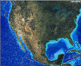 |
Colorado to Chixulub
|
Like just about everywhere else in the world, Colorado literally burned to
the ground in the aftermath of the impact. A rather inconspicuous clay layer
devoid of fossils but rich in extraterrestrial iridium, impact-shocked quartz
grains
and elemental carbon (char) marks the K-T boundary all over the globe. In
Colorado, the K-T clay and char crops out in only a few locations in the south,
including a road cut on I-25 between Trinidad and Raton, where it's all of 5-10
cm thick—not much to show for a global catastrophe. It's also exposed at the
south end of Lake Trinidad west of Trinidad in a 5 cm white clay over coal
layer.
Range-Front Basins
|
|
Brimming structural range-front basins (green) make up much of the state
|
Most Laramide uplifts are paired with deep structural
range-front basins, some of which eventually collected sediments to thicknesses
of several kilometers. Basins like these form when crustal shortening stacks
heavy thrust sheets on top of crust previously in isostatic
balance. As the newly overloaded crust sags, its stiffness carries the flexure
well beyond the mountain front. Abrupt mountain fronts are particularly
effective in creating these range-front downwarps known as foreland basins
or foredeeps,
and Laramide uplifts typically have at least one steep flank. Similar foreland
basins developed around the Frontrangia and Uncompahgria uplifts of the Ancestral
Rocky Mountains over 200 Ma earlier, and some of these—most notably the
Denver and Raton Basins—were reactivated during Laramide time.
Terrigenous syntectonic
sediments
began to collect in the foreland basins as soon as the Laramide uplifts emerged from the
Cretaceous sea.
As the sediments piled up, the receiving basins subsided further under their weight. The
basement floor of the Denver
Basin now sags nearly 14,000' (4.3 km) below the surface at Denver but sits at
least 22,000' (6.8 km) below the same basement horizon in the adjacent Front
Range. Not coincidentally, this largest of all Rocky Mountain foreland basins is
paired with the largest of the Laramide uplifts. Its contents record the history
of a large segment of the state over at least the last 300 Ma. Geologists and
paleontologists at the ^Denver Museum of Nature
and Science are working to read that record in unprecedented detail in their
ambitions ^Denver Basin
Project.
|
|
Castle Rock atop the Denver Basin
|
By the close of the Laramide at ~40 Ma, the foreland basins had filled to
overflowing and had become indistinguishable from surrounding tertiary
pediment surfaces. With subsequent regional uplift
and exhumation, they were uncovered and eventually
incised by crossing streams, particularly in the last 10 Ma. The resulting
exposures of syntectonic sediments are invaluable windows into the progressive
unroofing of the source uplifts.
The table below lists past and present major foreland basins (as geologists
often call them) in and around Colorado, in order of decreasing size within
Colorado.
Foreland Basins, Rocky Mountains and Colorado
Plateau
|
|
Basin |
Source Range or Uplift, Flank |
Notes |
|
Denver |
Front Range,
east |
-
By far the largest of all Colorado foreland
basins
-
Holds over 4 km (nearly 14,000') of sediments shed
to the east from both the
current Front Range and Ancestral Rocky Mountain
FrontRangia uplifts
-
Strata dip steeply
to the east at the range front
|
|
Piceance |
White River uplift, west; Uinta Mountains, south |
-
Holds ~2.5 km (8,500') of west slope sediments,
including the Wasatch and Green
River Formations, the latter with abundant oil shales
|
|
Maroon |
Uncompahgria, northeast; Frontrangia, southwest |
|
|
Paradox |
Uncompahgre Uplift, southwest |
|
|
Raton |
southern Sangre de Christo Range, east; Wet
Mountains, southwest |
|
|
San Juan |
San
Juan Mountains, south |
[] |
|
Sand Wash |
Uinta Mountains, northeast |
[] |
|
Laramie |
Front Range, northwest; Medicine Bow Mountains, northeast |
[] |
Map Units
The Geologic Highway Map of Colorado marks
Lower Tertiary Paleocene through Eocene strata "Tl" and maps them in
yellow. This map unit includes the Wasatch and Green
River Formations. Upper Tertiary Oligocene through Pliocene units, like
the Ogalla, are marked "Tu" and mapped in
tan. The anomalous K-T boundary layer doesn't show
explicitly, but it might be preserved anywhere Lower Tertiary "Tl"
and Upper Cretaceous "Ku1" units are found in contact, as they are
around Trinidad at the east edge of the Raton Basin.
Top
Page Index
Post-Laramide Magmatism, 36-5 Ma
 |
|
|
The San Juan
Mountains, the West Elk Mountains
(right) and the 39 Mile Volcanic Field are imposing erosional remnants of a once
vast volcanic blanket that covered much of
central and southwest Colorado in mid to late Tertiary time. This post-Laramide
magmatism came in three distinct waves. The Early and
Middle phases were dominated
by explosive volcanism that spread ejecta far and wide across the state. Most of
the resulting volcanic deposits are now long lost to erosion, but in their time,
they greatly influenced the present courses of some of Colorado's largest rivers
and streams. The Rockies are famous for improbable canyons cut through rather
than around impressive highlands.
Prolific post-Laramide volcanoes shoving streams this way and that before final
entrenchment were one of the factors controlling the courses of antecedent streams, particularly at the Black
Canyon of the Gunnison. Less violent Late Phase basaltic
flows ringed the margins of the Colorado Plateau and capped a number of central Colorado
ridges and mesas, preserving them in the process.
In the literature, post-Laramide magmatic events are often referred to simply
as "Oligocene". Since the Oligocene period (33.7-23.8 Ma) overlapped
all three phases, it can be difficult to assign such events to a specific phase
unless a specific date is given.
Post-Laramide Intrusions
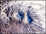
|
Spanish Peaks, NASA
|
As volcanoes busily reworked the post_Laramide surface, the subsurface became
riddled with igneous intrusions (magma reservoirs,
dikes and sills) that
eventually froze in place. The intrusions inflated surrounding host rocks and
induced contact metamorphism via their thermal and mineral-rich fluid emanations, as
in the Elk Mountains, on the west
flank of the Sawatch Range around Aspen, and at ^Spanish
Peaks (right) on the east flank of the southern Front Range. Gold, silver, lead, molybdenum,
copper and zinc concentrated in ore bodies as the hot magmatic fluids permeated
particularly receptive host rocks like the Mississippian
Leadville Limestone of mining fame. Intrusive (and presumably volcanic)
activity was particularly intense along a Proterozoic line of weakness now known
as the Colorado Mineral Belt.
Why Here, Why Now?
What brought on this hellish outburst is hard to say, but there are some
likely suspects, and they're probably related:
-
Upwelling of hot, buoyant asthenosphere
against the base of the North American plate as the Farallon
plate broke up and fell away after its flat-slab
subduction during Laramide time would uplift and stretch the North
American plate from the Laramide orogen west as it produced copious melt
within or below the lithospheric mantle. The melts would exploit
pre-existing weaknesses like the Colorado Mineral Belt
and new failures brought on by post-Laramide extension to reach the upper
crust and the surface.
-
Resumption of normal-angle subduction and hinge
rollback along the West Coast between 40 and 29 Ma would have put the
backarc in extension once again. The earliest Basin and Range extension
likely arose in this way, but how far east did the influence
extend?
-
Additional extensional stresses
developing in the crust as the Rio Grande Rift approached
from the south and quickly cut north up the middle of the Laramide orogen would
make the region even more permeable to the asthenosphere. Note, however,
that continental rifting here may or may
not have related to extensional processes to the west.
During the Middle
Phase of Colorado magmatism at 30-26.5 Ma, the entire Basin and Range east of the Colorado
Plateau extended east-west by 100% or more, and that cracking and stretching certainly
contributed to the devastating Ignimbrite Flare-up
at ~30 Ma. Colorado probably extended less than the Basin and Range, but
ignimbrites lit up Oligocene Colorado at the same time.
Early Phase Magmatism (37-31 Ma)
The first post-Laramide eruptions blanketed large areas with ^andesitic
lava flows, volcanic
mudflows, ash flows and ash falls, particularly in the
West Elk and San Juan Mountains. The far-flung West Elk Breccia dates from this
phase.
Wall Mountain tuff (WMT)
[photo coming]
|
Looking south from Dinosaur ridge,
the tablelands on the right are for the most part capped by the WMT.
|
Just south of Denver, erosional remnants of 37 Ma Late Eocene Wall
Mountain tuff or ignimbrite (AKA Castle Rock
^rhyolite)
up to 40' thick record one of the opening shots of the Early Phase in
the east — the arrival of a devastating ash flow erupted from the Mt. Princeton
area 138
km (86 mi) to the
east in the Sawatch Range. The massive ash flow rolled down the Eocene erosional
surface to blanket the western part of the Denver Basin incandescent ash at the
time up to 400' thick. South Park and other intervening valleys were filled to
brimming with syntectonic Laramide sediments at
the time and had not yet been exhumed.)
[photo coming]
|
[] cm WMT clast from Castlewood Canyon near Franktown, CO
|
The gray- to buff-colored Wall Mountain tuff now caps many of the
prominent buttes on the west side of the Denver Basin between Denver and Colorado Springs, but the younger Castle
Rock conglomerate caps most of the buttes and mesas to the east, including
its namesake butte on I-25 (right).
Middle Phase Magmatism (30-26.5 Ma)
Explosive Oligocene eruptions seared the eroded Early Phase landscape with fast-moving incandescent
ash flows (AKA pyroclastic
flows, glowing cloud eruptions, nueés ardentes) depositing welded tuffs (ignimbrites)
and unwelded tuffs over nearly a third of the state. Middle Phase tuffs
apron the south flank of the West Elks to form the Palisades on the
Gunnison. Today, rich volcanic soils help to make the Palisades region
the premier fruit-growing region in the state, wine grapes included.
The Middle Phase coincides in both timing and style with the
Ignimbrite Flare-up that turned the entire Basin and Range into a
lifeless moonscape of welded tuffs around 30 Ma. The event probably signaled the
return of hot asthenosphere beneath the western third of the
continent after removal of the horizontally subducted Farallon
slab, as detailed above.
Late Phase Magmatism (25-5 Ma)
|
Pliocene basalts capping Grand Mesa
|
|
Basalt-capped ridge of the northern Sawatch range
|
Late Phase volcanism (25-5 Ma) blanketed the state
with less violent basaltic lava flows. This final volcanic episode isn't
well preserved, but Late Phase Pliocene basalts still cap Grand Mesa (upper
right photo) and many ridges around Glenwood
(lower right photo). Late Phase basalts also ring the margins of the Colorado
Plateau. These readily distinguished, easily dated, originally
flat-lying flows provide investigators with
invaluable paleoaltitude and paleotopography indicators applicable to an number
of important questions involving exhumation rates, regional tilting,
paleoclimates, etc.
Colorado Mineral Belt
Long lineaments across the face of the earth are more often than not the work of
deep-seated processes. The Colorado Mineral Belt (CMB) is such a
lineament, and it goes down and back a long way. The ^Colorado
Geological Survey map at right shows the CMB in blue.
This legendary
50-mile-wide swath of mineral wealth cuts a straight path from Four Corners at
the Colorado-Utah-Arizona-New Mexico boundary to Boulder, CO on the east flank
of the Front Range—a distance of ~300 miles. Mineralization of the CMB came primarily by way of intrusions by Early and
Middle Phase mid-Tertiary magmas, but Laramide intrusions also played an
important role, particularly in the Idaho
Springs-Ralston shear zone and continental
divide segments at its east end. The CMB appears to be
a lithospheric-scale band of weakness that may
well have developed over 1.6 Ga earlier during the Early
Proterozoic assembly of Colorado. It may have started out as a suture associated with
one of the terranes that docked against the southern margin of the Wyoming
Province around 1.8-1.6 Ga to form the Colorado
Province, but that conjecture has yet to be documented. CMB segments have
been reactivated during the 1.4 Ga Berthoud Orogeny,
most notably at Mt. Evans and in the Homestake
shear zone of the northern Sawatch.
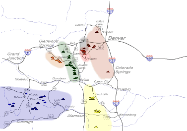 |
Colorado Fourteeners
|
The CMB Today
Today, the CMB appears as a string of heavily intruded and variably
mineralized Proterozoic shear zones stretching more than half the diagonal of
the state. Geophysically, it's characterized by a major gravity low, low crustal
seismic velocities and high heat flow—all suggestive of anomalously hot upper
mantle and lower crust below the
lineament. Large hot magma bodies related to the Laramide and mid-Tertiary
intrusions of the CMB may well still reside in its lower crust. Topographically,
the CMB stands high, even by Colorado standards. The hot mantle and lower crust
underlying the CMB probably buoy up the upper crust along its trace. Regardless
of the explanation, it's no accident that over half of Colorado's Fourteeners
lie within or near the CMB. Nor is it an accident that all but two of the
remaining Fourteeners stand on the shoulders of the Rio Grande
Rift. Common
Colorado Mineral Belt Ores
The primary ores of the CMB were
generally deposited as mixed metal sulfide veins containing pyrite (FeS2), galena (PbS),
sphalerite (ZnS, FeS), and chalcopyrite (CuFeS2) with variable doping by gold, silver and copper
impurities. Mineralized sedimentary rocks altered by contact
metamorphism tend to host similar metal sulfides. When ground
water reacts with pyrite, typically along the upper margin of a sulfide deposit,
the sulphuric acid released in turn attacks
other sulfide minerals to form secondary (usually oxide) minerals and occasional
native gold and silver. Thus,
miners often first encountered so-called "oxide minerals" like
cerrusite (PbCO3), cerargyrite (AgCl), argentite (Ag2S)
and chalcocite (Cu2S) as they dug toward the primary sulfide
bodies. Once weathered out of their host rocks, dense native metals
often accumulated in placer deposits along stream beds. In many Colorado mining
districts, the easily discovered and worked placers were the first big strikes.
Hard rock mining typically ensued only when the sources of played out placer
deposits could be located.
Map Units
On the Geologic Highway Map of Colorado,
Tertiary intrusions carry symbols "Tmi" and "Tui" and appear
in shades of hot pink; Tertiary volcanics are marked "Tov" and "Tuv"
and appear in brown and orange, respectively. To find the Colorado
Mineral Belt, follow the discontinuous diagonal band of dark maroon Laramide
intrusions marked "Tki"
and hot pink mid-Tertiary intrusions marked "Tmi"
from Four Corners to Boulder.
Top
Page Index
Post-Laramide Uplift, Extension and Rifting, 28-0 Ma
Broad regional uplifts with little tilting have a name—epierogenic.
They bear little geologic or topographic resemblance to the discrete,
fault-controlled uplifts of the Laramide Orogeny.
Many lines of evidence now point to one or more episodes of post-Laramide
epierogenic uplift affecting the Rockies, the Colorado Plateau,
the High Plains, and to a lesser extent, surrounding areas. Since continuous
epierogenic uplift starting at 28 Ma with a Miocene acceleration and some
spatial variation seems to be the most likely scenario, that's the picture I'll
present here. The story is one of hand-in-hand uplift
and extension, with a definite chicken-and-egg flavor.
Up Again
 |
Tertiary pediment, Front Range, looking south from Genesee Mountain
|
The mid-Eocene die-out of Laramide deformation at ~40 Ma brought both
tectonic calm and volcanic fury to the region. By
late Eocene time, erosion and attendant basin filling had reduced the regional
landscape to a high surface of at most modest relief punctuated here and there
by the tallest remaining peaks and ridges of the Laramide uplifts. Remnants of
this Tertiary pediment or Eocene erosional
surface are still visible in the Rockies today (right). Thick blankets of post-Laramide
volcanics erupted mostly in Oligocene time came to cover large portions of
the Tertiary pediment, adding relief near volcanic centers (most notably, the
San Juan, West Elk, Thirty Nine Mile volcanic fields) but reducing it everywhere
else. With few obstructions and gentle gradients, streams meandered lazily
across the pediment, the major rivers included.
Epierogenic uplift of this landscape began late in the Oligocene at ~28 Ma
and kicked into high gear in the Miocene at ~10 Ma. Stream incision and exhumation
of the by then largely buried Laramide uplifts ensued throughout the region,
particularly after the Miocene acceleration, which set the stage for much of the
Rocky Mountain and Colorado Plateau topography we see today. This kind of uplift
is to slow to measure in real time, even with GPS techniques, but most studies
confirm very recent and presumably current uplift at 1-3 times the rate expected
from isostatic response to erosion alone.
The Big Dome
|
Big Dome Fourteeners and radial drainage pattern
|
The effects of post-Laramide uplift aren't hard to spot. With 50+ peaks above
14,000', the Colorado Rockies boast the highest average regional elevation of
any place in North America, Alaska included. They owe much of their
extraordinary height to a huge and still rising dome-shaped post-Laramide uplift
centered over the
intersection of the Colorado Mineral Belt and the Rio Grande Rift
near Leadville. I like to think of
this mother of all post-Laramide uplifts as the Big Dome, but you won't
find that term in the literature. As the map at right shows, most of the state's
Fourteeners cluster around Leadville, and all of Colorado's major rivers (in clockwise order from north, the North
Platte, Laramie, South Platte, Arkansas, Rio Grande, San Juan, Gunnison,
Colorado, White and Yampa) flow off the dome in a radial drainage pattern of grand proportions.
 |
|
Mount Massive (14,421') at the top of the Big Dome, from Leadville
Airport
|
Deep Yampa River meanders cut in Weber Sandstone, Dinosaur National
Park East
|
The Colorado Plateau and surrounding uplands gained most of their present
elevations in the Late Tertiary as well. These scenic tablelands are now
famously dissected by rivers (the Colorado, the Green, the Yampa, the Escalante)
with seemingly impossible wide-swinging meanders deeply entrenched in hard rock
canyons—a hallmark of epierogenic uplift. In the Rockies, antecedent
streams invigorated by rising headwaters and steepened gradients cut spectacular
canyons (among them Royal Gorge and the Black,
Glenwood, Gore and Wind River canyons) right through the highly resistant
crystalline cores of many previously buried Laramide uplifts.
Subtler post-Laramide uplifts are also recorded. Stream course shifts and incision
patterns in the High
Plains over the Denver basin point to a broad domal uplift
of Miocene age centered on the
southern Front
Range. Up-to-the-south tilting of the sub-Ogallala
unconformity and up-to-the-west tilting of the Miocene Ogallala
Formation itself are important examples that help geoscientists quantify
recent uplift rates and geometries.
The Big Stretch
Extension went hand-in-hand with post-Laramide
epierogenic uplift from the start and no doubt had a large hand in promoting
the volcanism that accompanied it. (Volcanism thrives
on extension and in many settings requires it.) Normal faults are the most
conspicuous markers of extension, and their ages are often tightly constrained
by the independently datable structures that they do and do not cut. Blocks
down-dropped between opposing normal faults form structural basins (grabens and
half-grabens) that accumulate younger sediments. Normal faults and their
associated structural basins are much like stretch marks in skin, in that they
align roughly perpendicular to the direction of maximum local extension.
 |
Map of Colorado faults showing late Cenozoic to recent movement:
orange since 1882, red since 1.8 Ma, yellow since ~ 24 Ma
|
A look at Colman's Map Showing Tectonic Features of
Late Cenozoic Origin in Colorado or the Colorado Geologic Survey's ^map
of faults with late Cenozoic to recent movement at right shows two families of post-24 Ma
faults, all normal:
-
a larger swarm of subparallel
north-striking normal faults clearly associated with the Rio
Grande Rift— from onset to the present, the single most important
focus of extension in the region and the single greatest source of
earthquake hazard in Colorado. This family of faults stretches (pun
intended) from southern New Mexico into southern Wyoming and is probably
still cutting north.
-
a smaller set forming concentric partial rings around the
Rio Grande Rift within Colorado, roughly along the flanks of the Big
Dome.
Faults in the first family are involved in continental
rifting, which we'll take up next. The second set of faults may be a direct
response to uplift of the Big Dome, which must involve stretching of the crust.
These faults and their associated structural basins serve as first-order
guides to the distribution of post-Laramide extension in Colorado and also speak
to its origins,
as we'll see in the next section on the Rio Grande rift.
The Rio Grande Rift
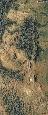 |
Rio Grande Rift
|
The Rio Grande Rift
(RGR, right) is a young, large, active and regionally important tectonic feature
splitting the Southern Rockies down the middle from New Mexico to southern
Wyoming. This fast-moving continental rift first appeared in the geologic record in New Mexico at
around 28-27 Ma, reached central
Colorado by 26-25 Ma, left behind 10-8 Ma intrusions at the Colorado-Wyoming
border and continues to cut northward through southern Wyoming today. The
nascent RGR has yet to sunder the continent and produce oceanic crust in Red Sea
fashion, but that day could well come. To what extent the RGR relate to
extensional processes operating to the west is unclear.
Along the RGR, heat escapes the earth at a much higher rate than in typical
intracontinental settings. A broad welt of uplift precedes the RGR's northern
cutting tip and continues to rise along the shoulders of the rift well after the tip
passes. These features are common among continental
rifts the world over.
Surface Manifestations
|
Colorado Plateau (pink), NASA
|
The RGR has many direct and indirect surface manifestations in Colorado and New Mexico.
In the NASA satellite photo of ^Four
Corners at right, the Rio Grande River follows the RGR south out of the San Luis
valley, a particularly wide RGR section. The upper Rio Grande valley marks the
RGR from there through southern New Mexico. North of the San Luis valley, the
RGR narrows through the deep graben of the upper Arkansas valley. The upper Arkansas River
follows the RGR south through central Colorado high-country and the San Luis
Valley before dog-legging east to cross the Front Range as an antecedent
stream and exit the Rockies at
Royal Gorge near Cañon City. The dogleg is consistent with the radial drainage
pattern associated with the post-Laramide Big Dome uplift of
central Colorado.
North of Leadville, the RGR lacks a discrete topographic
expression, but geophysical studies show that its cutting edge has
already crossed into southern Wyoming. Just east of the northern RGR trend,
however, between the Gore and Front ranges, is the lower
Blue River valley, a half-graben claimed to be the northernmost structural
expression of the RGR. The much broader and more recently
recognized Central Rockies Extensional Province (CREP) of northern Colorado and
southern Wyoming may or may not be directly related to the RGR, but the
extensional tectonics they share probably stem from the same processes.
|
The Rio Grande rift coincides with the swarm of NNW-trending faults at
left center in this map of Colorado faults showing late Cenozoic to recent
movement: orange since 1882, red since 1.8 Ma, yellow since ~ 24 Ma
|
Shoulder uplifts are a universal feature among continental
rifts, and the RGR is no exception. Riding
high on the shoulders of the
RGR are the Tenmile and Mosquito Ranges on the east and the Sawatch Range on
west. Tenmile Creek and its impressive Tenmile Canyon
appear to follow
a northern extension of the Mosquito Fault, one of the
major normal faults defining the east shoulder of the RGR in central Colorado,
right through the heart of the once undivided Park-Gore-Tenmile-Mosquito
basement uplift.
Damn the Torpedoes
Unlike the Colorado Mineral Belt, which appears to follow
ancient lithospheric weaknesses, the upstart Rio Grande rift follows its unswerving northerly course in
complete disregard for older structures, no matter how large. In or around Early
Miocene time, it sliced right through the eastern limbs of the massive Laramide-vintage
Sawatch and San Juan basement uplifts. The upper Arkansas River and CO24 now occupy a deep
rift valley between the Sawatch Range
on the west and its much smaller fragment on the east, the Mosquito
Range. Likewise, the San Luis Valley now occupies a 50 km gap between the
San Juan uplift on the west and its Sangre de Christo fragment on the east. The RGR now appears to be plowing into the Wyoming Rockies with equal
abandon.
[Part of the RGR story involves the Colorado Plateau. ??]
Causes of Post-Laramide Uplift and Extension
Causes for post-Laramide epierogenic uplift and extension in the Rocky
Mountains and the Colorado Plateau remain obscure—in part because
it's a chicken-and-egg question, but also because the mantle's still very
difficult to observe. We won't be able to tease out which came first, extension
or uplift, but it's important to recognize all the positive feedback loops
involved. No less than four processes are involved.
-
Primary extension driven by divergence at the mixed
Pacific-North American plate boundary, the closest one around by a long shot
-
Gravitational
collapse of the elevated North American upland from the Laramide orogen
west
-
Primary uplift driven by the upwelling of hot,
buoyant asthenosphere
-
Isostatic response to erosion
Their combined actions and second-order effects may well have accelerated
both uplift and extension.
Depending on scale, finite arch- or dome-like uplifts in the absence of
compression must stretch and thin the overlying crust, if not the entire
lithosphere—even with magmatism filling in gaps and adding volume as best it
can. But primary extension can also lead to secondary uplift. A relatively clean
example of the latter occurs along continental
rifts like the Rio Grande rift. Substantial uplift nearly
always occurs along the shoulders of such rifts. In fact, early sediments shed
off shoulder uplifts are commonly used to date the onset of rifting. Upwelling
of hot, buoyant asthenosphere into the
rift zone is the usual suspect here, but shoulder uplifts affect modern rifts
whether or not they show high heat flows, so there may be more to it than
thermal inflation.
Consider now a less tidy case at larger scale pertinent to the question at
hand. Thinning of the lithosphere across the Basin and Range as it stretches to
keep the North American plate in contact with the partly
diverging Pacific plate has led to a broad arch-like uplift of the entire
province, again presumably due to the influx of hot asthenosphere beneath the
thinning plate. But gravitational collapse driven by the uplift further thins
the lithosphere, which in turn fosters more uplift by buoyant forces rooted in
the mantle.
Complicating the picture further is the isostatic
response to erosion. The higher surface elevation rises due to
tectonic uplift, the faster erosion removes mass. But as erosion removes Rocky
Mountain mass to the High Plains, the Basin and Range and beyond, the rocks
of the Rockies rise via isostatic rebound. By itself,
rebound can't raise or even maintain average surface elevation against
erosion on a regional scale, but in combination with ongoing tectonic uplift, it
has no doubt slowed the regional loss of surface elevation due to
erosion. Gravitational collapse (a form of extension) can also trigger isostatic
rebound.
[] Thankfully, at least one potential explanation can be ruled out. Intrusive
and thermal
inflation of the crust related to post-Laramide magmatism
has clearly contributed to some local uplifts (e.g., in
south central Colorado) but can't account for the regional uplifts at issue here.
Excessive heat build-up beneath thermally insulating
continental lithosphere might play a role at larger scale and greater depth, particularly in a mobile
belt like the Colorado Province, but tomographic
imaging shows lower regional upper mantle temperatures beneath the Rocky
Mountains and Colorado Plateau than beneath the lower Basin and Range.
Farallon Plate Influences?
Post-Laramide machinations of the Farallon plate
clearly brought uplift, extension and magmatism to the Basin and Range, but did
its influences extend east to the Rockies and the Colorado Plateau? It's hard to
say.
At the conclusion of Laramide deformation at
~40 Ma, the East Pacific Rise, the Farallon plate's ridge of origin, was about
to be subducted along the west coast of the United States. The intervening and
then subducting portions of the Farallon plate must have been young, hot and
relatively buoyant from that time on, but some degree of normal-angle subduction
appears to have resumed along the West Coast. Renewed hinge rollback put a
broad, diffuse backarc region into extension once again. The earliest Basin and
Range extensions date back to this time.
Meanwhile, the portion of the Farallon plate already beneath North American
had been rolling back, breaking up and perhaps folding up as it pulled away from
the underside of the continent to end the Laramide period of flat-slab
subduction. Basin and Range magmatism related to this process lasted roughly
from 54 to 21 Ma, presumably via a prolonged and complex influx of hot
asthenosphere replacing the slab.
The Aspen Anomaly
It would seem unlikely that asthenospheric upwellings related to the Farallon
rollback would continue much beyond the die-out of Basin and Range magmatism at
21 Ma, but abnormal upper mantle does appear to be present under central
Colorado today, roughly beneath the Big Dome and the Rio
Grande rift. Tomographic imaging sees this so-called Aspen
anomaly as a large blob-like region of
anomalously low shear wave velocities presumably reflecting higher than normal
temperatures and greater than normal buoyancy. Whether the Aspen anomaly resides
in the lithospheric mantle or in the underlying asthenosphere remains under
debate, but either way, the presumed buoyancy could help to explain the many
high rootless mountains covering the Big Dome.
No one knows where the Aspen anomaly came from or how long it's been there,
but it's not a good explanation for post-Laramide uplift in general. For one
thing, it's too small relative to the region affected.
|
Central America plateau, south of Yucatan
|
Central American Plateau Analog?
Now consider a somewhat analogous epierogenic uplift involving the Central American
plateau of Honduras, well east of the magmatic arc associated with the Middle
America Trench. Tomographic imaging reveals that the subducting
Cocos plate broke off beneath the plateau and
that hot asthenosphere has welled up beneath the plateau via the slab defect.
The deeply entrenched river meanders
dominating the topography of the Central American plateau indicate that its uplift
occurred with
little tilt. Note that the Colorado Plateau has similar
topography. Note also that the plateau began to rise at ~10 Ma, about when the
slab broke. The near-simultaneity of these events implies a degree of
asthenospheric mobility that stands against lingering effects of the Farallon
rollback in the Rocky Mountain region today. Uplift in the Carpathian Mountains
has also been tied to slab detachment.
Pacific-North American Plate Boundary
Influences?
Plate-driven extension has clearly played a role in the Basin and Range since
the inception of the partly divergent
Pacific-North American plate boundary at 29 Ma. Have the Rocky
Mountains and Colorado Plateau taken part? Again, it's hard to say.
Over the last 29 Ma, the
nearest plate boundary, the Pacific-North American, has been at least 1,100 km away
from the central Rockies. All other North American plate boundaries have been far too
distant to have had any credible influence here.
Divergence along the Pacific-North American boundary has been driving Basin
and Range epierogenic uplift and extension since at least 29 Ma. Recall that the
Basin and Range stretched to the west by over 100% during the mid-Tertiary
alone. Coeval gravitational collapse of the Basin and Range further drives its
extension with mixed effects on regional uplift there.
How much of this plate-driven extension spilled east into the Rocky Mountain
and Colorado Plateau region is uncertain, but it's unlikely to have stopped
abruptly at with the Basin and Range. East of the Basin and Range, greater
uplift and lesser extension have played out over the same period, the latter
with a somewhat different style dominated by the Rio Grande rift.
Gravitational Collapse?
[] The pre-Laramide Creataceous Sevier orogeny to the west contributed to
oversteepening of the Basin and Range but stopped short of the Rocky Mountains
and the Colorado Plateau.
Map Units
On the Geologic Highway Map of Colorado,
Upper Tertiary sediments are marked "Tu" and appear in beige.
Top
Page Index
Exhumation and Rebound, 10-0 Ma
However grand, the Rocky Mountains and Colorado Plateau we see today are mere
remnants. Erosion began its attack as soon as the Laramide
uplifts began to rise (hence the syntectonic early Laramide gravels of Green
Mountain near Denver) and accelerated through the mid- and Late Tertiary as
regional uplift progressed and the climate became even wetter. Streams and later
glaciers carried off massive amounts of material, particularly from the higher
elevations, to reveal the surface we see today. The digging out of the Rockies
and the Colorado Plateau is a process geologists call exhumation.
Antecedent Streams, Improbable Courses
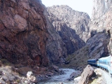 |
The Arkansas River in Royal Gorge
|
Today,
dramatic Colorado landmarks like Royal Gorge (right), Glenwood Canyon and the Black
Canyon of the Gunnison give the
impression that ornery Rocky Mountain streams would rather chew their way
through uplifts, ridges and ranges than go around them. Of course, no such thing ever
happened, but what did happen is just as strange. Streams that persist in courses first set in
long-gone topography are called antecedent, and antecedent streams,
large and small, contribute heavily to topographic style throughout the Rockies and the Colorado Plateau.
Free To Wander—the Eocene Erosional Surface
 |
Tertiary pediment, looking south from Genessee Mountain, infrared
telephoto
|
By
the time the regional Laramide deformations died out in Late Eocene time, around 40
Ma (23:47 h), the Laramide Rockies had already been
eroded to a lofty surface of relatively low relief sloping to the east
in rough continuity with the
High Plains. The tallest peaks, many probably in well above 10,000', continued
to stand high above this otherwise broad upland. Lesser peaks and ridges, on the
other hand, ended up buried in their own debris as surrounding intermontane basins filled
and eventually overflowed. Eventually, gentle gradients and a dearth of
structural barriers in the Eocene landscape allowed even the largest streams to meander at
will. At maturity, around 38 Ma or so, the landscape must
have resembled today's Wyoming Basin. Many know the vast high plains and
occasions ridges and peaks there from their travels along
I-80.
|
Tertiary pediment, looking south from Genessee Mountain
|
Remnants of this vast tertiary pediment or Eocene erosional surface
are still easily spotted throughout the Rockies—e.g., along the east slope of
the Front Range between Mount Evans and Pikes Peak (right and above) and also across the
Front Range between Boulder and Kremmling.
Gathering Storm
Mid-Tertiary
magmatic inflation, mid- and Late Tertiary regional uplift
and extension and an increasingly
wetter climate together reinvigorated the many streams meandering across low-relief uplands throughout the Rockies and the Colorado
Plateau. By most accounts, regional uplift and climate changes aligned to kick
stream incision into high gear around 10 Ma (23:57 h). By 6 Ma, Rocky Mountain streams
were on average removing more material from their beds than they received from
upstream.
Digging In...
Where stream courses were no longer subject to revision without notice by
volcanic events, entrenchment ensued. Deep, steep-walled,
hard-rock canyons began to dissect the Eocene erosion
surface. As long as the water kept
coming and gradients remained steep, entrenched streams had little choice but to cut down as best they
could through anything they found in their beds. When the entrenched streams finally reached the hard sedimentary covers and
even harder crystalline cores of long-buried the Laramide
basement uplifts (as did the Gunnison at its Black
Canyon, above right; the Arkansas at Royal Gorge, below right; and the Colorado at Gore
and Glenwood Canyons), they simply rolled up their sleeves, narrowed their cuts and kept on
sawing.
|
The Arkansas River in Royal Gorge
|
As subsequent erosion stripped more and more alluvial, volcanic and
sedimentary cover from the higher Laramide uplifts, their dissected cores were
left standing high, complete
with mind-boggling range-crossing antecedent streams. The high intermontane basins between
the uplifts were
also stripped of much of their fill during this time, with small remnants now left
clinging to mountain slopes here and there like so many crusty bathtub rings.
In the Colorado Plateau and adjoining flat-topped uplifts of the West Slope,
meanders deeply entrenched in resistant sedimentary rock deserve credit for the
head-scratching scenery in places like Echo Park in ^Dinosaur
National Monument and in Utah's completely improbable Escalante Canyon.
For stunning aerial photos of some of Colorado's more spectacular antecedent
stream courses, visit geologist Louis Maher's Rivers
that Cut Through Mountains. In fact, I'd recommend taking the time to study
all of his aerial photo pages. Nothing imparts an appreciation of the geometry
and provenance of a major landform as immediately as a well-chosen aerial
view.
... And Digging Out
As the entire Rocky Mountain and Colorado Plateau region rose higher and higher,
stream incision eventually
extended downstream to dissect the by now brimming range-front basins as well. The South
Platte River and its tributaries, for example, handily exhumed the western margin of the
Denver Basin to create the range-front trough of rolling hills and tablelands now know as the Colorado
Piedmont (AKA "I-25 Corridor"). The wet Late Tertiary climate provided ample hydraulic power for
the project.
Above 8,000', particularly exuberant stream incision set the stage for the glaciations to come. The glaciers would take the exhumational ball and run
with it, but much of the work had already been done.
Isostatic Rebound
Post-Laramide exhumation of the Rockies removed an immense mass from the
highlands, the peaks and intermontane basins alike, and redeposited it across the High Plains and in the lower Colorado
River basin. Just as a coal barge rises up out of the water as it's unloaded, so
the thick
Rocky Mountain crust has risen up out of the denser, plastic mantle on which it
floats in response
to erosion.
Isostatic rebound due to erosion can never produce net surface uplift
on a regional scale, but it can easily produce net rock uplift, which brings a specific rock
horizon to a higher elevation even as the surface continues to drop. In a glacial setting, isostatic rock uplift
can increase the net elevation of the highest summits in a range (but not
average elevation of the region) as large valley glaciers gouge out
wide and deep moats around them.
Continuing Uplift
All credible paleotopographic indicators suggest that the highest portions of
the Rockies have been standing near or above 10,000' since the onset of the Laramide
Orogeny. Over 65 Ma of alpine elevation in the face of continuous and at
times prodigious erosion can only mean ongoing uplift well beyond that
attributable to isostatic rebound. By comparison, the Ancestral
Rocky Mountains came and went from plain to plain in a mere 50 Ma.
Recent work by Margaret McMillan et al.
documenting long wavelength tilting of the Ogallala
and similar range-front alluvial deposits up to the east makes it very difficult
to pin the exhumation of the Rockies on climate change
alone. Most of the incision now observed was already in place when the climate
turned decidedly wetter and colder in the Pliocene at ~4 Ma. Continuing uplift
well beyond that attributable to exhumation-induced isostatic
rebound is the recurring answer, and Colorado's restless upper mantle
remains the prime suspect.
Map Units
On the Geologic Highway Map of Colorado,
Upper Tertiary sediments shed during exhumation are marked "Tu" and appear in beige.
Top
Page Index
Glaciation, 1.8 Ma - 10 Ka
About Time—the Quaternary Period (23:59:25 -
24:00:00 h)
The Tertiary Period (65-1.8 Ma, 23:39:12 - 24:59:25
h) ended and the Quaternary Period
(1.8-0 Ma, 24:59:25 - 24:00:00 h) and Pleistocene Epoch (1.8 - 10 Ka,
24:59:25 - 23:59:59.81) began with the onset of
the Ice Ages at 1.8 Ma. The ensuing Holocene Epoch
(10-0 Ka, 23:59:59.81 - 24:00:00 h) opened at the end of the Ice Ages and continues to unfold.
Rocky Mountain Glaciation
Only a few small glaciers survive in Colorado today, indeed in the United
States Rockies, but most Colorado
uplands currently above 8000' underwent rapid glacial erosion during the
Pleistocene and probably during the Pliocene as well. Like the Lake Creek Glacier at Twin
Lakes, some of the larger valley glaciers managed to nose their way down to even lower
elevations.
Most surviving glacial cirques, valleys, moraines, tills and outwash deposits in the
Rockies date from North America's two most recent glacial periods—the Bull Lake
(~160-40 Ka) and Pinedale (30-10 Ka). Continental ice sheets didn't reach the
Colorado Rockies in Bull Lake and Pinedale times, but extensive alpine ice
sheets formed as associated mountain glaciers coalesced. Deeply weathered
Pre-Bull Lake moraines like those fronting the east slope of the Gore
Range and east of ^Rocky Mountain National
Park are found here and there in the Rockies. Pre-Bull Lake ice
advances date from 5 Ma to 245 Ka, depending on the source. Sediment
pulses recorded in the Wet Mountains document several well-known post-Pinedale
cold periods, including the 1550-1860 A.D. world-wide glacial advance known as
the Little Ice Age. Today, large glaciers like ^Iceland's
retreating Breidamerkurjökull (right) survive only at high latitudes or
very high elevations.
Glacial Erosion
Alpine
glaciers are by far the most efficient of all agents of erosion. Under the right
circumstances, bedrock streams can erode spectacularly, as the Black
Canyon of the Gunnison and the Glenwood and Grand Canyons of the Colorado
attest, but glaciers are generally far more effective when it comes to local mass
removal and relief generation. Flowing ice can pluck up massive volumes of
bedrock and pre-existing valley fill and transport the load far beyond the
mountains of origin in a relatively short period of time.
 |
|
|
Alpine glaciers
typically remove the greatest volumes of rock well below their source areas,
after individual ice flows have coalesced into immense valley glaciers like the
one that carved South Willow Creek Canyon (right) into the southern Gore
Range. In so doing, they initiate an interesting positive feedback loop that
further enhances their erosive prowess. As large valley glaciers unload their
host ranges, local isostatic rebound can produce net
surface uplift in the high peaks
above them.* As they elevate their own source regions and collect even more snow with even
less summer melting, the valley glaciers grow and accelerate.
* Note: Isostatic rebound can't increase mean surface elevation across a
mountain range, but it can uplift the highest summits if enough material is
removed between them.
Alpine glaciers also enhance the erosive power of the bedrock streams below
them. Glacial outwash streams pass large fluxes of water and abrasive sediment
to draining fluvial systems at lower elevations. Glacial sediments may choke the
lower streams at times, but in the long run, these glacial inputs only boost
stream cutting power downslope. Glacially-induced isostatic rebound
may steepen
stream gradients as well.
Due to its lower average (2.2 km, ~7,200') and maximum elevations, the Colorado
Plateau largely escaped glaciation.
Map Units
On the Geologic Highway Map of Colorado,
the glacial gravels preserved here and there at elevation are not shown
explicitly, but glacial outwash contributes.
Top
Page Index
Holocene Uplift and Erosion, 10-0 Ka
Under
construction
About Time—the Holocene Epoch (23:59.59.81 -
24:00:00 h)
The Quaternary Period (1.8-0 Ma, 23:59:25 -
24:00:00 h) opened
with the Pleistocene Epoch (1.8 - 10 Ka,
23:59:25 - 23:59:59.81 h),
which coincided with the Ice Ages. The Holocene Epoch (10-0 Ka,
23:59:59.81 - 24:00:00 h) has been
in effect ever since.
More But Less Uplift
 Regional uplift due to ongoing mantle unrest and isostatic
rebound continue in Colorado and neighboring states to the north, south and
west, albeit perhaps at a slower pace than when the Rio Grande Rift
first cracked its way north through these parts. Regional uplift due to ongoing mantle unrest and isostatic
rebound continue in Colorado and neighboring states to the north, south and
west, albeit perhaps at a slower pace than when the Rio Grande Rift
first cracked its way north through these parts.
Dry Times
Stream erosion continues through the Holocene as
well, but with the much drier Holocene climate, but it's no match for the
Neogene exhumation that began in earnest at 10 Ma. Our
current climate is Colorado's driest since Early Jurassic Entrada
desert dune fields dominated the state (at least in the west) around 200 Ma.
Compared to the wet Pliocene and Pleistocene climates, the 12-14 inches of
precipitation the Front Range averages annually now is a drop in the bucket.
 |
John Charles Frémont
|
Tree-ring studies reveal a longstanding 40-year wet-dry periodicity in
Colorado's Holocene climate. Some worried that the drought of 2001-2002 might
signal the start of a decades-long dry cycle, but the late spring snows and
rains of 2003 and expedition logs kept by explorer John Charles Frémont (right)
in the 1840s remind us that wide swings in annual precipitation are the norm
here now, regardless of longer term trends.
Map Units
On the Geologic Highway Map of Colorado,
Quaternary sediments are marked "QT" and appear in beige along with
upper Tertiary ("Tu") rocks.
Top
Page Index
That's a Wrap—For Now
|
Royal Gorge
|
Well, there you have it:
Colorado—as gorgeous a place as you could ever hope for. And
it's not just a another pretty face: It's been around the block, and it knows a
thing or two.
So, what's next for Colorado? The short-range forecast calls for continuing uplift and
exhumation across the state—in the Rockies, the Colorado
Plateau, and the High
Plains—at the urging of mantle unrest and isostatic
rebound. For the foreseeable future, Colorado will continue to stand high
while her valleys deepen and her flat-topped uplands are cut back by stream
erosion.
Surf's Up?
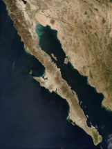 |
Baja Peninsula
|
What
the mantle has in mind is anybody's guess. If the region's dominant active
geodynamic process, the Rio Grande Rift, continues the rapid
progress it's made so far, the lower Rio Grande Valley could become a seaway
akin to the Sea of Cortez (right) in a few million years. In a few million more,
Leadville could find itself a
beach resort with scenery second to none featuring towering Sawatch Fourteeners
across the waves. I'd wouldn't buy up real estate there just yet, though.
Continental rifts fail all the time, as the Uinta and
San Juan basins will testify.
The Climate Factor
Climate has to be in the equation going forward, just as it's been in the past.
If the Colorado climate continues to dry, the overall pace of erosion will fall
off, but if global warming brings the predicted fewer but bigger storms per
season,
incision of the landscape could keep pace or even accelerate. (Most of the work
of erosion is done by bank-full streams and 100-year gully-washers, not by
average weather.) If another Ice Age should ensue, as some climatologists
foresee, we could expect a return to the Pleistocene
conditions prevailing a mere 10 Ka ago at 23:59:59.81 on the day
of creation ending now.
The Long Haul
The cooling of the earth in the presence of gravity drives plate tectonics.
Gravity's probably not going anywhere, but by some estimates, the earth has only
about 4-5 Ga worth of residual, chemical and
radiogenic heat to shed before cooling into a tectonically dead one-plate
planet like Mars and Venus. Real-estate will be a lot more dependable by then,
but the sun will enter its helium-burning red giant stage and engulf us in about
the same time frame, if not sooner, so things may get pretty hot. Even so, if we
can manage to turn ourselves away from the bright, dancing flame of
self-extinction, that still leaves time for plenty of surprises—including more
big impacts and a return of surf music. Maybe there's something to be said for
species-turnover after all.
Top
Page Index
References
In addition to the home page references, this
article relies on the following sources, in alphabetical order by first author:
-
Allmendinger RW,
Shaw JH, 2000, Estimation of fault propagation folding from fold shape:
Implications for earthquake hazard assessment, Geology v. 28, p.
1099-1102 (December)
-
Axen GJ, Selverstone J, et al., 1998, If the
Strong Crust Leads, Will the Weak Crust Follow?, GSA
Today v. 8, no. 12, p. 1-8 (December)
-
Bennison AP et al., 1990, Geological Highway
Map of the Southern Rocky Mountain Region, American Association of
Petroleum Geologists, Tulsa, OK
-
Bergendahl MH, 1963,
Geology of the Northern Part of the Tenmile Range, Summit County, Colorado, Geological
Survey Bulletin 1162-D
-
Betts PG, Giles D, Lister GS and Frick LR, 2002,
Evolution of Precambrian the Australian lithosphere, Australian Journal of Earth
Sciences, v. 49, p. 661-695
-
Bowring SA and Karlstrom KE, 1990, Growth,
stabilization, and reactivation of Proterozoic lithosphere in the
southwestern United States, Geology v. 18, p. 1203-1206 (December)
-
Bump AP, 2003, Reactivation, trishear modeling
and folded basement in Laramide uplifts: Implications for the origins of
intra-continental faults, GSA
Today v. 13, no. 3, p. 4-9 (March)
-
Collettini C,
Sibson RH, 2001, Normal faults, normal friction?, Geology
v. 29, p. 927-930 (October)
-
Colman SM, 1985, Map
Showing Tectonic Features of Late Cenozoic Origin in Colorado,
Miscellaneous Investigation Series, Map I-1566, USGS
-
Crosswhite JA,
Humphreys ED, 2003, Imaging the mountainless root of the 1.8 Ga Cheyenne
belt suture and clues to its tectonic stability, Geology
v. 31, p. 669-672 (August)
-
Collins AG, Guralnick R, Speer BR, Web
Geological Time Machine, University of California Museum of
Paleontology, Berkeley, CA
-
CD-ROM (Continental Dynamics of the Rocky
Mountains) Working Group, 2002, Structure and Evolution of the Lithosphere
Beneath the Rocky Mountains, GSA Today v. 12, no. 3, p. 4-9 (March)
-
Dickinson WR,
Lawton TF, 2003, Sequential intercontinental suturing as the ultimate
control for Pennsylvanian Ancestral Rocky Mountains deformation, Geology
v. 31, p. 609-612 (July)
-
Dann JC, 1991, Early Proterozoic ophiolite,
central Arizona, Geology
v. 19, p. 590-593 (June)
-
Durrheim RJ, Mooney WD, 1991, Archean and
Proterozoic crustal evolution: Evidence from crustal seismology, Geology
v. 19, p. 606-609 (June)
-
Erslev EA, 1991, Trishear fault-progation
folding, Geology
v. 19, p. 617-620 (June)
-
Fichter LS, 2000, ^Introduction
to Sedimentary Rocks, ^Introduction
to Igneous Rocks, ^A
Very Simple Classification for Metamorphic Rocks
-
Giles D, Betts P and Lister G, 2002, Far-field
continental backarc setting for the 1.80-1.67 Ga basins of northeastern
Australia, Geology v. 30, p. 823-826 (September)
-
Gilmer AK, Kyle JR, et
al., 2003, Extension of Laramide Magmatism in southwestern North America
into Trans-Pecos Texas, Geology
v. 31, p. 447-450 (May)
-
GTR Mapping, 1998, Colorado Geologic Highway
Map, 1991 revision, scale 1:1,000,000 (available at ^MAPSCO, Denver, CO)
-
Hamilton WB, 1989,
"Crustal geologic processes of the United States", in Pakiser LC
and Mooney WD, eds., Geophysical framework of the continental United
States, Geological Society of America Memoir 172, p. 743-781.
-
Heller, PL, Dueker K,
McMillan ME, 2003, Post_Paleozoic alluvial gravel transport as evidence of
continental tilting in the U.S. Cordillera, GSA Bulletin
v. 115, p. 1122-1132 (September)
-
Hill BM and Bickford ME, 2001, Paleoproterozoic
rocks of central Colorado, Accreted arcs or older extended crust?, Geology
v. 29, p. 1015-1018 (November)
-
Humphreys ED, 1995, Post-Laramide removal of
the Farallon slab, western United States, Geology v. 23, p.
987-990 (November)
-
Johnson KR and Reynolds RG, 2001, Ancient
Denvers—Scenes from the Past 300 Million Years of the Colorado Front Range,
Denver Museum of Nature and Science
-
Karlstrom KE,
Daniel CG, 1993, Restoration of Laramide right-lateral slip in northern New
Mexico by using Proterozoic piercing points: Tectonic implications from the
Proterozoic to the Cenozoic, Geology v. 21, p. 1139-1142 (December)
-
Kellogg KS,
2002, Geologic Map of the Dillon Quadrangle, Summit County, Colorado,
US Geological Survey Miscellaneous Field Studies Map MF-2390
-
Kellogg KS,
Bartos PS and Williams CL, 2002, Geologic Map of the Frisco Quadrangle,
Summit County, Colorado, US Geological Survey Miscellaneous Field
Studies Map MF-2340
-
Kueker K, Yuan H, and Zurek B, 2001,
Thick-Structured Proterozoic Lithosphere of the Rocky Mountain Region, GSA
Today v. 11, no. 12, p. 4-9 (December)
-
Leonard EM, 2002,
Geomorphic and tectonic forcing of late Cenozoic warping of the Colorado
piedmont, Geology v. 30, p. 595-598 (July)
-
Livaccari RF and Perry FV, 1993, Isotopic
evidence for preservation of Cordilleran lithospheric mantle during the
Sevier-Laramide orogeny, western United States, Geology v. 21, p.
719-722 (August)
-
Marshak S, Karlstrom KE and Timmons JM, 2001,
Inversion of Proterozoic extensional faults: An explanation for the pattern
of Laramide and Ancestral Rockies intracratonic deformation, United States, Geology
v. 28, p. 735-738 (August)
-
Marshak S, Paulson T,
1996, Midcontinent U.S. fault and fold zones: A legacy of Proterozoic
intracratonic extensional tectonism?, Geology
v. 24, p. 151-154 (February)
-
McCaffrey R, Abers GA, 1991, Orogeny in
arc-continent collision: The Banda arc and western New Guinea, Geology
v. 19, p. 563-566 (June)
-
Montgomery DR, 2002, Valley formation by fluvial
and glacial erosion, Geology v. 30, p. 1047-1050 (November)
-
Murphy JB, Strachan RA
et al., 2000, Proto-Avalonia: A 1.2-1.0 Ga tectonothermal event and
constraints on the evolution of Rodinia, Geology v. 28, p. 1071-1074
(December)
-
National Geographic
Society, 1998, Physical
Earth (insert map)
-
Nyman MW, Karlstrom KE, et al., 1994,
Mesoproterozoic contractional orogeny in North America: Evidence from ca.
1.4 Ga plutons, Geology v. 22. p. 901-904 (October)
-
Pederson JL, Mackley
RD and Eddleman JL, 2002, Colorado plateau uplift and erosion evaluated
using GIS, GSA Today, v. 12, no. 8, p. 4-9 (August)
-
Raynolds RG, 2002,
Upper Cretaceous and Tertiary Stratigraphy of the Denver Basin, Colorado, Rocky
Mountain Geology, v.37, p. 111-134 (November)
-
Raynolds RG and
Johnson KR, 2003, Synopsis of the stratigraphy and paleontology of the
uppermost Cretaceous and lower Tertiary strata in the Denver Basin,
Colorado, Rocky Mountain Geology, v.38, p. 171-181 (May)
-
Reed JC, ??, Colorado
Fourteeners, Trail & Timberline (Colorado
Mountain Club newsletter), no. 956
-
Rogers, RD, Hrafnkell K and van del Hilst RD,
2002, Epeirogenic uplift above a detached slab in northern Central America, Geology
v. 30, p. 1031-1034 (November)
-
Ryskin G, 2003,
Methane-driven oceanic eruptions and mass extinctions, Geology
v. 31, p. 741-744 (September)
-
Sahagian D,
Proussevitch A and Carlson W,
2002, Timing of Colorado Plateau uplift: Initial constraints from vesicular
basalt-derived paleoelevations, Geology
v. 30, p. 807-810 (September)
-
Scott RB et al., 2001, Geologic Map of the
Colorado National Monument and Adjacent Areas, Mesa County, Colorado,
scale 1:24:000,
Geologic Investigations Series I-2740, USGS (available at the Colorado
National Monument Visitor's Center)
-
Shaw CA, Karlstrom KE,
et al., 2002, ^Proterozoic Shear Zones in the Colorado Rocky
Mountains: From Continental Assembly to Intracontinental Reactivation,
printed handout from the GSA field trip of the same name
-
Shaw CA, Karlstrom KE, et al., 2001,
Electron-microprobe monazite dating of ca. 1.71-1.63 Ga and ca. 1.45-1.38 Ga
deformation in the Homestake shear zone, Colorado: Origin and early
evolution of a persistent intracontinental tectonic zone, Geology v.
29. p. 739-742 (August)
-
Taylor AM, 1992, Guide Book to the Geology of
Red Rocks Park and Vicinity, Cataract Lode Mining Company
-
Taylor AM, 1999, Guide to the Geology of
Colorado, Cataract Lode Mining Company
-
Tweeto, Ogden, 1979, Geologic
Map of Colorado, scale 1:500,000 (available at ^MAPSCO,
Denver, CO)
-
Tyson AR, Morozova EA et al., 2002, Proterozoic
Farwell Mountain-Lester Mountain suture zone, northern Colorado: Subduction
flip and progressive assembly of arcs, Geology v. 30. p. 943-946
(October)
-
Varga RJ, Rocky
Mountain foreland uplifts: Products of a rotating stress field or strain
partitioning?, 1993, Geology v. 21. p. 1115-1118 (December)
-
Vorlink MW, ^Tectonics
of the Banda Arc website.
Top
Page Index
URL: http://www.cliffshade.com/colorado/geo_overview.htm
|
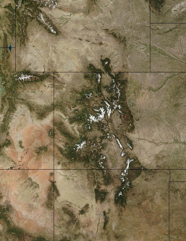
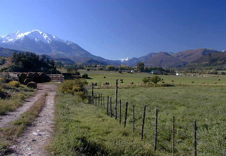
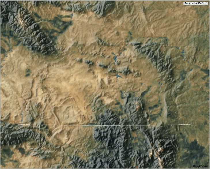
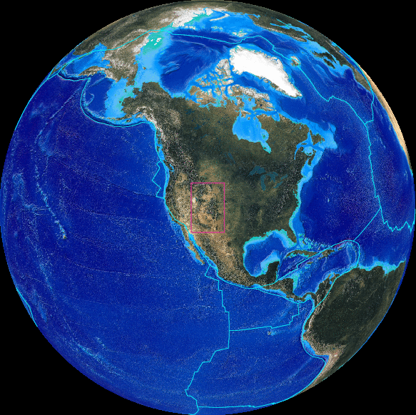
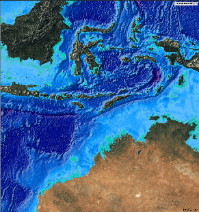
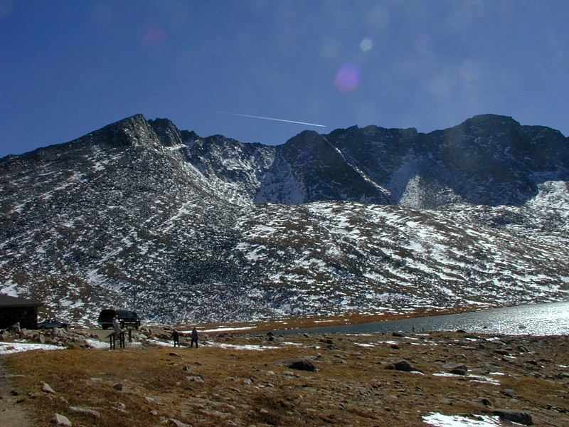

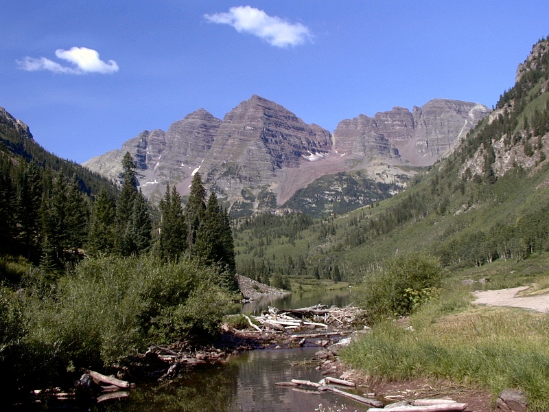
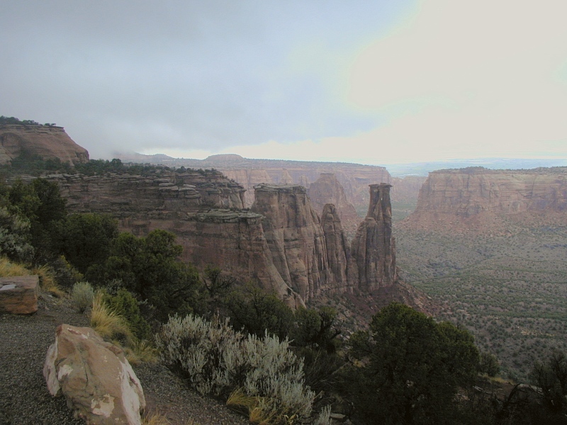

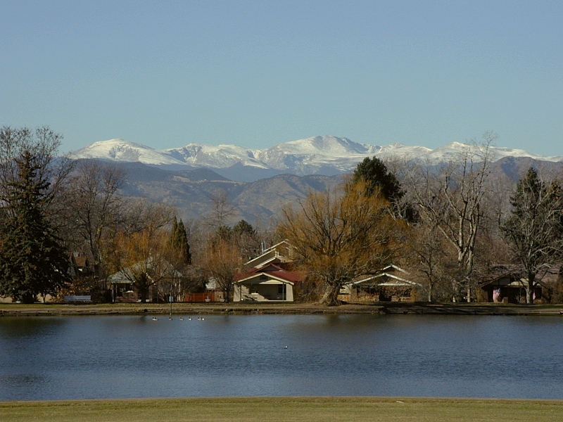

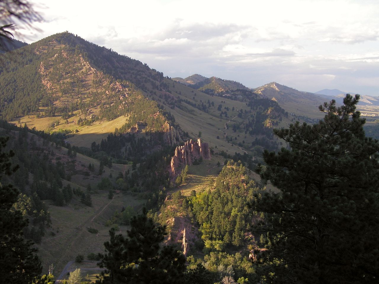

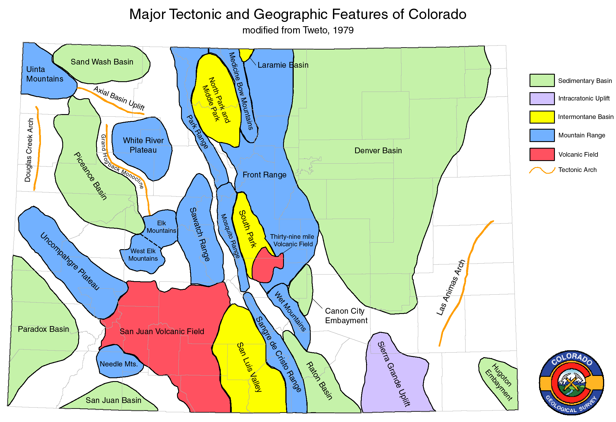
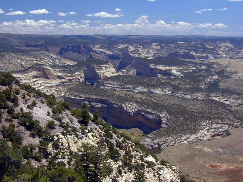
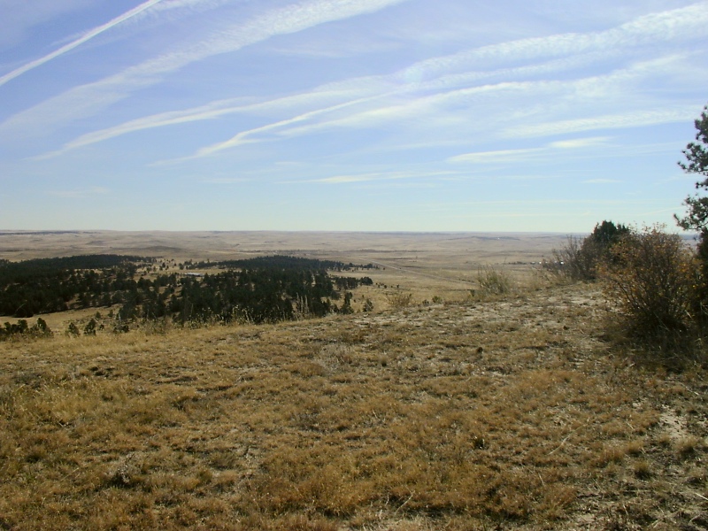
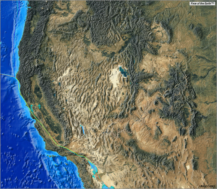
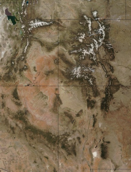

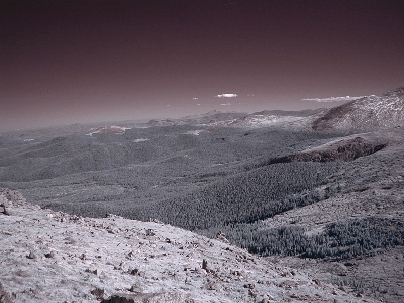
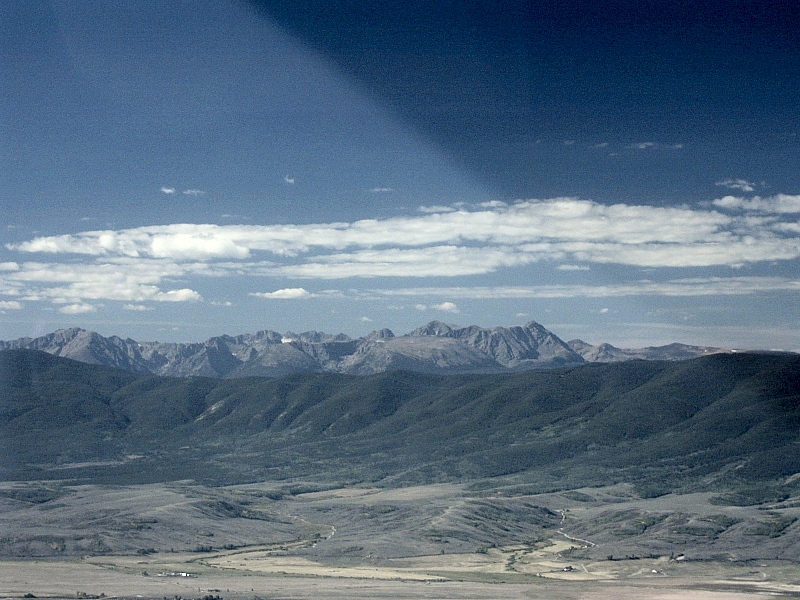
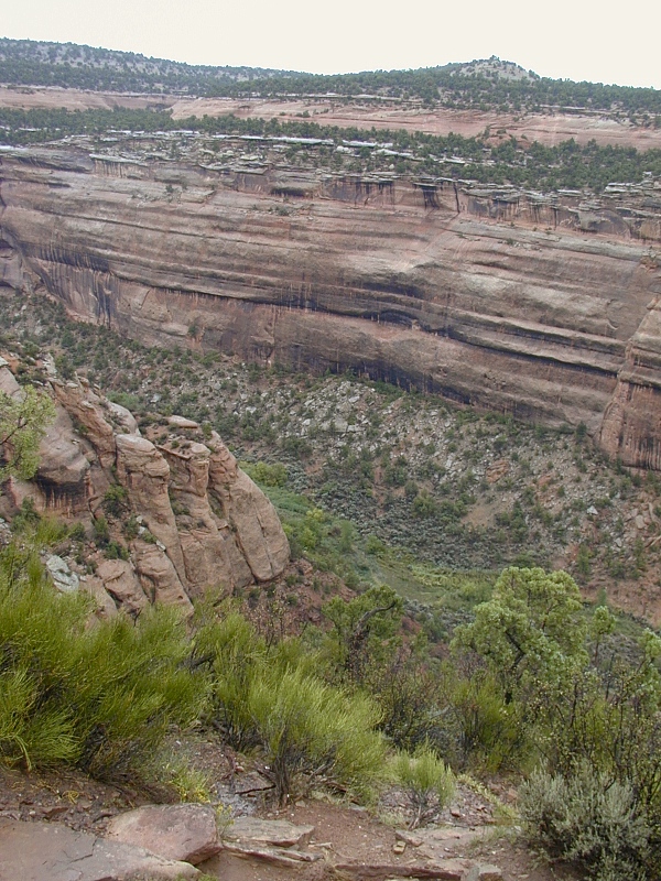
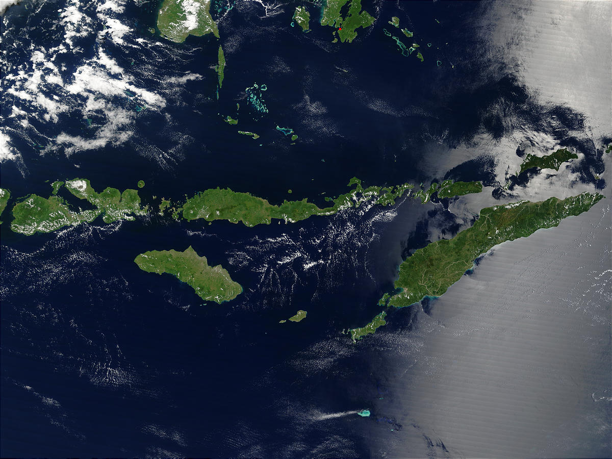


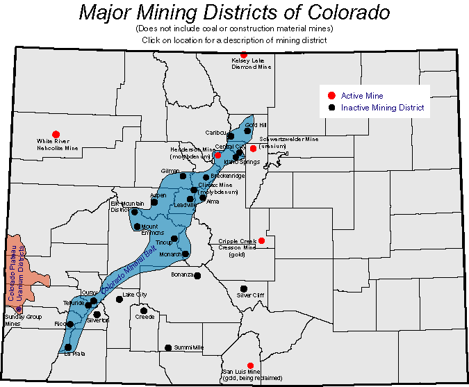
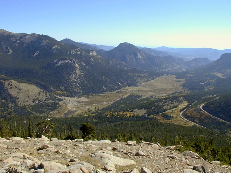

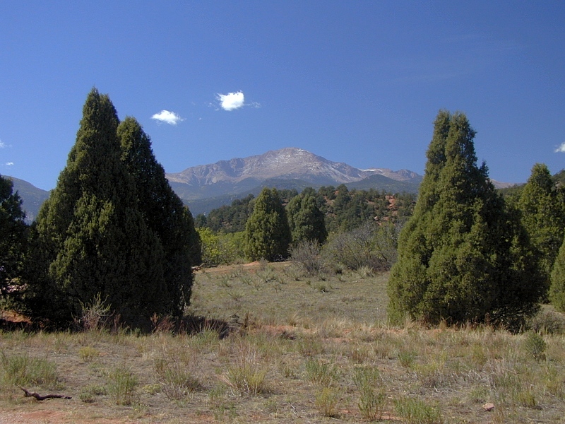
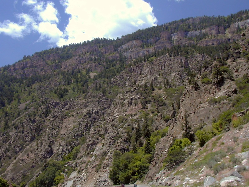
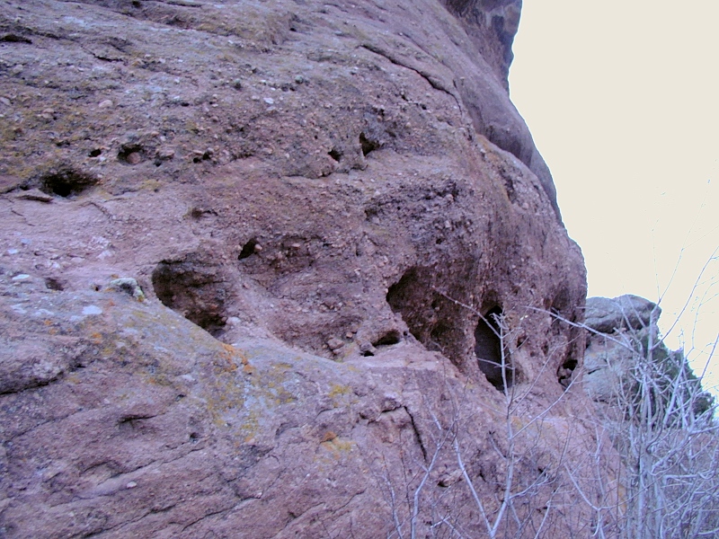


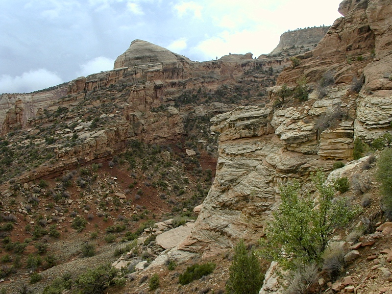

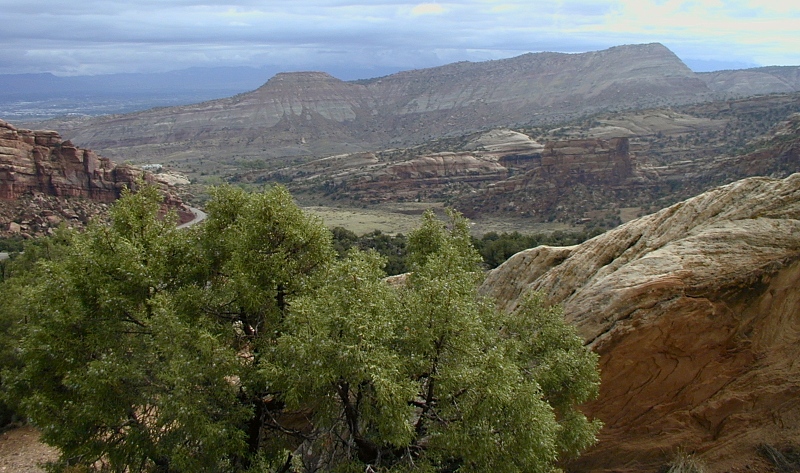

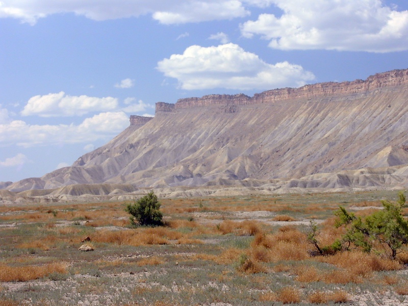
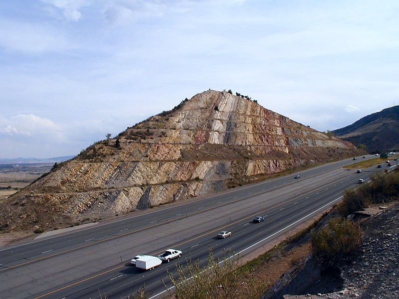
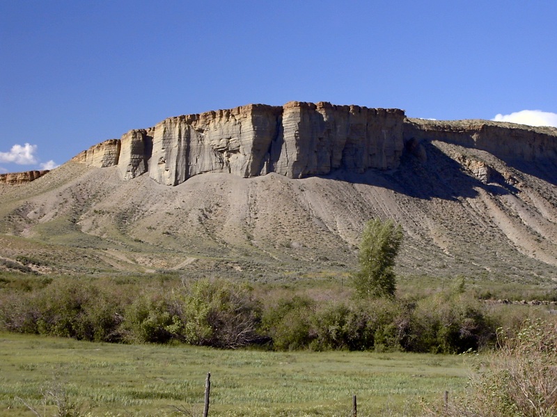
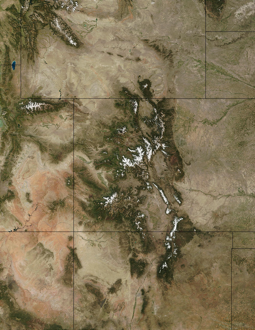
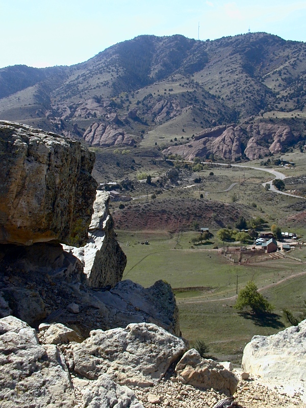
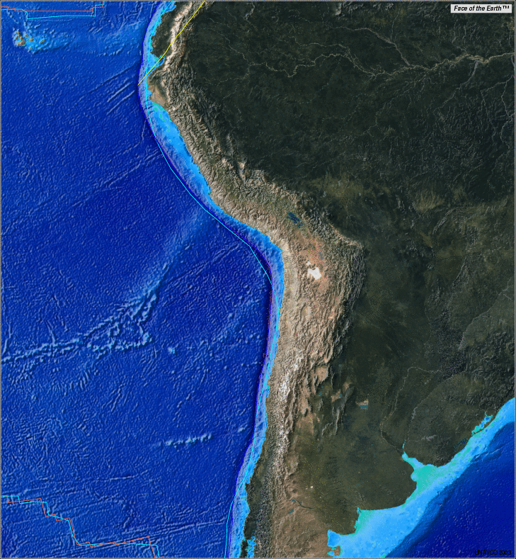
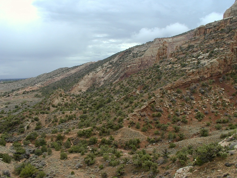
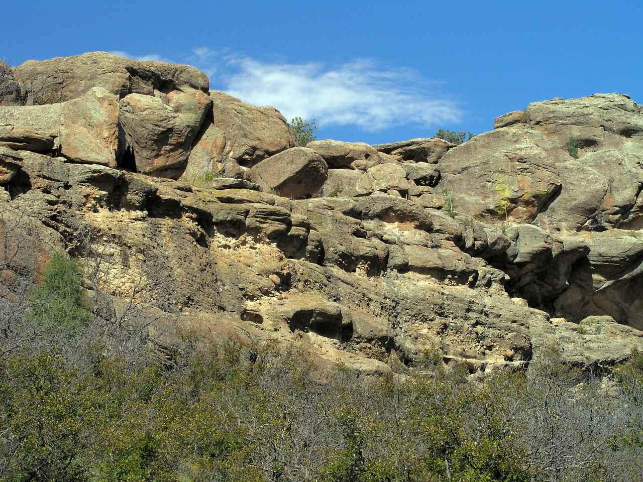


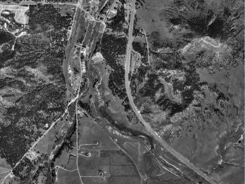
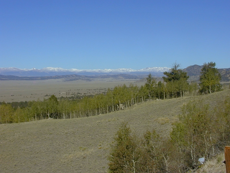
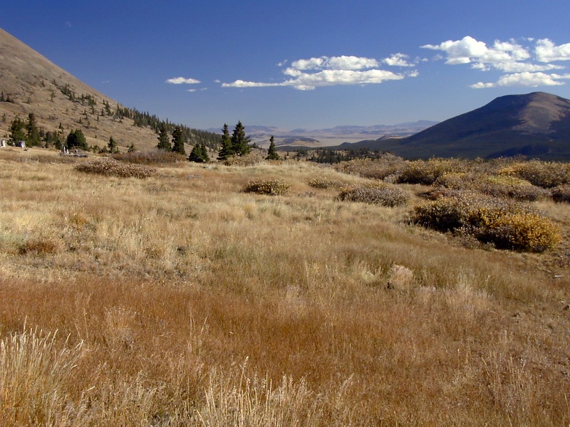

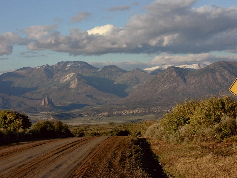
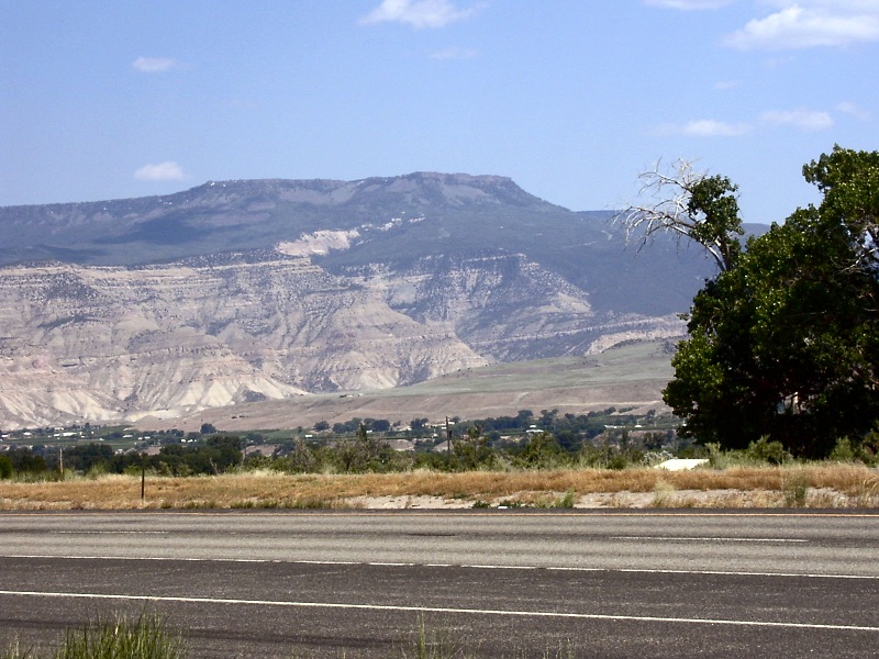

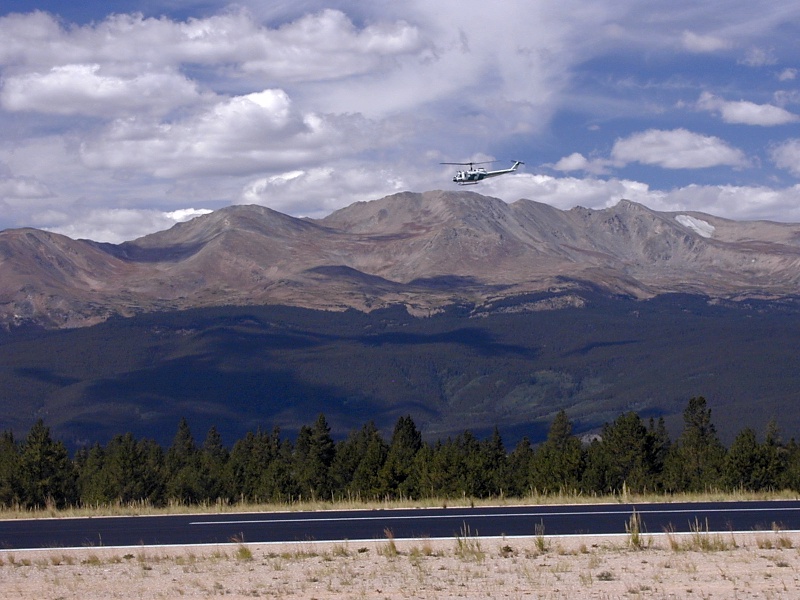
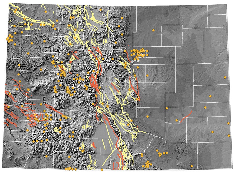


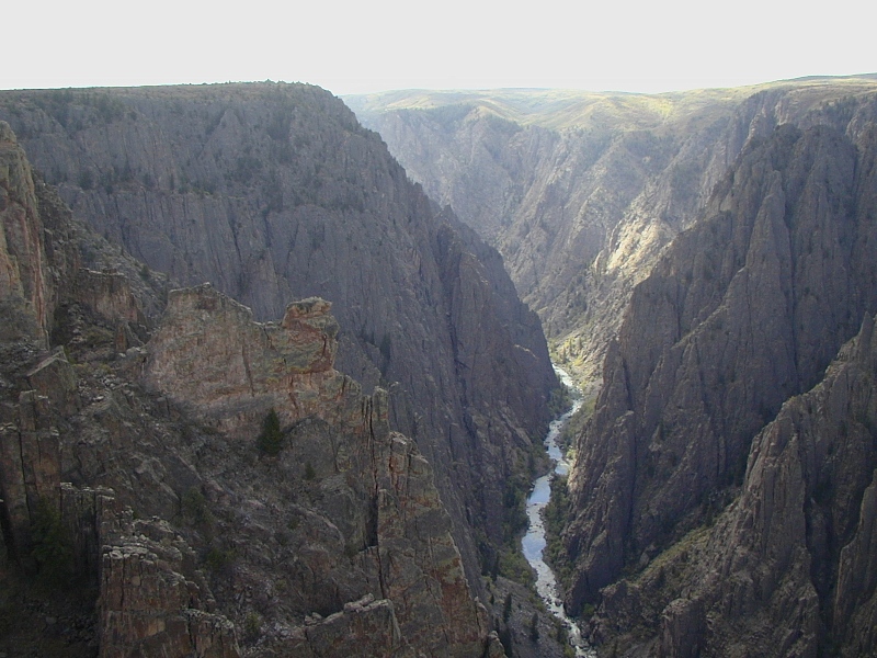
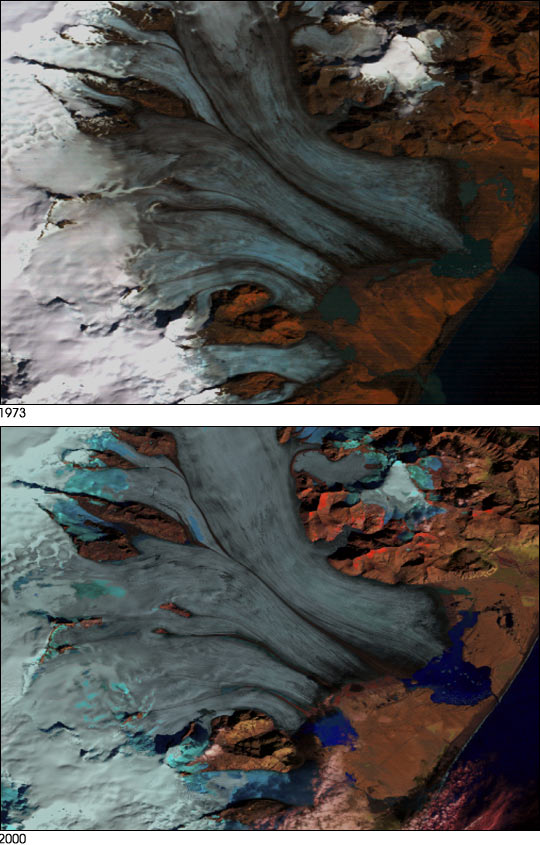
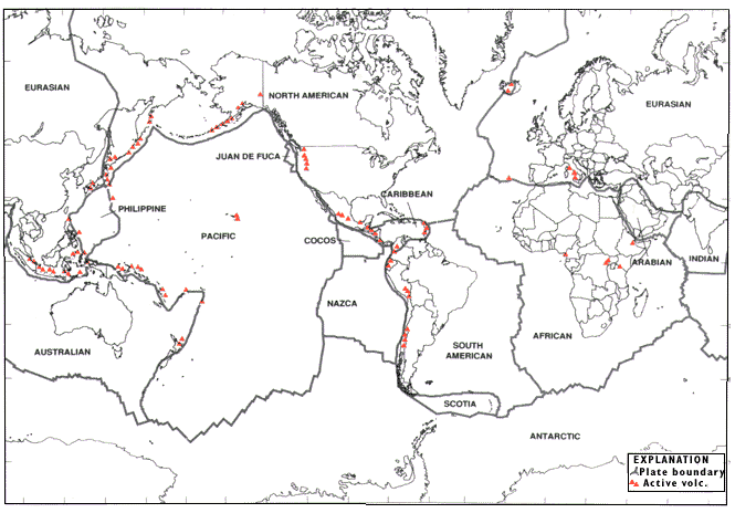