|
| |
Photojournal
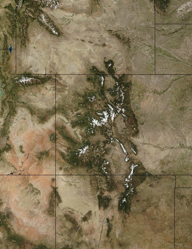
Dinosaur Ridge and Vicinity
A Tale of Two Uplifts and a Sea Dragged In By the Uplift Next Door
|
 |
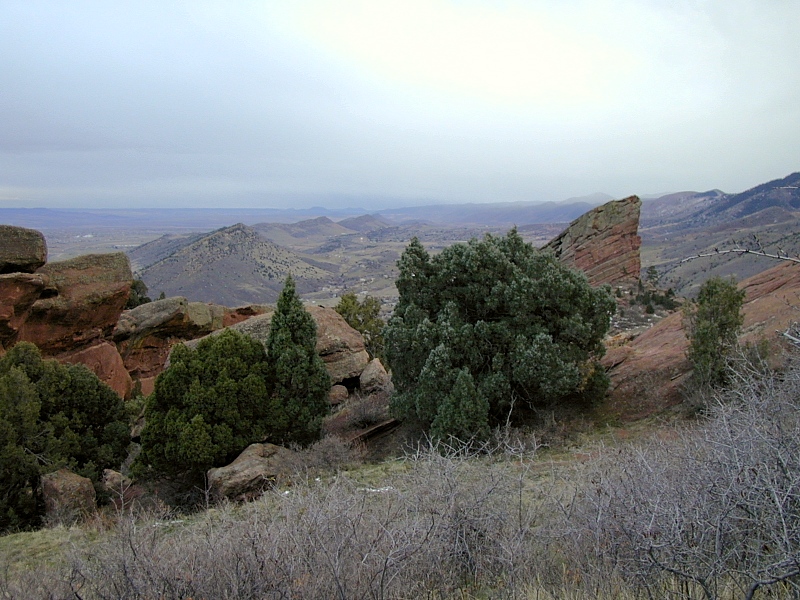
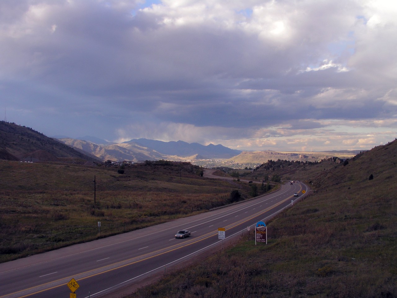
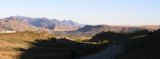
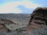
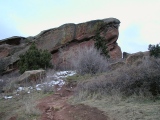
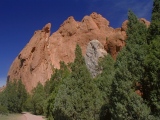
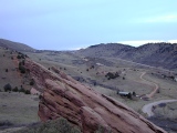
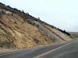
Dakota Hogback, looking south from the crest
|
Last modified 10/22/04
Dinosaur Ridge and Vicinity
Twenty miles or so west of Denver on I-70 is ^Dinosaur Ridge
(DR),
a particularly prominent segment of the Dakota hogback
heavily visited for its famous, easily accessible dinosaur trackways and
fossils, striking rock exposures, panoramic views and outstanding ridge-crest
trail, and many nicely-done interpretive markers. After umpteen visits, DR
remains a family favorite, and my kids don't even like to hike. On moving here
from California, it was a most welcome introduction to the natural wonders of
the greater Denver area, and it's the one place we strive to take all our
out-of-town guests.
Geologically, the DR area has been heavily studied, early on because of its
excellent and tantalizing natural exposures, its proximity to Denver, long a
hotbed of geoscience talent, and a number of nearby oil seeps. More recently,
much of DR's interior has been laid open to direct inspection by the immense road
cut I-70 uses to punch through its north end. Accordingly, the DR area is as
well worked out as anyplace along the east flank of the Front Range, but it
still holds many secrets, the most valuable of which may be the exact subsurface
geometry of the adjacent Front Range Precambrian core. Working out this geometry
has become a holy grail of sorts for geophysicists from far and wide — in no
small part because of the great bounty oil explorationists have placed on its
head. There are many reasons to believe that below 10,000' or so, the
Precambrian core of the Front Range overhangs a triangle of upturned
petroleum-bearing strata (most notably the elsewhere highly productive
"J" sandstone of the upper Dakota Group) to form a fault trap
containing potentially huge volumes of oil and gas, but no one's ready to gamble
the many millions it would take to drill the technically challenging overhang
once, much less to find its production sweet spot.
Since DR is also a very prominent range-front landmark identifiable at long
distances from many directions, it will serve as the focal point for this
article. Unless otherwise specified, all references to the Front Range, east
flank of the Front Range, mountain front, range front, and so on refer to the
Dinosaur Ridge area in this article.
Caveat Viator
A word of caution to the Front Range traveller: The east flank of the Front
Range is exceedingly complex. It varies substantially in both geology and
geometry along strike and resists all but the broadest of generalizations.
Understandings gained at DR don't necessarily translate even 10 miles to the
north or south. I'll try to highlight some of the more interesting variations
encountered within the range-front segment covered here — roughly from
Morrison to Rocky Flats.
Nearby Attractions []
Near Dinosaur Ridge are several other mountain-front scenic and recreation areas
popular for good reason with locals and tourists alike:
All these areas offer worthwhile views and hiking and biking trails with many fascinating
exhibits on local geology and paleontology.
In fact, you'd have a hard time finding another spot exposing as much of Colorado's geologic
history in one easy day trip. The exposures in the area provide
excellent opportunities to observe first-hand evidence of two of the region's
defining events of the last 300 Ma — the Ancestral
Rocky Mountain and Laramide
uplifts. These uplifts commenced over 200 Ma apart but share many similarities, some
visible right here.
Together, Red Rocks Park and Dinosaur Ridge expose
an uninterrupted sequence of Late Paleozoic to
early Cretaceous sedimentary rocks
tilted up against the crystalline
Precambrian core of the Front Range. For the most part, these were shed to the
east from the Ancestral
Rocky Mountains starting around 300 Ma. Just across C-470 to the east is Green Mountain, an erosional remnant of a
much larger apron of alluvial fans
shed to the east off the Front Range block as it rose during the Laramide
Orogeny starting around 72 Ma. Along its western base are exposures of late
Cretaceous sandstones marking the beginning of the Laramide uplift.
The area also offers stunning views of and access to the abrupt eastern front
of the Rocky Mountains, here embodied by the Front Range
foothills. At nearly
320 km in length (from
Cañon City to southern Wyoming) and up to 80 km in width, the Front Range is
the largest and 2nd highest of the Laramide
Rocky Mountain uplifts. Among many other
attractions, the Front Range is home to Mount
Evans, Pikes Peak and Longs
Peak—three of Colorado's tallest Fourteeners. The last two are the only
Fourteeners in the Southern Rockies located off both Colorado's main structural
lineaments — the Colorado
Mineral Belt and the Rio Grande Rift.
A Tale of Two Uplifts And a Sea Dragged In By the Thrust
Belt Next Door
The rocks in and around DR tell a dramatic story of two mountain-building
uplifts and an intervening invasion by the planet's largest known inland sea.
And who best to summarize a dramatic tale but a bona fide drama expert?
The Short Version, As Told Over the Phone By Someone
Else's Teenage Daughter
Well, it got like reeeeeally boring around here and there was like nothing to
do and OMG, it seemed like forever!!! But then like there was this really big
concert happening down south with all the big continents coming together and you
know, like jamming, and Africa tried to park next to Arkansas but it like didn't
slow down, duh, and so it smacked right into it instead and it even got Texas,
New Mexico, Colorado and even Utah all rumpled up, too! So Colorado got 2 really
big lumps that time, but after a while they just fell apart and made this really
big mess with gravel and sand and mud all over the place. But then it like
started raining a lot and all these big weeds started growing everywhere in the
mud and OMG, then a bunch of big dinosaurs just came in and started stomping all
around like they owned the place. And then something else smacked into
California and everything over there just got like shoved over and all piled up
on Utah, and Utah got like too thick or something, it made Colorado sink, it was
so heavy. So then this really big sea just barged in like it owned the place or
something, and there was all this water everywhere, and it left a bunch of sand
and mud and then some more sand all over the place. And then that crazy Farallon
plate, well it like flapped up under Colorado instead of going down like it was
supposed to. Can you believe it???? And it just started shoving stuff around, so
the big sea just left and Colorado got all rumpled up again, but this time,
there were like lots of lumps everywhere. No, duh, it like made these big
mountains and they were covered with all these volcanoes all over the place at
first but then the volcanoes just fell apart and made another big mess of
volcano pieces everywhere, but the mountains, they like didn't fall apart
completely so they're still hanging around and OMG they're still getting bigger,
but they keep leaving these really big messes, you know, like gravel and sand
and mud all over the place. So whazzup with you?
Now for the longer version...
The Great Unconformity
 By
600 Ma, most of Colorado and surrounding areas had been reduced to a vast
featureless plain of bare 1.7-1.4 Ga metamorphic and
granitic Precambrian basement rock.
In the Dinosaur Ridge area, the erosive regime persisted another 300 Ma.
Precious few traces of events going back to 1.4 Ga had survived the deep
regional erosion, and the sediments that might hold clues haven't been
identified. The resulting gap in Colorado's geologic record is known as the Great
Unconformity; at Dinosaur Ridge, it spans no less than 1.1 Ga,— nearly 1/4
the age of the planet. By
600 Ma, most of Colorado and surrounding areas had been reduced to a vast
featureless plain of bare 1.7-1.4 Ga metamorphic and
granitic Precambrian basement rock.
In the Dinosaur Ridge area, the erosive regime persisted another 300 Ma.
Precious few traces of events going back to 1.4 Ga had survived the deep
regional erosion, and the sediments that might hold clues haven't been
identified. The resulting gap in Colorado's geologic record is known as the Great
Unconformity; at Dinosaur Ridge, it spans no less than 1.1 Ga,— nearly 1/4
the age of the planet.
It is upon this stage that our tale of two uplifts and a large sea unfolds.
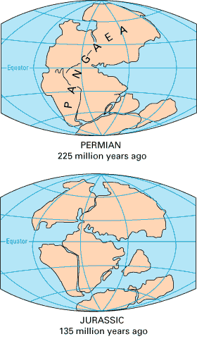
The Ancestral Rocky Mountains
During Late Pennsylvanian time, around 300 Ma, plate tectonic stresses emanating from a continent-continent
collision related to the assembly of the Gondwana supercontinent far to the southeast
began to
buckle up
a dozen or so discrete fault-bound northwest-trending uplifts stretching in a
band from Arkansas to
Utah. The two largest ranges rose in Colorado and are now collectively known as the Ancestral Rocky
Mountains (ARM). The eastern range, here called Frontrangia, stood roughly
where the Front Range stands today; Uncompahgria, the western range,
was
centered roughly where the Uncompahgre Plateau lies today.
Following the initial ARM uplift, Colorado entered a long and relatively
quiet period of continuous terrigenous, marine and transitional sediment
accumulation lasting nearly 200 Ma. As
Frontrangia rose and then completely eroded away between 300 and ~220 Ma,
it shed thousands of feet of largely terrigenous debris onto the surrounding Precambrian basement
surface in all directions. These sediments were laid down flat — first as syntectonic
range-front alluvial fans and finally as broad coastal flood plain muds similar
to those being deposited now in the Gulf states — and remained
flat until the Laramide orogeny
some 200 Ma later tilted them to the 30-110° dips observed along the east flank
of the Front Range today.
Progressively finer Frontrangia debris shed to the east contributed entirely
to the coarse syntectonic gravels and sands of the Late Pennsylvanian Fountain
Formation and substantially to
-
the Permian desert dune and fluvial sands of the
early Permian Lyons formation
-
the muddy coastal plain redbeds of the late
Permian through Triassic Lykins
and Ralston Creek formations
-
the colorful claystones and minor fluvial sands
and lacustrine limestones of the Late Jurassic Morrison
formations.
The Mid-Jurassic breakup of the supercontinent
^Pangea brought a wet
temperate climate and lush vegetation to a previously arid Colorado between
Ralston Creek and Morrison time, and with the moisture and vegetation came
burgeoning populations of dinosaurs. Dinosaur-wise, the Morrison is one of the
most fossiliferous formations on the planet.
In addition to the debris washing off its own ARM, Colorado from
time to time supplemented its Triassic and Jurassic sedimentary piles with both
fine and coarse sediments derived from highlands far to the west in Utah, where
troubled plate interactions along the west coast
of North America threw up high mountain chains on a recurring basis. In the
earliest Cretaceous, renewed uplift in Utah spread a pulse of distinctive chert-bearing
conglomeratic fluvial sands across the
state. of the Lytle Formation across the
state.
The Cretaceous Interior Seaway
The Lytle sands marked Colorado's last stand as dry land for the
next ~30 Ma, for close on their heels came the largest inland sea (an
extensive body of salt water floored by continental
rather than oceanic crust) the
planet has ever known. For much of its stay, between 100 Ma and 72 Ma, the Cretaceous
Interior Seaway (CIS) had most of Colorado under 600' of saltwater. It
flooded in simultaneously from the Arctic Ocean and the Gulf of Mexico to fill a
broad trough-like downward flexure of western North America representing at
least in part an isostatic response to
the combined weight of the many thrusts sheets already stacked to the west by
the early to late Cretaceous Sevier orogeny,
and it receded only with the onset of Laramide uplift. By the time the Colorado
was once again above water, the seaway had left behind a thick region-wide blanket of
originally flat-lying marine and transitional Cretaceous sediments, including
the
The Niobrara's small hogback east of
Dinosaur Ridge was quarried away shortly after the settlement of Denver, and
Early Jurassic sediments are for some reason absent throughout central and
eastern Colorado. Otherwise, all 200 Ma-worth of the post-ARM, pre-Laramide
sediments deposited east of Frontrangia are exposed in the Dinosaur Ridge area
today.
The Laramide Orogeny
Around 72 Ma, a deep-seated regional deformation known as the Laramide
orogeny
began to push up the Rockies
and to a lesser extent the Colorado Plateau in a patchwork of
discrete north- and northwest-trending block-like uplifts
stretching from southern Wyoming to central New Mexico. Resistant 1.7-1.4 Ga metamorphic and
granitic Precambrian basement rocks
cored the uplifts.
 |
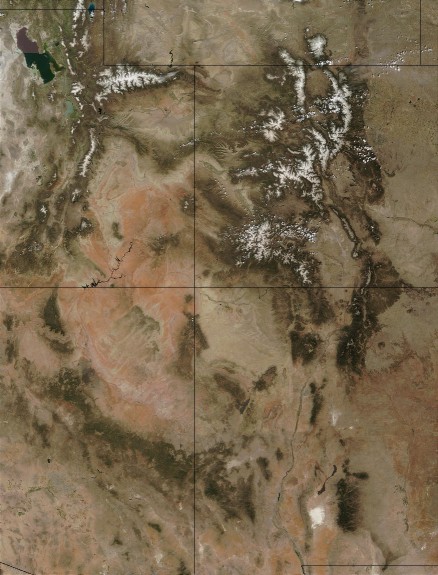
Four Corners, NASA
|
For the most part, the Laramide regional deformation reactivated
basement-penetrating normal faults left over from a series of Late
Proterozoic continental rifting events affecting the entire western two-thirds of the
US, including the Colorado
Province. Thousands of feet of
Mesozoic and Paleozoic
pre-Laramide sediments resting on basement prior to the Laramide were bent upward along steep reverse and
and shallower thrust faults flanking the rising Laramide blocks even as erosion
stripped the same strata from block summits.
Today, eroded Laramide uplifts still dominate the regional topography:
Forests and snow nicely color the Laramide uplifts green and white in the satellite photo of
Four Corners at right. They underpin Colorado's most prominent highlands,
including the Medicine Bow Mountains; the Front,
Park, Gore and Tenmile, Mosquito and Sawatch Ranges; the
San Juan
Mountains; and the Uncompahgre and White River Plateaus, and the Uinta
Uplift.
Top Page Index
East To West, Young To Old
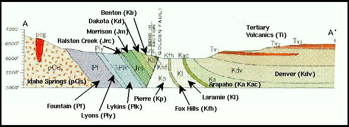 |
Dakota Hogback and Golden Fault cross-section
|
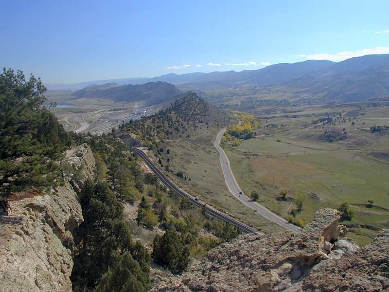
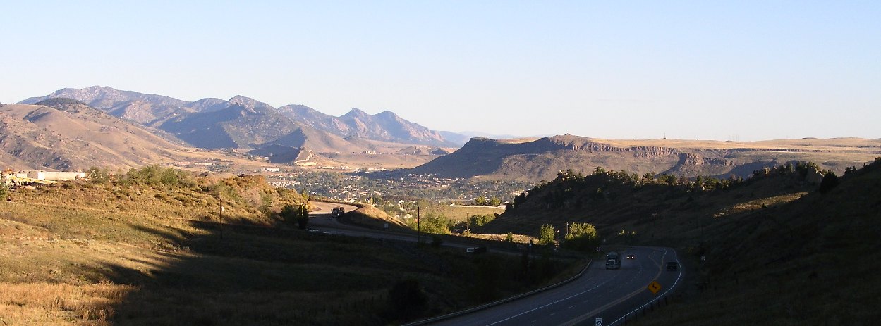
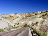
A drive west along
I-70 from Denver to the eastern foothills of the Front
Range is a trip back into deep time, as
this roughly west-trending section just north of I-70 through the town of Golden
shows. West and older are both to the left in the diagram. The bump left of
center is the Late Jurassic through Cretaceous Dakota Hogback. The hogback is
less pronounced at Golden than it is at the geologically
famous "I-70 road cut" (right) just east of the Morrison
Exit, No. 259.
 |
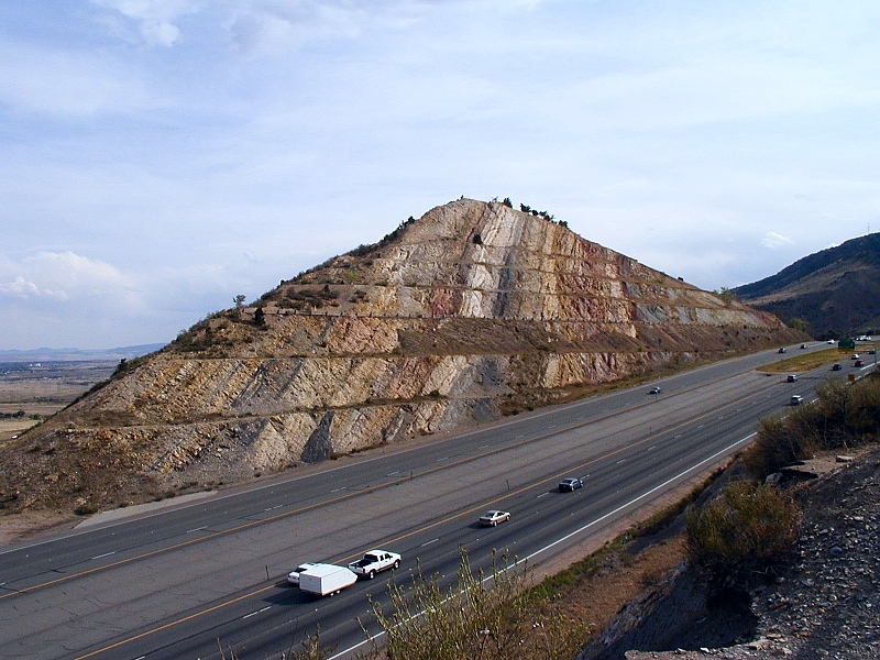
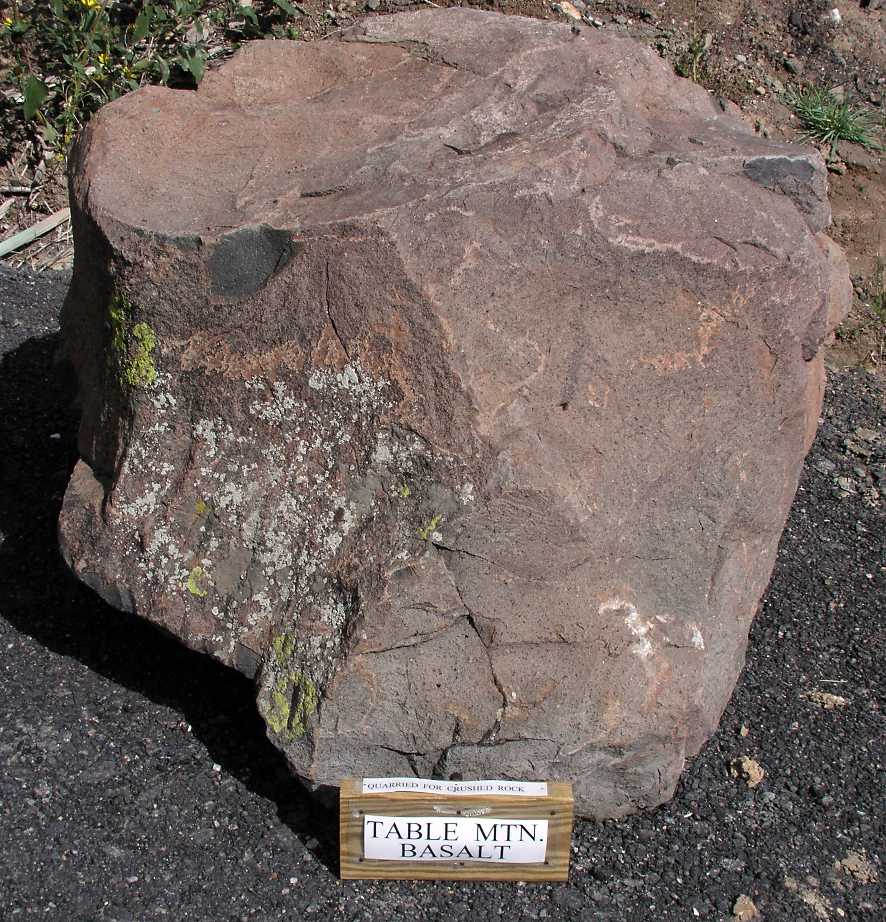
North and South Table Mountains
|
At Golden, the Paleocene basalts atop North and South
Table Mountains cap prominent mesas of
sediments trapped in the Denver basin, a
large and deeply
sagging range-front basement depression brimming with ~13,000' of late Paleozoic to late Cenozoic
sediments shed eastward from the current and Ancestral Rockies.
The vertical structural relief between the bottom of the Denver basin (below the
diagram and off to its right) and the top of nearby Mount
Evans (off to the left) is at least 22,000'.
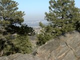 |
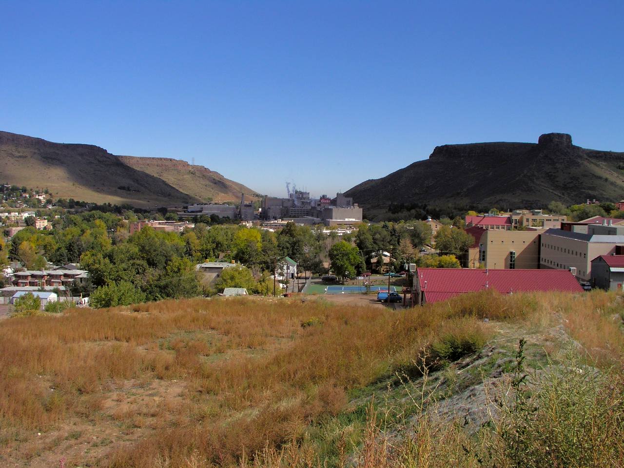
Denver from atop 8200' Genesee Mountain
|
Off to the right and a little south of this section, Denver nestles within the Colorado
Piedmont, a 1,000' deep range-front trough excavated by the North and South Platte,
Arkansas and Canadian Rivers and their tributaries in Late Tertiary time. In its
entirety, the Piedmont stretches from
southern Wyoming to northern New Mexico. At Denver, Early
Paleocene Denver Formation and Late
Paleocene Dawson Formation gravels, sands and muds floor the Piedmont trough
as the uppermost strata of the Denver basin.
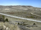
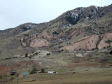
Green Mountain
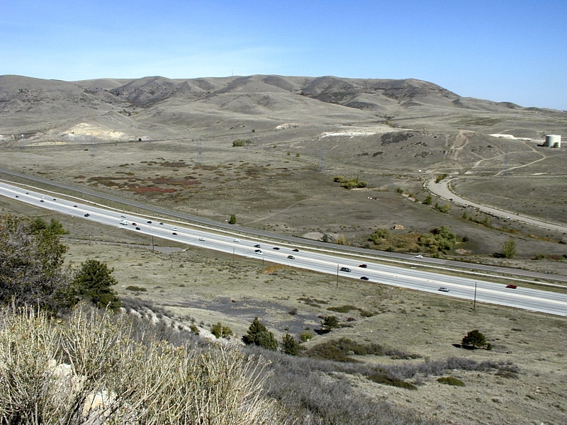
West of
Lakewood, the topography along I-70 gets more interesting as the deeper strata
of the Denver basin bend upward against the Precambrian core of the Front Range uplift. Starting at Green
Mountain (right), hillside exposures begin to
reveal their structure.
Green Mountain is the erosional remnant of
a once extensive flat-lying syntectonic apron of alluvial fans deposited all along the
east side of the rising
Front
Range during the Laramide mountain-building event.
These gravels rest unconformably on east-dipping Late Cretaceous strata,
including older syntectonic gravels, tilted upward
to varying degrees during the uplift of the east side of the Front
Range block during the Laramide
Orogeny.
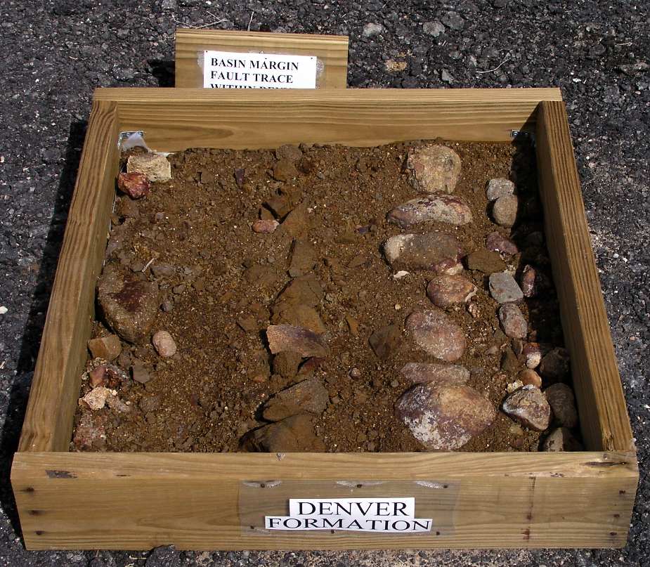
Cropping out along the lower western slopes of Green Mountain are the Latest
Cretaceous through Early Paleocene Arapahoe Formation
and Denver Formation. These
originally flat-lying syntectonic conglomerates and sands reflect different
levels of erosion in the rising Front Range. The Arapahoe is mostly debris from
the Mesozoic and Paleozoic sedimentary cover, while the Denver is largely
composed of basaltic clasts (rock fragments) coeval with the 65-63 Ma
Early Paleocene basalt flows preserved
as a caprock on North and South Table Mountains just a few miles
north of I-70 at Golden. Erupted early on during the Laramide, Front Range
volcanics probably found their way to the surface along leaky Laramide faults cutting the full
thickness of the crust, if not the entire lithosphere.
The Arapahoe and Denver Formations now dip to the east along with older Denver
basin strata.
Capping Green Mountain is the Late Paleocene Green Mountain
conglomerate, a flat-lying collection of gravels composed almost exclusively of pink granitic Precambrian clasts
shed from the Front Range to the west after its volcanic cover had been breached
by erosion. Its lack of tilt indicates that Laramide uplift of the Front Range
had largely subsided by the Late Paleocene. Visit
geologist Dick Gibson's ^Green Mountain
page site for more information.
Laramie and Fox Hills Formations
 |
White Fox Hills bluffs at he base of Green Mountain
|
Older near-vertical beds of light pink beach sands of the lower Laramie Formation (70-75 Ma) crop out
along the west margin of Green Mountain Park, where they underlie both the Denver/Arapahoe
Formation
and the Green Mountain conglomerate. Nearly
vertical light yellow beach and bar sands of the Fox Hills sandstone crop out at the
northwest base of Green
Mountain along the south side of I-70, where they underlie a horizontal unconformity covered with white alluvium. These
barrier island
sands were deposited by the retreating Cretaceous Interior Seaway
as the earliest Laramide deformations
broadly lifted Wyoming and Colorado out of the water.
 |
Steeply west-diipping overturned Laramie sandstone ridge at Golden
|
Why the Laramie and Fox Hills strata dip more vertically than those in and
west of the Dakota Hogback is unclear, at least to me. The standard
explanation is "drag-folding" due to movement on a west-dipping
reverse Golden
Fault during Laramide
time, and that may well be so. But the nature and timing of activity on the Golden
Fault is not so clear, as discussed in the following
section.
West of Green Mountain is the Laramide
Golden Fault, the Dakota
Hogback, Red
Rocks Park and finally the Front Range foothills. We'll visit them
all in the gallery below.
The Elusive Golden Fault
|
Dakota Hogback and Golden Fault cross-section
|
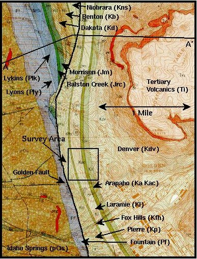
The north-trending Golden Fault (GF) runs along the east flank of the Front
Range for ~24 km (15 miles). It's known primarily from well logs and seismic
profiles, all of which consistently show a subsurface vertical offset of some
3.4 km (11,000') in the Precambrian-Fountain contact along the mountain front.
This offset is the GF. It has few verifiable surface traces, and details of its
subsurface geometry remain largely speculative, but most authorities show it as
it appears in the cross-section above — a steep, west-dipping reverse fault thrown up on the west.
This configuration explains how the GF brought late Paleozoic through early
Cretaceous sediments deposited on Precambrian basement up and over early
Cretaceous through late Tertiary sediments at the top of the Denver
Basin.
|
C-470 roughly marks the projected surface trace of the Golden fault,
here just south of Green Mountain in the background
|
I-70
divides the GF roughly in half. The southern half runs beneath soil cover just
east of the C-470 freeway (right), between Green Mountain and
the Dakota Hogback. North of I-70, the GF runs
west of North and South Table Mountains at Golden, where it
swings west toward the mountain front to cut
out the Dakota Hogback and adjacent strata. In the geologic map of Golden and
North Table Mountain below, note how the westward bend in the GF truncates the Dakota, Benton and Niobara strata at top
center. The bend may well reflect a change in the geometry of the Precambrian
core of the Front Range in the subsurface at Golden, but no one knows for sure
why the GF veers west here.
A Golden Mystery
 |
Geologic map of the Golden Fault (Clear Creek at bottom)
|
To this day, no one seems to know quite what to make of the Golden Fault (GF). At
only 8% the length of the 320 km-long Front Range, the GF has neither the length nor
the offset (well under half the total estimated Front
Range uplift) to claim the starring role in the raising of the east side of the Front
Range. It's often been cast as a local splinter off a deeper and much longer blind
thrust or reverse fault, but seismic profiling stands against that, at least at
Rocky Flats (see below).
Areas of controversy still surrounding the GF include its type, dip and
subsurface geometry, but a
Laramide age is fairly well established. One
way to bracket the timing and direction of the last movement of a fault is to identify datable
rocks that it did and did not deform or cut. Differential folding and tilting of
rock units
across the Golden Fault indicate that it moved up to but not during or after
eruption of the still flat-lying Table Mountain basalts,
which are radiometrically dated with considerable reliability at 62-63 Ma. This
strong evidence puts the GF active during Laramide time but doesn't exclude
pre-Laramide movement.
Most authors consider the GF a steep west-dipping reverse fault, up to the
west, but some still argue for a dip to the east, and others have even proposed
that it's actually a pre-Laramide
normal (extensional) fault. Sure enough, if you restore the strata it cuts to
their original horizontal attitude, its geometry and motion fit an east-dipping normal
fault, but this last view is not widely held.
Things are much more straightforward on the west flank of the Front Range,
where the well-exposed east-dipping Williams
Fork Thrust is clearly responsible for most if not all of Laramide uplift
and western displacement of the block's western edge. But there are no exposed
west-dipping reverse or thrust faults likely to have been responsible for the
uplift of the eastern edge of the Front Range anywhere along its ~320 km length.
Many lines of evidence point to the existence of such east-side faults, but they
have yet to show themselves directly, and the GF may or may not be one of
them.
Seismic imaging or profiling is one such line of evidence. Two
profiles shot across the mountain front just north of the town of Golden at
Golden Gate Canyon and Rocky Flats (the latter particularly well controlled)
show the Golden Fault as merely the inboard (west) member of a pair of
roughly parallel west-dipping range-front faults. The outboard (east) member,
dubbed the Basin Marginal Fault (BMF, not shown on the map at right) also
shows up in mountain-front profiles shot at several locations up and down the
east side of the Front Range.
Surface projections of the GF and BMF would lie ~3-4 miles apart near Golden,
but neither is directly exposed. Between the GF and BMF is a block of highly
deformed and rotated sediments variably exposing vertical to overturned Niobara,
Fox Hills and Laramie strata at the surface along the mountain front between
Denver and Boulder. This geometry explains, for example, the abrupt increase in
dip observed between the ~60° Dakota beds of the Dakota Hogback at Dinosaur
Ridge and the ~90° Fox Hills and Laramie strata at the base of Green Mountain
just across C-470, which roughly marks the inferred trace of the Golden Fault.
At Golden, the GF has cut out the Dakota Hogback, and the ~70° Fox Hills,
Laramie and Pierre beds there are actually overturned.
If the BMF is indeed the master Laramide fault on the east side of the Front
Range, the GF could represent a splinter joining it at some unimaged depth. The
relatively shallow Golden Gate Canyon profile allows this possibility, but the
deeper Rocky Flats profile shows the GF dying out some 6,000-7,000' below
the surface, well above the BMF. Geophysicists work hard to overcome the
technical difficulties inherent in the seismic imaging of steeply dipping
structures like the GF and BMF, but these relationships must still be taken with
a pinch of salt.
Paired range-front faults turn out to be fairly common elsewhere in the
Laramide orogen, Wyoming's Wind River range included. The cause for the pairing
remains unclear, but some think of the outboard fault as a zone of heavily
sheared sedimentary strata in the outboard limb of a tightly folded syncline
paralleling the master inboard fault. In that view, the GF would be the master.
Confused yet? You've got some very good company.
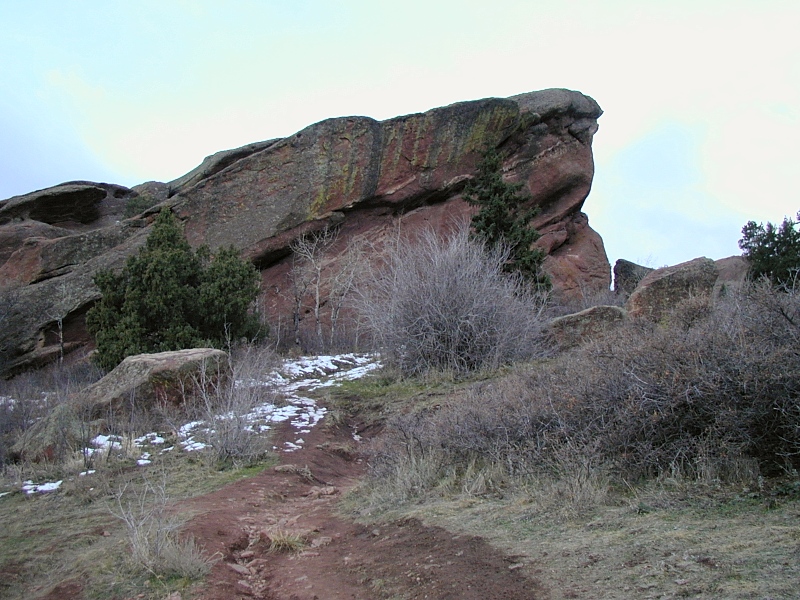
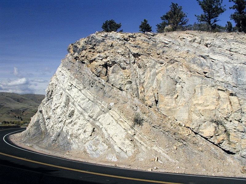
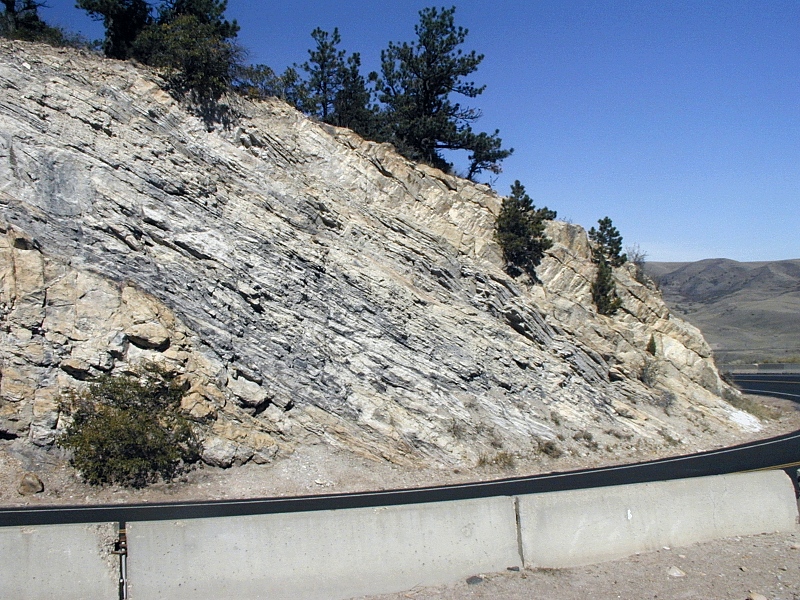
Dakota Hogback and Red Rocks Park Gallery
|
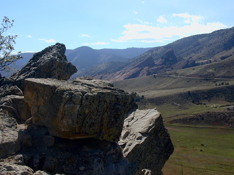
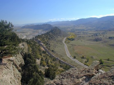
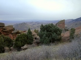
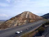
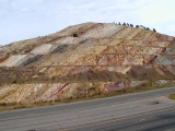
Dakota Hogback at Dinosaur Ridge
|
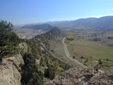 |
In the 1st frame, the
east-dipping Dakota hogback arcs to the south along the east
flank of the Front Range, as seen from its crest along
the highly recommended Dinosaur Ridge Trail just south of I-70.
The hogback varies considerably in size, dip and exposure along strike but is particularly well-developed
here with a ~60° dip to the west.
Resistant Early Cretaceous
Dakota sandstone here best seen at its crest caps the hogback, while softer, older Late Jurassic
Morrison and Ralston Creek claystones
form its lower west slope and the adjacent valley floor on the right. Uplift of the Front
Range basement block (on the far right) during the Late Cretaceous Laramide
Orogeny tilted these strata ~60° from the horizontal.
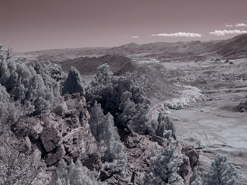
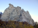
In the 2nd frame, an ^infrared
version of the 1st, Pikes Peak (14,120') dominates
the horizon at the south end of the Front
Range block. It's much better seen in haze-defying infrared light.
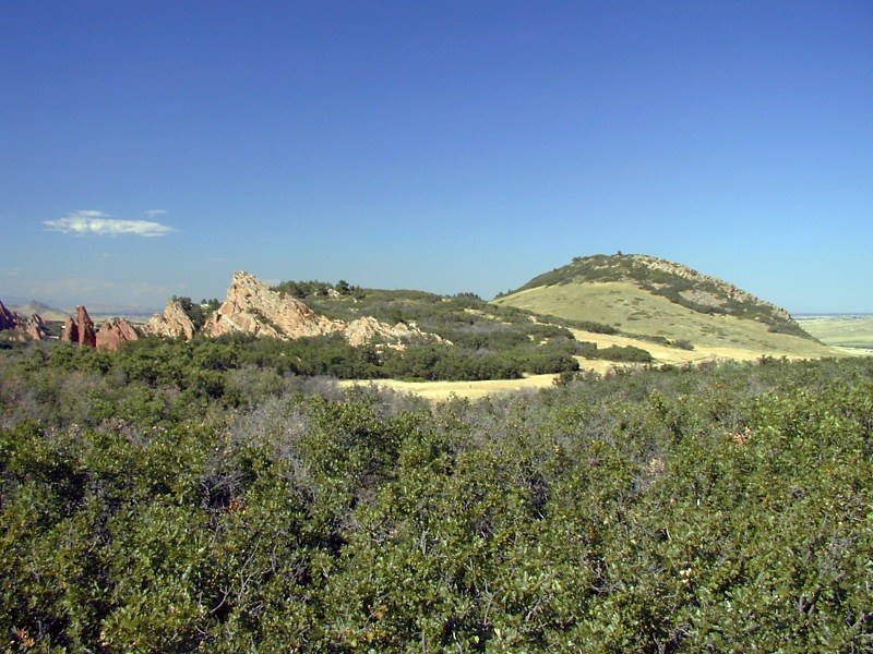
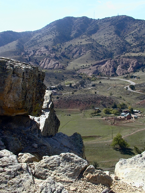
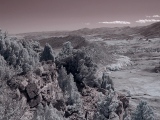
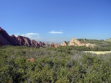
The 3rd and 4th frames show the Dakota hogback at Dinosaur Ridge as
seen from Red Rocks Park to the west. The facing west slope is composed
of porous, tree-dotted Lytle and Dakota sandstones over relatively
impermeable Morrison flood plain shales. The Morrison's trademark
purple, gray and green colors are hard to see in this light.
|
1. Dinosaur Ridge
|
 |
2. Dinosaur Ridge in near IR light
|
 |
 |
3-4. West slope of Dinosaur Ridge from Red Rocks
|
Dakota Hogback Variations North and
South of Dinosaur Ridge
|
[picture coming soon]
|
The
Dakota sandstone, the Lyons sandstone and the Fountain conglomerate vary
substantially and independently in cementation, section
thickness and exposure all along the Front Range. Strong
cementation generally makes for prominent exposures, but structural
variations like the Golden
Fault also play a role. This series of images shows a number of
variations in the prominence of the Dakota Hogback along strike.
No hogback: Just north of I-70 at Golden (not shown),
the Dakota hogback is absent, having been cut out by the Golden
Fault. The 1st frame looks west from a Laramie Formation
outcrop in Golden.
Low hogback: Twenty
miles or so south of I-70 at ^Roxborough
State Park, a subdued Dakota Hogback (on the right in the 2nd frame) is
much less imposing
than adjacent Lyons (buff) and Fountain
(red) flatirons, which are particularly well cemented here. The 2nd and
3rd frames in this series are a north-looking west-to-east sweep.
Medium hogback: The 4th frame
looks north to the Dakota hogback at the mouth of Royal Gorge at Canon
City.
Large hogback: The Dakota hogback is particularly
well-developed at Dinosaur Ridge, as the 5th frame shows
Double
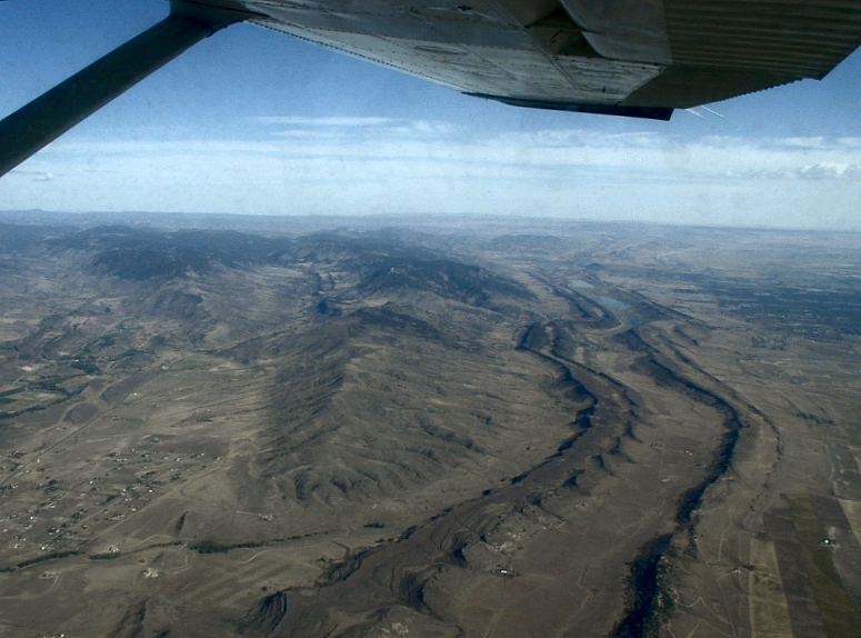
hogback: North of Boulder, a
double hogback snakes along the Front Range into southern Wyoming. In
the 6th frame, the Dakota hogback
runs on the east (right) in this aerial view to the north as we
flew east from Fort Collins. The rock capping the older hogback on the
left is probably the Late
Permian Lyons Formation. A low divide revealed by
Colorado's 2001-2002
drought splits the normally one-piece Horsetooth Reservoir, which was cleverly dammed between the
hogbacks.
|
1. West of Golden
|
 |
 |
2-3. Roxborough Park
|
 |
4. Canon City
|
|
|
5. Dinosaur Ridge
|
 |
6. North of Forth Collins
|
Fountain
Formation in Red Rocks Park and Points South
|
 |
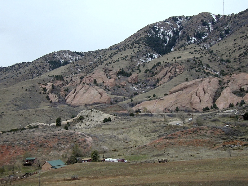
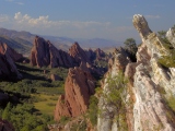
Red Rocks Park:
The 1st and 2nd frames in this series look southwest to ^Red Rocks
Park from Dinosaur Ridge Trail atop
the Dakota Hogback just south of I-70. Bold red fluvial sandstones and conglomerates of
the Late
Pennsylvanian
Fountain Formation rest uncomformably on the Precambrian core of
the Front Range uplift here. Fountain erosional remnants form the park's
flatirons and monoliths, some of which circle to form the acoustically renown
natural amphitheater now known as Denver's ^Red Rocks
Amphitheater. The park also offers excellent hiking among the flatirons.
The 3rd frame
looks back at the Dakota hogback to the south southeast across Fountain
flatirons. The south-looking 4th frame shows a closer view of a Fountain
flatiron with a patch of late
November snow.
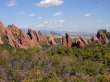
Roxborough and Garden of the Gods: Much more impressive
red Fountain flatirons and monoliths crop out to the south in ^Roxborough
State Park (5th and 6th frames, both looking north) and Garden of
the Gods Park (7th and 8th frames). Buff-colored desert dune sands
of the Lyons Formation, barely
exposed at Red Rocks, also form much more prominent hogbacks (5th
frame), flatirons and fins (8th frame) in these locations. Why the
difference? The Fountain and Lyons are better cemented
and therefore more resistant here than they are at Red Rocks.
Fountain facts: The coarse alluvial fans preserved in the Fountain Formation record the initial uplift of the
Ancestral Rocky Mountains in Late Pennsylvanian time, around 300 Ma, just as
Green
Mountain strata to the east record the initial uplift of the modern
Rockies in Late Cretaceous Laramide
time, around 72 Ma. Such deposits are said to be syntectonic.
Range-front streams dumped the first Fountain gravels (300 Ma) onto a flat erosional surface
of 1.4-1.7 Ga Precambrian
basement; the resulting 1.1-1.4 Ga gap in the rock record is known regionally as
the Great Unconformity.
Around 230 Ma later, Laramide
mountain-building tilted the Fountain, underlying Precambrian
basement and overlying strata to their present 30-40° dips. In
contrast, the youngest Green
Mountain gravels were deposited flat and remain so.
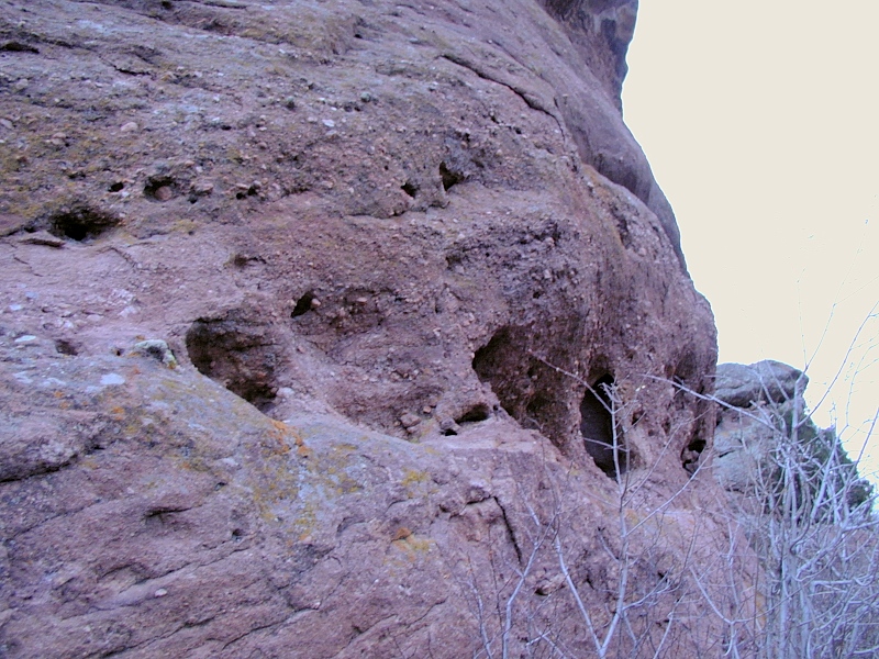
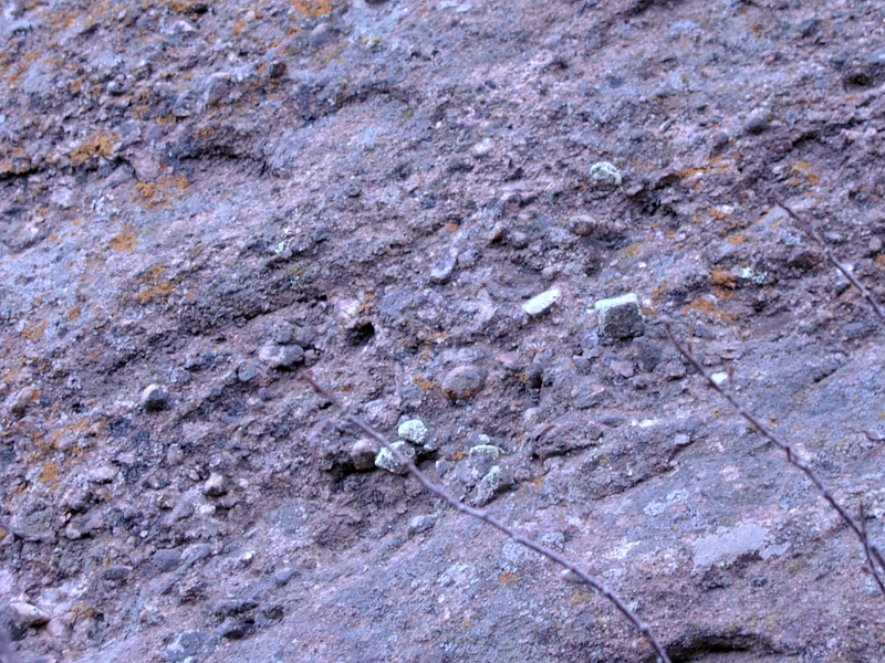
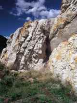
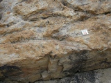
Basal Fountain
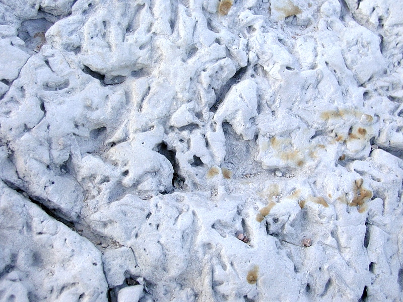
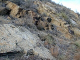
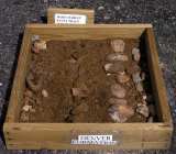
strata: In the 9th frame, wind caves pock a basal unit of
the Fountain Formation at
Red Rocks Park. The contact between
the Fountain and underlying basement rocks is difficult to pinpoint
around here but can be razor-sharp in places. A plaque marks the contact
in the amphitheater parking lot.
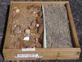
The 10th and final frame in this series shows classic syntectonic alluvial fan sediments
at the base of the Fountain, again at Red Rocks Park. Their coarse angular clasts of quartz and
feldspar tell of a high-energy stream bed draining nearby exposures of crystalline
Precambrian basement. Since feldspar weathers quickly to clay during stream transport, feldspar clasts this large can't be far
from home. Originally laid down flat along the Ancestral
Rocky Mountain range front, these beds acquired their pronounced
30-40° dip to the east during the Laramide
Orogeny.
|
 |
1-2. Red Rocks from Dinosaur Ridge
|
 |
 |
3-4. Red Rocks flatirons up close
|
 |
 |
5-6. Fountain flatirons at Roxborough, with Dakota
Hogback in the background
|
 |
 |
7-8. Lyons flatirons at Garden of the Gods
|
 |
 |
9-10. Basal Fountain strata at Red Rocks
|
 |
These two frames
show all the strata eroded from the east side of the Ancestral Rockies,
from oldest to youngest. The 1st frame looks southwest from Dinosaur
Ridge to the Front Range foothills. Below the red Fountain flatirons
of Red Rocks Park is a short ridge of white Lyons Formation,
a younger collection of Permian stream, beach and eolian dune sands eroded from the by then low-lying
Ancestral Rockies. Lower still on the slope is the soft red Late Permian to Early
Triassic Lykins Formation, an
even younger redbed of micaceous mudstones with minor limestones recording brief marine transgressions
from the east. By the end of Lykins time, around 220 Ma or so, the Ancestral Rockies were gone. The 2nd frame is an opposing view
looking northeast from the Fountain flatirons of Red Rocks Park to
Dinosaur Ridge. Beyond the small ridge of white Lyons
sandstone and the lower slopes of Lykins
mudstones, we pick up the sequence again with soft,
easily-eroded valley-forming Late Jurassic Ralston Creek mudstones,
here seen under the road in the distance. Morrison
Formation floodplain deposits form the lower west face the Dakota
hogback here at Dinosaur Ridge; the upper slope and crest are in Dakota
sandstone.
|
1. Fountain, Lyons and Lykins Formations
|
 |
2. Fountain, Lyons, Lykins, Ralston Creek, Morrison,
Lytle and Dakota strata
|
Dinosaur Ridge—Morrison Formation
|
|
The diagnostic gray, green and maroon terrigenous floodplain clays making up
the bulk of the statewide, dinosaur-rich Late Jurassic Morrison Formation
are poorly exposed on the west slope of Dinosaur Ridge (1st frame), but they're beautifully laid
out in cross-section in the nearby I-70 road cut (on the
right in the 2nd frame). Minor stream and lakebed sandstones and thin discontinuous
resistant lacustrine limestones (not shown here) imply a flat and poorly
drained Morrison landscape in a wet Late Jurassic climate. The wealth of dinosaur fossils and traces
found in the Morrison throughout the state implies an abundance of supporting vegetation.
The 3rd frame shows more typical Morrison colors exposed in all their
glory in badlands near the dinosaur quarry on the west side of Dinosaur
National Monument.
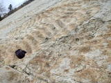
Dinosaur
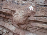
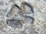
footprint sags: The 4th and 5th frames show fractured depressions in
sandy upper Morrison Formation strata thought to be
sauropod (long-necked leaf-eating dinosaur) footprints in cross-section. The marker is about 6 inches long.
|
1. West slope of Dinosaur Ridge from Red Rocks
|
 |
2. Colorful Morrison strata in the I-70 road cut
|
 |
3. Morrison strata in full color, west Dinosaur NP
|
 |
 |
4-5. Sauropod footprint in Morrison at Dinosaur Ridge
|
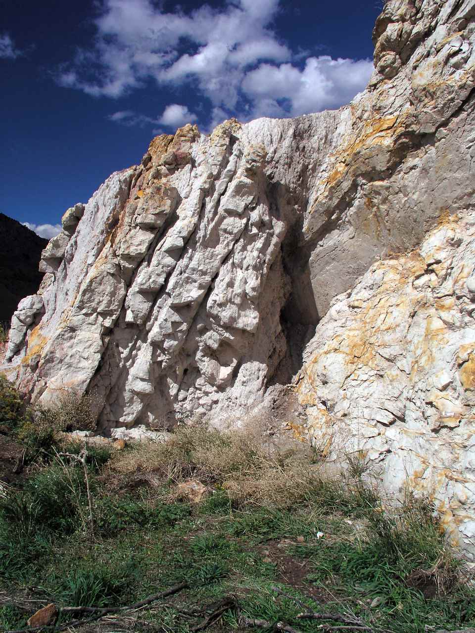
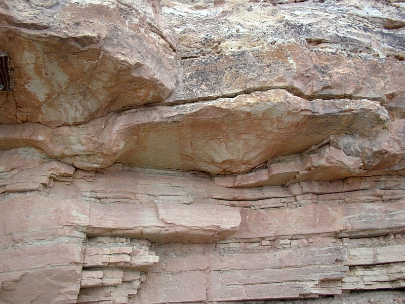
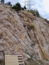
Dinosaur Ridge — Dakota Sandstone
|
 |
Arrival of the Cretaceous
Sea: This sharp contact separating the colorful
coastal floodplain claystones of the Morrison Formation below from the transgressive (advancing)
Dakota beach sands above marks the arrival of the Cretaceous Interior
Seaway.
For the next 60 Ma, the area would accumulate over ??,000' of Cretaceous marine sediments. The
Late Cretaceous Foxhills Sandstone at the base of nearby Green
Mountain to the east marks the Cretaceous seaway's retreat at the
beginning of the Laramide orogeny.
Brother-in-law John Malone, providing scale, is younger than the
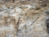
contact, but not by as much as he'd like. |
1. Morrison-Lytle contact
|
 |
Dakota
sandstone: Alameda Parkway
(CO26) nips through the crest of the Dakota Hogback in this west-to-east
sweep looking to the NW through a ridge cut also visible in the hogback photos
above. The resistant, well-cemented, generally light-colored Dakota sandstone contains distinctive black to
gray organic-rich
"coaly" layers, but true coals are rare in the Dakota in
Colorado. (Strictly
speaking, this is South
Platte sandstone,
but I'll stick with the common Dakota appellation here.)
By Dakota time, around 100 Ma, North America had reached its
present latitude. The climate was temperate. Large coastal rivers
brought mature sands to the Cretaceous shoreline from high mountains far
to the west. Dense coastal forests and swamps dotted the sandy
landscape.
|
 |
1. Dakota sandstone at the crest of Dinosaur Ridge
|
 |
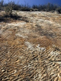
Dakota
beach ripples: Symmetrical beach-style
shallow water ripple
marks decorate the upper surface of this Dakota bedding plane on the
east side of the hogback. (Asymmetric ripples imply a stream or
wind-blown origin.) Algal mats covering the beach preserved the
ripples.
The slow westward advance of the Cretaceous Interior
Seaway left
behind thick Dakota sands from central Kansas through Colorado and well
across Utah to boot. Accordingly, the Dakota is one of the most
pervasive and most easily recognized of Colorado's sedimentary strata.
Along I-70, the Dakota pops up nearly a dozen times between Denver and Grand
Junction alone.
The top frame shows the ripples slipping under younger Dakota strata.
The center frame looks straight up the steep bedding plane bearing the
ripples. The bottom frame includes a glove for scale.
|
 |
 |
1-3. Symmetrical beach ripples in Dakota sandstone
|
 |
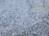
Sticks in
stones: Fallen
branches and roots left the linear casts recorded in these Dakota
bedding surfaces. The temperate Dakota shoreline included extensive mangrove
swamps, which crawled across Colorado along the advancing Cretaceous
Interior Seaway shoreline like so much green fluff before the waters. |
 |
1-2. Mangrove branch and root casts in Dakota
sandstone
|
 |
Dakota
trace fossils: The
myriad worm and shrimp burrows perforating this Dakota beach horizon,
along with the mangrove litter and the dinosaur
tracks nearby, tell of a temperate coastal environment teaming with life.
As the Cretaceous seaway pushed west, coastal forests became wetlands
became beaches became open water. The encroaching Dakota sands were well
suited for burial and preservation of Colorado's Early Cretaceous
coastal ecosystem.
|
 |
1-2. Mangrove branch and root casts in Dakota
sandstone
|
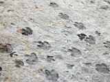 |
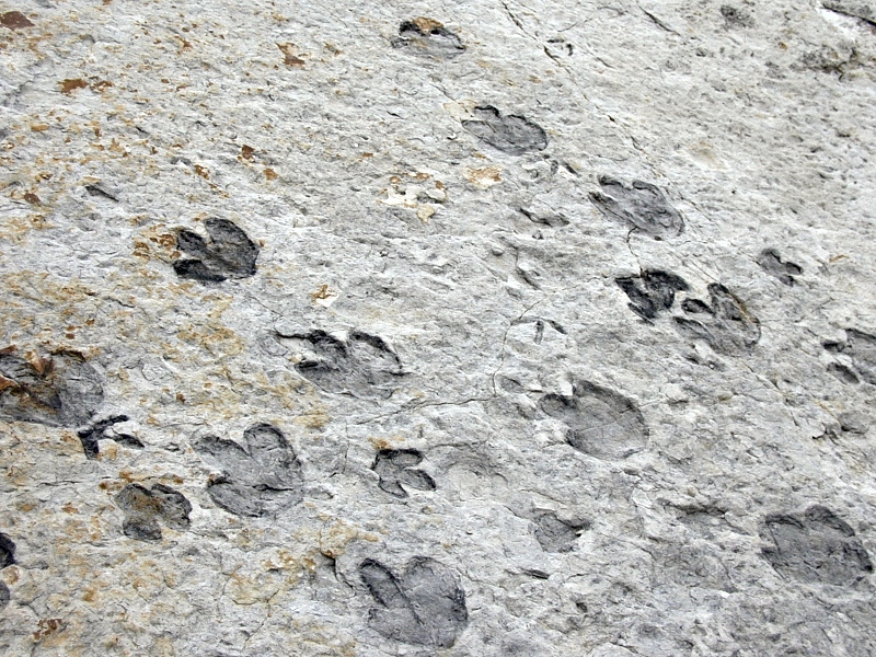
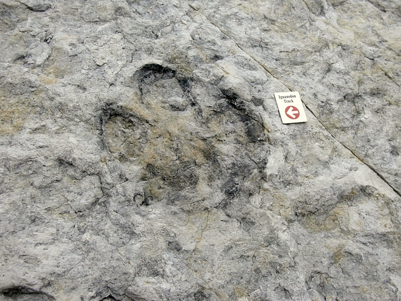
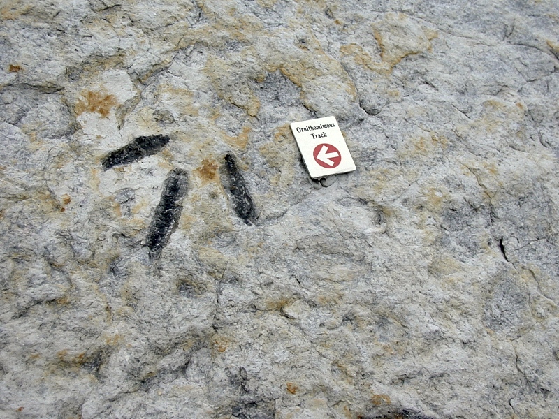
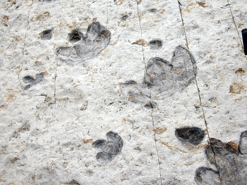
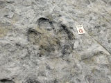
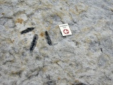
Dakota
dinosaur crossing:
The famous criss-crossing dinosaur trackways of Dinosaur Ridge are
exposed on the
east flank of the Dakota Hogback. The tracks have been shaded with
charcoal for better visibility. The markers are about 6 inches
long. The host Late Cretaceous Dakota
sandstones have been dated at 98 My.
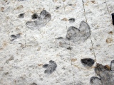
The larger four-toed tracks (frames 2-3) belong to a duckbilled herbivore usually
identified as an iguanodontid (bird-hipped) dinosaur, but recent work
suggests that the last of the iguanodontids may have died out shortly
before 98 My. Some paleontologists now believe the tracks to belong to
an early hadrosaurid such as Eolambia instead, but the debate is
far from settled. Some of the size variations are thought to record the
presence of both adult and juvenile duckbills.
The slender three-toed ornithomimid (bird-like) tracks seen in frame
4 were probably made by a much smaller and faster bipedal therapod dinosaur rather than a
bird. Heron-like shorebirds existed in the Early and Middle Cretaceous,
but none this large are known, and other track details also favor a
dinosaur as the trackmaker here.
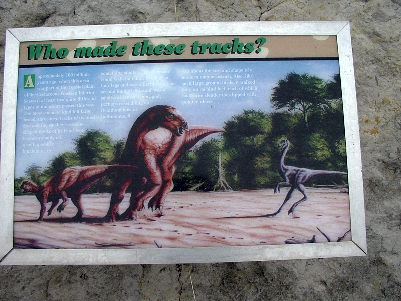
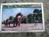
Roadside interpretive markers (frame 6) give life to the tracks. For more
information on the tracks and the dinosaurs responsible for them, visit
the well-illustrated ^Friends of Dinosaur Ridge web
site.
For a real "you were there" treat, however, I strongly
recommend the outstanding ^Ancient
Denvers exhibit at the ^Denver
Museum of Nature and Science. As of this writing, the online version
is still under construction, but the exhibit's truly spectacular
original large-format paleogeographic paintings are well worth a visit
if you're in the area. The museum also sells a beautiful Ancient
Denvers guide book. The museum's
extensive mineral, ecology and paleontology exhibits provide invaluable
learning opportunities for any student of Colorado's past and present.
|
1. Main Dinosaur Ridge trackway
|
 |
 |
2-3. Iguanodon tracks
|
 |
4. Therapod track
|
 |
5. Crossing trackways
|
 |
6. Typical interpretive marker
|
 |
Dakota-Benton
contact: The dark, organic-rich Benton Shale overlies the Dakota along
Alameda Parkway
at the east base of Dinosaur Ridge.
Oil and gas cooked up from organics in the portion of the Benton still buried deep in the Denver
Basin rise across this boundary to take up residence in porous Dakota
sandstone traps drag-folded by motion along the Laramide
Golden Fault, which around here runs along the east side of the C-470
freeway (2nd frame). The Golden Fault is a steep reverse fault
reactivated
|
1. Dakota-Benton contact
|
|
|
2. Inferred Golden Fault trace
|
|
|
Dakota
unconformity: Broad lowland rivers draining high
mountains of the Sevier orogeny far to the west in Utah crossed the
sandy Dakota coastal plain in
many places. The coarsely cross-bedded Dakota
sandstone on the left in the 1st frame is a fossil
river bar nicely exposed in the north side of the I-70 road cut
in the upper Dakota. The interpretive marker here explains the sudden change in bedding plane orientation
as the signature of an
abrupt and sustained reversal in river flow, but others believe that the
unconformity reflects a basement disontinuity far below. |
1. Dakota unconformity
|
North and South
Table Mountains at Golden
|
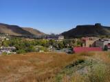 |
Historic
Golden, Colorado nestles against and between North and South Table
Mountains. (The latter is on the right in east-looking frame 1.) A
series of 4 well-dated 63-64 Ma Laramide basalt flows (2nd frame) caps both
mesas. The mesa slopes below the cap are the poorly consolidated
Paleocene strata of the Denver Formation (3rd frame) and Arapahoe
conglomerate (4th frame), both of which consist largely of earlier
Laramide andesitic volcanic debris. A thickness of Denver Formation
sediment separates the earliest flow from the others — hence the
double cliffs. All the flows consist of shoshonite porphyry
— an unusually potassium-rich fine-grained basalt peppered with large
feldspar crystals — and appear to have erupted over a span of 1 Ma or
so.
Clear
Creek, a large Front Range stream headwatering near the Continental
Divide, splits the originally intact flows into into north and south
mesas after
spilling out of a spectacular range-front canyon. From Golden, CO6 takes
Clear Creek canyon up and the west to Idaho Springs — a drive not be
missed. The upper canyon follows the Idaho
Springs-Ralston shear zone, an important section of the east end of
the Colorado Mineral Belt.
The meandering course of the lower canyon and the creek's
improbable run directly through the Table Mountain flows tell of a
gently sloping range front surface built upon mid-Tertiary sediments
long since removed during exhumation of the Colorado
Piedmont.
Judging from the large volumes of volcaniclastic debris captured in
the Paleocene Denver Formation,
volcanics must have erupted widely
during the opening of the Laramide
orogeny, but the generally fine grain of the debris puts most of the
eruptive centers some distance off to the west — certainly not at the
range front. Nevertheless, the flows at Golden are Colorado's only preserved
Laramide volcanic edifices (they may lie in a protective graben), and
their vents are only a few miles to the north. Moreover, the Table
Mountain flows are the only evidence of basaltic volcanism in the
Laramide. Laramide
volcanism in the Front Range was no doubt intense, but it was no
match for the erosion that followed.
The ^Colorado School of Mines (CSM)
campus takes up the foreground in the 1st frame in this series. Behind
it, the massive Coors brewery sprawls along Clear Creek between the
mesas. The 2nd, 3rd and 4th frames are exhibits along the CSM geologic
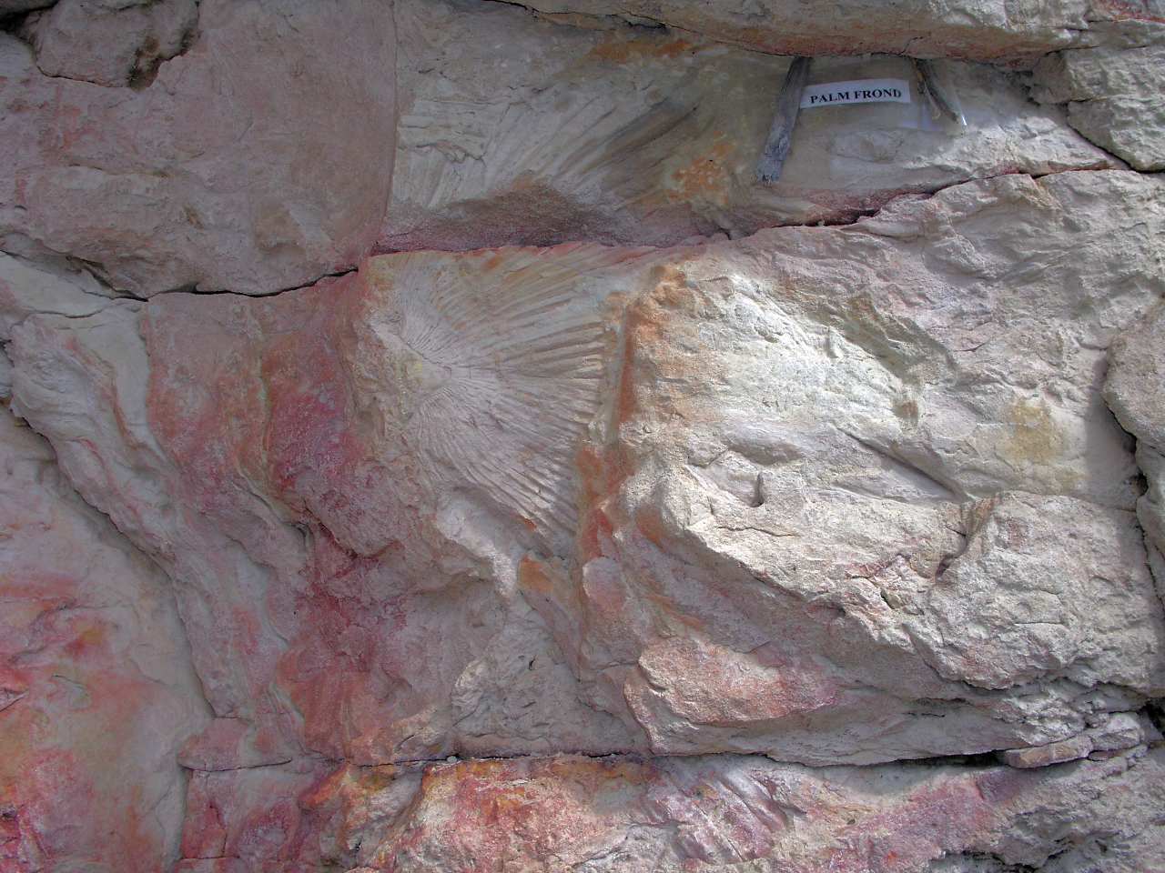
museum's worthwhile geology trail. Prominent overturned ridges of
near-white fossiliferous Laramie sandstone run through the west end of
the campus (frame 5).
Frames 6 and 7 look north toward Golden from the parking lot on the north side of
the I-70 road cut through the Dakota Hogback — 6 in
the morning and 7 in late afternoon. The morning light on the
crisp October day in frame 6 nicely shows off the range front. The famous Fountain
flatirons just south of Boulder tilt up steeply against Front Range
Precambrian basement in the distance at left center. Golden lies in the
middle distance, with North and South Table Mountains on its right. The
1-2° southeast dip of flat erosional surface atop the table mountains shows
that there has been little local range-front uplift since the
capping basalts flowed at 63-64 Ma.
West of Golden, an intriguing westward bend in the Golden
Fault cuts out the Dakota Hogback. In the late afternoon photo
(frame 7), it's easy to see the Dakota Hogback at the north end of
Dinosaur Ridge petering out in the right foreground. A small hogback
reappears north of Golden, but it's not well seen in these photos.
The 8th frame is a plan view of South Table Mountain and its basalt
cap from 8,200' Genesee Mountain in the foothills to the west. This perspective
clearly shows
the cap to be a remnant of a larger flow. The most likely vent site is
an intrusive body and dike complex in the foothills to the north
northeast near
Ralston Creek. The age and composition of the intrusives there match
those of the capping basalts. Thinning of the basalt cap to the southeast
is also consistent with this source.
|
1. Golden, CO between North and South Table Mountains
|
 |
2.Table Mountain basalt
|
 |
3. Denver Formation
|
 |
4. Arapahoe conglomerate
|
 |
5. Palm frond in Laramie sandstone
|
|
6. Mountain front at Golden, late afternoon
|
 |
7. Mountain front at Golden, late afternoon
|
 |
8. South Table Mountain from Genesee Mountain
|
Green Mountain
|
|
East of
Dinosaur
Ridge across C-470 and the Golden Fault is Green Mountain, topped by a flat-lying
pile of syntectonic gravels shed in alluvial fans from the Laramide Front
Range uplift to the west. Upended Fox Hills sandstone is quarried in the
light-colored patches at the
base of Green Mountain.
The lower frame captures two generations of syntectonic gravels: The Late Cretaceous
Green Mountain Conglomerate on the horizon behind the Dakota Hogback records the
initial Laramide uplift of
the current Rockies, while the Late Pennsylvanian Fountain
Formation in the foreground at Red Rock Park records the initial uplift of
the Ancestral Rockies.
|
|
I-70 Road Cut and the Front Range Foothills
|
 |
The geologically
famous I-70 road cut through the Dakota Hogback west of Denver
beautifully exposes (from left to right) ever older, east-dipping South
Platte, Lytle, Morrison and
Ralston Creek strata in this shot of the south side. The same Mesozoic
strata arch discontinuously across the Rockies to the opposing
west-dipping Grand Hogback at Newcastle, 155 miles to the west.
The buff
and black Dakota strata shown on the far left in the 2nd frame are easily
recognized throughout Colorado. Gray, green and maroon claystones
of the equally recognizable Late
Jurassic Morrison Formation stand to the right of the Lytle-Morrison contact seen in
the 3rd frame.
Informative plaques along the footpath along the other (north) side of
the road cut recount some of the stories the rocks have to tell. Access
both sides of the road cut via Alameda Parkway (CO26) or the Morrison
Exit, I-70 #269.
|
 |
|
|
This view to the southwest from Dinosaur Ridge shows the Fountain
Formation flatirons of Red Rocks Park resting on the Front Range foothills,
here composed of hard Precambrian
gneiss and pegmatite of the 1.7 Ga Idaho Springs Formation.
|
 |
Mount Vernon Canyon: West of the Dakota
Hogback, I-70 climbs
up onto the crystalline basement of the Front Range foothills
via Mt. Vernon Canyon, seen in the 1st frame looking west from Dinosaur Ridge. Road cuts in the canyon expose 1.7 Ga pink granites
and pegmatites and dark gray to white banded
gneisses of the Front Range core.
The sedimentary cover is long-gone here but reappears on the west flank of the
Front Range just east of Dillon, where Dakota strata dip west.
The 2nd frame looks back to the east toward Denver from atop Genesee Mountain (8,284') near
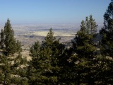
the top of Mt. Vernon Canyon. In the foreground is an outcrop of 1.7 Ga metavolcanic
gneiss of the Idaho Springs Formation.
|
|
References
In addition to the references cited on the home
page and in the supporting articles, this
article relies on the following sources, in alphabetical order by first author:
URL:
http://www.cliffshade.com/colorado/dakota_hogback/index.htm
|