|
| |
Photojournal
Colorado National Monument
A Taste of the Colorado Plateau
|
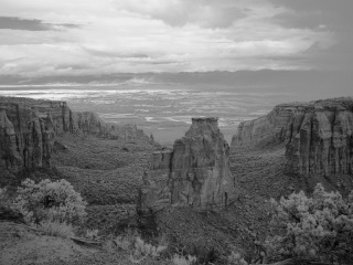 |
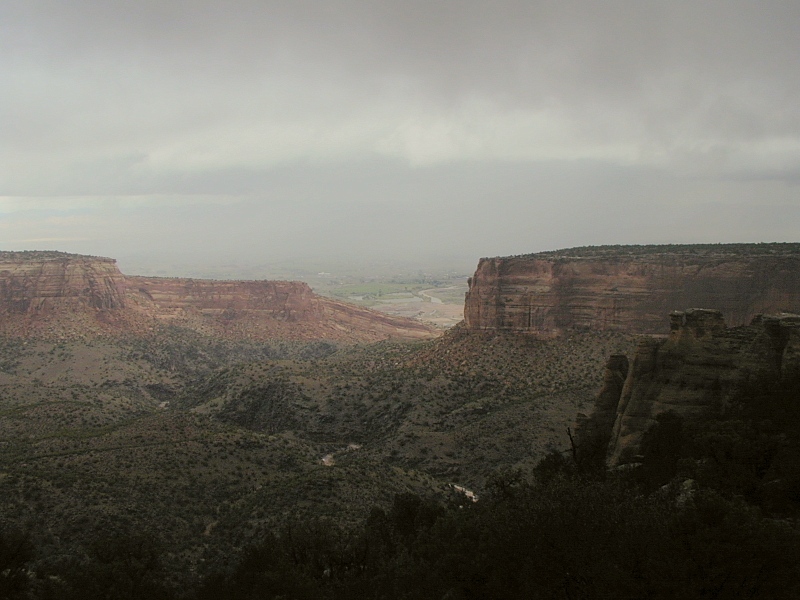
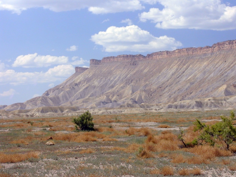
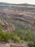
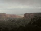
Monument Canyon
|
Last modified 10/17/04
A Taste of the Colorado Plateau
 |
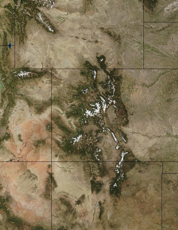
Colorado Plateau (pink), NASA
|
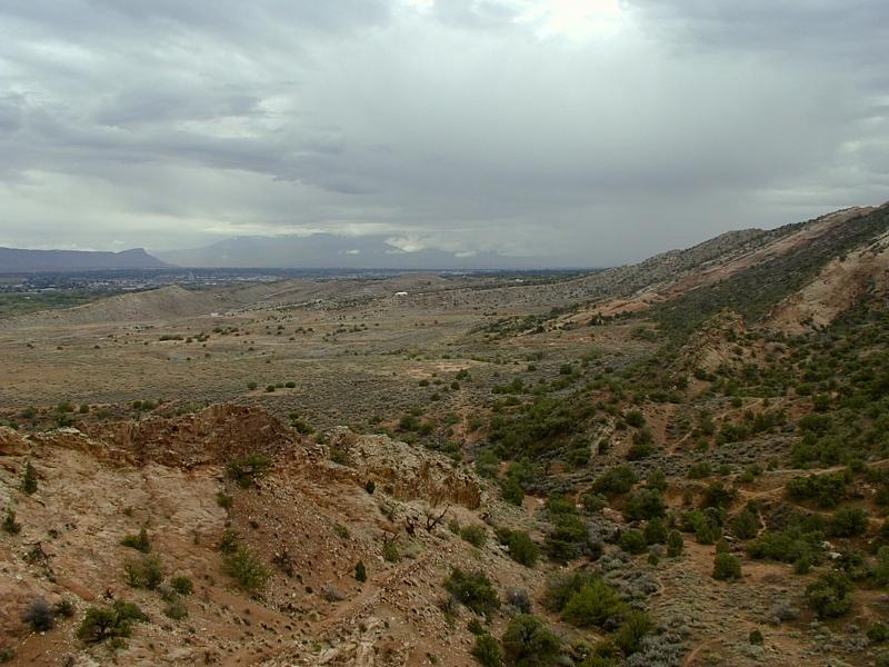
Our September, 2002 Colorado geology road trip included a blustery rainy
morning in the Colorado National Monument (CNM). The CNM stands on the northeast margin of the Colorado
Plateau, a vast, haunting and geologically important physiographic province roughly centered
on the Four Corners area of the southwestern US. In the NASA satellite
photo of ^Four
Corners at right, the central salmon-colored rocks mark the Plateau fairly
accurately.
The Rise of the Colorado Plateau
Prior to the onset of the Laramide
Orogeny in Latest Cretaceous time, the Colorado Plateau had evolved more or less in step with the
Southern Rockies to its north and east. Since then, it's shown a bit more independence. For starters, the
Colorado Plateau shifted north by some 100-170 km relative to the Rockies during
the Laramide but sustained less intense Laramide faulting, folding and uplift. Then it spurted up
to its present elevation during the last 15-25 Ma, mostly in the last 5 Ma.
Something's clearly been going on in the upper
mantle beneath the Colorado Plateau since at least 25 Ma, but exactly what, no one's
sure.
 |
Grand Monocline
|
For the most part, Mesozoic sediments
like those at right now exposed in the Colorado National Monument accumulated near sea level. They now stand up to 7500' higher atop the Uncompahgre
Uplift, another faulted anticline initiated in the Laramide
and raised with little tilt to its present elevation by regional
uplift from the mid-Tertiary on. On top of the uplift, the sedimentary strata rest horizontally and
unconformably on 1.7 Ga Precambrian
basement rock exposed in the floors and lower walls of the deeper canyons. As
they fold and ultimately break over the basement-penetrating reverse and thrust faults
beneath the NE flank of the uplift, the Mesozoic sediments
form a spectacular monocline—a textbook example of
the Laramide
structural style.
The Colorado Geology Overview has more
information on the Colorado Plateau.
Colorado National Monument and Grand Junction
|
Colorado National Monument
|
 |
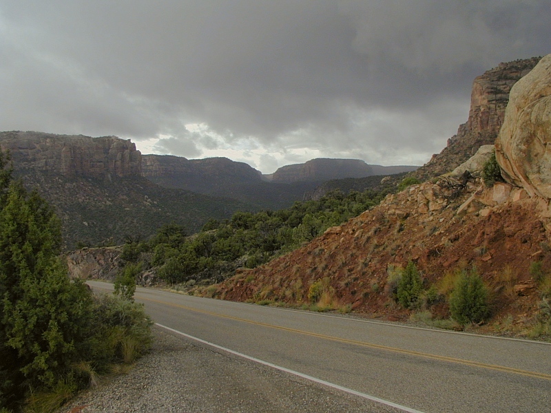
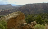
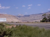
East Entrance:
As we approached the East ( Grand Junction) Entrance to the Colorado National
Monument, we left behind the Book Cliffs, here seen rising
in the distance to the NE in the 1st frame.
From the same vantage, the 2nd frame looks up and SW into the heart
of the Uncompahgre Plateau, where the thin, hard Triassic
Kayenta Formation caps massive cliffs of Triassic
Wingate sandstone.
Climbing up onto the plateau now along Monument Road in the 3rd
frame, we pass the
soft, deep red slope-forming Triassic
Chinle Formation at the base of the Wingate Formation above the road
in the right
foreground. The Chinle rests unconformably on the 1.7
Ga Precambrian basement here. Intact exposures of the weak Chinle rock
were hard to come by here, but we found a decent one near the West
Entrance. The Chinle is thicker and better preserved at ^Canyonlands
National Park in nearby western Utah.
|
 |
 |
|
|
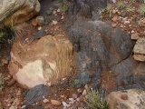
Melon-sized clasts of
Wingate
sandstone rest against black 1.7 Ga mica schist bedrock here. This is
a colluvial, not a depositional contact. (Colluvium is fallen
loose debris at the foot of the slope.) The soft, easily eroded Chinle
should be in between, but
red Chinle debris can be seen all around these clasts. |
|
Morrison cuesta:
The 1st frame is a view to the SW along the steep, winding climb up onto the plateau from
the East Entrance shows a bold NE-dipping Dakota/Morrison cuesta on the
flank of the Great Monocline. In the middle distance, diagnostic green, gray
and maroon claystones of the fossil-bearing Late
Jurassic Morrison Formation form the slope beneath the Early
Cretaceous Dakato Sandstone caprock.
In the foreground (2nd frame), a
buff-colored Wingate outcrop shows the thin cross-bedding identifying it
as a dune field deposit.
|
 |
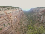 |
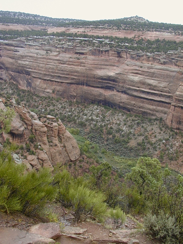
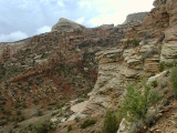
Red Canyon:
View to
the north shows contrasting incisions made by Red Canyon Creek. The
small V-shaped notch in the far canyon floor is the best the creek could
do in the resistant 1.7 Ga Precambrian gneiss it encountered beneath the
Chinle Formation. The stream was much more effective in removing the softer sediments above
this exposure of the Great
Unconformity. In the 3rd frame, the north rim of
Red Canyon reveals the erosional habits of three of the Monument's most
recognizable formations: From top to bottom, the salmon-colored
bull-nosed Early Jurassic Entrada
Sandstone; the tough, irregularly-bedded white to purple Triassic Kayenta
Formation; and the massive cliff-forming cross-bedded buff-colored Triassic Wingate
Sandstone. The 4th frame gives a better view of the Great
Unconformity, here marking the passage of ~ Ga at the base of
the red, rubbly Triassic Chinle
Formation.
A Close Call: Not far from here, we noticed the snap-snap sound of electrical
arcing around the metal stays of our open umbrella as static electricity built up
around us in preparation for a lightning strike that thankfully never
materialized. Once we
figured out what was going on, we took down the umbrella and dashed for the car
as fast our rubbery knees would carry us. We never actually saw lightning that
morning.
|
 |
 |
 |
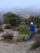 |
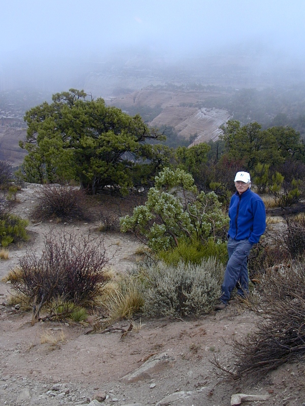
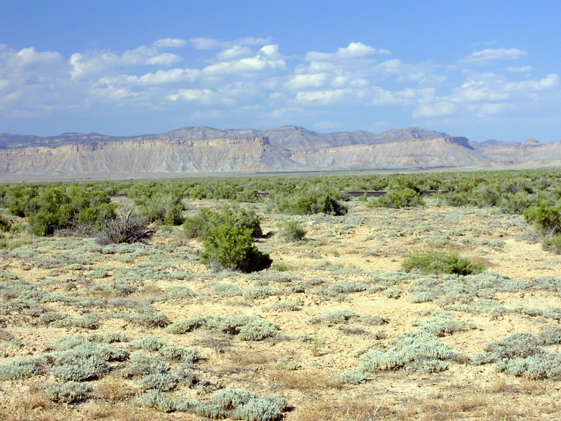
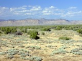
Plateau
country flora: John hobnobs with the flora of
the Uncompahgre Plateau at the rim of Red Canyon during a lull in the
rain: From back to front, pinyon pine, white-berried
Utah juniper, spindly bright green Mormon tea and woody sage. |
 |
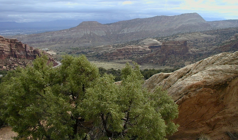
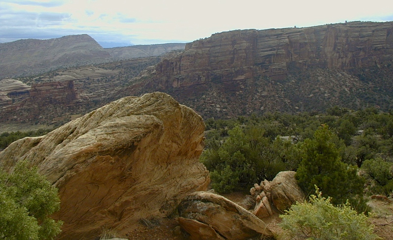
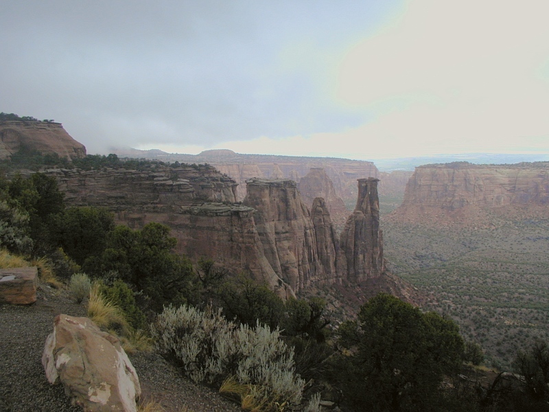
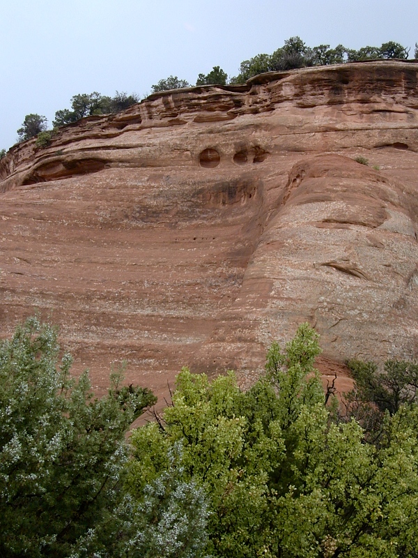
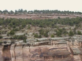
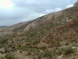
Monument
Canyon: The thin but tough Triassic
Kayenta Formation caps many of the Wingate mesas and spires along the NE
margin of the CNM. Streams flowing to the SW over Wingate dunes deposited
the irregularly-bedded Kayenta muds, sands and gravels. Silica- and calcite-rich groundwater
later permeating the Kayenta and firmly cementing
its grains hardened it into a highly resistant caprock serving in that
capacity throughout the Colorado
Plateau. The slopes skirting the bottoms of
the high vertical Wingate cliffs are Chinle mudflat deposits. I couldn't
make out any Precambrian basement exposures through the alluvial cover
in this series.
The Kayenta/Wingate/Chinle triad is a visually distinctive
combination responsible for very similar plateau country topography in ^Canyonlands
National Park and vicinity in western Utah, where the Chinle also
includes silicic ashfalls blown hundreds of km across the Southwest from magmatic
arcs active along the west coast of the time.
I can't recall the name of the prominent spire near center in the 1st
frame, but note its hard Kayenta cap. Once the cap succumbs to erosion,
the spire will be rounded into a bullet shape like the towers at the
Coke Ovens (not shown).
|
 |
 |
 |
 |
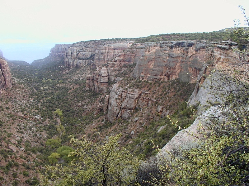
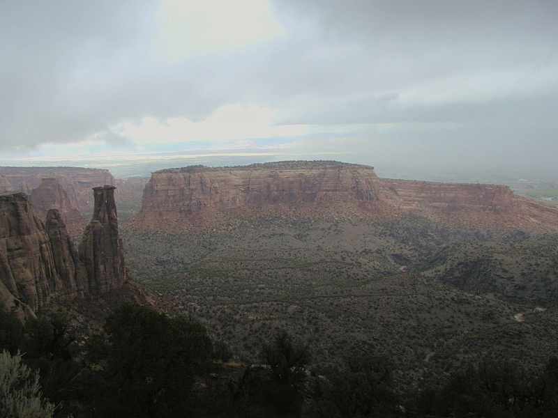
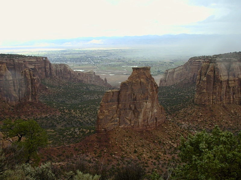
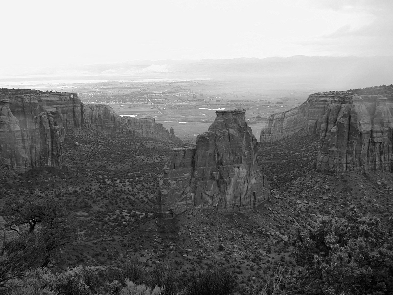
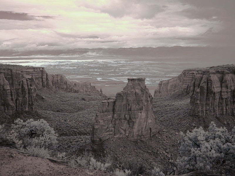
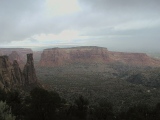
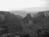
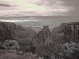
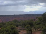
Independence
Monument: Looking north from Independence Monument View over
550-foot-high Independence Monument, Monument Canyon and Fruita to the Book
Cliffs in the distance.
The top two images in this series were made from visible light—an
original in in color and a copy converted to B&W in post-processing.
The bottom 2 frames are made from near infrared (NIR) light through a
Hoya R72 NIR-pass filter—an original in color and a copy converted to B&W in post-processing.
^Infrared digital
photography isn't for everyone, but I get a big kick out
of it—mainly for the otherworldly tonality and exceptional clarity it brings to
the scene, even on hazy days like this one.
|
 |
 |
 |
 |
Wind erosion: Wind carved graceful caves and
arches into upper Entrada sandstone near Grand View. Before the Colorado
River acquired its present name, it was aptly known as the Grand River.
Grand Junction stood at the confluence of the Grand and the
Gunnison. |
 |
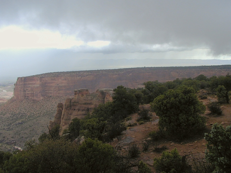
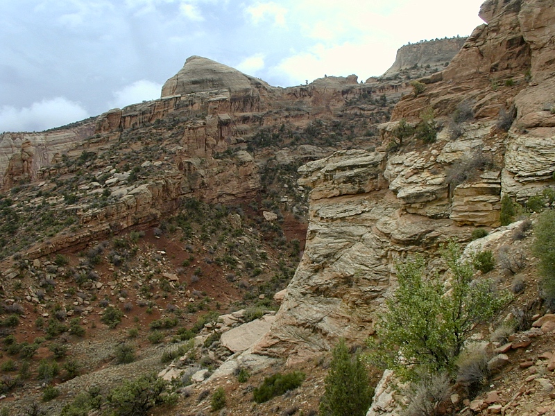
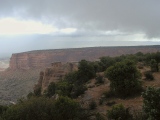
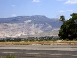
Great Monocline:
In this panoramic sweep from east to SE (top to bottom) taken near the
West (Fruita) Entrance, the Great Monocline on
the north flank of the Uncompahgre Plateau flexes up over the reverse basement
fault that uplifted the plateau in Laramide
time.
In the 1st frame, the Book Cliffs rise on the left in the far
distance to the east. Hulking behind them is Grand Mesa. In the middle
ground (zoomed in 2nd frame), buff to red Triassic Kayenta/Wingate cliffs slant above a thin
deep red Triassic Chinle
Formation resting 1.7 Ga
Precambrian basement rocks not exposed here. On the back of
(upsection from) the Kayenta in the middle distance rides the Early
Jurassic Entrada Formation, a salmon-colored cross-bedded dune field
deposit that tends to form bull-nosed layers rather than the
square-shouldered vertical cliffs seen in the Wingate.
|
 |
 |
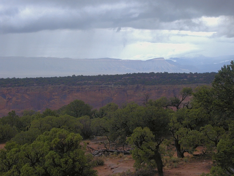
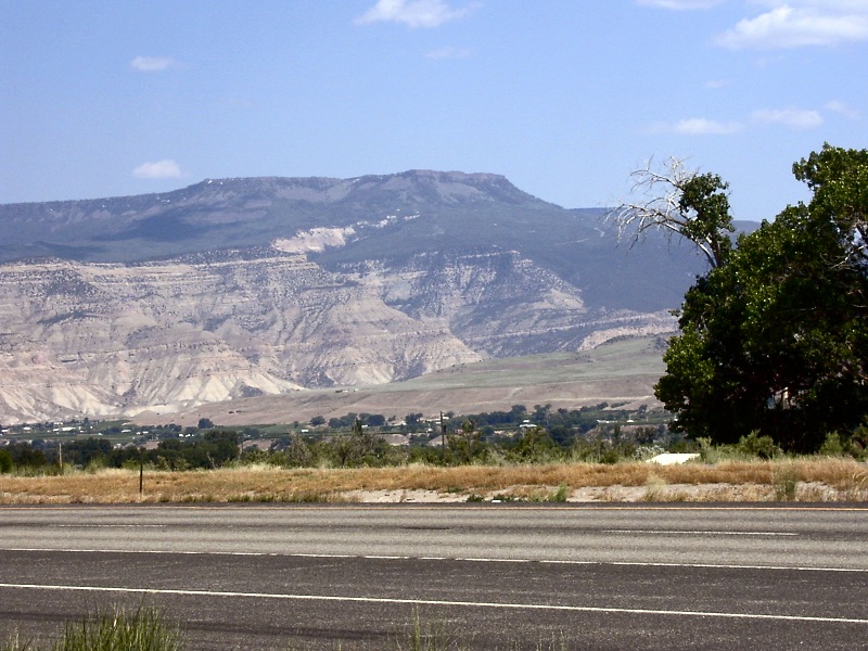
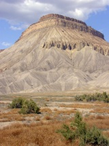
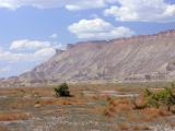
Book Cliffs From Near And Afar
|
 |
Book
Cliffs: On my first to the Book Cliffs, the weather
was less than idea for viewing from any distance. A subsequent trip
through Colorado and Utah segments of the Colorado
Plateau provided many photogenic encounters with the Book Cliffs,
which seem to be everywhere in plateau country.
In west central Colorado, the imposing Book Cliffs form a remarkably straight 1,000-2,000' high, 75 km-long wall
(frames 1-4) trending
northwest from Grand Junction. In fact, they form both
the north wall of Grand Valley—a broad floodplain of the Colorado
River (formerly known as the Grand)—and the southwest edge of the base
of the Roan Plateau.
Frame 1 in this series is a telephoto of
the Book Cliff seen to the
east across the top of the Uncompahgre Plateau from Independence Monument View.
Frame 2 is a wide-angle of the cliffs standing on the horizon behind Monument
Canyon at Colorado National Monument. Grand
Valley is just this side of the cliffs. Frame 3 shows the cliffs at far left over the base of the Great
Monocline at Colorado National Monument. Frame 4
shows the cliffs in the distance north of the East Entrance
to Colorado National Monument.
Now for a closer look taken along I-70 just east of Grand Junction. The caprock atop the
Book Cliffs (frame 5) is resistant buff-colored sandstone of the Late
Cretaceous Mesaverde Group. Badlands-style weathering
in the soft Mancos Shale below
it form vertically corrugated yellowish slopes that from a distance apparently
reminded someone of books lined up on a shelf. The Mesaverde and
Mancos formations correlate respectively with the Laramie
and Fox Hills sandstones and
the Pierre shale of the eastern
Rockies. All these sediments rest on the state-wide Dakota
sandstone.
The Book Cliffs outcrop widely throughout the Colorado
Plateau. Wherever they're found, the Mesaverde caprock displays its
distinctive "hog nose" erosional habit, whether in Colorado
(frame 6) or Utah (frame 7).
Book Cliff strata underlie the Tertiary Green
River shale and Wasatch
Formation sediments that make up the Roan Cliffs, as seen in frame
8. The same Tertiary sediments underlie Grand Mesa, with its obvious
protective cap of Pliocene Late
Phase basalt.
|
|
|
|
On a later trip...
|
 |
 |
 |
 |
 |
Grand Junction
|
 |
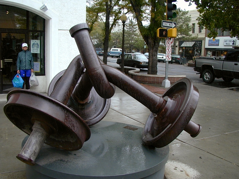
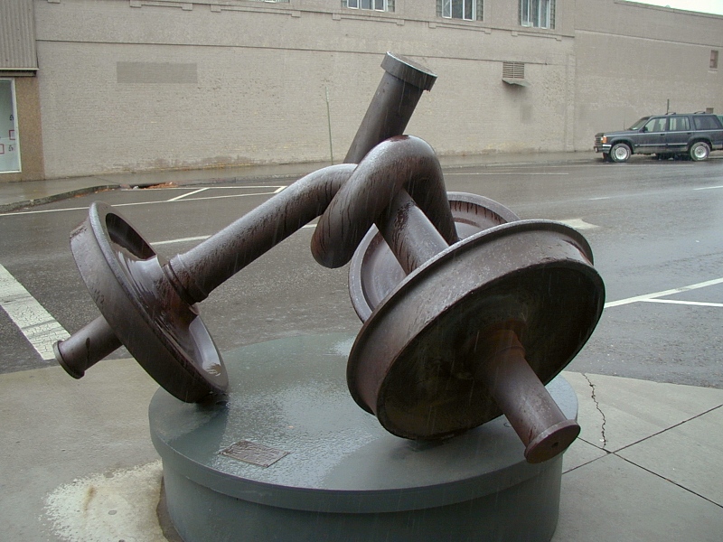
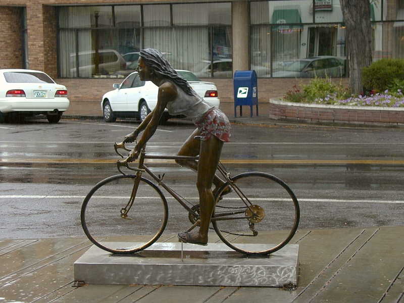
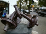
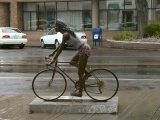
Back in town: We took lunch at the Rockslide pub in Grand
Junction and then shopped the
Main Street mall for spousal appeasements, extra hiking pants and some
leg warmers for bicycling. At left are but two of the many
intriguing metal sculptures dotting the downtown mall. The graceful bends in
the massive train axles suggested an impossible pliability. The lifelike
girl on the bike seemed about to wheel off at any moment.
We'd intended to spend the afternoon cycling in the Monument, but
when the rain escalated, we decided stay in town instead. John found a
workout room while I hunkered down with a briefcase full of maps,
geology books and hiking guides to choose a fitting hike the next day, for our last
full day on the road. The winner, Cathedral
Lake off Castle Creek Canyon south of Aspen, would prove to be an
excellent choice.
Grand Junction stands on soft Mancos Shale
flooring the Grand Valley.
|
 |
 |
 |
John and his long-time friend
and former partner Dick tussle over who gets the next slug. We spent
the night at Dick's before heading out for the Black
Canyon of the Gunnison early the next morning. We appreciated his
hospitality. |
Gallery Note: All the images on this page were taken in September, 2002 unless otherwise
noted.
References
In addition to the references cited on the home
page and in supporting articles, this
article relies on the following sources, in alphabetical order by first author:
URL: http://www.cliffshade.com/colorado/colorado_mon/index.htm
|