|
| |
Photojournal
Garden of the Gods
A Mad Dash From Aspen to Colorado Springs
|
 |
|
|
Last modified 11/22/03
 Under
construction Under
construction
A Mad Dash from Aspen to Colorado Springs
 |
Twin Peak
|
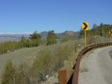
This page features points of interest along the final
pedal-to-the-metal leg of the Colorado
geology road trip John Barr and I took in September, 2002. We left the Cathedral
Lake trailhead in Castle Creek Canyon south of Aspen late in our next to
last afternoon, bound
for Garden of the Gods above Colorado Springs the next morning and Denver International Airport (DIA) by
mid-afternoon to catch John's plane back to California.
Along the way, we encountered many attractions. We were in far too much of a hurry to do any of
them justice, but we caught some interesting sights nevertheless.
Gallery
|
Independence Pass and the Sawatch Range
|
 |
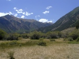
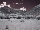
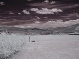
Independence
Pass: From Aspen, scenic CO82 took us first south and then east
up the Roaring Fork River to Independence
Pass (at 12,095', one of the highest in the US), where it crosses the crest
of the towering Sawatch Range along a weakened fault zone. On average,
the Sawatch is the tallest of the ranges comprising the Colorado
Rockies. Looking south from CO82 at the ghost town of Lincoln Gulch just
west of the pass, these visible and NIR photos show a large glacial cirque carved into Independence
Mountain (12,703'), part of a ringed Tertiary intrusive and volcanic
complex that may be a large dissected volcano. East of the pass, CO82 descends
with the North Fork of Lake Creek along the southern flank of Mt. Elbert
(14,433'), the highest peak in Colorado. |
 |
 |
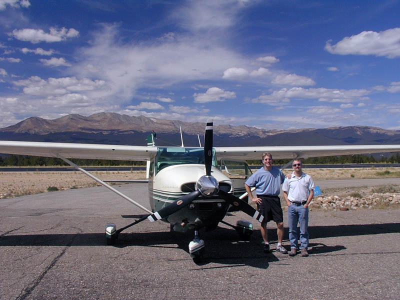
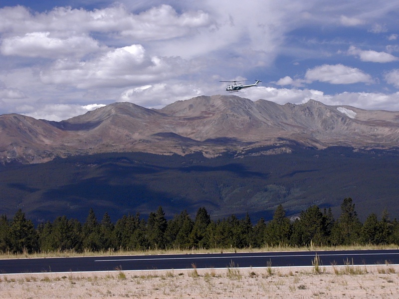
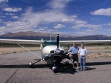
Mount
Massive: In the 1st frame, aptly named Mt. Massive (14,421', 2nd highest
peak in Colorado) looms to the west from the Leadville airport, the
highest in North America at 9,927'.
Some of the aerial photos on this site came from the back seat of this
300 hp Cessna 182 while my pilot friend Jim Fischer (left, 1st frame)
practiced his mountain flying with instructor ^Ron
Zawadzinski on his right in the 2nd frame.
Leadville attracts mountain flying trainees
and flight tests from all over the world. Jim was proud to collect one
of the "I landed at Leadville" certificates the airport operator
issues.) you get a much closer look at Mt. Massive just east of Independence
Pass, which is just out of view to the left in the 3rd frame. The
helicopter in the 1st frame was a new Huey adaptation under testing by
the US Forest Service.
|
 |
 |
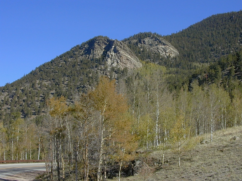
Twin Lakes and Lake Creek Valley
|
 |
Twin
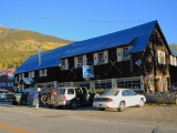
Lakes: After an overnight at the Nordic Inn in
Twin Lakes, we set out early to take in Florissant
Fossil Beds National Monument and Garden
of the Gods before John's 5PM flight to Oakland. US24 first took us
south and down via the spectacular upper Arkansas River valley, an active segment of the
Rio Grande Rift. Hemmed in at first between high, sheer
buff-colored 1.7 Ga Precambrian granite walls, the Arkansas valley broadened as
we passed Mt. Oxford (14,153'), the northernmost Fourteener of the
Collegiate Range, as the southern half of the Sawatch is known. |
|
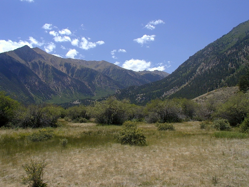
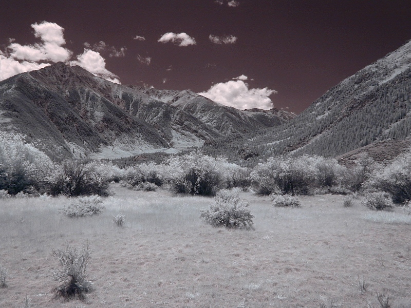
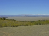
Lake
Creek Valley: The 1st and 2nd frames look SW from the
town of Twin Lakes. Impressive Sawatch peaks frame the large classic U-shaped valley
carved by the massive Pleistocene Lake Creek valley glacier.
Just east of here, the glacier stuck its big nose into the Arkansas River valley, forcing
the river east into the 1.7 Ga granites at the base of the Mosquito Range.
The peak on the left is Twin Peaks (13,333'); the base of Parry Peak
(12,683') is on the right. Hidden behind Twin Peaks is La Plata Peak
(14,336'). The large Tertiary La Plata intrusion crosses the valley to
form Parry Peak and perhaps Twin Peaks as well.
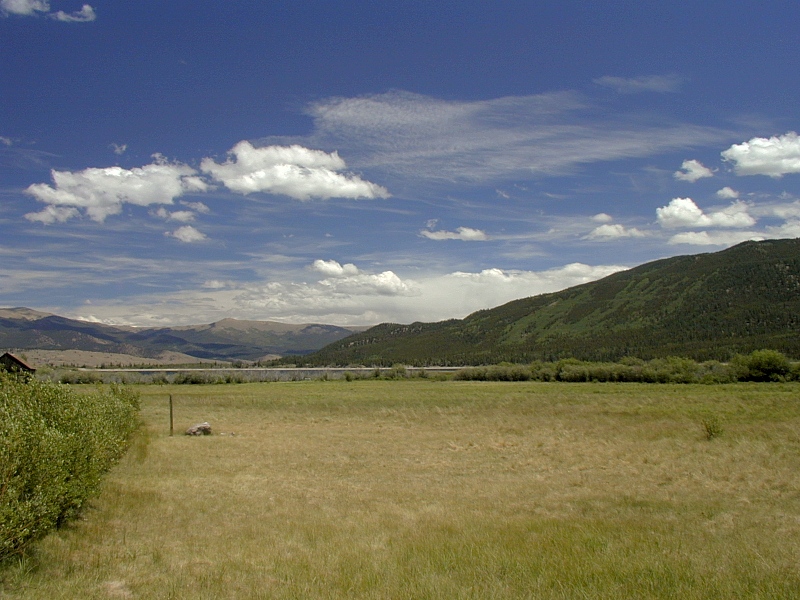
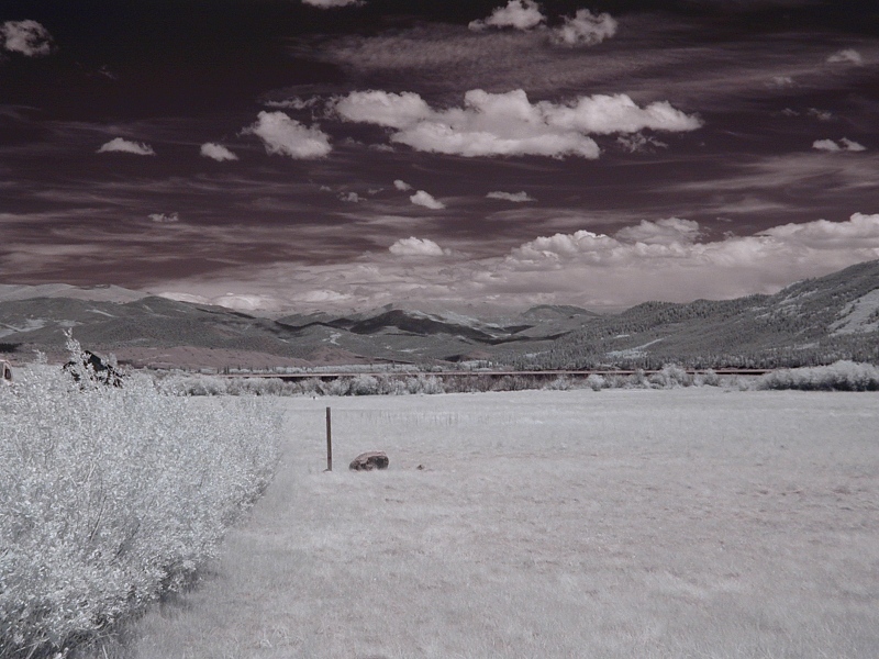
The 3rd and 4th frames look to the east from the town of Twin Lakes
down the broad outwash plain deposited by the receding Lake Creek valley
glacier. Barely
visible in the middle ground beyond the plain are Twin Lakes, originally
dammed by the glacier's terminal moraine and now by man.
The Mosquito Range, in the distance across the hidden Arkansas
River, was the eastern limb of the Sawatch Range anticline before the Rio Grande Rift
lopped it off in the Miocene.
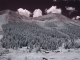
BTW, all the false-color ^near infrared (NIR) photos on
this page were taken through a Hoya R72 NIR pass filter on an
Olympus C-2020Z digital camera. |
 |
 |
 |
Southern Mosquito Range
|
 |
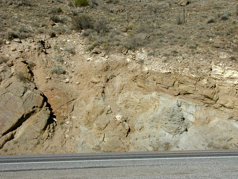
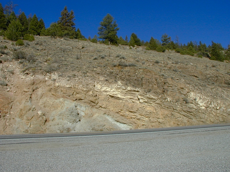
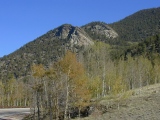
Trout
Creek Pass: At majestic Mt.
Princeton (14,197') in the Sawatch Range, we turned east to follow US24 up Trout Creek and
across the south toe of the Mosquito Range via Trout Creek Pass (9,010'
??). Just west of the pass at US24 Milepost 223, this roadcut exposes
Pennsylvanian sediments resting unconformably on 1.7 Ga Precambrian granite.
The Pennsylvanian rocks (on the right in the 1st frame) are part of the faulted western limb
of a large sedimentary syncline that floors South Park and ultimately includes Ordovician
through late Cretaceous deposits. The Pennsylvanian limestone (white),
sandstone (brown) and evaporites (gray) accumulated in the Maroon Basin between the
Ancestral Rocky Mountain
uplifts. A fault just east of here exposes even older Maroon Basin sediments. |
 |
Wilkerson Pass and South Park
|
 |
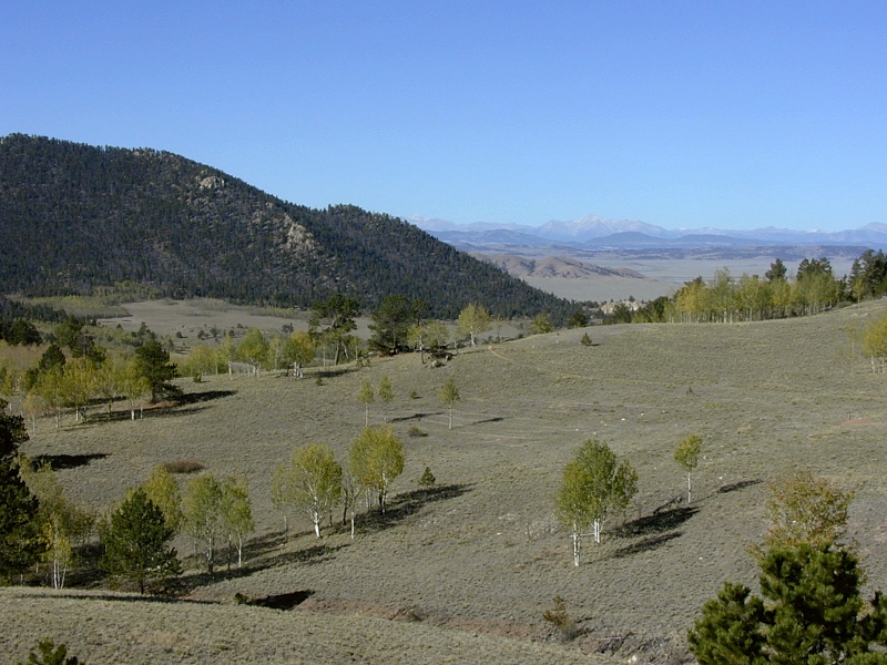
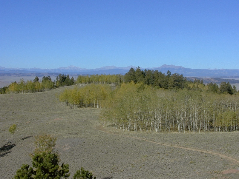
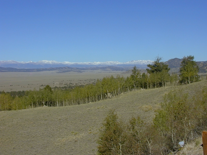
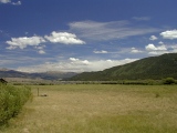
Wilkerson
Pass panorama: After
crossing South Park and the Elkhorn Thrust, eastbound CO24 took us back into the Front Range at Wilkerson Pass
(9,705'). This south-to-north sweep looks back to the west across South Park toward the Mosquito and
Sawatch Ranges.
The 1st frame looks to the southwest from Wilkerson Pass
over the
Precambrian east wall of South Park, one of several large
faulted Rocky Mountain synclines that somehow managed to
escape Laramide and subsequent uplifts. The Mosquito Range forms the distant west wall of South Park.
In the 2nd frame, West and East Buffalo Peaks (~13,471' and 13,411',
respectively) dominate the southern Mosquito Range skyline at right center.
Hard Tertiary andesitic volcanics
that once
filled a paleovalley now support their widely visible twin summits in a
classic example of topographical inversion. Subsequent erosion of
the paleovalley walls left the more resistant volcanics standing in
positive relief.
In the 3rd, 4th and 5th frames, the first low dark ridge on the floor of
South Park beyond
the foreground hill is a west-dipping hogback of lower Cretaceous Dakota sandstone
recapitulating the sedimentary sequence found at the east-dipping Dakota Hogback
between Denver and the Front Range. Upper Cretaceous Pierre Shale floors
South Park on this side of the hogback.In the 6th and final
frame, 1.7 Ga Precambrian metasediments bordering Wilkerson Pass on the
north moved to the west up and
over the Pierre Shale of the South Park floor along the Laramide Elkhorn
Thrust,
an analog of the Williams
Fork Thrust bordering Middle Park to the north. The metasediments accumulated around one of the island
arcs that accreted to the North American continent along the southern
margin of the Wyoming Craton around 1.7
Ga.
|
 |
 |
 |
 |
 |
Florissant Fossil Beds
|
|
Sorry, no pictures yet |
Florissant Fossil Beds:
We had no time for pictures on our whirlwind stop at ^Florissant Fossil Beds
National Monument, but the story is worth recounting. By late Eocene
time, a broad mountain valley floored by Pikes Peak granite and the Wall
Mountain tuff had developed at Florissant. Tall redwoods flourished in
the warm climate. But explosive volcanoes active to the west in the
Sawatch Range and to the south in the Thirty-Nine Mile volcanic field
soon changed all that. Around 34 Ma ago, a massive Early
Phase lahar (volcanic mudflow)
from the west paved over and dammed the valley to form ancient Lake
Florissant. The 2x12 mile lake served as a sediment, ash and fossil trap for
many years thereafter. Volcanic ash falling onto and washing into the lake provided the rapid burial
by fine-grained sediments crucial to the preservation of delicate
fossils. Periodic volcanic mudflow breccias covered the fine-grained
lake deposits. Today, the Florissant beds give us a rare window into the
mid Tertiary evolution of many plant and small animal species. They're
unusually rich in insect fossils, with over 1,100 species cataloged to
date. |
Garden of the Gods Park
|
 |
First things first: Our first
stop at Garden of the Gods was
the gift shop, where John and I secured suitable
offerings and sacrifices for our generous and understanding spouses in preparation for family
life re-entry. This young lady guided us well—the goddesses were
appeased. |
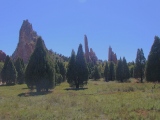 |
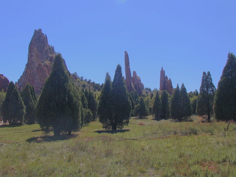
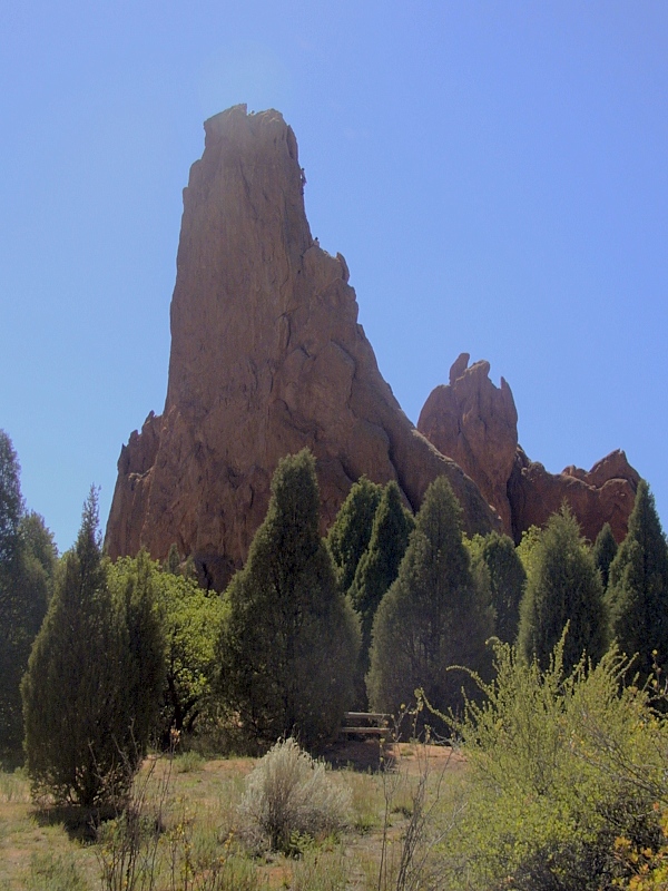
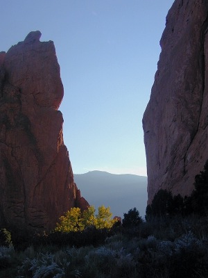
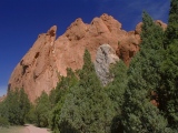
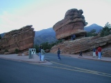
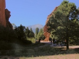
Garden of the
Gods Park: The white, salmon and maroon
towers and spires characteristic of the east side of Garden of the Gods are erosional remnants carved
for the most part from strong, vertically-dipping Early Permian Lyons
sandstone, here
a coastal dune sand deposit durably cemented with silica and
hematite derived from ferromagnesian minerals in the igneous
and metamorphic rocks exposed by
the Ancestral Rocky Mountain Orogeny. Elsewhere along the eastern margin of the Front Range, the
neighboring and slightly older Permian-Pennsylvanian Fountain Formation is
responsible for many spectacular flatirons, as at Red Rocks Park
and ^Roxborough
State Park near Denver, but the Fountain here is only weakly cemented and can muster only smaller edifices.
These Lyons and Fountain strata lie at the southern tip of the largely
Precambrian Rampart Range, an eastern splinter off the Front Range
uplift. They've been preserved in part in a graben down-dropped
between two major Laramide faults, the Rampart on the east and the Ute Pass on
the west. The Rampart Fault splits the park. To its east are vertical
Lyons strata and the spectacular spires and fins they create; to
its west are gently-dipping strata and lower landforms like Balanced
Rock in the final frame.
The Three Graces march off to the SE in the 1st frame in this series.
The 2nd and 3rd frames feature the Sentinels. A pair of dove-like birds
watch the crowd from a small wind cave in the 4th frame, which details a
Sentinel wall. The fenestration between the Kissing Camels atop North
Gateway Rock is barely visible near the top of the 5th frame. The 6th
frame features Balanced Rock, the most popular spot in the park by far.
Its strata dip modestly to the east, as do most of the rocks west of the
Rampart Fault.
For more info and pictures, visit the worthwhile ^Garden of the
Gods website.
|
 |
 |
 |
 |
 |
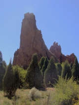 |
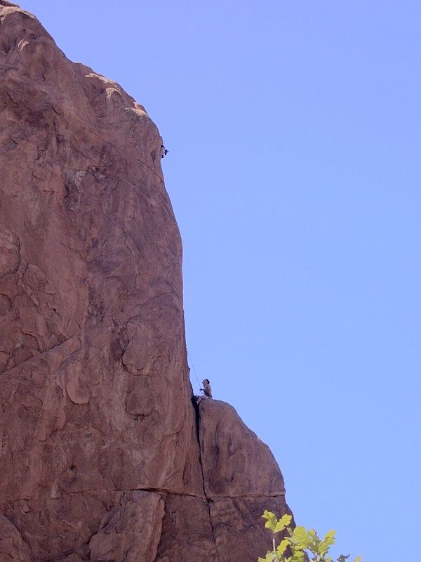
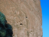
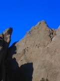
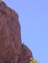
Garden
climbers:
We saw "climbing by permit only" signs at every turn in Garden of the Gods,
but that didn't seem to be much of an obstacle. Climbers like the ones
shown here were out in force on this warm, sunny mid-September day. They
reminded John of his daughter Heather, an avid climber currently serving
in the Peace Corps in Nicaragua. She'd love to climb here some day, he
thought out loud.
Vertical bedding planes are clearly visible on the face of the spire
in the 2nd frame.
|
 |
Pikes Peak from Garden of the Gods
|
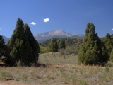 |
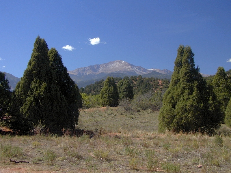
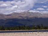
Glimpse of a
giant:
The 1.1 Ga
Precambrian granite summit of Pikes Peak (14,110') dominates the
southern skyline at Garden of the Gods, and for that matter, throughout
the southern Front Range. Pikes Peak is merely the
pinnacle of a much larger Pikes Peak Batholith extending 50 miles to the
southeast beneath the High Plains. The high part of the batholith lost a
cover of early Paleozoic sediments during the Ancestral Rockies Orogeny
and later, a late Paleozoic through Mesozoic cover during the Laramide.
The Pikes Peak Batholith formed during the Grenville
Orogeny. Granites intruded at ~1.7 Ga and ~1.4 Ga are common in Colorado (in fact,
the latter are common throughout North America and Europe), but intrusions of
Grenville age are very rare here.
All 3 photos here show Pikes Peak from Garden of
the Gods. Gateway Rocks frame the broad summit in the distance
in the 3rd photo in the late afternoon sun. For more views of Pikes Peak from Mount
Evans, click here.
|
 |
 |
Gallery notes: The Independence Pass photos are from a trip to Aspen in July,
2002. The Leadville Airport photos and the mid-day photos at
Garden of the Gods are from September,
2002. The
late afternoon Garden of the Gods shots are from a return trip in October, 2002.
References
In addition to the references cited on the home
page and in supporting articles, this
article relies on the following sources, in alphabetical order by first author:
URL:
http://www.cliffshade.com/colorado/garden_gods/index.htm
|