|
| |
Home
About This Site
Use the links at left to navigate. The photojournals
feature discussion and annotated photographs of sites of geologic interest in Colorado. The
groundwork articles provide in-depth background on Colorado geologic
history,
rocks and tectonics.
|
|
|
|
Last modified 01/03/05
Top
Page Index
Introduction
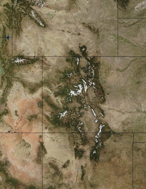
Her high mountains and deep canyons leave no doubt that Colorado's beauty is
far more than skin deep. In fact, it's four-dimensional if you count
time, and of course you must.
Over the last 1.8 Ga
(billion years), many seascapes and landscapes have played out in the place we call Colorado—from
deep ocean trenches to shallow tropical seas to beaches and offshore bars to vast desert dune fields to arid tidal mudflats, from lush redwood forests to
volcanic moonscapes, from tropical volcanic islands to high glacier-carved inland
mountains. The rocks now exposed at the surface in Colorado provide an
incomplete but still fairly readable record of its physical journey through deep
time. The otherwise inaccessible rocks glimpsed in road cuts, tunnels, mines and wells help geoscientists flesh out the
story.
This website
celebrates just a few of the many stories Colorado's rocks have to tell. Recounting them
online is an exercise in geo-journalism, a reporting of the what, where, when,
how and why of physical Colorado in a regional context while
featuring points of particular interest in the Colorado landscape. (Occasionally,
the who figures in as well.) If my words and photographs impart even a hundredth of the wonder and
fascination that a writer like ^John McPhee or a painter
like ^Maynard
Dixon can stir, I'll have done a decent job.
With a subject as four-dimensional as geology, you can never have too many
diagrams and photographs. I wish I had many more, but my permissions, time and artistic skills go only so far.
Most of the diagrams shown here come with permission from ^Geological Society of
America publications or from online public domain ^US
Geological Survey and NASA resources.
Like Colorado itself, this site is a work in progress. The personal geologic vignettes
and photographs gathered here come from day trips in and around the Denver area, family
vacations in Colorado, geologic field trips guided by
professionals, and
geologically-oriented road trips around the state in the company of my good friend
and fellow reader of rocks, John Barr. I plan to add more material as my travels widen. The supporting
"groundwork articles" draw from many resources,
some of which are acknowledged below.
Link Types
This site relies heavily on internal
and ^external links opened in the same browser window, and
also on %selected internal and external pages opened in a
new browser window.
After clicking an internal or ^external
link, use your
browser's [Back] button to return to the internal page where you left
off. Thumbnails with no border behave the same way.
Links prefixed
with a percent sign "%" lead to internal or external pages opened in a new browser
window. The same is true of thumbnail images with a heavy green border. If left open,
the same new window will be used for all subsequent "new window"
links.
Hyperlink Characteristics
|
|
Link Prefix
|
Thumbnail Border
|
Browser Window
|
Return
|
|
None
|
None
|
Same
|
[Back]
|
|
^
|
None
|
Same
|
[Back]
|
|
%
|
Heavy
|
New
|
Click on old window
|
Terminology and Units
Albert Einstein once said something like, "When you fully understand an
idea, you can explain it in simple terms," but he never said it would be
easy. I've done my
best to write by that creed, but my understanding has limits, and geoscience
jargon does afford a certain economy of word, thought and mental image. I've made an effort to introduce
important terms along the way, but in the interest of text
flow and time (mine), I've often assumed an unrealistic familiarity with
geologic lingo and timescales—at least for most potential visitors.
If
you find yourself in need of definitions or time frames, I heartily recommend
the online geologic glossaries and timescales
listed on the search page. This site follows the 1999 ^Geological
Society of America timeline.
Striking the proper balance between simplicity and nuance, overview and
detail, lumping and splitting is
always a challenge. In a primarily observational science like geology, juggling
the known with the conjectured invites even more verbiage. I've never been known
for brevity, but I've done the best I can to be fair to the data without losing
the mountains for the rocks.
Time and Distance Units
Throughout this site, deep time units are expressed as follows:
The last two examples illustrate a potentially confusing ambiguity in the way
these units are used here and in most geology texts. Logically, a stated time may represent a
duration (the 30 Ma in the second example) or a specific time in the past (the
10 Ka in the last example). Feel free to add "ago" to these time units
as context requires.
For now, distances appear in both English and metric units at my convenience.
Eventually, they'll all be metric.
Limited Warranty
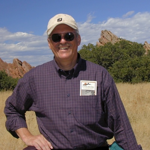
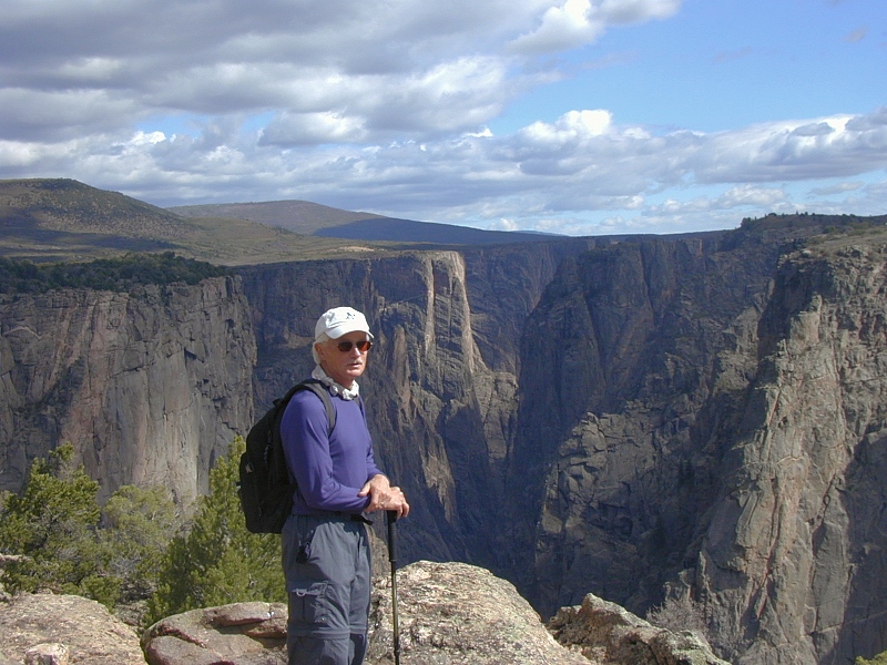
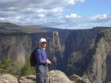
 |
The author at Roxborough State Park, 2003
|
The information presented here is accurate and current to the best of my knowledge.
When I first undertook this site in late 2001, with a view toward learning
Colorado geology as quickly as possible by writing about it, I was an avid amateur
geologist with 25+ years of geology reading
and professionally- and self-guided field trips under my belt — all primarily
in California. As of January, 2005, however, I'll be a graduate student in
geology at the ^Colorado School of Mines.
My research for this site has been careful and
reasonably complete, but all errors and misconceptions are mine. If you spot one,
or any other opportunity for improvement, please let me know at
colorado@cliffshade.com.
Thanks for stopping by.
Jeremy McCreary, MD
Denver, CO
Top
Page Index
Photojournal Index
Most of the photojournals linked on the left
below focus on a particular Colorado destination of geologic interest. They
include one or more sections of introductory text followed by a photo gallery
also divided into sections. The text and gallery sections are linked separately
in the table below.
Many of the photojournals also
include material on points of interest encountered on the way that may or may
not pertain to the main destination. You'll find these side attractions included
among the gallery links.
Coming Attractions
-
Front Range Medley
-
San Juan Mountains
-
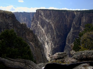
Black Canyon, South Rim
Top
Page Index
Visual Aids
Geology plays out in four dimensions. To get a grip on at least two of them,
I strongly recommend attempting to digest this site with some visual aids in hand.
I've included as many illustrations as I can get my hands on legally, but the
site could
obviously use many more.
Top
Page Index
Sources
Colorado's story continues to evolve—both in the rocks and in the minds of
geoscientists. Her profound beauty, her spectacular exposures and her
tantalizing puzzles have long attracted some of the best minds in the business,
but her many overprinting processes have left a
tangled web indeed. Many chapters in the story remain controversial or frankly
unknown, and some just beginning to yield to investigation may take decades to tease out.
I've assembled the "big picture" presented
here
as best I can from a number of
sources, including
Over the years, many kind geoscience mentors have
contributed to the understandings offered here, as I've acknowledged elsewhere,
but the misunderstandings here are
all mine.
Top
Page Index
Acknowledgements
 |
Matt & Casey
|
Over the last 25 years, I've had the good fortune to live in two hotbeds of
geoscience talent—California's San Francisco Bay Area and Denver,
Colorado. I first realized how eager most geoscientists are to share their knowledge
and enthusiasm with interested laymen in 1982, when I timidly joined the
Peninsula Geologic Society, a veritable "who's who" of West Coast
earth science drawn primarily from the Stanford faculty and the USGS Western
Division headquarters in Menlo Park, CA. At monthly meetings and on many a field
trip, these early mentors gave me a solid leg up on field geology that no book
could impart. Special thanks go to the late Clyde Wahrhaftig for allowing me to
assist in his Marin Headlands field work, for putting up with my ceaseless
questions, and for helping me learn to make some sense of the aptly-named "trash-can geology"
of coastal California. At 80, Clyde could still out-hike me, and I was 30
something and in very good shape at the time.
My good luck with the Peninsula Geologic Society
emboldened me to try tapping into the local talent once again on moving to Denver
in 2001, and I've not been disappointed. Conversations and field trips with many
geoscientists met through the ^Geological
Society of America, the ^Colorado
Scientific Society, the ^Colorado School of Mines,
the ^Rocky Mountain Association of Geologists
and this web site have been invaluable. I'm particularly grateful to Warren
Hamilton, Bob Raynolds and Vince Matthews, as noted below.
Geological Society of America Meetings and Field
Trips,
Denver, 2002 and 2004
When the
Geological Society of
America (GSA) annual meeting came to Denver in 2002, a year after our
move to Colorado, I couldn't resist. A 2-day pre-meeting field trip focused on
Colorado's Precambrian history turned out to be the perfect setup for the talks
ahead, which in 2002 included no less than 6 half-day technical sessions devoted
to the Rockies. I couldn't have asked for a better leg up on the current state of Colorado geology,
but even more gratifying was the opportunity to meet and talk with many of the
leading workers in the Southern Rockies.
When the meeting came back to Denver in ^2004,
I signed up for two field trips, both to the northeast flank of the Front Range
— an area at the heart of a long-standing and deep-seated controversy
regarding the structure and tectonic style of the entire Laramide orogeny. There
were fewer Rocky Mountain talks than there had been in 2002, but
2002 Shear Zone Field Trip
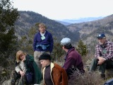 |
Field trip, stop 3
|
I'm still patting
myself on the back for signing up for a seminal pre-meeting field trip to the Front
and Sawatch Ranges, ^Formation,
Reactivation, and Evolution of Proterozoic Shear Zones in the Colorado Rocky
Mountains: From Continental Assembly to Intracontinental Orogeny, ably led by
Colin Shaw, Karl Karlstrom and Michael Williams. As the GSA meeting to
follow unfolded, I came to realize that the field trip roster amounted to a current "who's
who" of Colorado geology — and I'd managed to pick the brains of just about
everyone there! All proved to be gracious and enthusiastic teachers, but I'm
especially grateful to
-
my field trip vanmates (particularly Bill
Nesse, Tom Moeglin, Tom
Plymate and Amanda Tyson) for helping me put the stops in context, for
shaping my current understanding of Colorado's Precambrian and Laramide
past, and most of all, for resisting the urge to throw me out
-
Chuck Chapin
of the New Mexico Institute of Mining and Technology for helping me wrap my head
around Colorado's Tertiary magmatism
and the importance of climate change in the geologic record
-
the entire Australian geoscience contingent—particularly
Peter Betts and David Giles—for familiarizing me with
the many compelling
Paleoproterozoic and modern analogs to Colorado's past to be found in and
around Australia
-
Andy Kerr of the Newfoundland & Labrador
Department of Mines and Energy and Pat Bickford and Barbara Hill of Syracuse
University for making sure I took in all the important field
observations along the way
-
Eric Nelson of the ^Colorado School of Mines for his tutelage at the rocks and
for hooking me up with the geologically-oriented ^Colorado
Scientific Society.
2004 Front Range Field Trips
To a student of the Rockies in general and the Front
Range in particular, the ^2004
GSA field trip offerings presented some tough choices. There were at least four
tasty Front Range trips, but one before and one
after the meeting were the best I could do. I finally settled on two that brought somewhat conflicting
interpretations to the northeast flank of the Front Range between Fort Collins
and the Wyoming line. A wealth of observable
structural and tectonic detail makes the northeast flank a natural focal point
in ongoing debates surrounding the kinematics and dynamics of the Front Range
and indeed of the Laramide orogen[] as a whole. (For the uninitiated, kinematics
studies the way things move — direction, velocity, timing — without regard
to driving forces; why they move the way they do is the purview of dynamics.)
Along its southern and central segments (south of Boulder), the high and steep
east flank of the Front Range drops precipitously into the deepest portion of
the Denver Basin along largely inferred high-angle reverse faults (among them
the Golden Fault) with at least 25,000' of accumulated throw. In contrast, the
range front basement north of Fort Collins is broken into a jostled array of
large and small blocks that generally stair-step down to the east into a much
shallower northern lobe of the Denver Basin. Between Fort Collins and Boulder is
a transition zone characterized by fewer blocks and a basin floor of
intermediate depth. Vince Matthews' superbly
illustrated pre-meeting trip entitled "Overview of Laramide Structures
along the Northeastern Flank of the Front Range" focused on kinematics
— specifically, on evidence for differential uplift of the northeast flank's
basement blocks along steep (presumably reverse) northeast- and
northwest-trending faults. We visited many striking examples of Paleozoic and
Mesozoic sedimentary strata draped in ductile fashion over variably uplifted
basement blocks separated by brittle faulting. The trip ended at a spectacular
exposure of the southern edge of the large, east-dipping Blue Mountain block
along the north side of Dry Hollow Creek, west of Berthoud. A markedly
attenuated Fountain Formation monocline
stretched over the edge of the basement block added weight to Matthews' view of
the sedimentary strata as so much "melted cheese" covering the
shattered basement of the northeast margin of the Front Range block. Eric
Erslev's post-meeting trip entitled "Laramide Horizontal Shortening in
the Rockies: Faulting and Folding in Oblique Backlimb-Tightening Structures of
the Northeastern Flank of the Front Range, Colorado" presented the case
for regional east northeast-trending horizontal shortening as the main driving
force for northeast flank structure, Front Range uplift and for Laramide
deformation in general. Although colleagues often
portray Matthews and Erslev as respective spokesmen for the long-opposed "verticalist"
and "horizontalist" camps of Laramide dynamics, I came away from the
2nd trip thinking that the Laramide may well be big enough for both of them. Erslev's
orogen-scale horizontal dynamics reconcile easily with Matthew's local
high-angle kinematics if one steps back and views the northeast flank as a large
high-angle backthrust belt related
to limb-tightening as the eastern margin of the Front Range block thrust eastward over Denver Basin sediments during the Laramide.
Could their perceived disagreement turn out to be nothing more than an artifact
of focus and scale? Six wise men long famous for their early elephant
observations might find grounds for optimism here. Luckily,
the GSA's Field Guide 5:
Field Trips in the Southern Rocky Mountains, USA, edited by Eric P. Nelson
and Eric A. Erslev, contains detailed field guides for the two trips I was most
reluctant to pass up: Karl Kellogg's
"The Colorado Front Range: Anatomy of a Laramide Uplift" led by
Karl Kellogg, Bruce Bryant and John C. Reed, and "Continental Accretion,
Colorado Style: Proterozoic island arcs and backarcs of the central Front Range"
led by Lisa Rae and Thomas R. Fischer. Charley Haddox and I have been working through them as weekend
time and winter weather permit.
GSA and USGS Publications
Jeanette Hammann at ^Geological Society of
America headquarters in Boulder deserves a tip of the hat for helping me arrange permissions to
use graphics from two superb
GSA publications, Geology and GSA Today. Since my text would have
had a hard time standing without these invaluable visual aids, I'm also grateful to the GSA for its generous permission policy.
Among the many authors of USGS public domain publications whose knowledge and
graphics went into this effort, explicit thanks go to
W. Jacqueline Kious and Robert Tilling, authors of ^This
Dynamic Earth: The Story of Plate Tectonics for all the excellent
diagrams, maps and photos. This site would have been graphically barren without them.
Special Thanks
My deepest thanks go to ^Warren Hamilton,
Distinguished Senior Scientist in geophysics at the ^Colorado School of Mines, for his generous
and patient mentoring on geodyanmics following an initial e-mail exchange
regarding his thought-provoking 2002 GSA meeting talk
later published as ^An
Alternative Earth. His capacity for questions is exceeded only by the quality of
his answers. Warren's advanced my understanding of global and local tectonics by
orders of magnitude. I have no doubt that his overarching view of the planet and
its workings and his dogged
focus on the observations (as opposed to the stories told about them) will
guide the way forward in geodynamics.
 |
John Barr
|
My true friend and geology buddy John Barr wins the
stamina award hands down for listening to me puzzle out overlook after outcrop
on our many, many outings together—and especially for poking holes where required. His
interests range wide, his love of nature runs deep, and his ability to resist
glazing over is exceeded only by that of my dogs, who don't even seem to know
how. I enjoy John's company and conversation immensely.
According to an old Chinese proverb, when you're ready to learn, your teacher
will appear. To my great good fortune, two excellent teachers
appeared — ^Bob
Raynolds, research associate and consulting geologist attached to the ^Denver
Museum of Nature and Science and its exciting ^Denver
Basin Project, and ^Vince
Matthews, current director of the ^Colorado
Geological Survey. Both sought me out (within the same week!) on finding
this site, and both have been extraordinarily generous with their time and
knowledge ever since — despite the fact that no good deed goes unpunished when
it comes to putting up with my questions. Their perspectives on the history of
Colorado geology remind me that with the excitement of any new finding or
synthesis must come a healthy dose of caution and a look back to the quality of
the original data.
 |
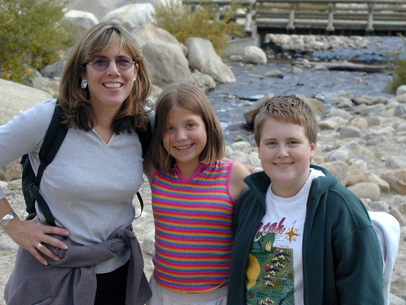
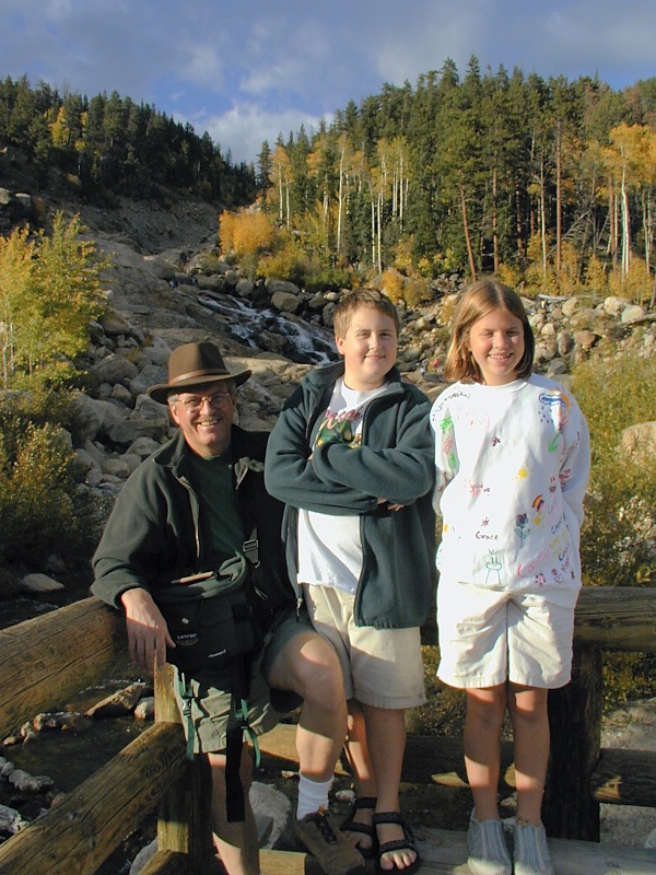
Kathy, Matt & Casey
|
Finally, I'm hopelessly indebted to my wife Kathy, son Matt and daughter
Casey for putting up with the endless side excursions to points of geologic
interest ("It'll just take 30 minutes, honey, I swear."), the
incessant photos ("Wait, I can't leave without snagging that gorgeous
contact over there. It'll just take 10 minutes, honey, I swear.") and the
predictable last-minute book consultations ("I'll catch up with you down
the trail as soon as I look up this formation. It'll just take 5 minutes, honey, I
swear.") that riddle every family trip. They are more patient than I
deserve, and Kathy always graciously accepts more than her fair share of the
driving while I feverishly thumb through my briefcase full of geology references
en route to the next attraction.
Top
Page Index
General References
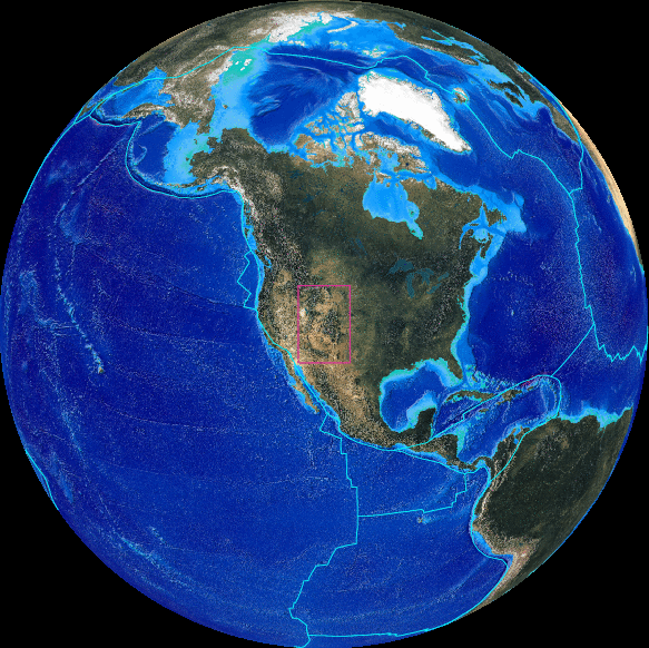
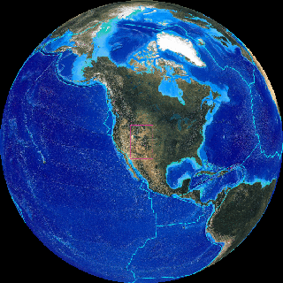 |
Southern Rockies (red square) in context
|
Listed alphabetically by title below are excellent online and hardcopy resources for
anyone interested in the geology behind
Colorado's incomparable scenery. This site relies heavily on many of them. The
references likely to be most useful are marked with double stars "**".
See also the
more topical references at the end of each article on this site—particularly
those cited in the groundwork articles Colorado
Geology Overview and Earth At Work.
-
A Guide to the Rimrock Drive, Colorado National Monument, 3rd
ed., 2000, by
Rose Houk, Colorado National Monument Association
-
Annals of the Former World, 1998, by John
McPhee, Farrar, Straus and Giroux
-
** Ancient
Denvers — Scenes from the Past 300 Million Years of the Colorado Front Range, 2001,
by Johnson KR and Raynolds RG of the ^Denver Museum of Nature and Science,
now ^online
and augmented with many superb new geologic maps and diagrams.
-
** Colorado Geologic Highway
Map and Shaded Elevation Map, GTR Mapping with the cooperation of the ^Colorado
Geological Survey, 2002 (available at ^MAPSCO, Denver, CO).
A must for every glove box. I cut my teeth on the 1991 revision, but this
updated geologic map shows Fourteeners for better localization of contacts,
and the new shaded elevation is much more useful than the previous
unannotated shaded relief map.
-
**^Colorado
Geological Survey web site — lots of must-have Colorado geology resources,
including several ^field
trip guides, an excellent and very revealing downloadable ^Colorado
shaded relief map, a ^map
of Colorado's major tectonic and geographic features and a ^Colorado
earthquake map among many others.
-
** Colorado Recreational Road Atlas, Pierson Guides, 1991
(available at ^MAPSCO, Denver, CO) —
detailed coverage of the entire state on a shaded relief background, with
most of the best unpaved roads marked.
-
** Colorado Seamless USGS Topographic Maps on
CD-ROM, 2000, v. 2.6.4 with TOPO!
viewer, ^National Geographic
Society
-
Colorado's Fourteeners, 2nd ed., 2000, by
Gerry Roach, Fulcrum Publishing Co.
-
^Friends of
Dinosaur Ridge web site — this non-profit organization has sponsored a decade of earth science
education at the Dinosaur Ridge
segment of the Dakota Hogback
west of Denver.
-
Geology
by Lightplane— University of Wisconsin geologist and pilot Louis Maher shares
with us his highly illuminating collection of aerial photographs of geologic
interest. He also shares high-resolution versions of his photos via FTP.
Nothing imparts an appreciation of the geometry and provenance of a major
landform as immediately as a well-chosen aerial view.
-
Guide Book to the Geology of Red Rocks Park and Vicinity by Andrew M.
Taylor, 1992, Cataract Lode
Mining Company (available at the Dinosaur Ridge Visitor's Center and at
The Tattered Cover bookstore in Denver)
-
** Guide to the Geology of Colorado by Andrew M.
Taylor, 1999, Cataract Lode
Mining Company (available at the Dinosaur Ridge Visitor's Center, The
Tattered Cover bookstore in Denver, and at the Colorado National Monument
Visitor's Center)
-
Heart of the Desert Wild, Grand Staircase-Escalante
National Monument, 2000, by Greer K. Chesher with photographs by Liz
Hymans, Bryce Canyon Natural History Association
-
** Hiking Colorado's Geology by Ralph and Lindy
Hopkins, 2000,
^The Mountaineers
-
James
Madison University Geologic Web Sites — Lynn Fitcher's excellent
compendium of online geologic tutorials
-
** ^Jules
Verne Voyager, Jr. — UNAVCO's impressive interactive online global
tectonic viewer and map server.
-
** Messages in
Stone: Colorado's Colorful Geology, 2003, Colorado Geological Survey,
Matthews V, KellerLynn K, Fox B, eds. — a gorgeously illustrated guide to
the state's varied and often world-class geology, with authoritative text by
the geologists of the ^Colorado
Geological Survey.
-
^PALEOMAP
Project — this impressive site by Christopher R. Scotese features still
and animated plate tectonic reconstructions dating back to the late Precambrian.
-
Plate Tectonics: An Insider's History of the
Modern Theory of the Earth, 2001, Naomi Oreskes, ed., Westview Press
-
^Popular
Geology — geologist Dick Gibson's witty portal to lay geology articles
and online resources
-
** Roadside Geology of Colorado, 2nd
ed., 2002, by Halka Chronic and Felicie
Williams, ^Mountain Press — an
invaluable start on the identification and understanding of the rocks and
structures visible from Colorado's highways, this updated edition covers
most of the state with variably detailed text, maps and photographs. Some of
the theories and explanations are dated now, but the prose is very
accessible, and the book remains a valuable guide worthy of any glovebox.
-
^Rocky Mountain Association of
Geologists web site — Denver-based RMAG serves petroleum and mining
geologists primarily, but its excellent ^On
the Rocks field trips are open to anyone interested.
-
The Mountain Geologist, v. 38, no. 3, July, 2001
— a special issue
of the journal of the ^Rocky Mountain Association of Geologists devoted to
Dinosaur Ridge (available at the Dinosaur
Ridge Visitor's Center)
-
The New Summit Hiker by Mary Ellen
Gilliland, 1999, Alpenrose Press
-
** ^This
Dynamic Earth: The Story of Plate Tectonics — a well-illustrated USGS educational site by
W. Jacqueline Kious and Robert Tilling
-
^Virtual Field Trips
— brief
descriptions and illustrations of field trips of general interest sponsored by
the Rocky Mountain Association of Geologists.
-
** ^Visible
Earth — a treasure trove of spectacular public domain NASA photos
-
** ^Web
Geological Time Machine— the University of California (Berkeley) Museum of Paleontology publishes
this excellent online geologic timescale with hyperlinks to explanations of
the boundaries separating the time divisions.
Top
Page Index
URL: http://www.cliffshade.com/colorado/index.htm
|