|
| |
Photojournal
Tenmile
Canyon and Range
Post-Laramide Creations of the Rio Grande Rift
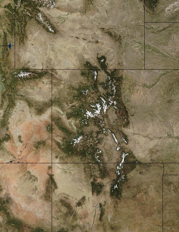
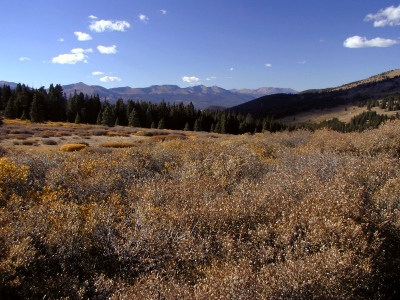
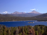
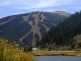
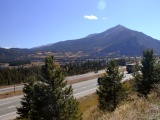
Right: September view of Peak 9, Peak 10 and
Crystal Peak, southern Tenmile Range, as seen from the bike path between
Frisco and Copper Mountain, Colorado
|
 |
Last modified 12/05/03
 Under
construction Under
construction
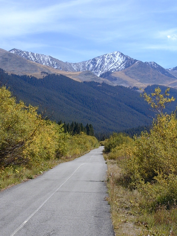
Tenmile Canyon
 |
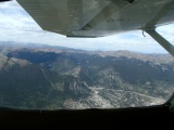
Mouth of Tenmile Canyon at Frisco
|
Tenmile Canyon is an impressive
north northeast-trending fault-controlled gash running nearly 3,000' deep through the
shared Precambrian core of the north-trending Laramide
Gore-Tenmile uplift.
The canyon hosts I-70 between Frisco and Wheeler Junction, where CO91 comes in
at Copper Mountain. Travelers on that stretch of
the interstate can hardly miss it, but only those able to look straight up
through the open top of a convertible can fully appreciate its
spectacular scale.
The faulted west slope of the Tenmile Range forms the canyon's
precipitous east wall;
lower peaks of the southern Gore Range, its less sharply
defined west wall. In the aerial photo at right, the mouth of Tenmile Canyon opens between Royal Mountain (10,501')
on the left and Wichita Mountain (10,855') on the right as seen from the south. The town
just beyond the mouth
is Frisco. Royal Mountain is the closer of the two
guardians of the portal and belongs to the Tenmile Range. Wichita is part of the
Gore Range.
Tenmile Canyon marks the geographic boundary between the Gore Range
on the northwest and the smaller but somewhat higher Tenmile Range on the
southeast. Geologically, both
ranges are carved from the same uplifted Precambrian basement block, but their
post-Laramide tectonic histories differ substantially. The Gore Range is for the
most part a classic Laramide
uplift of faulted
anticline structure (although it too has its complications), while the Tenmile Range is both a Laramide uplift and a
major post-Laramide fault-block mountain of the Basin and
Range Province. The Tenmile Canyon and Range owe much of their grandeur to the
passing of the Rio
Grande Rift at around 20 Ma.
The canyon walls expose 1.7
Ga oceanic metasedimentary and metavolcanic rocks likely of island arc
origin. These rocks occur in a highly deformed but distinct stratigraphy, with
the oldest and deepest rocks exposed at the outlet. In places, the metamorphic banding patterns seen in the west
wall mark relict bedding
planes, as in the road cut at I-70 Milepost 199. Pegmatite veins of
varying
widths cut both walls. Within the canyon, there are no younger rocks to help
date the movement of the canyon fault.
The Tenmile Canyon Fault
A substantial vertical offset between the rocks exposed in its east and west walls
leaves no doubt that Tenmile Canyon follows a fault, but the timing of its
movements remains controversial. Structurally, the 1.7 Ga metasedimentary rocks
of the east wall are much higher than those on the west. Slickensides marking the
variably exposed fault surface can
be seen in the east wall near I-70 Milepost 196. A major canyon fault also
explains the improbable course of Tenmile Creek
across the common Gore-Tenmile Precambrian core.
South of Tenmile Canyon, the steep west slope of the Tenmile Range
is the scarp of the Mosquito Fault, a major
north-striking post-Laramide normal fault
forming the east shoulder of the Rio
Grande Rift. There the Mosquito Fault has accumulated ~30,000' of vertical
movement (down to the west) since early Miocene time, ~20Ma. The resulting
rift graben
(down-dropped fault block) sits between Fremont Pass (CO91, 11,318') and Tennessee
Pass (CO 24, 10,404').
Some investigators consider the fault in Tenmile Canyon a northern extension
of the normal Mosquito Fault with late Tertiary movement. The canyon's trend and
observed vertical offset are both consistent with that theory. Others, however,
consider the canyon fault a Laramide structure. Based on what little information
I can find on the subject, I've adopted the former stance in this article.
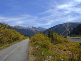
Tenmile Creek
 |
Tenmile Creek near Frisco
|
As it tumbles from headwaters near Climax and
Fremont Pass (11,318') on CO91, Tenmile Creek follows the Mosquito
Fault at least as far as the head of Tenmile
Canyon. It follows a fault through the canyon as well, but the identity of
the canyon fault remains unclear.
In its present form, the
creek hardly looks capable of cutting a defile like Tenmile Canyon. It was no doubt more formidable in the wetter Pliocene
climate and the during the subsequent Pleistocene
glaciations, but it was not likely to have been a major river at any time in
its history. Nor was it likely to have been an antecedent stream across the
common Gore-Tenmile Precambrian core, as the Arkansas was across the southern
Front Range or the Gunnison across the Gunnison Uplift. Tenmile Creek clearly got lots of help from the
canyon fault, which softened up the otherwise highly
resistant Precambrian rock along its course.
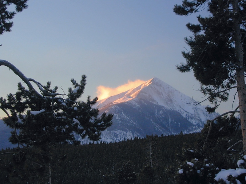
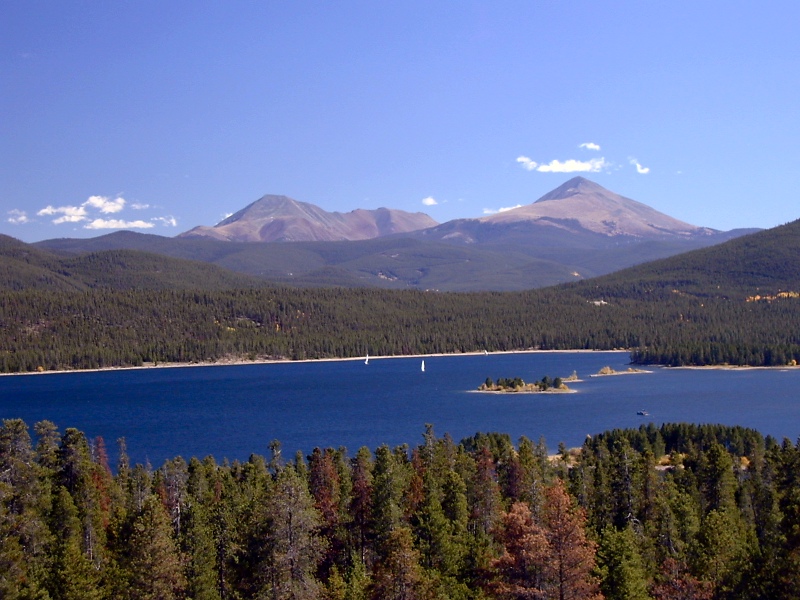
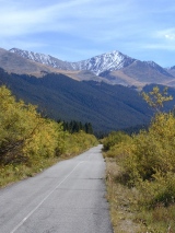
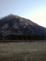
Tenmile Range
 |
Tenmile Range from Boreas Pass
|
The Precambrian core of the Tenmile Range is continuous across Tenmile Canyon
with the core of the southern Gore Range, but Tenmile isn't just another Laramide
faulted anticline. It no doubt rose in Laramide time, but it probably rose
more, via normal faulting and mantle-related uplift, with the east shoulder of the Rio
Grande Rift in late Tertiary time, more than 20 Ma after the main pulse of
Laramide deformation had ended. The Mosquito Fault
separating it from the sedimentary strata of the Late Paleozoic Minturn
and Maroon Formations along its west
flank is not a Laramide
thrust or reverse fault, but a post-Laramide
normal fault with ~30,000' of vertical movement to its credit. On the east
flank of the Tenmile Range, gently folded and tilted Cambrian through Cretaceous
sedimentary strata rest unconformably on the Tenmile Precambrian core. Their structural relationships to the core and to one another
remain
uncertain, but these densely intruded sediments played a pivotal role in the mining history of the
Tenmile Range.
 |
Peak 1, Tenmile Range, from Buffalo Mountain
|
Geographically, the Tenmile Range sports ten peaks named, from north to
south, Peak 1 (right) through Peak 10. The prosaic names notwithstanding, all ten are
worthy summits above 12,600'. Paramount Studios could easily have modeled their
famous logo after Peak 1 (12,805'), a near-perfect pyramid in shape—especially
when viewed as at right from nearby Buffalo Mountain.
The
highest peak at the north end of the range corresponds to Peak 2 but more often goes by the
name Tenmile Peak (12,933'). The east
slope of Peak 8 (12,987') is home to Breckenridge, a rich 1860s mining camp turned
rich ski resort.
At the range's higher south end, just south of Peak 10 (13,633'), are several Fourteeners clustered along
the Continental Divide, which arbitrarily separates the southern Tenmile Range from the
northern Mosquito Range. Among these giants are Quandary Peak (14,265'), the only
Tenmile Fourteener, and Mt. Lincoln (14,286') on the Mosquito side.
Location, Location, Location
As already noted, the Tenmile Range stands high on the east shoulder of the Rio
Grande Rift (RGR). No less significantly, it also stands directly astride
the Colorado
Mineral Belt (CMB). This position near the intersection of the RGR and CMB—by
far Colorado's two most important structural and magmatic trends—left the
Tenmile Range a sitting duck for intrusive
attack from below. In the latest Cretaceous and early Tertiary, it drew Laramide
intrusions in prodigious volume and
took several notable mid-Tertiary hits as well, the latter probably related to active rifting
along the RGR. Vein filling and contact metamorphism attending the
numerous intrusions brought great mineral wealth to the entire area,
particularly in the heavily intruded sedimentary cover of the southeast flank. In the
years following 1859, mining districts like Breckenridge, Climax, Fairplay and
Frisco quickly sprang up along the flanks of the Tenmile Range to harvest its
bounty of gold, silver, copper, lead, zinc and molybdenum. (By weight, most of
pay came in
the form of placer gold and molybdenum ore.) The Gore Range
was too far off both the CMB and the RGR to get in on much of this action.
 |
|
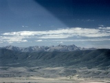
Tenmile summits (above) show less rugged glacial topography than Gore
summits (below).
|
In Pliocene and Pleistocene time,
the Tenmile Range saw substantially less glaciation than the
Gore Range
(right) and now has a
much less craggy look to show for it. Whether it stood lower than the Gore then,
or stood off the prevailing easterly storm tracks of the time, or received more
shielding from higher peaks to the east, is unclear, but to this day, the
resulting topographic difference is striking, especially from the air.
Otherwise, the higher reaches of the Tenmile and Gore Ranges are physically
similar, having been exhumed from
similar Precambrian rock.
For better or for worse, its
location at the intersection of the CMB and the RGR
and its smoother topography destined the Tenmile Range to attract much more mining,
residential, resort and recreational development than the Gore Range,
much of which remains designated wilderness to this day.
Royal Mountain Remembrance
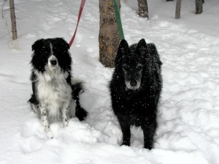 |
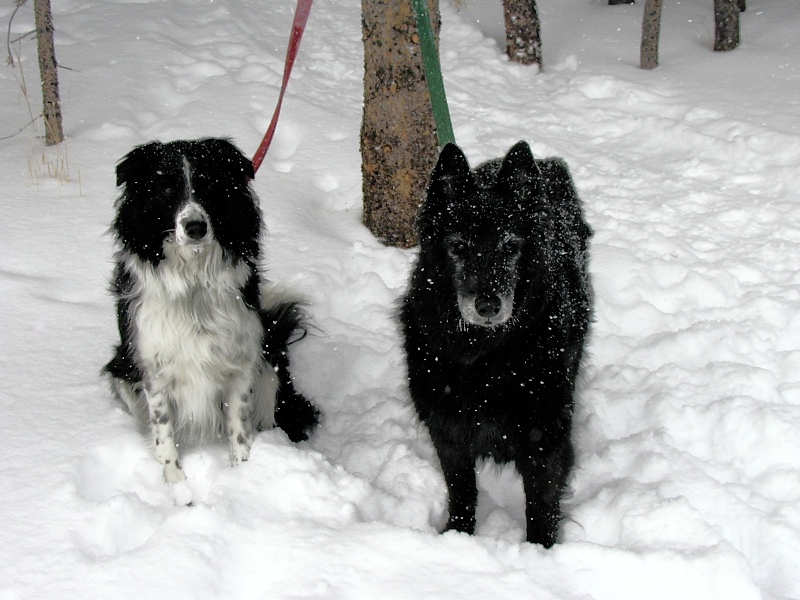
Megan and Orca (left)
|
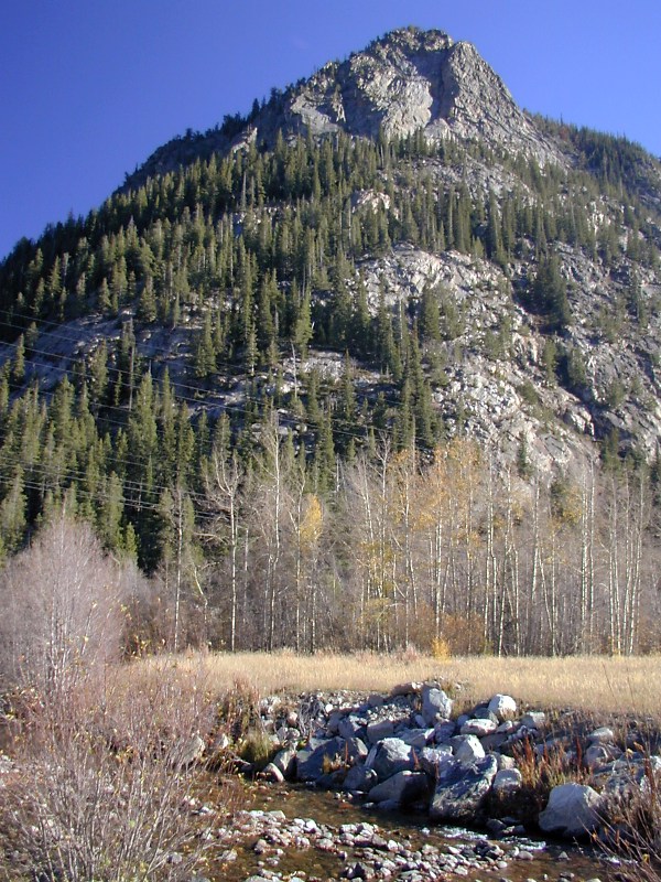
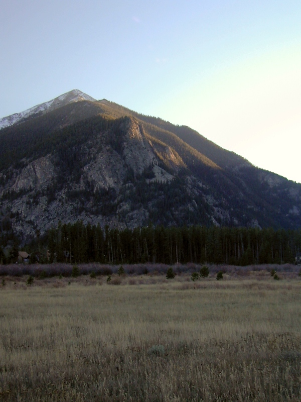
Royal Mountain (10,501') is a very steep but rewarding 1,500' climb from Frisco
en route to
Peak 1. This crag is a dramatic outcrop of the same 1.7 Ga horneblende gneiss
of metasedimentary and metavolcanic origin that makes up
much of the east wall
of Tenmile Canyon.
The 1.5 mile trail to the top climbs nearly 1,000' in the last half mile.
When I first hiked it in a light snowfall one February morning in 2002, the temperature
was around 15°F. The dogs ran
circles around me up and down the trail while I took the steep section one step at a
time, huffing all the way. I had on 4 layers of high-tech
outerwear; they were in the same coats they wear in the condo. I had on fancy
Sorel boots over wool and polypro socks; they were in their bare feet. Never
once did I see either of them slow down to catch their breath or shiver at the
cold.
Our Belgian sheepdog
Orca (on the right) was 14 years old at the time. She died of old age a
year later. We miss her big black and white smile. Imagine the evolutionary engineering behind a creature as hardy and versatile
and noble and loving as a dog.
An Untidy Divide
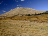 |
Boreas Mountain from Boreas Pass
|
 |
Prominent Thirteeners Mt. Guyot and Mt. Baldy mark the untidy divide
|

|
Looking southeast from Boreas Pass into South Park.
|
For no obvious reason, the Continental Divide in central Colorado jumps west from the central Front
Range to the northern Mosquito Range along a very high and rather peculiar
southwest-trending ridge that precisely follows the Colorado
Mineral Belt (CMB). The same ridge also happens to form the northwest wall of
South Park.
Laramide intrusions and
adjacent altered Cambrian to Cretaceous sedimentary strata overlying the east flank of
the southern Tenmile Range make up much of the ridge, with lesser outcrops of
crystalline Precambrian rock. Boreas Mountain (13,082', top right) is part of a
very large Laramide intrusion
straddling this portion of the divide. Also on the divide here are Mt. Guyot
(13,370') and Mt. Baldy (13,684'), both prominent Summit County landmarks. Where
the ridge joins the Front Range, we have a cluster of Fourteeners, including
Torreys Peak (14,267), Grays Peak (14,270'), Mt.
Evans (14,264') and Mt. Bierstadt (14,060'). Where it meets the southern
Tenmile and northern Mosquito Ranges, we have another tight cluster of
Fourteeners, including Quandary Peak (14,265'), Mt. Lincoln (14,286') and Mt.
Cameron (14,238') among others.
Something Big
Something big's clearly happening here, but why this ridge stands so high remains
unclear, at least to me. Structurally, it's not part
of any Laramide uplift, and
it's east of the main uplifts associated with the Rio
Grande Rift (RGR). The CMB's clearly implicated, but how? CMB-related
intrusions have added significantly to the volume of the upper crust along the
ridge. Geophysical methods show that unusually hot upper mantle still underlies the CMB, and
large magma bodies
related to Laramide and post-Laramide CMB intrusions may well still reside in the
lower crust here. These hot materials may buoy
up the ridge. Alternatively, the rocks that make up the ridge may be
particularly resistant, perhaps due at least in part to contact metamorphism. Of course, these
factors
may well be acting in concert, and others may also play a role in
this spectacular if untidy piece of Rocky Mountain topography.
Tenmile Gallery
|
Tenmile Canyon
|
 |
North
end of Tenmile Canyon: The 1st frame is an aerial view looking north
toward Frisco and the mouth of Tenmile Canyon between Royal Mountain
(10,501', left) and
Wichita Mountain (10,855', right). From Frisco, the canyon runs south
southwest to Wheeler Junction and Copper Mountain—hence the talk
of east and west walls. The 2nd frame shows the sheer east wall of the canyon at its mouth.
This wall is in fact the scarp of the canyon
fault responsible for the canyon's location. Here at the outlet, the east wall rises about 1,400' above the canyon
floor, but further south, the relief reaches almost 3,000'.
The 3rd frame shows the canyon's east wall en face in fall color from the frontage road at Officer's Gulch.
The 1.7
Ga oceanic metasedimentary and metavolcanic rocks rocks exposed here are
structurally higher than those across the canyon.
|
 |
 |
|
 |
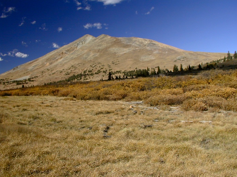
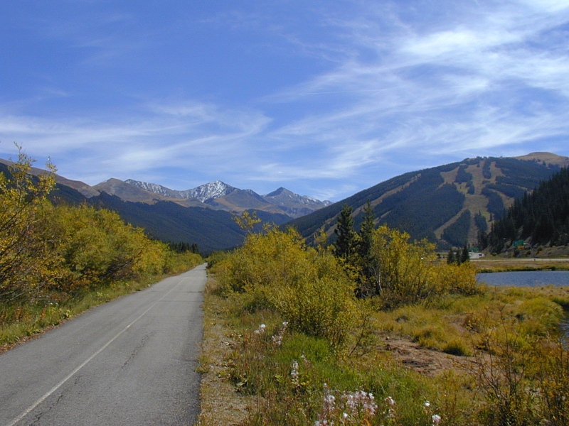
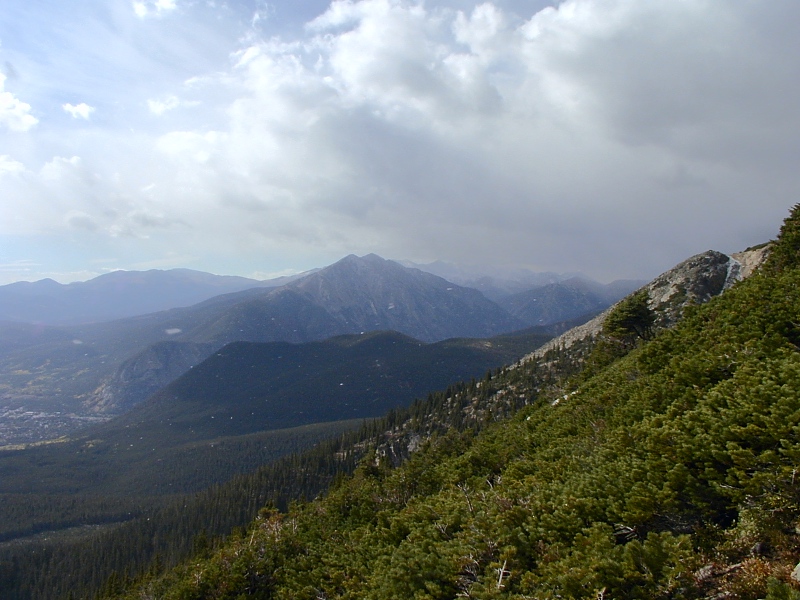
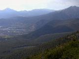
South end of Tenmile Canyon: Peak 9 (13,795'), Peak 10 (13,633') and Crystal Peak (13,852')
of the
southern Tenmile Range ring a large cirque
on the distant skyline to the south over the paved
Summit County Recreation
Trail connecting Frisco and the Copper Mountain (12,441') ski
resort (domal peak on the right, 1st frame). From
here, the path and I-70 both lead northwest to Vail Pass (10,666'). North-flowing Tenmile Creek enters the deepest part of the canyon
just north of here. There's been no glaciation within the depths of
the canyon, but the big cirque on Crystal Peak proves that glaciers and
glacial outwash were close at hand in the Pleistocene.
|
 |
 |
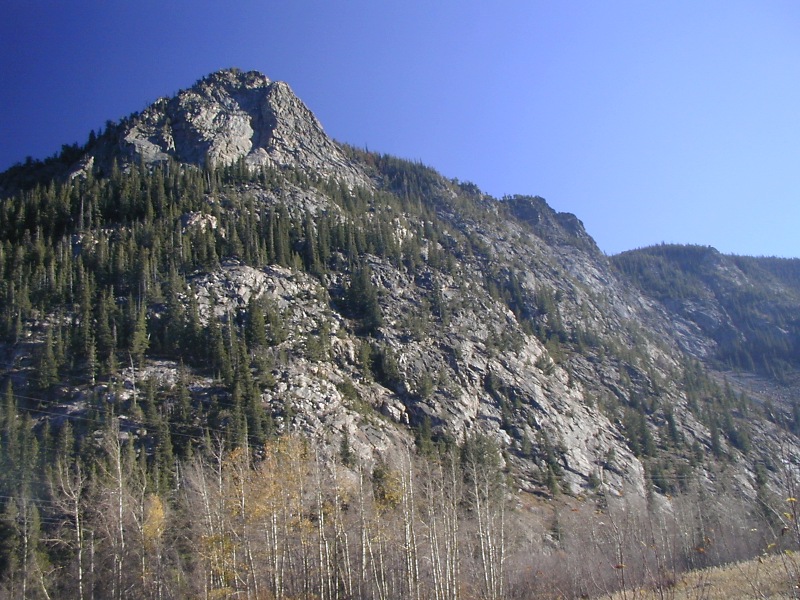
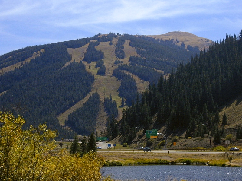
Copper
Mountain: Copper Mountain sits at the south end of the canyon.
Its ski slopes run down the
southernmost tip of the geographic Gore Range,
which continues west as far as Vail. The Precambrian core of the Gore Range continues south through the
Tenmile
Range across the canyon. |
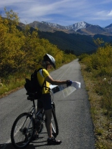 |
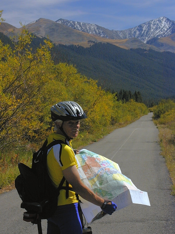
Map check:
John Barr stops to
consult our well-worn copy of the Colorado
Geologic Highway Map—a must for anyone interested in the
rocks behind and beneath Colorado's incomparable scenery.
Much can be learned from careful study of this map alone, but
the excellent Roadside
Geology of Colorado is an excellent companion reference,
particularly the updated 2002 2nd edition. Andrew Taylor's Guide to the Geology of
Colorado is another invaluable tool featuring annotated outcrop
photographs to simplify field identifications.
|
 |
 |
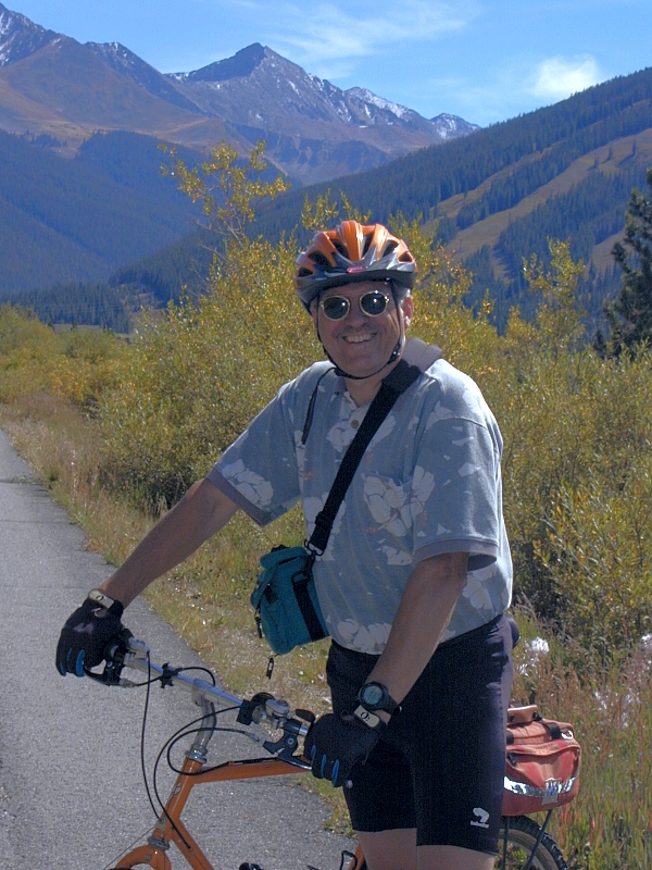
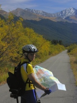
Optical
illusion: The long, smooth downhill ride
from Copper Mountain back to Frisco was a
blast; hence the grin on my face. In that direction, there could be no
mistake—the path had a substantial grade. On the way up, however, the bike path looked like a gentle grade
even though it felt like the huff that it truly was. One particularly deceiving
uphill stretch along a lake
actually looked like a downhill but proved to be a fast downhill coast on the way
back down. Next
time, I'll believe my quads, not my eyes.
|
Northern Tenmile Range
|
|
Tenmile Range
from Boreas Pass: The 1st frame, a northwest view from Boreas Pass
(11,481'), lays out most of the length of the Tenmile
Range. Peaks 1-9
are seen here from right to left. Compared to the Gore Range (2nd
frame), the rounded summits of the Tenmile Range show only mild glacial
sculpting.
|
|
 |
Peak
1: Always striking, Peak 1 (12,805') of the northern Tenmile
Range is particularly beautiful in morning light, as seen here from
the base of Buffalo Mountain above Silverthorne. This view of Peak 1
from the deck of our little Silverthorne condo was my No. 1 reason for
buying there, and I have yet to tire of it.
The 2nd frame shows Peak 1, Tenmile Peak (12,933') and a portion of the northern
Tenmile Range, here looking south from the southeast face of Buffalo
Mountain.
Taken from the scenic overlook on westbound I-70 between Silverthorne
and Frisco (Exits 205 and 203), the 3rd frame looks southwest at Peak 1
and Tenmile Peak, the latter barely visible to the left of Peak 1's summit. Fall
colors brighten the lower slopes south of Frisco (right center), which nestles up
against the mountain front beneath the rocky face of Royal
Mountain at right center.
|
 |
 |
|
Royal
Mountain: The 1st frame is an aerial view looking north
toward the mouth of Tenmile Canyon between Royal Mountain (10,501') and
Wichita Mountain (10,855'). Royal Mountain is the closer of the two. Now
a resort community and commercial center of sorts, the old mining and
smelting town of Frisco stands in the foreground.
In the 2nd frame, taken from the southeast face of nearby Buffalo
Mountain (12,777'), we see Frisco and Royal Mountain from the north.
Wichita Mountain is hidden from view here.
Above and to its right are Peak 1 (12,805') and
Tenmile
Peak (12,933') of the Tenmile Range.
Royal Mountain sits at the north end of Tenmile
Canyon, which continues out of sight to the right in this
view.
The 3rd frame shows Royal Mountain from the bank of Tenmile Creek at
the west end of Frisco, CO. In the 4th frame, also taken from Frisco,
Royal Mountain stands at the near end of the tall, steep scarp of the canyon
fault.
The 5th frame, taken from the frontage road along Dillon Reservoir,
shows Royal Mountain in proper pecking order in last light. Snow-dusted,
triangular Peak 1 stands at skyline above it. The
forested summit along the ridge between Royal Mountain and Peak 1 is Mt.
Victoria (11,785'), known for its stunning Summit County views.
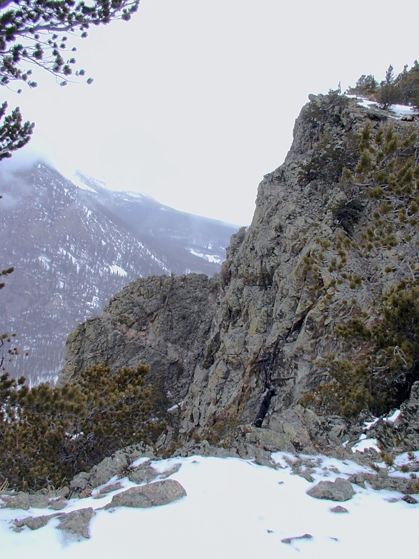
In the 6th frame, the craggy metavolcanic hornblende
gneiss atop Royal Mountain affords a
dizzying perch overlooking the southern end of the Gore
Range, the north end of Tenmile Canyon
The 7th frame shows I-70 with ant-size toy cars whizzing by 1,400'
below.
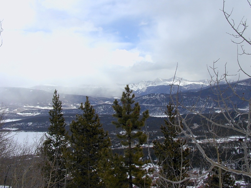
The trail up to Royal Mountain affords many fine views of the
Continental Divide to the east and southeast. In the 8th frame, the
divide to the east is partially enshrouded by an incoming
winter storm front.
|
 |
|
|
 |
 |
 |
 |
References
In addition to the references cited on the home
page and in the supporting articles, this
article relies on the following sources, in alphabetical order by first author:
URL: http://www.cliffshade.com/colorado/tenmile.htm
|