|
| |
Photojournal
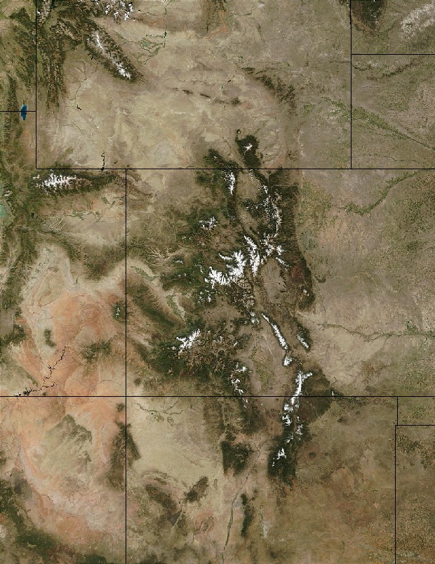
The Gore Range, the Lower Blue River Valley and the Williams Fork Mountains
More Complicated Than They Look
|
 |
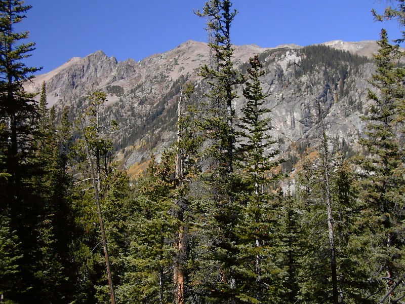
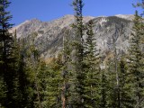
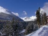
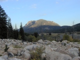
Southern Gore Range, looking west
|
Last modified 11/22/03
Faults and Glaciers
The first day hike of our September, 2002 Colorado geology road trip aimed
for the summit of Buffalo Mountain, a distinctive 12,777' granite dome at the
southern end of the Gore Range. Buffalo is a widely
visible and easily recognized central Colorado landmark that looms over Dillon Basin, the hub of
human presence in
Summit County. We were hoping for panoramic views of the central Colorado Rockies from
Buffalo's summit, but an early fall snowstorm forced us off the mountain just short of
our goal.
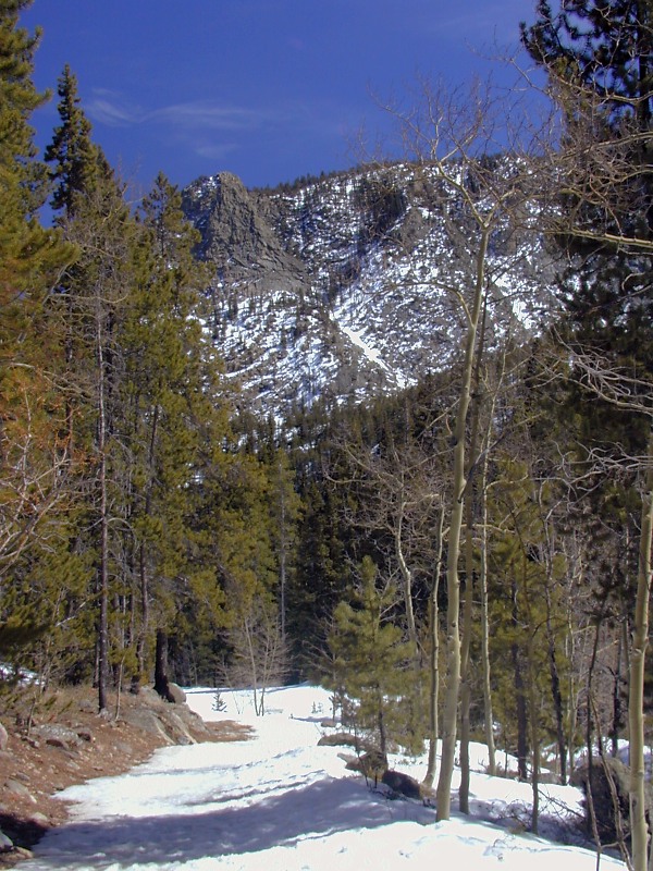
A month before, I'd visited Lower Cataract Lake, a postcard hike at the foot
of the east side of the northern Gore Range a few miles off CO9 south of Kremmling. Between Upper and Lower Cataract Lakes, both of glacial origin,
Cataract Creek takes an impressive 900' plunge over a steep wall of Precambrian
rock.
Across the lower Blue River Valley from both Buffalo Mountain
and Lower Cataract Lake are good views of the Williams
Fork Thrust, the fault that bounds the Laramide
Front Range uplift on the west. This nearly horizontal thrust carried the
Precambrian core of the Front Range at least 10 km west over Late Cretaceous Pierre
shale.
The Gore Range
 |
East side of the northern Gore Range
|
Geologically speaking, the Park, Gore, Tenmile and northern Mosquito Ranges
are all cut from a single south-trending Laramide
basement uplift running down the
center of the Rockies from the Wyoming border roughly to Leadville. Topographic
features of fairly recent origin demarcate the individual ranges.
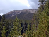
Fault-controlled Late Tertiary Tenmile Canyon
separates the Gore Range from the Tenmile
Range and northern Mosquito Ranges on the south, with the Continental Divide
arbitrarily separating the Tenmile and Mosquito. At the north end west of
Kremmling, Gore Canyon, a deep and narrow antecedent
canyon of the Colorado River, separates the Gore and Park ranges.
Structurally speaking, major faults define the east and west sides of the
Gore Range.
The Blue River Frontal Fault
The steep east flank of the Gore Range is largely the scarp of the Blue River
Frontal fault, a major Late Tertiary normal fault with several thousand
meters of down-to-the-east movement last active in the Pliocene. As the Gore
Range rose along this fault, the adjacent west edge of the lower
Blue River Valley block dropped down to form a half-graben (an
elongated fault-bounded block dropped down on one side only).
 |
Glacial South Willow Creek Canyon, east side of the southern Gore Range
|
Thanks to a steep slope, a high crest and prevailing easterly winds, the rugged east
side saw unusually heavy glaciation
during Pliocene and Pleistocene
times. Lofty knife-edge arêtes separating deep, steep-walled cirques, large
U-shaped hanging valleys like South Willow Creek Canyon at right, and massive
moraines are glacial legacies easily seen from CO9 as one drives the lower
Blue River Valley between Silverthorne and Kremmling.
The Gore Fault
The less abrupt west slope of the Gore uplift is defined by the Gore fault,
which separates the Precambrian core of the Gore Range from Late Paleozoic Maroon
Basin sediments to the west. The Gore fault was probably last active in Laramide
time, when the Gore Range block was likely thrust up and to the west. It was
clearly functioned as a high-angle reverse fault during the Pennsylvanian uplift
of the Ancestral Rocky Mountains and may
participated in Precambrian deformations as well. Faults with many lives are not
uncommon in the Rocky Mountain region.
 |
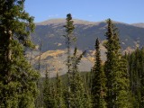
North Tenmile Canyon, southern Gore Range
|
Gore Range Highlights
The Gore Range hosts
many spectacular alpine summits over 12,000' but no Fourteeners. Mt.
Powell (13,575') is its highest peak. The
bold and widely-visible granite dome of Buffalo Mountain
west of Silverthorne sits near its southern tip on the east side. Much of the Gore Range falls under the protection of the Eagle's Nest
Wilderness (named after Eagle's Nest, 13,901'), but its spectacular hiking
remains easily accessible from population centers like
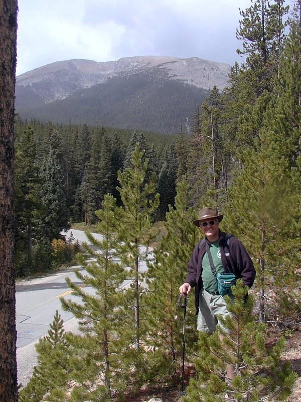
Silverthorne, Frisco and Vail. Worthwhile Gore destinations include Buffalo
Mountain, South Willow Creek Canyon, Lower Cataract Lake
and North Tenmile Canyon (right). The southern end of the west slope is home to Vail, the
town and vaunted ski resort.
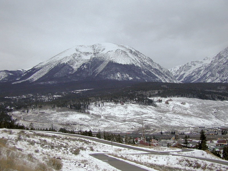
The Lower Blue River Valley
The lower section of the Blue River Valley (LBRV), between the Gore and Front
Ranges, is a structural rather than an erosional feature borne of Late Tertiary
normal displacement along the Blue River Frontal fault.
Technically, the LBRV is a half-graben, an elongated fault-bounded block
dropped down on one side only relative to surrounding blocks. In the case of the
LBRV, the west side went down relative to the flanking Gore and Williams Fork
Ranges while the east side stayed put.
Even though it's now well over 8,000' in elevation, the LBRV never hosted a significant valley glacier. Some of the larger valley
glaciers flowing east out of the Gore Range nosed into it from time to time, but they
neither widened nor deepened it. The Blue River uses the 5-9 km wide LBRV
half-graben as a convenient route north from the Continental Divide to the
Colorado River; it's done little to remodel the valley filling during its
residence.
 |
Apron of glacial deposits ringing the base of Buffalo Mountain's
granite dome
|
The Gore Range forms the valley's rugged west wall;
a thick apron of confluent glacial deposits (right) shed east from the Gore crest
blankets its base. The Williams Fork Mountains of
the Front Range form the east wall. Late Cretaceous Pierre
shale floors the LBRV and runs a variable distance up its unstable east wall
as well. Landslides in the Pierre shale and in the highly-fractured Precambrian
rock overlying it above the Williams Fork Thrust present
ongoing hazards. Landslide deposits and gullied cliffs of soft black Pierre
shale alternate along the base of the east wall.
The impermeable Pierre shale inhibits deep-rooted plants and trees on the
flat valley floor, but scrub oak and lush grass flourish there with the help of
abundant Blue River water. The LBRV has long been one of the premier cattle
ranching localities in the Rockies. With its many working ranches and its
imposing walls, the picturesque lower Blue River Valley still delivers a heady
dose of Western romance, but in recent years, the valley's come under increasing
attack by developers. If you haven't driven the valley along CO9, I suggest you
do it soon.
Rio Grande Rift Involvement
The Blue River Frontal fault and the lower
Blue River Valley half-graben are Late Tertiary extensional structures
superimposed on older Laramide structures. The tell of ongoing regional uplift
and extension along a north-trending broad welt centered just west of the
Park-Gore-Tenmile-Mosquito Laramide uplift. In fact, they are currently the northernmost geologic (as opposed to
geophysical) manifestations of the Rio Grande
Rift, the main trend of which runs west of the
Gore Range into southern Wyoming.
The Williams Fork Mountains and Thrust
The Laramide Williams Fork thrust (WRT) marks the western structural
boundary of the massive Front Range uplift. Just east of Dillon, the WRT runs
near the base of the Williams Fork Mountains, the last major Front Range ridge
to the west. From there north, it gradually ascends the east wall of the lower
Blue River Valley toward the Williams Fork crest, but its trace is largely
hidden by trees and colluvium. The WRT is well exposed in a side canyon along
I-70 just east of Dillon, but access may be tricky.
 |
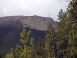
Rounded crest of the Williams Fork Mountains
|
|
|
Craggy crest of the northern Gore Range
|
East-west shortening of the Rockies during the Laramide
Orogeny forced the Precambrian crystalline
core of the Front Range block at least 9 km to the west over Late Cretaceous Pierre
shale along the WRT. The east-dipping WRT is nearly horizontal over the
Pierre shale, but further under the Front Range to the east, it presumably bends
downward into a steeper attitude once it's traversed the Mesozoic sedimentary
cover and has stiff Precambrian basement both above and below. The ~1.7 Ga
gneisses, schists and granites above the horizontal WRT segment are pervasively
fractured, presumably by stresses sustained as they rode up and over the bend in
the fault and sagged onto the Pierre shale.
The intense fracturing left the normally strong crystalline
rocks of the Williams Fork crest weak and unstable. The unusually rounded
topography of the steep-sided crest reflects ongoing gravitational collapse of
the weakened rock above the WRT. (You can make a sugar pile only so pointy.) In
contrast, unfractured but otherwise similar crystalline rock along the Gore
crest is strong enough to support a very sharp glacial topography, as you can
see at right. Yes, the Williams Fork Mountains were probably less glaciated than
the Gores, but that alone doesn't account for the striking difference in
topography.
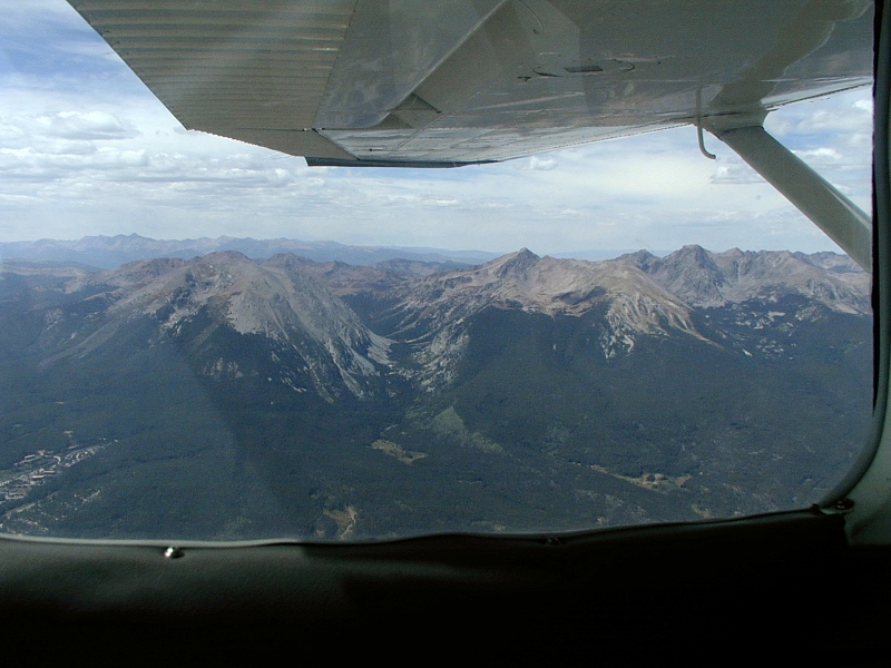
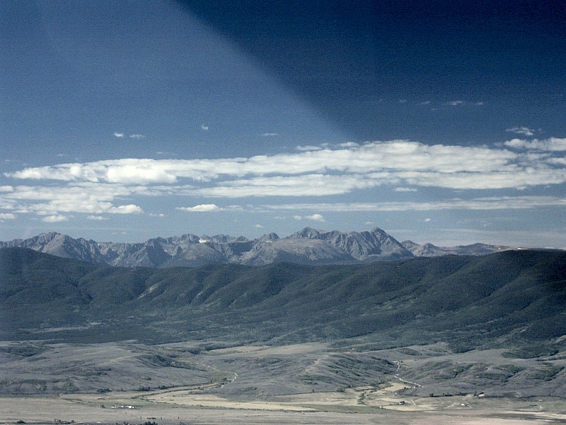
Gore Range Gallery
|
Gore Range
|
|
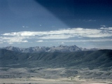
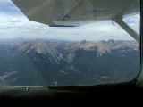
Gore
Range: Glaciers
deeply dissected the rugged Gore Range, an imposing Laramide
uplift rising just west of the Front Range and just north of
I-70. These west-looking aerials from above Silverthorne
(1st frame) and Kremmling (2nd frame) respectively show the southern and
northern ends of the east side of the range, which was steepened by
thousands of meters of normal displacement along the Blue River Frontal
fault during Late Tertiary extension associated with the Rio
Grande Rift.
Buffalo Mountain stands on the left in the
1st frame. The
large, broad U-shaped South Willow Creek Canyon to Buffalo's north (on
its right in the photo) and the sharp "ice cream scoop" topography of the northern
Gores are classic glacial landforms.
The 3rd frame show the steep glacier-carved north wall of South
Willow Creek Canyon from Buffalo Mountain on the south wall.
|
|
 |
Buffalo Mountain
|
 |
Buffalo Mountain:
Buffalo Mountain
(12,777') is a handsome and striking granite dome (not a volcano) at the southeast
corner of
the Gore Range. Buffalo's pink,
coarse-grained 1.7 Ga granites and pegmatites intruded darker 1.7
Ga banded gneiss and schist during the Early Proterozoic Colorado
Orogeny. The summit's reddish brown tinge comes from the granite's
pink feldspar. A gray remnant of the metamorphic host rock forms the rubbly
shoulder on the right limb of the granite summit in the 3rd frame.
Subtle but distinct color variations like these can be very helpful, but
be careful to correlate them with a geologic map before relying on
them—granites are often neutral grays, and metamorphics can contain
pink feldspars, too. The deep glacial
cirque stair-stepping down Buffalo's south face and the broad
gently-sloped morainal deposits ringing its base are reminders of the
heavy glacial erosion the Gore Range sustained in Pleistocene
and Pliocene times. The domal shape, however, relates to exfoliation,
not to glaciation. Domes are common
granitic landforms shaped by a sheet-like delamination
spurred by the pressure release attending overburden removal. Many such
domes dot the eastern parts of ^Rocky Mountain National
Park, but they're less common in Summit County.
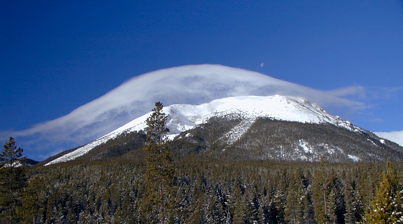
In the
3rd frame, a lenticular cloud and a gibbous moon grace Buffalo's summit,
here seen from Timber Ridge above Silverthorne one cold January morning
in 2001.
Snow highlights the cirque and both avalanche scars in the 4th frame,
taken a month earlier from Dillon Dam. We would climb the smaller avalanche scar
on the right in September, 2002. Buffalo hosted another large avalanche during the heavy
snowfalls of 2003.
The 5th frame shows Red Peak (13,189') over Buffalo's shoulder in a
view to the NW from Timber Ridge at Wildernest in
Silverthorne, CO. Red Peak's sharp, craggy ridgeline is typical of
glaciated Gore Range topography further the north. Buffalo's smooth dome
is an outlier. The aerial photo in the 6th frame shows the deep glacial valley of South Willow Creek separating Buffalo
and Red Peak.
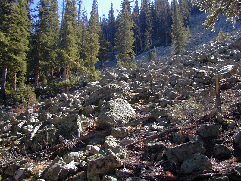
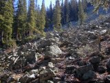
The 7th and last frame shows part of a much larger boulder field, one of many
along the Buffalo's east flank near South Willow Creek Canyon.
I'm betting that these represent rockfalls spalling off Buffalo's
granite dome during exfoliation, but I haven't entirely ruled out a
glacial origin. |
 |
 |
|
|
|
|
|
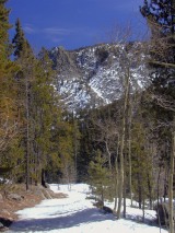
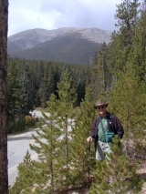
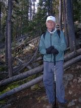
Buffalo Assault, September, 2002
|
 |
Before the cold front hit on this bright, clear
mid-September morning, a
T-shirt was plenty warm enough at 10,000' and 0645 hours. From the Forest Service trailhead at the top of
Ryan Gulch Road in Silverthorne, the Buffalo summit trail climbs an
ever-steeper moraine to reach the base of Buffalo's smaller avalanche scar
east of the cirque.
Many pegmatite and quartz cobbles and boulders litter the trail below the scar. |
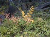 |
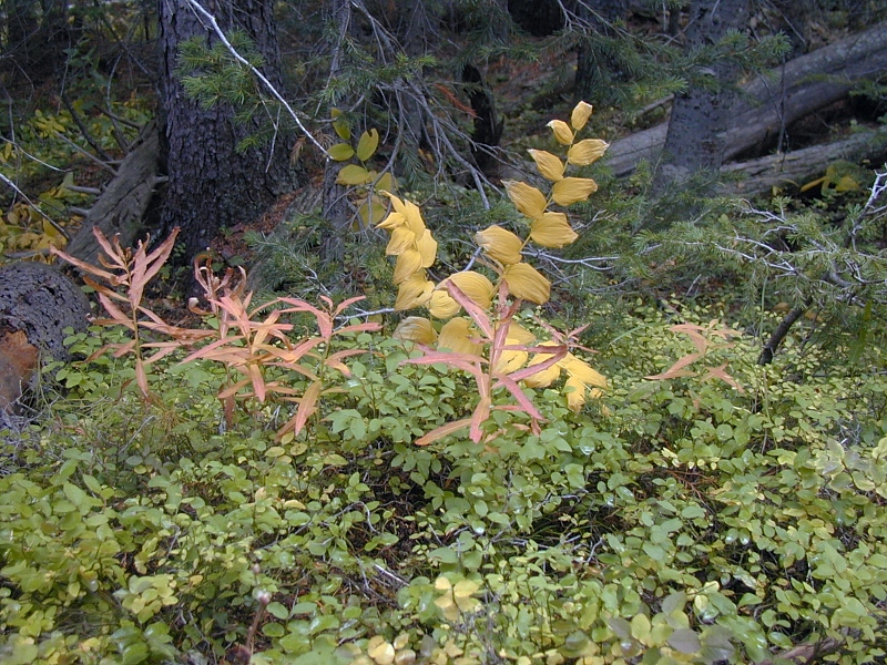
Once above tree line, we could see small
glades of already-yellow aspen dotting the moraines that drape the base
of Buffalo
Mountain, but this little shrub was
the best early fall color we found near the trail. |
 |
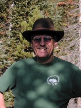
Behind John, a jumble of downed timber
marks the
base of the smaller of Buffalo's south face avalanche scars. The log
mass, the teeth of the avalanche, came to rest near the 10,500' level.
From here, the ill-defined trail to the summit
braids its way up the scar to tree line near 12,000. That's about where we got snowed off the
mountain this time around, but according to
The Summit County Hiker, the path to the summit is an unmarked boulder hop
from there. |
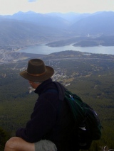 |
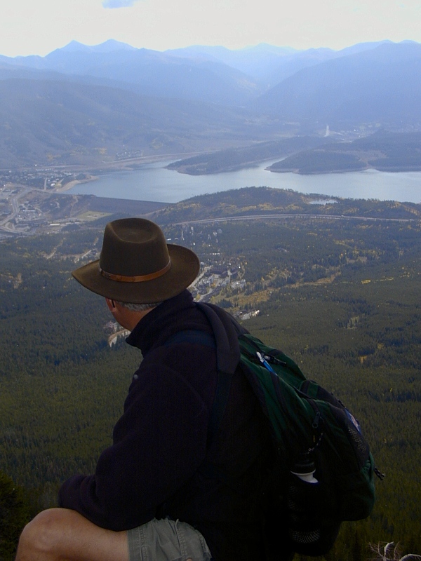
Here I'm looking SE toward the
Continental Divide and Dillon Reservoir from halfway up the avalanche
scar. Colorado's worst drought in over 100 years left the reservoir 60%
below capacity. Lumpy glacial moraines stretch from the foot of Buffalo
to the lake.
Aspens and conifers use very different strategies to survive the
severe mountain environment and to compete for sun and nutrients on the moraines. Aspens are common
post-fire pioneers—hence the sinuous shapes typical of aspen glades.
|
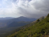 |
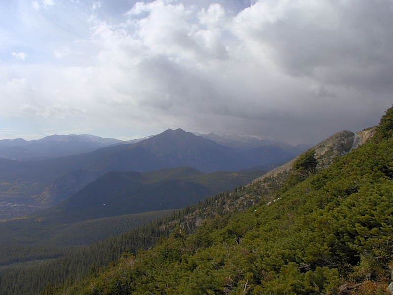
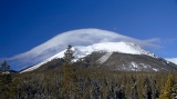
A snap cold front bringing the first snow of the
2002-2003 season noses through Ten
Mile Canyon south of Buffalo Mountain. The temperature and
barometric pressure had already
dropped quite a bit by this time, but the snow was yet to come. |
 |
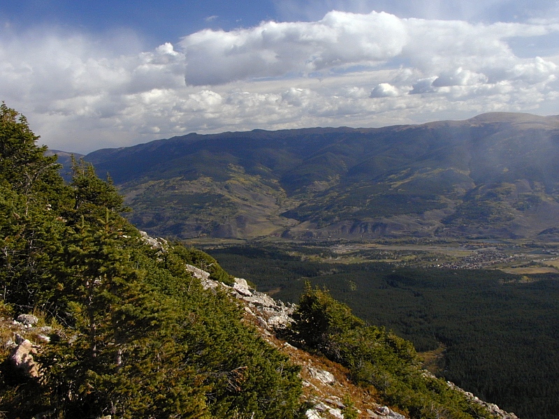
Frisco: To the south, Frisco nestles
against the thoroughly fractured Precambrian hornblende gneiss of Royal Mountain, a
steep 1500' climb from Frisco with rewarding views of Middle Park, the
Continental Divide, the Gore Range, and Tenmile
Canyon. |
 |
Metamorphic
fin: A fin-shaped remnant of rubbly gray country rock (1.7
Ga banded gneiss and schist) clinging to
Buffalo's 1.7 Ga granite dome creates a false summit behind me, but I'm standing
on granite here. Glowering clouds and building fits of snow and wind
turned us back at this point, about 800' vertical feet below the true
summit.
Metamorphic fins like this one are common decorations on the granite
domes of the Front Range. The 3rd frame shows granite dome with several
fins in Horseshoe Park on the east side of ^Rocky
Mountain National Park.
|
 |
 |
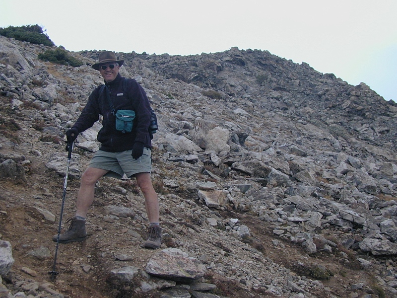
Photo ops galore: When the going gets this steep
(3,000' in 1.8 miles), lots of must-have shots keep popping up magically
along the trail, even on the way down. The weather was still very
unsettled on the mountain, but this welcome snatch of sun felt warm
and reassuring. We even talked about turning around for another whack at
the summit, but things looked a lot less inviting up there. |
 |
Wondering: Second-guessing mountain weather is always
a risky, high-stakes business. Looking back at our unattained goal from Timber Ridge
at the end of the hike, we couldn't help wondering if we should have pushed on to the
top in spite of the weather. The storm clouds had lifted and thinned by
this time, but heavy rains would come at 10,000' shortly thereafter as
we packed for our next stop, Colorado
National Monument. Judging from the snow pack we saw at 12,000' and
up over the next few days, we weren't prepared for amount of snow
Buffalo's summit likely drew that day. I'll settle for alive and
wondering.
We turned back at the top of the shrub line (about 12,000') between the cirque and
the gray fin of 1.7 Ga gneiss and schist clinging to the dome on the
right in the 2nd frame. The 3rd frame show a
granite dome with several such fins on the east side of ^Rocky
Mountain National Park.
|
 |
|
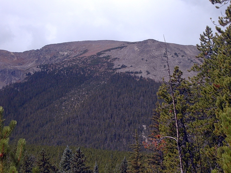
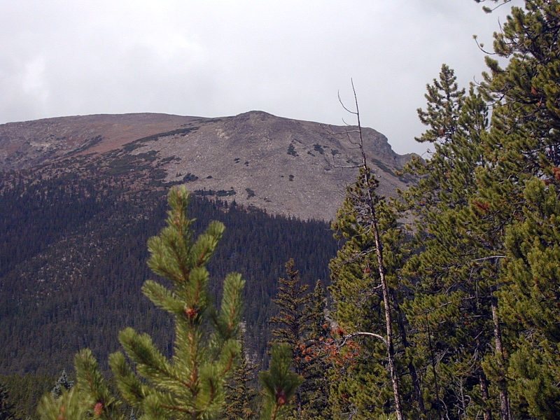
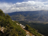
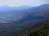
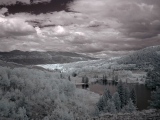
Williams Fork Mountains
|
|
Williams
Fork Mountains: Taken from the the 11,000' level on Buffalo Mountain,
the 1st frame looks to the NE across the lower Blue River Valley
to the Williams Fork Mountains at the western edge of the Front Range uplift.
Severely weakened Precambrian crystalline
rock runs along their lofty but rounded crest, while gullied black
cliffs of soft Late Cretaceous Pierre
shale crop out along their base. Somewhere in between is the largely
obscured Williams Fork thrust, along which the
Precambrian core of the Front Range pushed up and over the Cretaceous
shale during Laramide
contraction of the Rockies. Between Silverthorne and Kremmling,
impermeable shale
floors the lower Blue River Valley half-graben.
The 2nd frame is a closer look at the Williams Fork Crest from a
point lower Buffalo's east slope. Note the rounded topography at the
crest.
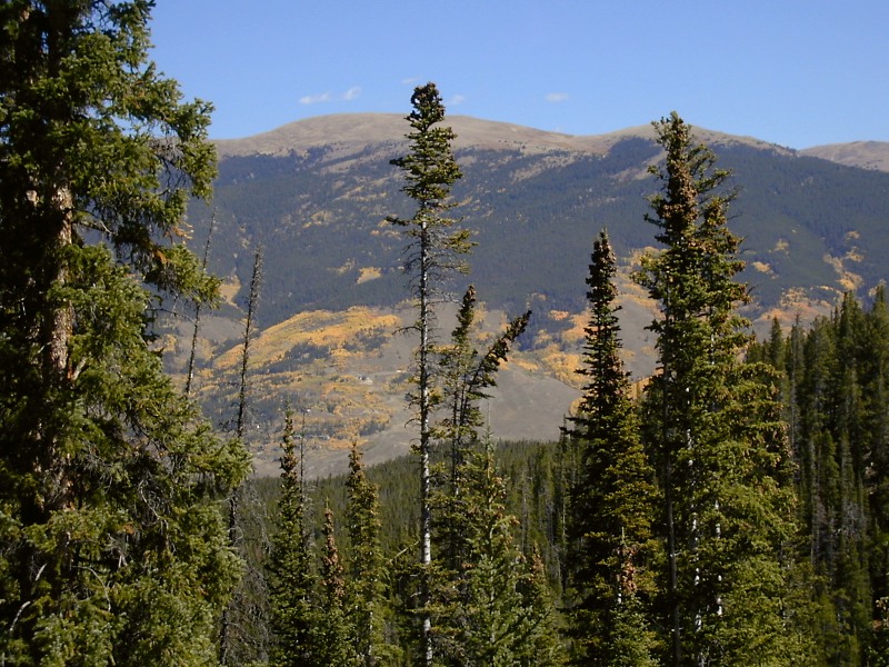
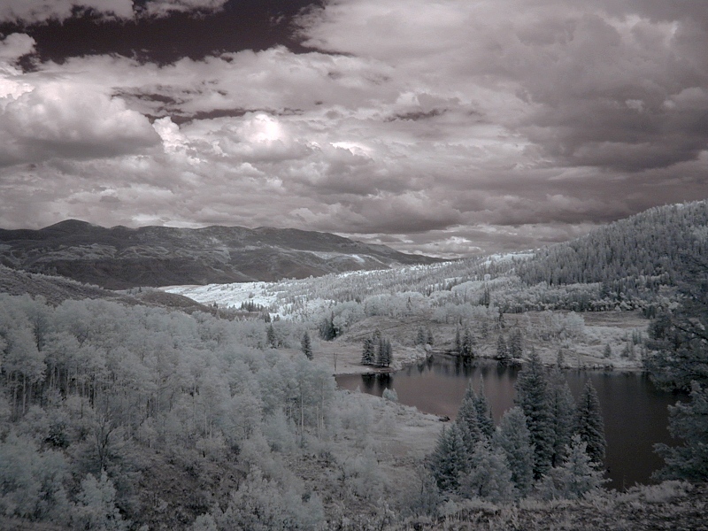
The 3rd and 4th frames view the Williams Fork Mountains from
Lower Cataract Lake on the east slope of the Gore Range ~20 miles north
of Buffalo. At center in the 3rd frame are rumpled Pierre Shale cliffs
somewhere below the Williams Fork thrust. The 4th image is a wider-angle SE-facing ^near infrared view of the
Williams Fork Mountains.
|
 |
 |
 |
Lower Cataract Lake
|
| (Sorry, pictures coming) |
[Cataract Lake photos] |
Gallery Note: Unless noted otherwise below, all the images on this page are from the
summer and fall of 2002.
References
In addition to the references cited on the home
page and in supporting articles, this
article relies on the following sources, in alphabetical order by first author:
URL: http://www.cliffshade.com/colorado/gore/index.htm
|