|
| |
Photojournal
Mount Evans
And Other Giants of the Front Range
|
 |
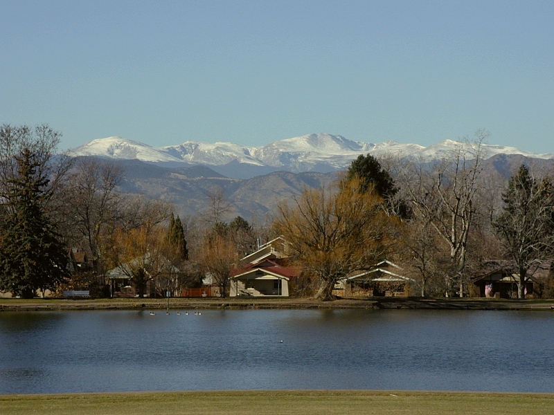
Mount Evans from Denver
|
Last modified 10/17/04
 Under construction Under construction
Towering Above the Mile-High City
 |
Mt. Evans from Denver's Washington Park
|
|
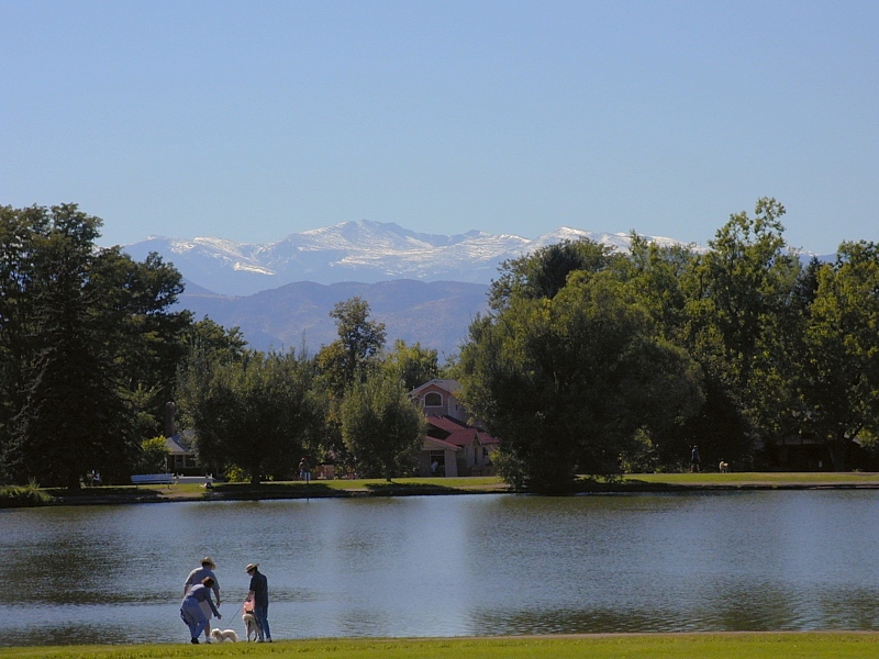
Mount from I-25 south of Arapahoe Road
|
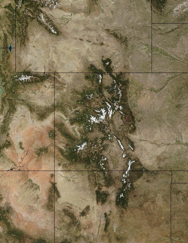
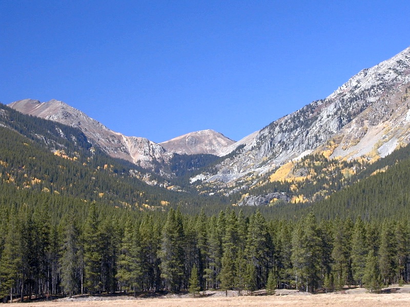
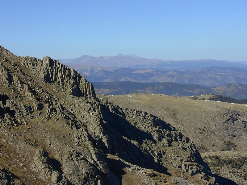
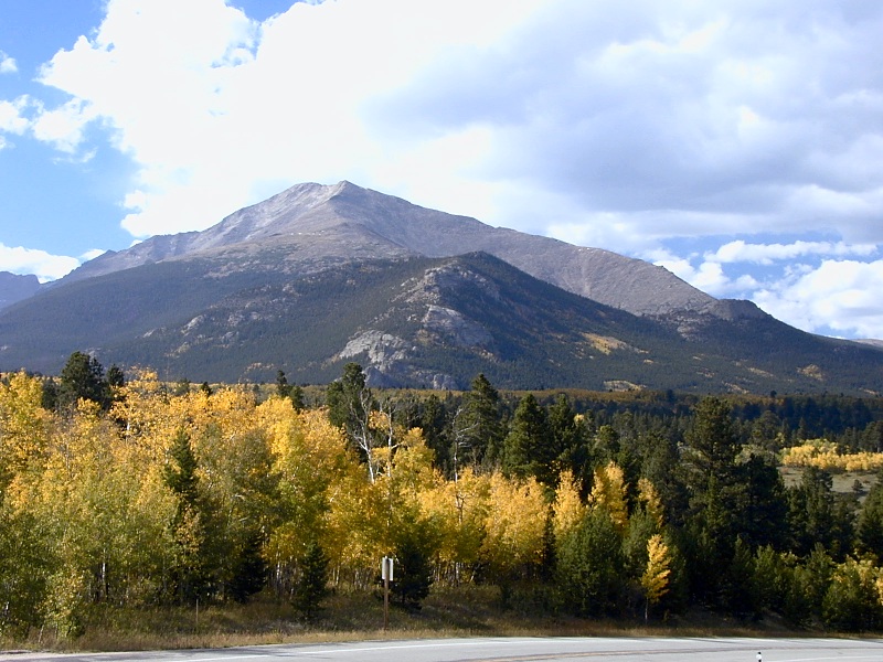
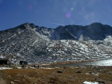
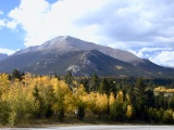
Of Colorado's 55 Fourteeners, Mount Evans (14,264') is the most accessible
and also one of the highest. It dominates the western skyline from nearly
everywhere in Denver. On a good day, you can reach Summit
Lake—a 9,000' elevation gain and a world away—in under an hour from downtown.
In the lower frame at right, the Mount Evans massif towers over, from far to
near, the Rocky Mountain foothills, the Dakota Hogback and the suburbs south of
Denver. Unusually late and wet thunderstorms rolling east over the mountains on
a daily basis kept the summit covered in snow throughout August and September,
as in this September, 2004 photo.
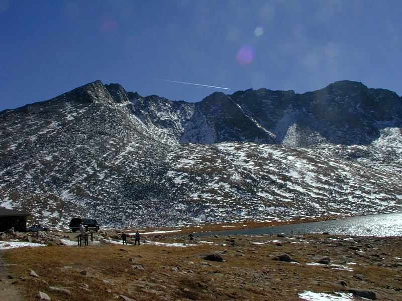
Just above Echo Lake (10,600'), a paved toll road,
the Mount Evans Scenic Byway (CO5), leads to the summit parking lot at 14,130'.
A quarter-mile trail covers the last 134 vertical feet to the summit. The Summit
Lake parking lot at ~12,850' is also a worthy destination if the road beyond
happens to be closed, as it was—by the first snow of the season—when we first visited Mount Evans in September,
2002.
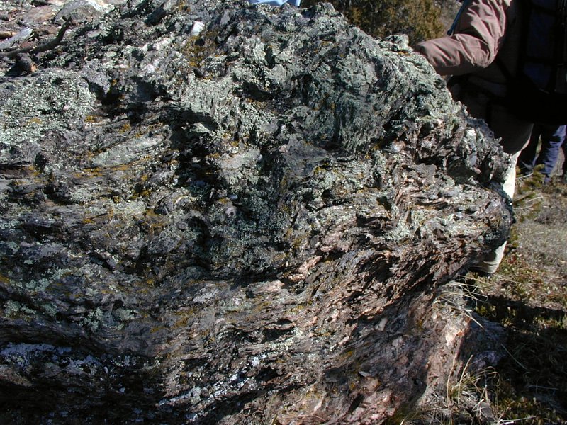
Mount Evans Batholith
 |
Mount Evans summit
|
Mount Evans is roughly equidistant from Longs Peak (14,256') to the north and
Pikes Peak (14,110') to the south. Together with Mount Bierstadt (14,060'), Torreys Peak (14,267') and Grays Peak (14,270'), these three giants dominate the Front Range
crest. Mount Evans sits on the southern margin of the Colorado
Mineral Belt. Pikes Peak and Longs Peak are the only Fourteeners found well
off Colorado's two most profound structural lineaments—the Colorado
Mineral Belt and the Rio Grande Rift.
As you might expect from their elevations, erosion has stripped their
summits of all sedimentary cover to expose
the Precambrian basement rock of
the Front Range uplift. At Mount Evans, the basement is dominated by 1.7 Ga
metasediments and metavolcanics hosting several 1.4 Ga granitic plutons (intruded
magma bodies that never reached the surface) during the Berthoud Orogeny,
all probably under the control of the
ca. 1.7 Ga Idaho Springs-Ralston shear zone. A 1.1 Ga granite
was emplaced during the Grenville
Orogeny some 300 Ma later. In and around the summit of Mount Evans, these intrusions include
-
1.44 Ga Mount Evans batholith*, a large
body of handsome pink, coarse-grained granite at and north of the summit
-
1.44 Ga Rosalie granite, a small pluton at
nearby Rosalie Peak
-
1.42 Ga Silver Plume granite, NW of the summit, all around Georgetown and Silver Plume,
and all through
-
1.09 Ga Pikes Peak granite on the east face,
probably a northern extension of
the Pikes Peak batholith near Colorado Springs
Locally, the Mount Evans batholith is the largest of these granite bodies,
but the massive Pikes Peak batholith dwarfs it in overall size.
* Note: The currently accepted age for the Mount Evans batholith is 1.44 Ga by
U-Pb zircon methods, but some texts, including the 2002 edition of Roadside
Geology of Colorado, still list it as Early Proterozoic (ca. 1.7 Ga).
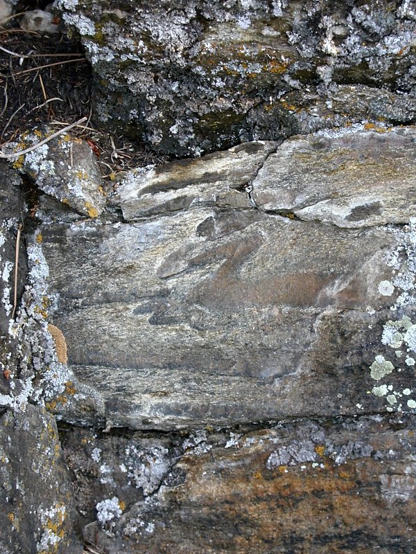
Idaho Springs-Ralston Shear Zone
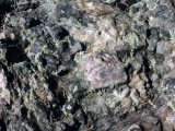 |
1.7 Ga schist
|
The Idaho Springs-Ralston shear zone (ISRSZ) is an broad east
northeast-trending
swath of thoroughly tortured (technically, foliated and mylonitized) Precambrian rock
stretching from Georgetown to the Front Range foothills north of Golden. This
important Colorado Mineral Belt segment is
a long-standing zone of weakness in the Colorado crust dating from the Early
Proterozoic assembly of the Colorado
basement ca. 1.7 Ga. The west end of the shear zone fizzles out in the Mount
Evans batholith in a manner that indicates renewed motion during the
batholith's intrusion at 1.44 Ga. At right is a 1.7 Ga schist derived from
arc-related volcaniclastic sediments
at the east end of the ISRSZ in Golden Gate Canyon State Park.
Nearly 1.4 Ga later, the ISRSZ was still taking hits from below—this time
from Laramide intrusions now exposed
just northeast of Mount Evans. Mineral-rich fluids released by these Early Tertiary
intrusions deposited rich veins of gold, silver, copper, lead and zinc as they
tracked along the myriad fissures and cracks of the shear zone. The discovery of
gold-bearing quartz near Blackhawk in 1859 launched the Central City-Idaho
Springs Mining District into fame. The ISRSZ is also home to the top-producing
Georgetown, Silver Plume and Empire mining districts.
Gallery
|
Mount Evans
|
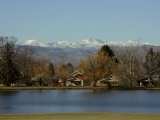 |
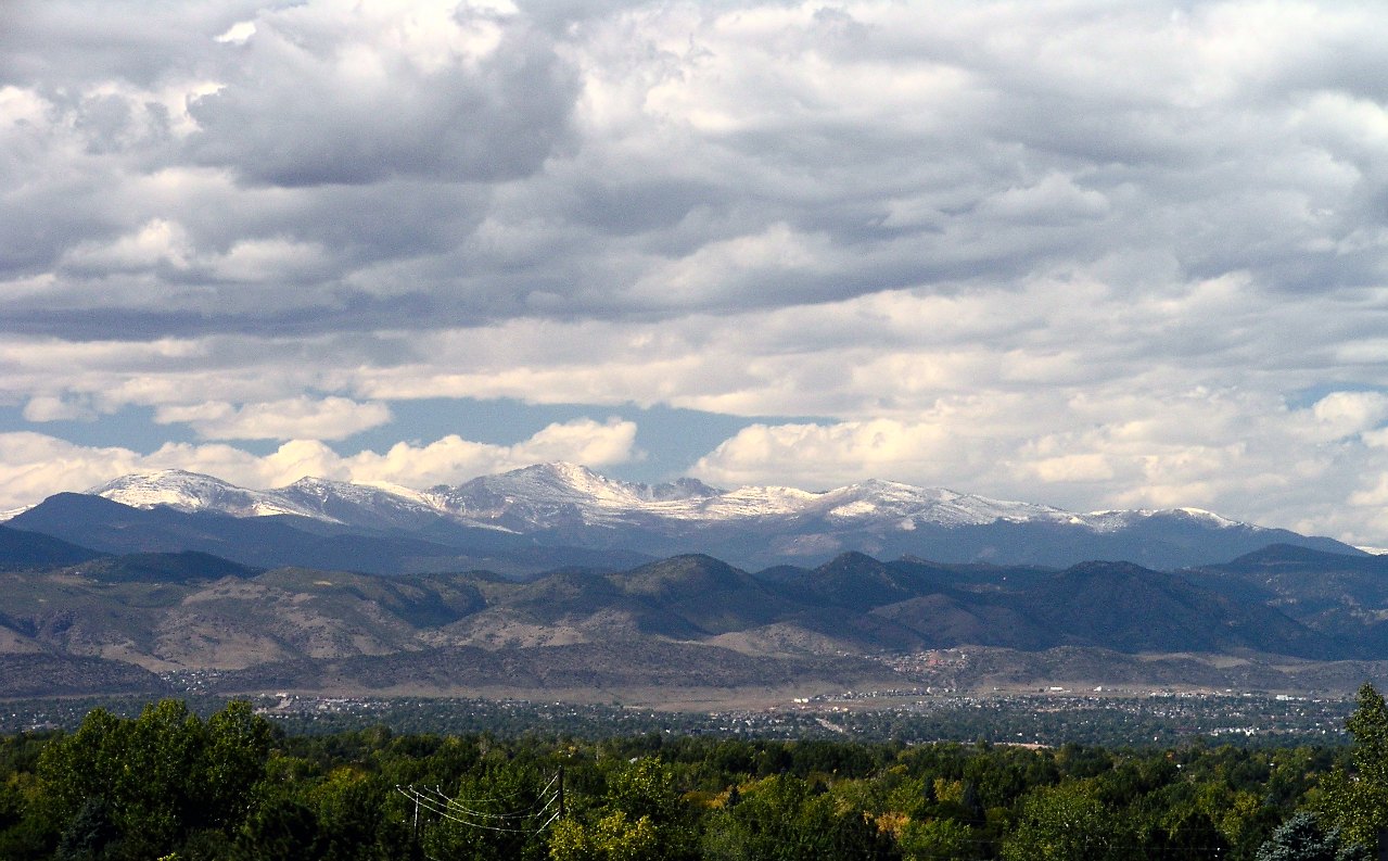
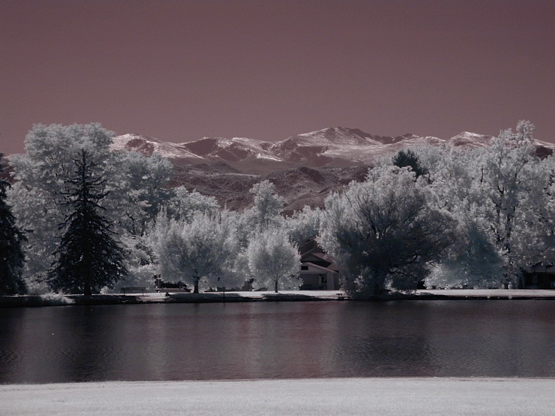
From
Denver: Mount Evans as seen to the east from Wash (Washington) Park in Denver in September,
2001, just after one of the first snows of the season. Summit Lake
cirque can be seen to the right of the highest point, Mount Evan's
summit. Mount Bierstadt (14,060') is on its left.
The 3rd frame is a ^near
infrared (NIR) shot of the same view.
In good weather and average traffic, it takes less than an hour to
get the top of Mount Evans from here. The route gains 9,000' of
elevation in under 40 miles as it climbs first Mount
Vernon Canyon, then Clear Creek Canyon and finally Chicago Creek
Canyon to the summit.
|
|
 |
|
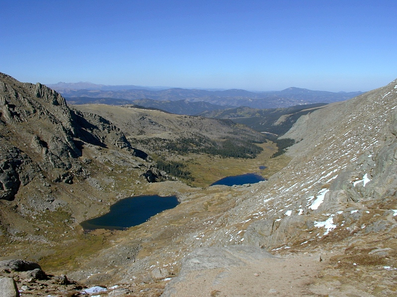
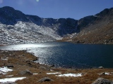
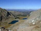
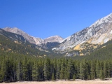
Summit
Lake: The 1st frame looks south at the summit
ridge from Summit Lake (11,830'). At wider angle, the 2nd frame shows
more of the Summit Lake cirque, the one
visible from Denver. Mount Evans (14,256') is on
the left and Mount Spalding (13,842') rises to the right. The permafrost
underlying Summit Lake Flats in the foreground is the only US occurrence
this side of Alaska. The rock at the summit and around the lake is the
handsome pink, coarse-grained 1.44 Ga granite of the Mount Evans
Batholith, which intruded 1.7 Ga metavolcanics and metasediments (not
shown here but found all around the flanks of the mountain) of island
arc provenance during the Berthoud Orogeny. |
 |
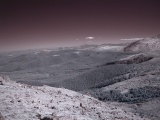 |
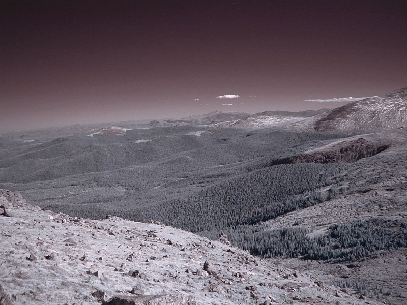
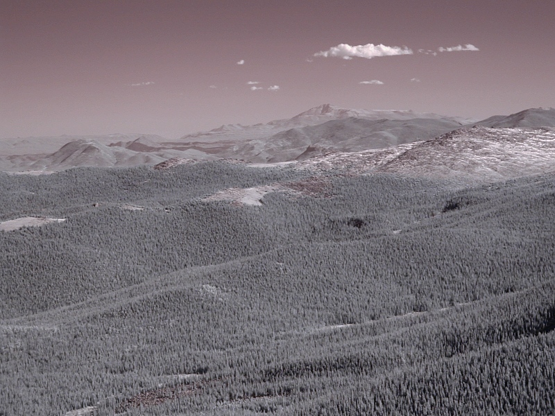
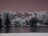
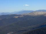
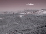
Tertiary
pediment: A wider-angle NIR view to the
south showing more of the Tertiary pediment, an erosional surface dating
from the Eocene and once continuous with the High Plains but now deeply
dissected by east-flowing South Platte tributaries draining the Front
Range. |
 |
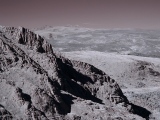
Chicago
Basin: Looking NE from the divide
between the Summit Lake and Chicago Lakes cirques, Chicago Lakes wet the
treads of a classic U-shaped glacial staircase. Chicago Creek drains the
north face of Mount Evans. From I-70, the Mount Evans Scenic Byway (CO5)
follows it most of the way up to the summit. In the distance to the
left is Longs Peak (14,256'). |
 |
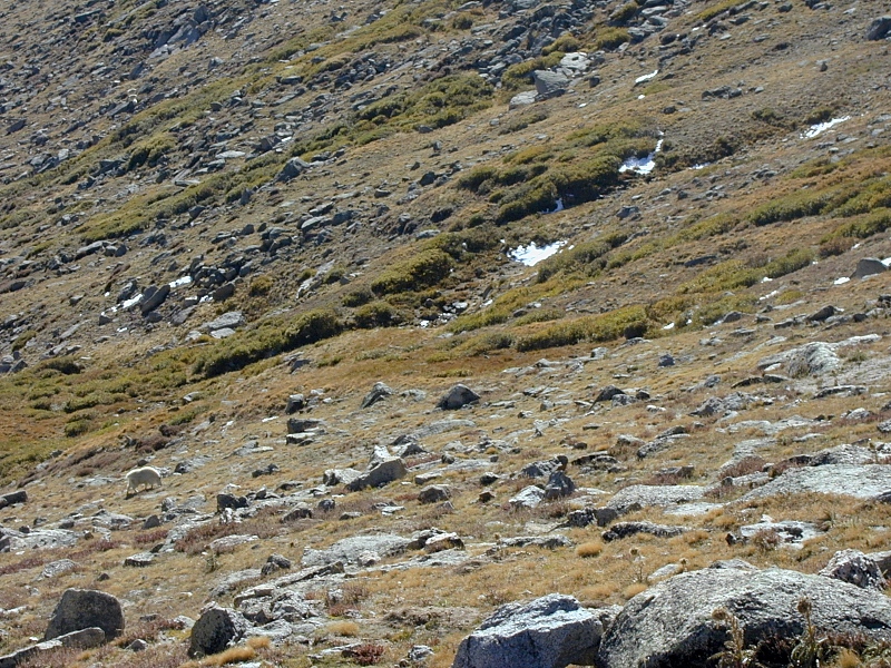
Mountain goat: A mountain goat grazes on the
tundra of Mount Evan's east face near the 12'000' level. This one got
away before I could get my teleconverter lens mounted, but the local
mountain goats and bighorn sheep often come up to parked cars on the
road in hopes of handouts from tourists. |
Longs Peak
|
 |
Longs
Peak: The 1st and 2nd frames are 180 mm telephotos of Longs Peak (14,256'), 74 km
to the north, taken in visible light and NIR from the Summit
Lake area on Mount Evans. Longs Peak, a
particularly handsome massif of 1.4
Ga Silver Plume Granite in the southeast corner of ^Rocky Mountain National
Park, stands watch over the north end of the Front Range.
Note how much clearer the air is at NIR wavelengths (2nd frame).
Aerial and reconnaissance photographers have relied heavily on NIR for
decades for just that reason. The extraordinary transparency of the
atmosphere in the NIR is one of the main draws of NIR photography, and
it's never been easier with today's digital cameras.
The 3rd frame shows the south face of Longs Peak from CO7.
The 4th frame shows a bit of the west face of Longs Peak above and to
the left of Glacier Gorge (center) in ^Rocky Mountain National
Park.
|
 |
 |
 |
Pikes Peak from Mount Evans
|
 |
Pikes
Peak: These 180 mm telephotos show Pikes Peak (14,110')
98 km to the south in visible (top) and NIR (bottom) light. This
imposing Fourteener is the tip of an iceberg, but here, the frozen
material is the 1.1 Ga Pikes Peak granite rather than water. Pikes Peak is
merely the exposed part of a much larger Pikes Peak batholith,
intruded during the Grenville
Orogeny and extending another 50 miles to the east beneath the High
Plains. Interestingly, the east face of Mount Evans also includes a
sizeable outcrop of Pikes Peak granite, apparently a northern side-lobe of the main
batholith. Click here for closer
Pikes Peak views and more information.
|
 |
Idaho Springs-Ralston Shear Zone at Golden Gate
Canyon State Park
|
 |
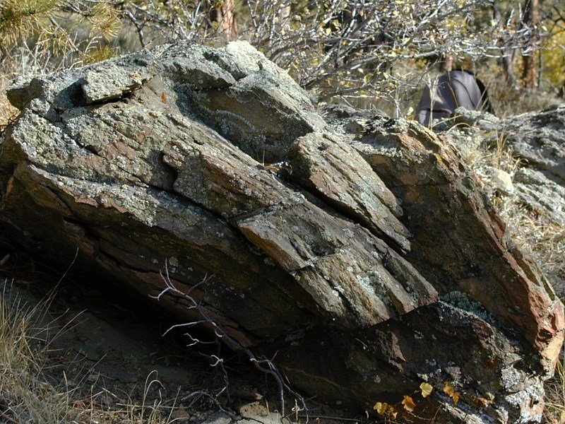
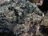
Mylonite:
These 3 frames show a foliated quartz
monzonite of the 1.7 Ga Boulder
Creek batholith cut by the Idaho Springs-Ralston Shear Zone. The
strong mylonitic (sheared)
fabric parallels the shear zone. |
 |
 |
|
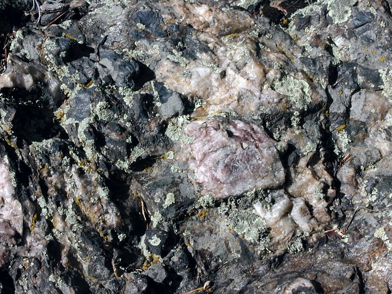
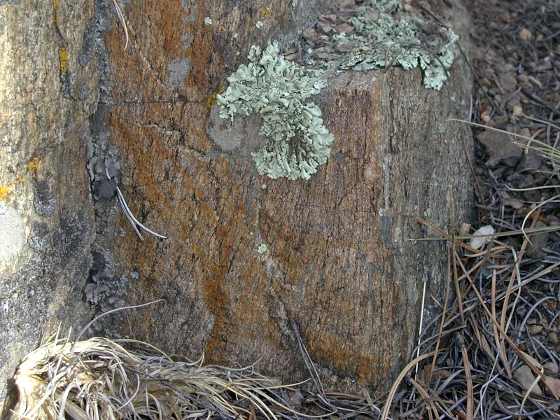
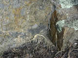
Porphyroblastic
schist: This 1.7 Ga metapelite (metamorphic marine
claystone) includes large porphyroblasts
of pink quartz and andalusite (the dull dark gray blocky crystals). Andalusite
(Al2SiO5) is a high-T, low-P metamorphic
aluminosilicate mineral derived from clay minerals.
The 2nd frame shows the same outcrop from the side. Note the very
coarse schistosity. The wavy
alignment of porphyroblasts indicates a complex deformation history.
These rocks also display mylonitic fabrics. |
 |
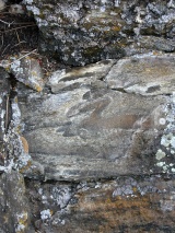 |
Isoclinal
folds: This schist exposure, about 5 ft tall, sports Z-shaped
recumbent isoclinal folds. The term isoclinal means that the
limbs of the fold have roughly the same dip; the term recumbent
means that the fold is lying on its side. This kind of deformation
requires considerable plasticity and implies a high-T environment at the
time of stress. |
Gallery Note: All photos on this page from September, 2002 unless otherwise noted.
References
In addition to the references cited on the home
page and in supporting articles, this
article relies on the following sources, in alphabetical order by first author:
URL: http://www.cliffshade.com/colorado/mt_evans/index.htm
|